HSIE Teachers
  • Home
  • Blog
  • 11 Geography
    • Earth's Natural Systems >
      • Key Terms
      • Processes, cycles and circulations >
        • Atmospheric systems
        • Hydrological systems >
          • Georges River Introduction
          • Georges River
          • Georges River Fieldwork
          • Water Management
          • Flow of Water Though Catchments
          • Catchments - Key Terms
          • Murray-Darling Catchment
          • Human impacts on hydrological processes
        • Geomorphic systems
        • Ecological systems
    • People, Patterns and Processes >
      • Population and resource consumption >
        • Demographic processes
        • Demographic processes - Mortality
        • Population pyramids
        • Challenges of changing population
    • Human-Environment Interactions >
      • A contemporary hazard >
        • Volcanic Eruptions
        • Floods 2022
        • COVID-19
        • Bushfire 2019-2020 >
          • Spatial distribution
          • Managing a contemporary hazard
  • 12 Geography (from 2025)
    • Global Sustainability >
      • Pillars of Sustainability
      • Evaluating Sustainability
      • Tourism - Nature and Spatial Patterns
      • Tourism - Influences >
        • Biophsical Influences
        • Ecological Influences
        • Economic Influences
        • Socio-Cultural Influences
        • Political Influences
        • Organisational Influences
        • Technological Influences
      • Tourism - Trends and Future Directions
      • Tourism - Sustainability >
        • Impacts of Tourism
        • Tourism in Venice
    • Urban and Rural Places >
      • One urban place - Ashbury (suburb) >
        • Ashbury - location and character
        • Ashbury - changes
        • Ashbury - responses to changes
    • Ecosystems and Global Biodiversity >
      • Coral Triangle
  • Geographical Tools
    • Tools Checklist
    • Maps >
      • Topo map basics
      • Area and Grid Reference
      • Sight Lines
      • Bearing
      • Gradient
      • Cross Section
      • Vertical Exaggeration
      • Sketch Maps
      • Synoptic Charts
      • Latitude and Longitude
    • Geographical Inquiry >
      • Soil characteristics
      • Vegetation Profile
      • Fieldsketch
      • Water Quality
      • Microclimate Fieldwork
    • Graphs and Statistics

HSIETeachers.com

Ideas, resources, inspiration

River Regulation in the Mekong

6/2/2015

0 Comments

 
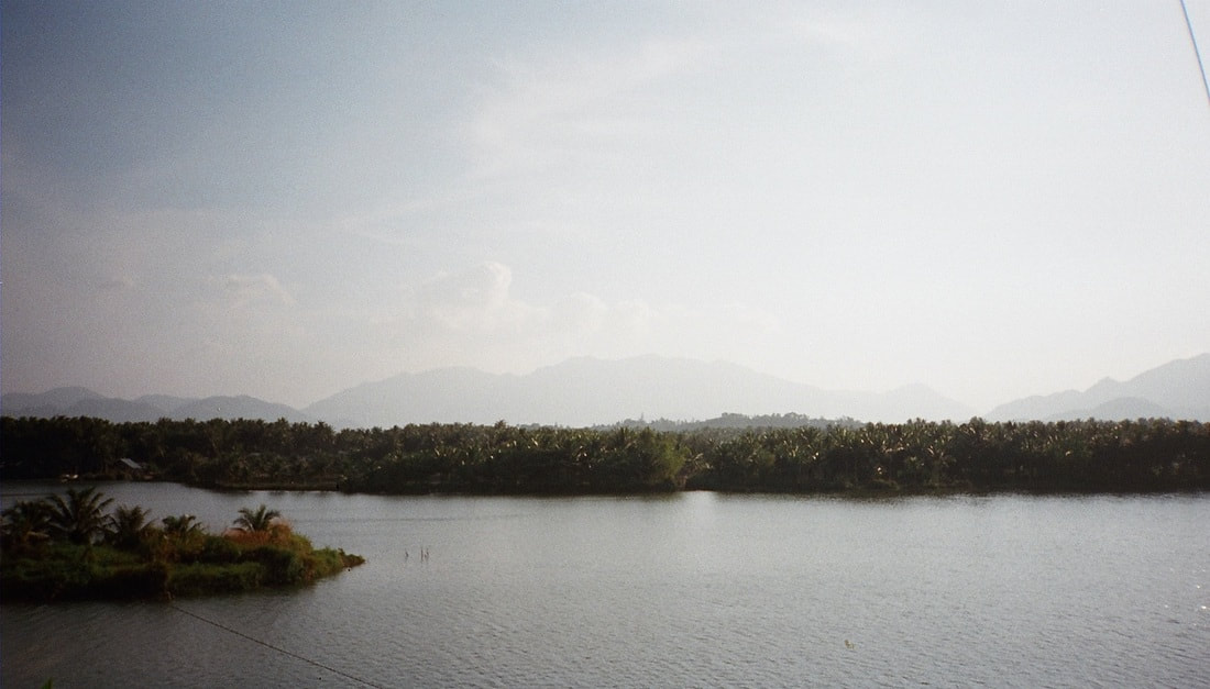
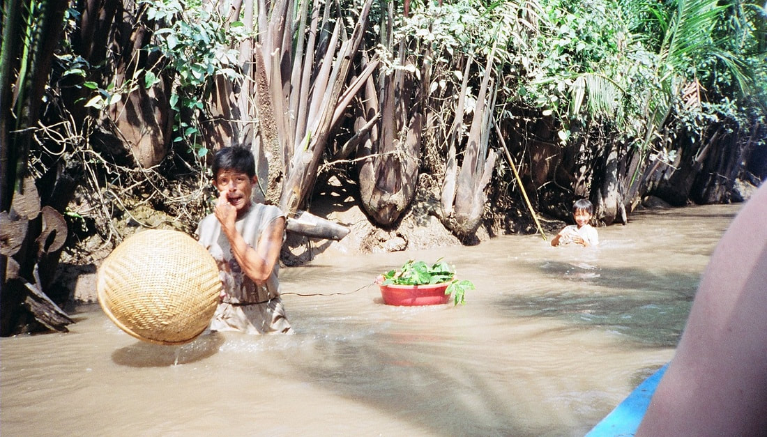
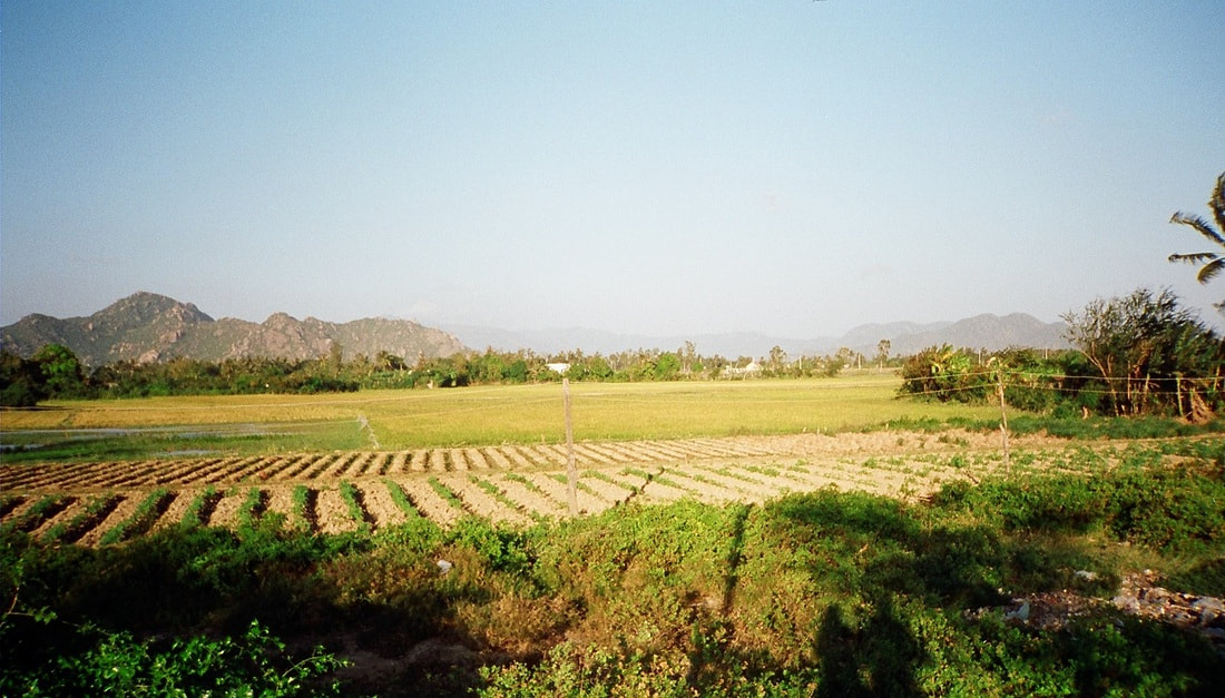
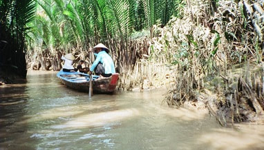
What is river regulation?River regulation refer to strategies and modifications to the natural flow of a river. This can include changes to improve navigations such as dredging or river widening, building of levees to protect populations in times of floods, construction of dams, and diversions for agriculture. How is the Mekong River regulated?In built up areas, some parts of the Mekong have been modified by having natural river beds replaced by cement. In rural areas, dwellings are built out into the river and the Mekong is used for a range of activities including washing, catching fish, rubbish and sewage disposal. While the Mekong has been modified and changed over time, the most significant changes have occurred in the past 20 years with the constructed of dams along the length of the river. 
​
Useful links:

Mekong River Commission
Mekong River nations defer dam decision
Save the Mekong
Power and responsibility: Mekong River Commission and Lower Mekong mainstream dams
Picture
Picture

Biophysical Interactions
A variety of factors affect the flow of rivers. These factors include climate, vegetation cover, soil, rock structure or ground covering, shape and slope of landforms.

Atmopshere - Climate
Climate has a direct impact on the way a river flows. At times of heavy rainfall a river will have greater volume of flow (more water flowing). At times of hot weather evaporation of water increases. This reduces the volume of water (less water flowing).

Biosphere - Vegetation
Vegetation absorbs water from soil to use in plant growth. Vegetation greatly reduces runoff. The less vegetation, the more abundant and rapid the runoff will be. A close plant cover will modify the violent affects of heavy rains. Vegetation growing in and on river channels may be regarded as a surface roughness which can slow the flow of the river (this is particularly important in times of flood).

Lithosphere - Soil/Rock structure/Ground covering
The ground surface surrounding a river will affect how much water will enter the river as run-off and groundwater. Together with vegetation, the ground cover type influences the amount of water that will infiltrate or run-off. Some soils or rock structures are highly permeable (they absorb water) and have a large water-holding capacity, e.g. coarse-grained sandstones and porous limestones. These rocks and soils can even out the groundwater discharge even during dry seasons. Other ground surfaces such as cement pathways, driveways and tarred roads greatly increase the amount of run-off because no water is able to infiltrate. This increased run-off generally known as stormwater enters drains and is directed to nearby creeks and rivers. 

Lithosphere - Landform shape and slope
Slope greatly affects the amount of run-off which will occur and thus how much water will enter a river. Generally the steeper the slope, the more run-off. Flat areas (especially where marshes and lakes occur) tend to accumulate water and slow down the flow of water.

Catchments which are bordered by or contain high, steep landforms are more likely to have greater volumes of water due to the occurrence of orographic rainfall (cool air travels across the land and warms up, it hits mountains and rises causing rainfall).

The size of the catchment can also influence the volume of water flow. Small drainage basins (catchments) show a great increase of flow after rainfall, while large catchments are more able to absorb the effects of precipitation.
​
True or false
- A flow of water in a river in a larger catchment will be affected more by rainfall than a river in a smaller catchment.
- An area with little or no vegetation is likely to have more run-off than an area with dense vegetation
- An impermeable ground cover will allow water to soak into the surface.

Rivers - Key Terms
​

river source
river mouth
tributary
delta
pool
cutoff
riffle
billabong/backswamp
meander
meander scar
upstream
downstream
stream velocity
river discharge
stream capacity
eyot
wetland
flood plain

Picture
Picture
Picture
Picture
Picture
Fluvial Landform Features


Delta
When a river reaches an ocean, sea, estuary or lake, it deposits sediment. This deposition forms a number of smaller streams branching out from the main river and flowing into the stationary water body.


Braiding
When a river is carrying a lot of sediment it will divide into a series of diverging and converging channels. Eyots are formed by the deposited sediment.


Meanders
When a river flows at low gradients (gentle slopes) towards the middle and lower reaches of a river, repeated curves in the river channel will occur. Alternating pools and rifles develop. Sediment is deposited on the inside of the bend.


Oxbow lakes
During floods, the river may cut across the narrow neck of land separating two meander loops. The abandoned section is the oxbow lake.

​
Floodplain
Broad flat areas adjacent to the river.

Natural levee
Elevated ground which develops on either side of the main channel.


The Mekong - Sensitivity to change

Xayaburi Dam and the Fate of the Mekong
An overview of the pros and cons of the Xayaburi dam in Laos. Read more...

New Mekong Dam a Go, and a Blow to Megafishes?
An indepth examination of the impacts of dams along the Mekong. Read more...

Photos: Dams threaten Mekong River Megafishes
A photo gallery from the National Geographic exploring the impact of dams on the Mekong. Read more...

Why we shouldn't dam the worlds most productive river
Zeb Hogan from the National Geographic describes how changes to the Mekong River are likely to drive many of the mega fish found in the river to extinction. Read more...

Mekong countries at odds over Mega-dams
Kirk Herbetson explores relations between Cambodia, Laos, Thailand and Vietnam

Environmental issues in the Greater Mekong
WWF outlines some of the greatest ecological issues in the Greater Mekong region including hydropower and infrastructure development, climate change, deforestation and degradation, wildlife trade. Read more...

Exploring the Mekong's Uncertain Future
Jeff Opperman writes a series of blogs about his trip along the Mekong, exploring the interconnected components of the environment and livelihoods of the people who liv

Hydropower development in the Greater Mekong
WWF examines how hydropower developments impact on sediment and nutrient transfer, impact on water flow and natural regulation, the relocation of loc

Mekong giant catfishWWF explores threats to the Mekong giant catfish including dam developments, alterations to migration routes, dredging and over-fishing. Read more...

​
Irrawaddy dolphins in the MekongWWF explores the reasons that the Irrawaddy dolphin is threatened. Threats include pollutants, fishing, hydropower developments and ecosystem degradation. Read more...

Management
Regional Cooperation on Mekong in tatters
WWF article outlining issues with management agreements between countr

WWF - Solutions in the MekongWWF outlines some of the initiatives currently being put in place to address some of the issues in the Greater Mekong. These solutions include conservation efforts in threatened forests and rivers, ensuring that hydropower developments are sustainable, and strengthening law enforcement. Read more...

Catalyzing sustainable hydropowerWWF is encouraging a 5 year ban on mainstream dams in the lower Mekong river to counter some of the many environmental costs of dams. Read more...

River fieldwork

Examples of fieldwork that can be conducting on rivers:
- Measuring changes in channel shape
- Measuring velocity at different parts of the river
- Discharge
- Material carried in the stream

Examine fieldwork currently being conducted in the Mekong region:
Stelar-S2S
Whale and Dolphin Conservation Society - Irrawaddy dolphins fieldwork
Sustainable Energy - Thoughts on fieldwork in Laos

Mekong River Problem Based Learning

The aim of this activity will be to identify a range of environmental problems affecting the Mekong River, and to explore possible solutions to some of these problems. Below is a very brief overview of the lesson sequence. The attached file contains much more detail includin scaffolding of the activities.

Overview
Lesson 1
Begin reading through the booklet of readings that you have been provided with. The readings all relate to issues impacting on the Mekong region. Summarise the articles in the table provided. 
 
Lesson 2
Continue reading and summarizing the articles provided.
Pair work - Determine one underlying issue affecting the Mekong Region.

Lesson 3
Create a flow chart which explores how your problem impacts on the biophysical environment. 
Individual work - Write a summary of how the Mekong Region is sensitive to change.

Lesson 4
In pairs, suggest a range of solutions or management strategies to address your underlying problem.
Design a management strategy that can be applied across countries, up and downstream to address the issues in the Mekong
Region.
Identify a range of professionals that you will need to employ to put your management plans into place. 
 
Lesson 5
Mekong overview and presentation of management plans.
Picture
Picture
0 Comments

Your comment will be posted after it is approved.


Leave a Reply.

    12 Geography
    11 Geography
    Geography Skills
    Legal Studies
    Studies of Religion
    Commerce
    History
    Changing Places
    Environmental Change

    Categories

    All
    10 Geography
    11 Geo
    11 Geography
    12 Geography
    12 Legal Studies
    6 Geography
    7 Geography
    8 Geography
    9 Geography
    Aboriginal Culture
    Aboriginal Education
    Accreditation
    Adani
    Affordability
    AGTA2017
    AGTA 2022
    AGTA 2024
    AI
    Ancient History
    ANZAC
    App
    Arctic
    Ashbury
    Asia
    Augmented Reality
    Australian Curriculum
    Australians At War
    Balmain Foreshore Project
    Biomes
    Biophysical Interactions
    Biosphere
    Both Ways
    Buddhism
    Bush Care
    Bushfires
    Business Studies
    BYOD
    Cabramatta
    Case Studies
    Catchment
    Catchment Functioning
    Change
    Changing Places
    ChatGPT
    Citizenship
    Climate Change
    Coastal Geography
    Cold War
    Collaboration
    Commerce
    Consumer Choice
    Contemporary Hazard
    Coral Reefs
    Cross Curriculum Priorities
    Cross Curriculum Project
    Cultural Integration
    Curriculum Reform
    Deputy Principal
    Differentiation
    Discrimination
    Economic Activity
    Ecosystem Restoration
    Ecosystems At Risk
    Elearning
    Elective Geography
    Environmental Change
    Excursion
    Faculty
    Fertility
    Fieldwork
    Fluvial
    Forest
    Gaming
    General Capabilities
    Geographical Investigation
    Geography
    Geomorphic Hazards
    Georges River
    Global
    Google
    Great Barrier Reef
    GTAConference2024
    GTANSW2017
    GTA NSW Conference 2018
    Herculanuem
    Historiography
    History
    Homelessness
    Housing
    HSC
    Human Environment Interactions
    Human Rights
    India
    Insurance
    Kakadu
    Leadership
    Learning Across The Curriculum
    Learning And Support
    Legal Studies
    Legal Studies Association
    Life Skills
    Light Rail
    Literacy
    Liveability
    Management
    Mekong
    Metroline
    Mining
    Modern History
    Modifications
    Natural Hazards
    Natural Resources
    Natural Systems
    New Nsw Syllabus
    New Syllabus
    Online Learning
    Outcomes
    Papua New Guinea
    PBL
    Personal Finance
    Picture Books
    Place And Liveability
    Population
    Population Pyramids
    Precis
    Preliminary
    Primary
    Principal
    Problem Based Learning
    Professional Associations
    Professional Learning
    Program
    Project Based Learning
    Purpose
    Refugees
    Reporting
    Revision
    Rivers
    Rock Art
    Sea Level Rise
    Senior Geography Project
    SGP
    Shelter
    Sia
    Skills
    Social Media
    Solutions
    Stage 3
    Stage 4
    Stage 5
    Stage 6
    Studies Of Religion
    Sustainability
    Sydenham To Bankstown
    Sydney
    Teacher Visioning
    Teacher Wellbeing
    Tech
    Technology
    Tourism
    Transport
    Travel
    Urbanisation
    Urban Places
    Venice
    Video
    Virtual Reality
    Visible Leadership
    Vision
    Volcanoes
    WestConnex
    World
    World Cities
    World Heritage Sites
    Writing
    WWI
    WWII
    Year 10
    Year 9

    Archives

    December 2024
    October 2024
    September 2024
    May 2024
    April 2024
    December 2023
    October 2023
    September 2023
    August 2023
    June 2023
    May 2023
    April 2023
    March 2023
    February 2023
    January 2023
    December 2022
    September 2022
    August 2022
    July 2022
    May 2022
    April 2022
    June 2021
    March 2021
    April 2020
    February 2020
    January 2020
    July 2019
    June 2019
    May 2019
    April 2019
    March 2019
    February 2019
    June 2018
    March 2018
    February 2018
    October 2017
    August 2017
    July 2017
    May 2017
    April 2017
    March 2017
    February 2017
    January 2017
    December 2016
    November 2016
    September 2016
    August 2016
    July 2016
    June 2016
    May 2016
    April 2016
    December 2015
    August 2015
    July 2015
    June 2015
    May 2015
    February 2015
    December 2014
    October 2014
    August 2014
    July 2014
    June 2014
    May 2014
    March 2014
    February 2014
    December 2013
    November 2013
    October 2013
    September 2013
    August 2013
    July 2013
    June 2013
    May 2013
    April 2013

Powered by Create your own unique website with customizable templates.
  • Home
  • Blog
  • 11 Geography
    • Earth's Natural Systems >
      • Key Terms
      • Processes, cycles and circulations >
        • Atmospheric systems
        • Hydrological systems >
          • Georges River Introduction
          • Georges River
          • Georges River Fieldwork
          • Water Management
          • Flow of Water Though Catchments
          • Catchments - Key Terms
          • Murray-Darling Catchment
          • Human impacts on hydrological processes
        • Geomorphic systems
        • Ecological systems
    • People, Patterns and Processes >
      • Population and resource consumption >
        • Demographic processes
        • Demographic processes - Mortality
        • Population pyramids
        • Challenges of changing population
    • Human-Environment Interactions >
      • A contemporary hazard >
        • Volcanic Eruptions
        • Floods 2022
        • COVID-19
        • Bushfire 2019-2020 >
          • Spatial distribution
          • Managing a contemporary hazard
  • 12 Geography (from 2025)
    • Global Sustainability >
      • Pillars of Sustainability
      • Evaluating Sustainability
      • Tourism - Nature and Spatial Patterns
      • Tourism - Influences >
        • Biophsical Influences
        • Ecological Influences
        • Economic Influences
        • Socio-Cultural Influences
        • Political Influences
        • Organisational Influences
        • Technological Influences
      • Tourism - Trends and Future Directions
      • Tourism - Sustainability >
        • Impacts of Tourism
        • Tourism in Venice
    • Urban and Rural Places >
      • One urban place - Ashbury (suburb) >
        • Ashbury - location and character
        • Ashbury - changes
        • Ashbury - responses to changes
    • Ecosystems and Global Biodiversity >
      • Coral Triangle
  • Geographical Tools
    • Tools Checklist
    • Maps >
      • Topo map basics
      • Area and Grid Reference
      • Sight Lines
      • Bearing
      • Gradient
      • Cross Section
      • Vertical Exaggeration
      • Sketch Maps
      • Synoptic Charts
      • Latitude and Longitude
    • Geographical Inquiry >
      • Soil characteristics
      • Vegetation Profile
      • Fieldsketch
      • Water Quality
      • Microclimate Fieldwork
    • Graphs and Statistics