|
Linking to other websites
You can provide a link to another website without attribution as the website will have its own logos, copyright information, etc. associated. However, if a website has a document available that you download, you can’t legally upload the document onto your site. You can only link to the document in its existing location. For example you can’t download a HSC exam of syllabus document and upload it onto your site. Youtube and Google Maps Some website creators/blogs allow you to directly embed Youtube clips and Google Maps onto your webpage. When you do this, you are actually providing a link to the Youtube site or Google site and as a result you don’t need to attribute/cite the source. The Youtube or Google logos will show on your website where you have embedded the resource. Youtube has the responsibility to ensure that their users meet copyright regulations. For example if there is a clip of the Sydney Symphony Orchestra playing a piece by Beethoven, it is the responsibility of Youtube to address the copyright issues. If you decided to take a screen shot from a Youtube clip or Google Maps application this would require attribution. Music Music is very difficult to work with in online publishing. Copyright applies to both the performance of music and the written piece of music. In most cases a licence must be paid for use of music online which can be very expensive. A work-around is to embed a Youtube clip of the music being performed to pass on the copyright responsibilities to a third party. Using material from other websites If you want to use material from other websites it is best to just link to the site. However in the case where you just have a small section of text it is fine to just quote the source and provide a link back to the webpage that you found it. In the case of the Board of Studies, they are very touchy about their property being reproduced. If you use a section of the syllabus for example, type NSW Board of Studies beneath the quote and then link from the words “NSW Board of Studies” to the page the information is found. Working with graphics When creating your class website, you need to be very wary that all the images and graphics that you use are copyright clear and don’t breach any privacy policies of the Department of Education. 1. Use photographs that you have taken yourself. Dig out your holiday snaps. Ideally you don’t want to be using photos of yourself, but you can always edit yourself out if necessary. Don’t forget that most phones these days have pretty good camera capabilities. If you are out somewhere and see a great shot that would work well on your website then take it. 2. Don’t publish photos of students. Most students at the school have signed a “Permission to Publish” form, but some have not. This could be for a whole range of reasons such as a witness protection, domestic violence issues, etc. To avoid any problems it is best to avoid photos with students. If you want to use photos of students doing something or making something try to frame the photo so that you just see the student’s hands or the back of their head. Obviously photos of students are posted on the official school websites, but these go through a series of checks to ensure that no-one is published that shouldn’t be. 3. Use image repositories. Sites such as wikicommons, flickr, shutterstock, and getty images allow some of their images to be used in online projects without citing the source (some of these will also require that you pay for them). Others will require that you cite the source correctly. In this case you will need to state the owner/creator as well as the type of license used. See below “Using Wikicommons”. 4. Create your own images. You may choose to create your own diagrams or modify images using programs such as Adobe Photoshop or Adobe Fireworks. This is usually a more complicated option for using graphics, but can be mastered fairly quickly. For further information examine the DEC resource: Copyright for Teachers.
0 Comments
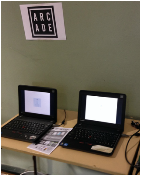
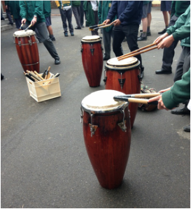
Business Day On Friday our school ran an event combining both Multicultural Day and Business Day. The Year 11 Business Studies students and the younger accelerated Business Studies class have spent the past few weeks developing their business ideas, sourcing or designing their products and marketing their businesses. They have had posters around the school for the past couple of weeks and have been speaking about their businesses at the whole school assemblies. This has obviously involved a lot of organising, monitoring and guidance from the Business Studies teachers. The students set up their stalls in the period following recess. Most of them were located in the school hall, but several of them set up around the playground. Business ideas included some basic carnival-style games, but several of the groups had quite sophisticated and successful ideas. Interestingly the students who have quite well developed outside interests seemed to be involved in some of the most innovative businesses. One student who last year developed and launched his own computer game was in a group which developed a gaming arcade for students to trial mini games which they could then download. The students had developed the games themselves. Another group of students interested in DJing created their own CDs and T-Shirts. They quickly sold out of all their products.
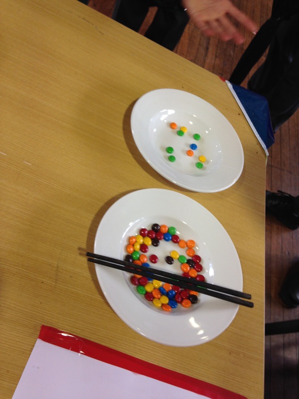
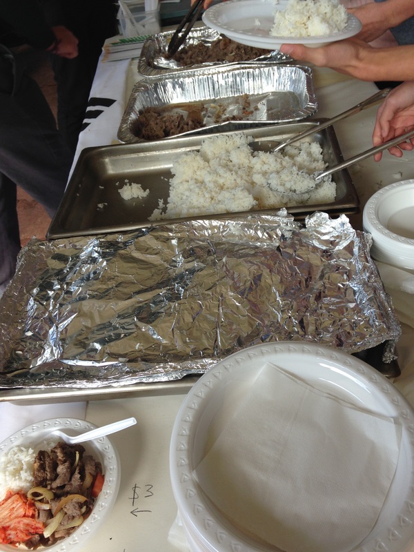
During the period before lunch, all junior classes (and a few seniors) attended the "day" which ran much like a school fete. At lunch time all students were involved in the day. As well as it tying in perfectly with Geography, Commerce and Business Studies themes in HSIE, it was a great opportunity to see the school come together as a community. One of our CAPA/Languages teachers did the majority of the organisation for the Multicultural Day, but it was amazing to see the contributions from a range of faculties and subjects such as ESL, Music and TAS. It was also a great opportunity for the students to show leadership and really showcase another part of their communities and themselves. Students were very excited when staff chose the food that they had brought in from home or had made themselves in the Trade Training Centre. I was not involved in the organisation of the day's events but witnessed the hard work of my fellow teachers who did an amazing job. Coincidentally, in Year 9 Geography we have been doing Multicultural Communities so the day was perfectly timed.
What is E-learning? E-learning is supporting learning through electronic (online) material. Students are able to access resources anytime and any place as long as they have access to the internet. E-learning can involve students accessing digital resources in class, just at home, or a combination of both. It can include videos, audio, interactive websites, online forums as well as text and images. It can incorporate mobile devices (phones, ipads, tablets). How could we use E-learning? - Subject – specific resources - Cross-curriculum projects - Welfare/Wellbeing resources - Library resources - Professional Learning for staff - Online courses/information for parents What are the issues related to introducing E-learning? - Staff training - Staff time and enthusiasm - Copyright issues - images, music, video, diagrams, etc - Quality control - Student access - across devices, using DEC internet - Marketing the school - Maintaining a competitive edge (seniors) - some people may be reluctant to share their senior resources. 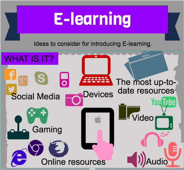 There are a range of options that can be used to introduce E-learning: - Moodle - iPads/Apps - Youtube - Gaming - Edmodo - Weebly/wordpress,etc
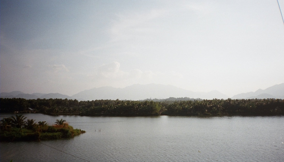
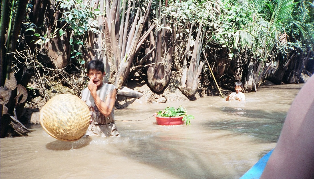
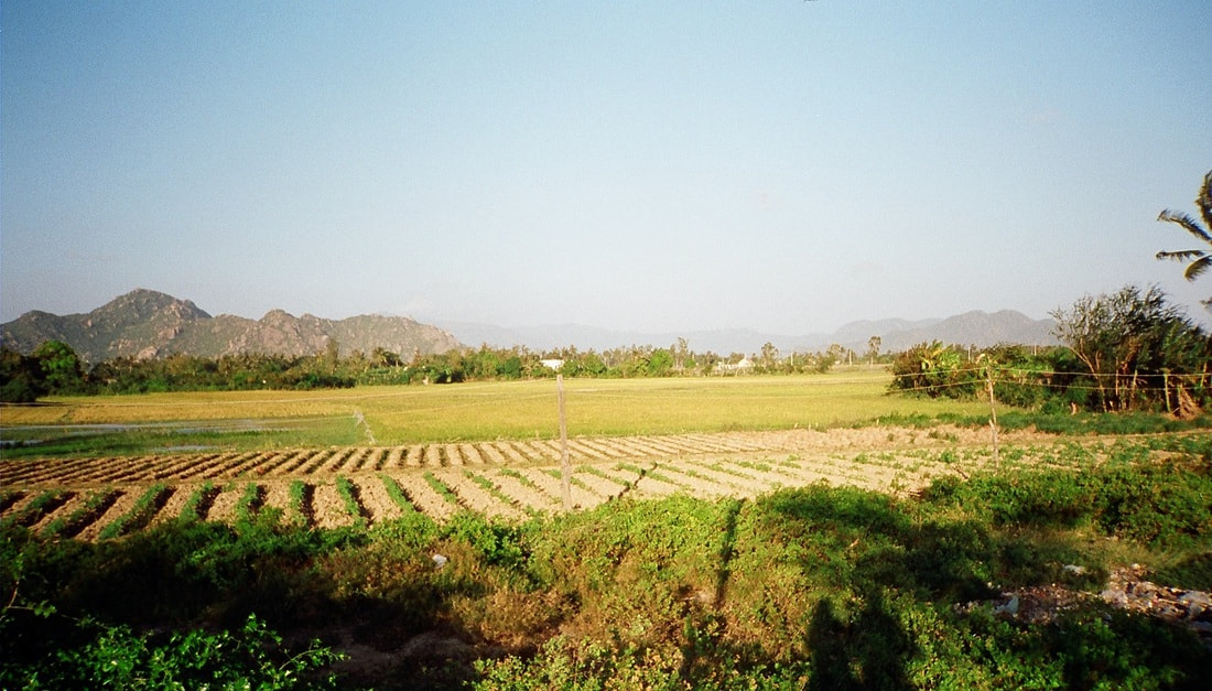
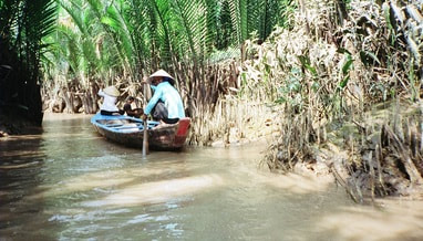
What is river regulation?River regulation refer to strategies and modifications to the natural flow of a river. This can include changes to improve navigations such as dredging or river widening, building of levees to protect populations in times of floods, construction of dams, and diversions for agriculture. How is the Mekong River regulated?In built up areas, some parts of the Mekong have been modified by having natural river beds replaced by cement. In rural areas, dwellings are built out into the river and the Mekong is used for a range of activities including washing, catching fish, rubbish and sewage disposal. While the Mekong has been modified and changed over time, the most significant changes have occurred in the past 20 years with the constructed of dams along the length of the river. Useful links: Mekong River Commission Mekong River nations defer dam decision Save the Mekong Power and responsibility: Mekong River Commission and Lower Mekong mainstream dams
Biophysical Interactions A variety of factors affect the flow of rivers. These factors include climate, vegetation cover, soil, rock structure or ground covering, shape and slope of landforms. Atmopshere - Climate Climate has a direct impact on the way a river flows. At times of heavy rainfall a river will have greater volume of flow (more water flowing). At times of hot weather evaporation of water increases. This reduces the volume of water (less water flowing). Biosphere - Vegetation Vegetation absorbs water from soil to use in plant growth. Vegetation greatly reduces runoff. The less vegetation, the more abundant and rapid the runoff will be. A close plant cover will modify the violent affects of heavy rains. Vegetation growing in and on river channels may be regarded as a surface roughness which can slow the flow of the river (this is particularly important in times of flood). Lithosphere - Soil/Rock structure/Ground covering The ground surface surrounding a river will affect how much water will enter the river as run-off and groundwater. Together with vegetation, the ground cover type influences the amount of water that will infiltrate or run-off. Some soils or rock structures are highly permeable (they absorb water) and have a large water-holding capacity, e.g. coarse-grained sandstones and porous limestones. These rocks and soils can even out the groundwater discharge even during dry seasons. Other ground surfaces such as cement pathways, driveways and tarred roads greatly increase the amount of run-off because no water is able to infiltrate. This increased run-off generally known as stormwater enters drains and is directed to nearby creeks and rivers. Lithosphere - Landform shape and slope Slope greatly affects the amount of run-off which will occur and thus how much water will enter a river. Generally the steeper the slope, the more run-off. Flat areas (especially where marshes and lakes occur) tend to accumulate water and slow down the flow of water. Catchments which are bordered by or contain high, steep landforms are more likely to have greater volumes of water due to the occurrence of orographic rainfall (cool air travels across the land and warms up, it hits mountains and rises causing rainfall). The size of the catchment can also influence the volume of water flow. Small drainage basins (catchments) show a great increase of flow after rainfall, while large catchments are more able to absorb the effects of precipitation. True or false - A flow of water in a river in a larger catchment will be affected more by rainfall than a river in a smaller catchment. - An area with little or no vegetation is likely to have more run-off than an area with dense vegetation - An impermeable ground cover will allow water to soak into the surface. Rivers - Key Terms river source river mouth tributary delta pool cutoff riffle billabong/backswamp meander meander scar upstream downstream stream velocity river discharge stream capacity eyot wetland flood plain
The Mekong - Sensitivity to change Xayaburi Dam and the Fate of the Mekong An overview of the pros and cons of the Xayaburi dam in Laos. Read more... New Mekong Dam a Go, and a Blow to Megafishes? An indepth examination of the impacts of dams along the Mekong. Read more... Photos: Dams threaten Mekong River Megafishes A photo gallery from the National Geographic exploring the impact of dams on the Mekong. Read more... Why we shouldn't dam the worlds most productive river Zeb Hogan from the National Geographic describes how changes to the Mekong River are likely to drive many of the mega fish found in the river to extinction. Read more... Mekong countries at odds over Mega-dams Kirk Herbetson explores relations between Cambodia, Laos, Thailand and Vietnam Environmental issues in the Greater Mekong WWF outlines some of the greatest ecological issues in the Greater Mekong region including hydropower and infrastructure development, climate change, deforestation and degradation, wildlife trade. Read more... Exploring the Mekong's Uncertain Future Jeff Opperman writes a series of blogs about his trip along the Mekong, exploring the interconnected components of the environment and livelihoods of the people who liv Hydropower development in the Greater Mekong WWF examines how hydropower developments impact on sediment and nutrient transfer, impact on water flow and natural regulation, the relocation of loc Mekong giant catfishWWF explores threats to the Mekong giant catfish including dam developments, alterations to migration routes, dredging and over-fishing. Read more... Irrawaddy dolphins in the MekongWWF explores the reasons that the Irrawaddy dolphin is threatened. Threats include pollutants, fishing, hydropower developments and ecosystem degradation. Read more...
Management Regional Cooperation on Mekong in tatters WWF article outlining issues with management agreements between countr WWF - Solutions in the MekongWWF outlines some of the initiatives currently being put in place to address some of the issues in the Greater Mekong. These solutions include conservation efforts in threatened forests and rivers, ensuring that hydropower developments are sustainable, and strengthening law enforcement. Read more... Catalyzing sustainable hydropowerWWF is encouraging a 5 year ban on mainstream dams in the lower Mekong river to counter some of the many environmental costs of dams. Read more... River fieldwork Examples of fieldwork that can be conducting on rivers: - Measuring changes in channel shape - Measuring velocity at different parts of the river - Discharge - Material carried in the stream Examine fieldwork currently being conducted in the Mekong region: Stelar-S2S Whale and Dolphin Conservation Society - Irrawaddy dolphins fieldwork Sustainable Energy - Thoughts on fieldwork in Laos Mekong River Problem Based Learning The aim of this activity will be to identify a range of environmental problems affecting the Mekong River, and to explore possible solutions to some of these problems. Below is a very brief overview of the lesson sequence. The attached file contains much more detail includin scaffolding of the activities. Overview Lesson 1 Begin reading through the booklet of readings that you have been provided with. The readings all relate to issues impacting on the Mekong region. Summarise the articles in the table provided. Lesson 2 Continue reading and summarizing the articles provided. Pair work - Determine one underlying issue affecting the Mekong Region. Lesson 3 Create a flow chart which explores how your problem impacts on the biophysical environment. Individual work - Write a summary of how the Mekong Region is sensitive to change. Lesson 4 In pairs, suggest a range of solutions or management strategies to address your underlying problem. Design a management strategy that can be applied across countries, up and downstream to address the issues in the Mekong Region. Identify a range of professionals that you will need to employ to put your management plans into place. Lesson 5 Mekong overview and presentation of management plans.
|


