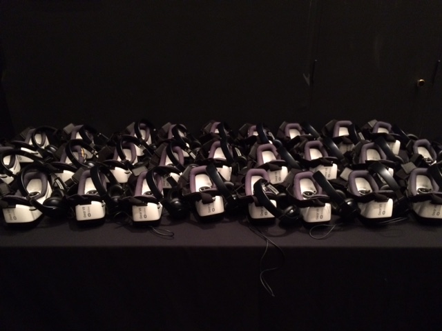
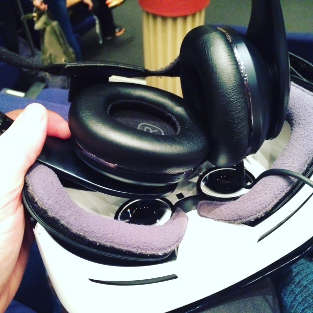
The Australian Museum is currently hosting two David Attenborough Virtual Reality experiences - one on the Great Barrier Reef and one on prehistoric life in oceans. It used a Gear VR headset and headphones to provide this experience. Inside the headset was a Samsung device which provided the audiovisual stimulus. This operated very similarly to the cheaper models you can buy on Ebay (see a previous post - Google Cardboard - bringing virtual reality to your classroom) however this more sophisticated set fits to your face without having to hold it, has padding around the eyes and the head phones are quite good quality. This is clearly a more superior virtual reality experience than the Google Cardboard, but I think that is to be expected given the obvious price difference. The two experiences were relatively short, but were successful in giving the viewer a feeling of being immersed, particularly the First Life presentation which had slightly longer continuous sections in full 360 view. The experiences were part documentary, part virtual reality immersion experience. The Great Barrier Reef experience began with the viewer flying out to part of the reef on a helicopter. By moving your head to the left you could see the back rotor blades and by looking up you could see top rotor blades. The view in front and below was of the reef from above. The footage included of the Great Barrier Reef demonstrated the scale of some of the reef structures and the diversity and number of organisms. The experience has some documentary-style sections where coral polyps and reef building are explained. This provides a short, but effective session aimed to develop the awareness of the viewer about the reef and ends with a call to action for us to act on climate change and protection of the reef. The First Life session was in the style of computer rendered animations. At first I was aware of the difference between this style as compared with the previous 360 video style of the Great Barrier Reef session, but after a short time I forgot about it. This session has longer periods of the 360 immersive experience and it works quite well. You actually get the sensations of feeling like you are moving and some of the quick movements of the species are very effective in making you feel like you are present in the experience. As I have discussed in a previous post, this is an emerging technology that still has a long way to go before it is truly valuable to educational outcomes, other than just purely addressing engagement. The sessions were very good, but require greater length and detail to be really useful in an educational setting. Regardless, I think this is a really powerful technique, and these particular sessions give us a real idea of what the future of documentary making is going to be. If get the chance - go and have a look.
Australian Museum
0 Comments
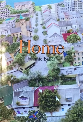
Using picture books to integrate Geography and History into Stage 1 – Home by Jeannie Baker8/22/2016
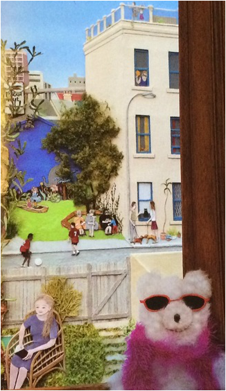
http://www.jeanniebaker.com/book/home/ Introductory activities: Front cover: Does this place look like your neighbourhood or community? Do any of these houses look like your house? Do any of these backyards look like your backyard? Does this look like a nice place to live? Why or why not? The story begins with a pregnant woman and her husband moving into a home, and traces the steps of Tracy, their daughter's, life. The window frame and the wall around it provide clues to show that time is passing - a card celebrating the birth of a new baby, a mug with "I am 4" on it, a note about her 10th birthday, and on it goes. The documenting of time passing provides a opportunity to begin to explore the historical concept of change and continuity and develop skills in sequencing events. This would need to be accompanied with explicit teaching of days of the week and months, and also holidays, events celebrated by students and their families. Activity: Students are provided with images representing Tracy's age and are asked to cut them out and glue them in the correct sequence. Students bring in photos of their childhood with the ages written on them and sequence them to create a timeline. The teacher uses photos of the class or school throughout the year to create a timeline as a wall display. See this pinterest post: https://au.pinterest.com/pin/205547170466044607/ The geographical concept of place is explored in terms of their unique characteristics, the value we place on places, and human influences. We see the way Tracy and her family interact and influence their own backyard, and we get an idea about how they value their place by the activities and experiences they have there. We see how the community begins to value place as the neighbourhood changes into a thriving place for people to relax, interact and work. Activity: Students identify their favourite places around the school and at home. Why do they like these places the most? How do different places make you feel? Are some places safe places? The geographical concept of change is an obvious theme throughout this book. The backyard develops from an empty, barren space into a shady, green oasis. We see the neighbourhood develop from a run down, graffitied area into a green, friendly community. The smash repairs develop into a local park, the demolition of a large building opens up the view of a lake and parkland, old buildings are renovated and new buildings are constructed. We have glimpses of the development of the city, but much of this is hidden by the greening, leafy community. Activity: Students take photographs of a change occurring in their school or local environment (excursion) and label them. This could be repeated several times so that there is a visual record of the change. Student examine historical photos of their suburb and compare them with contemporary photos. A study of the illustrations provides an opportunity to introduce the geographical concept of scale. There is enough visual interest and complexity to simply concentrate on the changes that occur within the family backyard. This could then be extended to looking at what can be seen on the street corner opposite and the main street. This enables discussion about a community, suburb or local scale. In the background of the illustration you can see the city skyline, this could be used to introduce the scale of the town or large city. Activity: Students are given a template with different sized circles. They use the template to draw images of their house, their street, their community, their city, their country and the world (starting from smallest to biggest). This could then be repeated with images of themselves, their immediate family and their extended family. See this pinterest post: https://au.pinterest.com/pin/451274825131466444/ While the story only examines a timespan of approximately 25 years, it does provide a chance to begin to explore the historical concept of changes and continuities in family life and the local community over time. The story comes full circle when the main character gets married and has her own child. We can begin to introduce the historical concept of empathetic understanding by asking why the yard of the family home looked so different when they first moved in to how it looked at the end of the story. Why did Tracy's parents live differently at that time in history to the way they live now? Activity: Students bring in artefacts, or treasured family objects (perhaps a photograph if it is really treasured) and recount family stories. They ask other students questions about their objects. While the geographical concept of sustainability is not expected to be addressed in Stage 1, this story has a clear message encouraging communities to bring back native plants and animals, and to better understand and care for places.
Outcomes:
Communicates an understanding of change and continuity in family life using appropriate historical terms. Identifies and describes significant people, events, places and sites in the local community over time. Inquiry questions: How has family life changed or remained the same over time? How can we show that the present is different from or similar to the past? How do we describe the sequence of time? It would also be quite easy to make links to the English, Maths and Art syllabuses. Virtual reality is an artificial, computer generated recreation of a real life situation or a simulation of an imagined or created environment (like a virtual tour). The view feels immersed in the experience. David Attenborough’s virtual reality experience has shown us the relevance of this type of activity to the study of geography and coral reefs specifically. http://www.hsieteachers.com/home/attenboroughs-vr-experience-at-the-australian-museum Hear David Attenborough talk about his virtual reality experience: https://www.youtube.com/watch?v=BqSotmvj12k&feature=youtu.be My Google Cardboard class set arrived on Friday. Google have designed a really cost effective way to allow people to access virtual reality. As a kid of the 80s, I remember using my Mattel View Master to look at scenes from movies and TV shows. Google Cardboard kind of works the same way, except that instead of using slide cards you use your phone to view the experience. Before I get too far into this, virtual reality is by no means a substitute for fieldwork, and I think we are a long way off before anyone could even try to claim that. This is just a fun activity, with the potential to enhance learning in the future as the apps and technology develops. There are a range of different headsets that you can buy to experiment with virtual reality, There are different brands, materials, sizes and quality. As a first foray into this world, I have gone for pretty much the cheapest option available. In my opinion, if you are intending to use it in your classes, you are going to want to get one of the cheaper models so that you can have more of them for your students, and so that it isn't such a big deal if they get broken. The Google Cardboard in the image below cost about $2.00 on ebay. The other headset featured cost about $10-15 dollars, and was purchased from Typo. So what do you need? - A viewer - A smartphone (for each viewer, so you might have to ask the students to download the app and use their own phones). - A range of virtual reality apps downloaded (you will need to do some research to find the right one for your topic and students). Below: A version of Google Cardboard available on Ebay for about $5. 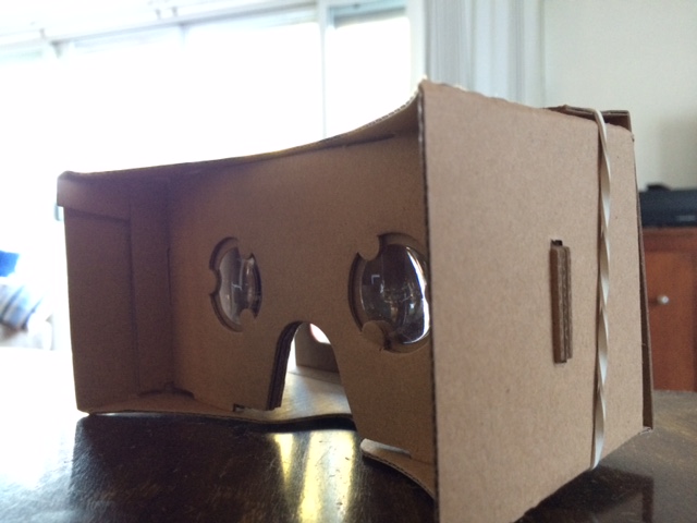 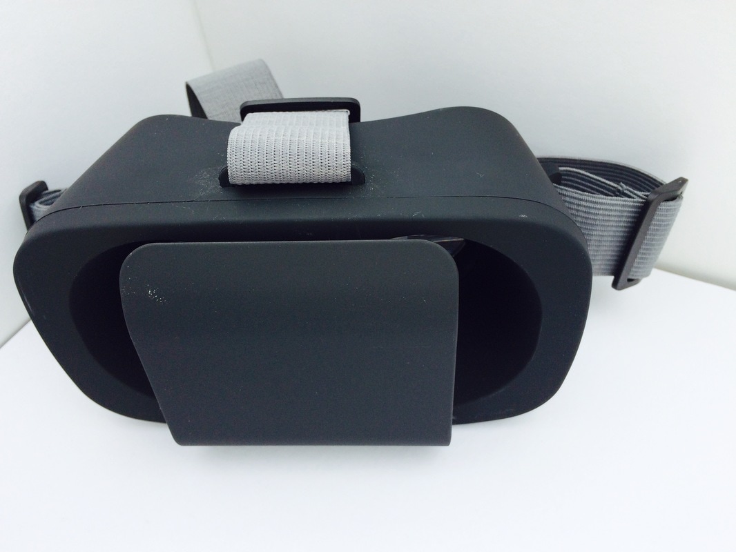 There are a few apps that you can use to access the experiences: - Google Cardboard - Youtube (use 360 videos) - Street View - Within Affordable access to virtual reality experiences is relatively new, and the apps and experiences are really only beginning to become available. When you open the apps, you will see a split screen with two images that are roughly the same, but shown at slightly different angles. When you place your phone inside the Google Cardboard and look at it through the lenses it will give the impression of being 3 dimensional. This will enable your students to feel like they are immersed in the environment. Youtube 360 The simplest way to use virtual reality is Youtube 360. Simply go to Youtube and search “coral 360 video”. A range of options will come up that you can use with or without head sets. These have been generally designed for tourists, but may be an easy way to begin to introduce virtual reality if you are a little apprehensive. The benefit of using Youtube 360 is that you can use it on your desktop computer/laptop if you don’t have access to personal devices.
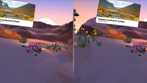
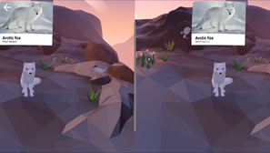
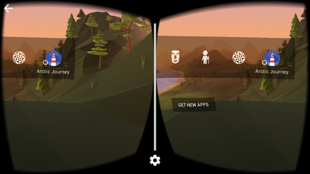 The Google Cardboard app is really quite interesting, and provides a number of examples that give you an idea of what the potential will be, but in terms of education, in my opinion it is not all the valuable just yet. What it does show is what the potential is. The screenshots below show an example of an Arctic environment. When you select different items in the scene a popup appears providing some basic information about the feature. Given the right scene or environment, and the right level of information this could be useful in an educational sense if it were developed further.
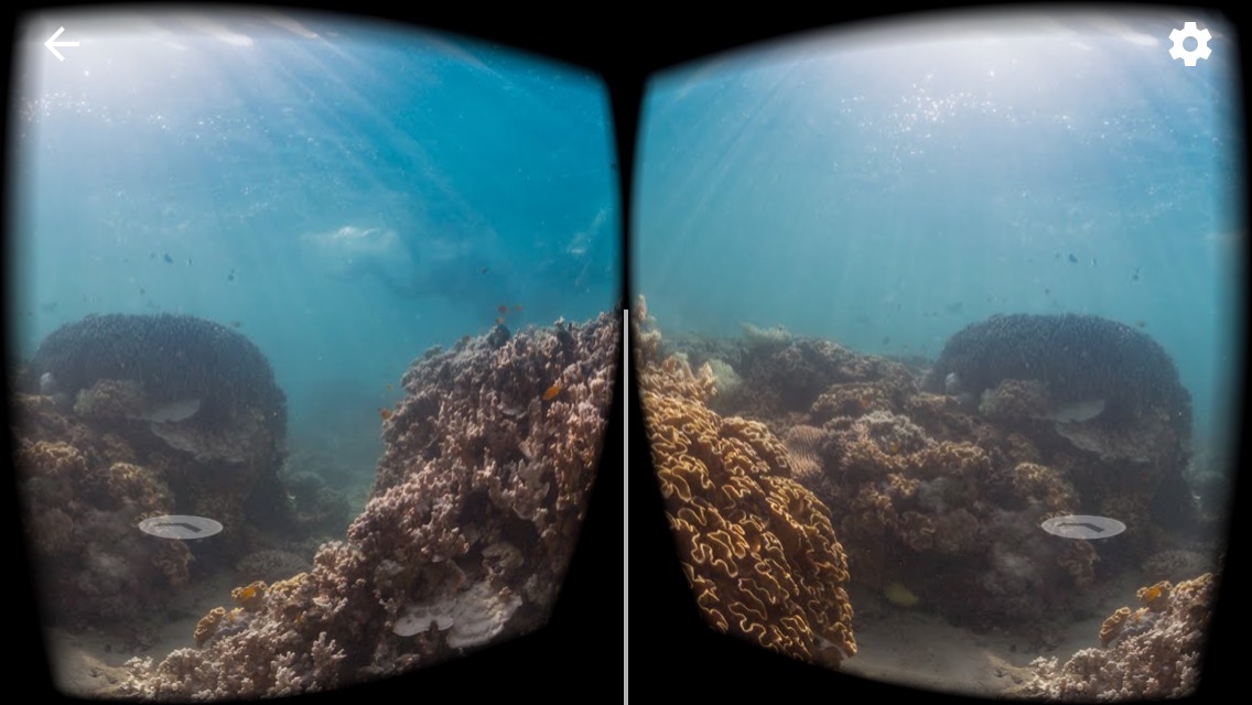
A couple of the great virtual experiences are the ones where you are immersed in a real environment (rather than a cartoon-like environment). Street View enables you to explore places with the full 360 degrees. Click Explore, Choose a location, and click the Google Cardboard icon. You do really feel like you are part of the place. This could be valuable in helping students develop an appreciate of the places you are studying, and to get a better understanding of what those places are actually like
 Virtual reality lesson 1 Use Google Streetview to examine a range of sites around the Great Barrier Reef and Coral Triangle. Choose specific sites, eg, several locations around Lizard Island, or Kimbe Bay. Compare the two main virtual field sites. Students can make judgements about the quality of the corals, the colours of the corals, etc. Students may try to identify specific types of coral to compare complexity and biodiversity (although this may be a bit too complicated). Students can use this as a form of observation to be backed up with secondary data
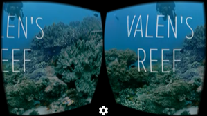
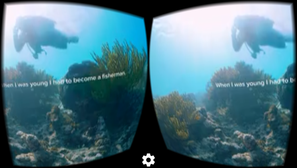
Open the Within app. Select Valen’s Reef. This presentation follows a local fisherman explaining the pressures on him and his local reef. A narrative is provided over the footage of the reef and the island Students can maneuver around the scene to access 360o views. Students will feel immersed in the scene and the story. Virtual reality lesson 2 - Valen's Reef Students view Valen’s Reef, using the Within app. A couple of quick questions:
Discovery VR app The Discovery VR app has a number of presentations that relate to Geography generally, and a series “Sharks Among Us” which can be tied in with Marine Environments generally or coral reefs. Examine Google Cardboard here: https://vr.google.com/cardboard/
You can follow Google Classroom on twitter at @GoogleVR. Guest blogger: Bruce BarclayThe recently released stage six draft modern history syllabus fails to clearly articulate a vision for the study of modern history in a globalised world. In its previous incarnation, the stage six syllabus at least paid lip service to areas of modern history which were not European in nature, i.e. India as one option. This final draft does not reflect the four options which were tabled to teachers who took the time to provide feedback to BOSTES previously. Teachers of this subject have been ignored with the release of the final draft.
The National Study and Peace and Conflict topic areas have been left relatively unscathed. However the inclusion of Iran into the national study topic area replaces India which is a lost opportunity. Similarly, the Peace and Conflict topic retains the main options, with the inclusion of Conflict in the Gulf 1991-2011, which replaces the UN as Peacekeeper. Essentially these two areas of study have escaped political influence. One of the real, if not the most problematic areas, is the core topic. Instead of utilising one of the options tabled at the consultation process, BOSTES has obviously bowed to political pressure and ignored the recommendations of the majority of teachers. World War One was a topic which although staid, at least had the advantage of being politically neutral and allowed teachers to engage in different national studies with no disadvantage to its students. For example a teacher of the USSR topic can build on students’ knowledge of the World War One topic. However as it stands, the core topic is Nazi Germany 1933-39 and teachers have to cover 9 detailed dot points taking up 60% of course time. To further compound the problem, teachers then need to teach another dictator, e.g. Pol Pot for 30% of the course. This begs the question: why is Nazi Germany deemed the most important topic for the core? Compounding the obvious bias, is that instead of removing Nazi Germany from the National Study it keeps Nazi Germany, but focuses on 1914-33. Clearly any teacher with half a brain will teach the German National Study first, then the Core/Nazi topic and if you haven’t got your fix of Nazi German history, you could finish with the European Conflict option for the Peace and Conflict topic. Already roughly 70% of the state teaches the Nazi option for the National Study so BOSTES wants the rest of the state to follow suit. As one person at the BOSTES consultation meeting at Hurstville remarked “That’s the end of the Soviet Union in every sense”. The USSR and for that matter the other options have been "relegated to the dustbin of history," to quote Goebbels, I mean Trotsky. It’s already working! Unlike the Ancient History course, BOSTES have removed the Personality topic from Modern History and replaced it with Change in The Modern World. I actually thought there has been a lot of change in the modern world in the twentieth century - that is why students love studying Modern History. BOSTES wants teachers to not only teach a personality, e.g. Gorbachev but link it to a time frame of nearly 70 years - The Changing World Order 1945-2011. This option has 19 dot points to cover, plus an evaluation of Gorbachev during the Cold War period. Furthermore, as a hat tip to the old UN as Peacekeeper topic, teachers have to assess the role and impact of the UN as international peacekeeper in relation to one trouble spot in the world, e.g. Somalia. Evidently the old inconsistencies of comparability between the ancient and modern course remain but are amplified, further alienating modern history teachers. If I was a student and had equal interest in modern and ancient history I would choose ancient for ease of content and variety. I hope that someone more technically adept than myself will be able to create a parody of the modern syllabus using snippets from The Downfall movie on youtube. I won’t even start on the exam specifications. |