|
Most faculties are engaged in some way with curriculum reform. Some have syllabuses currently being implemented, some are familiarising and getting ready for implementation, and some are engaging with drafts and providing feedback. There are a range of professional learning resources available for staff in management positions regarding change management in relation to implementing curriculum reform and managing staff through this period. This post will take a look at this issue from a perspective of managing interpersonal relationships, different management styles, stages in career and levels of motivation. Head Teachers Head Teachers are tasked with the job of motivating and coordinating staff in developing quality teaching and learning programs, incorporating school and system objectives and building staff capacity. Some Head Teachers will be really enthusiastic about the idea of curriculum reform, some may be less so. For most head teachers that have been in the role for more the 6 or 7 years, chances are they have already led curriculum reform before (the last round of syllabus changes began implementation in 2015, with the final subjects still being implemented when the current curriculum reform was announced). Whether you are a Head Teacher or a teacher it is important to get an understanding of the role of the Head Teacher and how their approach can influence this process. Explore the perspectives of the three hypothetical Head Teachers below. None of these is ideal - Head Teacher 1 wants to keep everything as is and just make a few tweaks to existing programs. He probably isn't going to engage all that much and will only encourage the most necessary changes to existing programs. He will validate longer-term teachers in the faculty by not "reinventing the wheel" and recognising hard work of the past, but may miss opportunities to incorporate new and engaging case studies or projects, or innovative practices. Head Teacher 2 is super keen, he's looking closely at the syllabus changes, his new programs are probably going to be good, but he is not bringing his staff on the journey with him, and they probably aren't going to enjoy teaching with the new programs because there is no buy in. As a new Head Teacher, he also hasn't tried to draw on the existing expertise in his faculty, and it appears that he is disregarding past work of the faculty. Head Teacher 3 has a collaborative approach, is engaged in the proces of curriculum reform and has a strong understanding of all the things needed in a quality teaching and learning program. She is wanting to ensure the teaching and learning programs are rigorous and address the needs of the students. However, she may be trying to do too much early on in the process and may burn out her staff. She risks making her staff feel overwhelmed by the scope of the project.  As Head Teacher, how do you ensure that you are positive, collaborative, value the opinions your staff, respect past work, encourage rigour, but don't overwhelm the faculty? Teachers and Head Teachers Building Staff Capacity In any faculty, there are staff with a range of expertise and skills. Curriculum Reform provides an excellent opportunity for staff of all stages to gain professional experience that is of benefit for them. Experienced staff may be in a position to mentor other teachers in programming. They may be tempted to go ahead and do a lot of the programming themselves, but they should be looking to expand their leadership, collaboration and mentoring skills in the process. This may involve teaching other staff about school-specific programming conventions, sharing expertise about syllabus interpretation or content knowledge, or guiding staff to existing faculty resources that may be useful. Out of subject teachers may be keen to expand their knowledge and experiences by engaging in programming for new subjects within the faculty - e.g. a Commerce/Business Studies teacher programming for Legal Studies. This helps to create a faculty with a broader skill set, and keeps the staff member engaged and interested because they have the opportunity to try something new. It can also build stronger relationships between staff working together and learning from each other. Beginning teachers may bring new ideas and perspectives to programming, and may have a skillset that the more experienced staff member doesn't have - e.g. technology skills or relevant industry experience. The beginning teacher will benefit from engaging with the more experienced staff members to learn about the process of programming within the school including programming scaffolds, school priorities (e.g. there might be particular approaches to literacy, or a conceptual framework that the school incorporates in their programs) and school resources.  What do each of these people bring to the faculty? How can we facilitate them working together? It is important that the staff can work together as a team, and it might be useful to find a way to add some social aspects to the programming sessions so that it feels less like a chore, and to continue to build strong interpersonal relationships in the faculty - afternoon tea, dinner or a a faculty social event afterwards. Self reflection: How do you see yourself? What do you bring to the table? What is your view of collaborative programming? Honestly, I find collaborative planning hard. I know what I like, I know what I think works well, and I just want to sit down and get the job done. However, I also know that people won't want to teach a program that they've had no say in, or mostly represents one person's cultural perspective or interests. "Easy" does not always mean "best" - for you, the faculty or the students. The best programs incorporate a range of different perspectives. Decisions to consider early:
- What resources are you going to draw on? Digital platforms? New text books? Resources from professional associations? Videos and documentaries? Existing resources? - How will programming be divided up in your faculty? How will you ensure that the load is shared but the workload is manageable? - How will the faculty both make use of existing expertise in the faculty and develop the knowledge and skills of more junior staff? - How will you find the time? - Do you have a timeline that you are working to? Does it provide flexibility to take into account busy periods - exams, reports, school events, etc. ? Staff wellbeing A key consideration in this process is going to be looking after staff wellbeing - ensuring faculty relationships are stable and professional, ensuring some people aren't taking on too much of the load, ensuring people feel their opinion is valued, and managing the overall workload of the faculty is manageable. During periods where the faculty has multiple subjects requiring new programs, some meetings or extra initiatives may need to be cut back to accomodate. Keep in mind that keeping the faculty functioning well is more important than a series of perfect documents with no one to teach them.
0 Comments
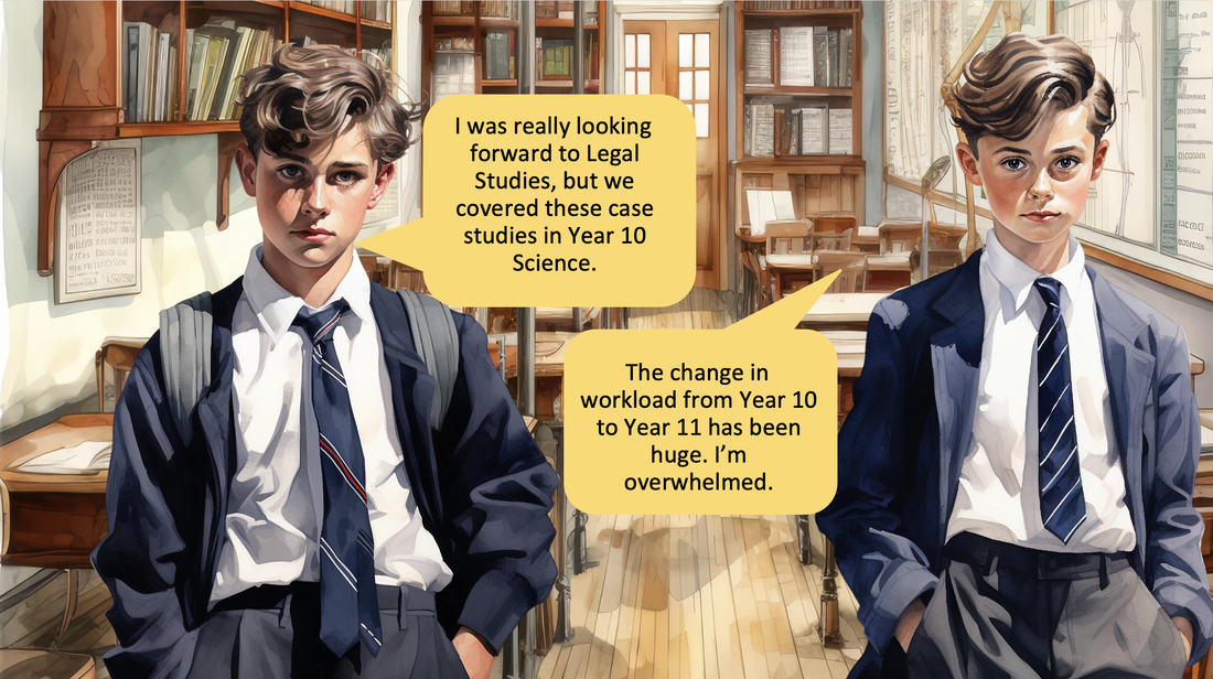 Just as students transition from primary school to high school, students experience a similar period of transition when moving from junior years to senior years of high school. Often students experience a similar period of anxiety, reassessing organisation structures, and feeling overwhelmed. This transition should be managed in a similar way as the transition from primary to high school and consideration should be given to curriculum sequencing as one measure towards addressing this. Curriculum sequencing to support students transitioning into senior years can include: - curriculum mapping to determine gaps, overlaps and repetition from junior years to senior years. - ensuring a range of teaching strategies are used with seniors to ensure continued engagement in their subjects. - gradually increasing the complexity of assessment tasks and structures from Year 9 to 11 to more closely resemble Stage 6 tasks. Assessment policies should also reflect this. - continuity and increased complexity of school programs that address student literacy and numeracy skills should be ensured. - personalised learning and support provided for individual students should be re-examined and meetings with parents should occur to ensure that families understand the provisions that are allowed in Stage 6. This process should be centralised within the school, not done by individual subject teachers. 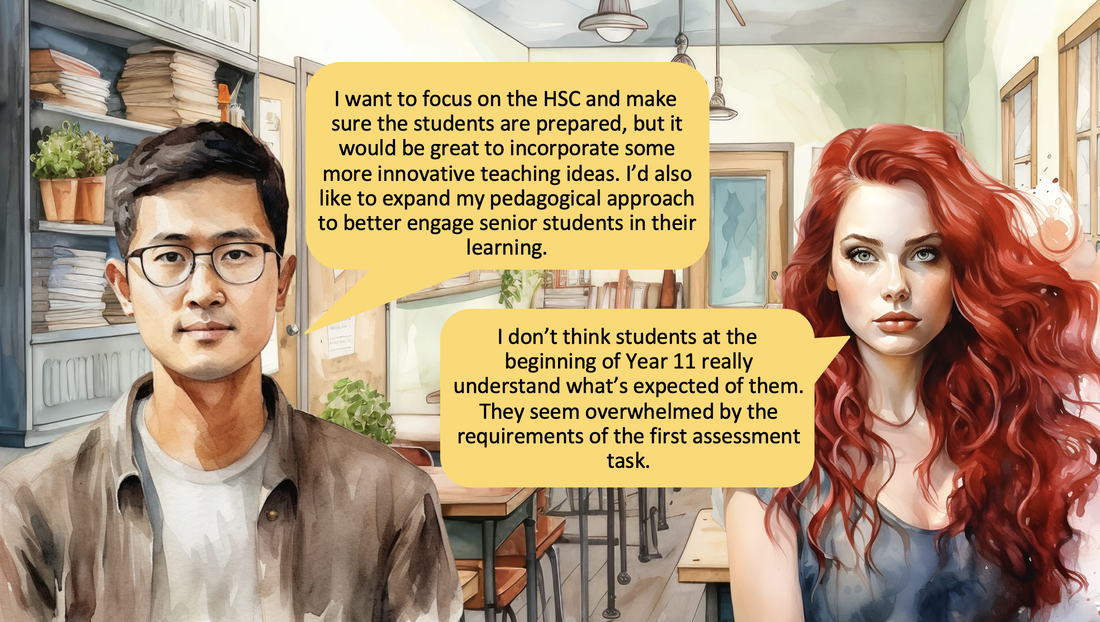 7-10 syllabus implementation timeline: 2024 – English and Maths, Aboriginal, Classical and Modern Languages, Computing Technology implemented 2026 – Science, Dance, Drama, Music, Technology 7-8, Auslan implemented 2027 – PDHPE, Geography, History, Aboriginal Studies, Commerce, Visual Arts, Agricultural Tech, Engineering Tech, Marine and Aquaculture Tech implemented 2028 – Photographic Media, Child Studies, PASS, Visual and Motion Design, Work Education, Geography Elective, History Elective Industrial Tech, Design and Tech, Food Tech, Textiles Tech, Graphics Tech implemented 11-12 syllabus implementation timeline: 2024 – Geography, Enterprise Computing, Software Engineering 2025 – Health and Movement Science 2026 – English Studies/Standard/Advanced/Extension/EAL/D/Life Skills, Mathematics Standard/Advanced/Extension 1/Extension 2/Life Skills 2027 – Biology, Physics, Dance, Drama, Music 1, Music 2, Ancient History, History Extension, Modern History, Economics, Legal Studies, 2028 – Chemistry, Earth and Environmental Science, Music Extension, Visual Arts, Aboriginal Studies, Business Studies, Society and Culture, Agriculture, Engineering Studies, Industrial Technology, Textiles and Design This post is only focused on subjects due for implementation up until 2028. Other syllabuses are scheduled for 2029 and some have timelines yet to be announced, but these haven't been included due to the possibility of changes to the schedule given that it is a considerable time away. Programming and sequencing considerations for 7-12 English/Maths The 7-10 English and Maths syllabuses are being implemented in 2024, while the 11-12 syllabuses for English and Maths (all levels are planned for implementation in 2026. As the junior teaching and learning programs will be written and implemented first, 7-10 English and Maths should inform Senior English and Maths programs. 7-10 Science and Stage 6 Biology, Physics, Chemistry and Earth and Environmental Science The 7-10 Science syllabus is planned for implementation in 2026, while Biology and Physics are due to be implemented in 2027, and Chemistry and Earth and Environmental Studies aren't due until 2028. 7-10 Science programs should inform all senior Science teaching and learning programs. 7-10 Geography and Stage 6 Geography Stage 6 Geography is currently being implemented in 2024, while 7-10 Geography is not due for implementation until 2027. In this case the senior teaching and learning programs, assessments, scope and sequences will be completed prior to the junior years. When junior programming begins, teachers will need to refer to the Senior Geography programs and backward map. 7-10 History and Commerce, and Stage 6 Ancient History, History Extension, Modern History, Economics and Legal Studies. All of these subjects are due for implementation in 2027. This is an opportunity for collaborative programming and sequencing for 7-12 to try to avoid replication, appropriate development of understanding of metalanguage, skills and content. Unfortunately, this is a huge workload for HSIE teachers involved in programming, and will require a lot of time and effort in 2026 for staff to be able to get through the programming requirement for each subject, and the risk of having so many subjects being implemented in the same year is that planning may be compromised by workload issues. 7-10 Computing Technology, Stage 6 Enterprise Computing and Software Engineering These subjects are all being implemented in 2024. There is an opportunity for junior and senior collaboration and program review in 2024 and 2025 to work on sequencing. 7-10 PDHPE, Stage 6 Health and Movement Science Stage 6 Health and Movement Science is due for implementation in 2025, while 7-10 PDHPE is due for implementation in 2027. Senior Health and Movement Science should inform planning for 7-10 PDHPE programming. 7-10 Dance, Drama, Music and Stage 6 Dance, Drama, Music 1 and Music 2 7-10 Dance, Drama, Music is being implemented in 2026, while Stage 6 Dance, Drama, Music 1 and Music 2 are being implemented in 2027. The junior teaching and learning programs should inform the senior programs. Simplified timeline for collaboration Below is a possible timeline for collaboration to allow sequencing for primary, junior and senior syllabuses up until the end of 2026. This includes information discussed in another post regarding Curriculum Reform: Curriculum Reform - Primary and Secondary Sequencing. 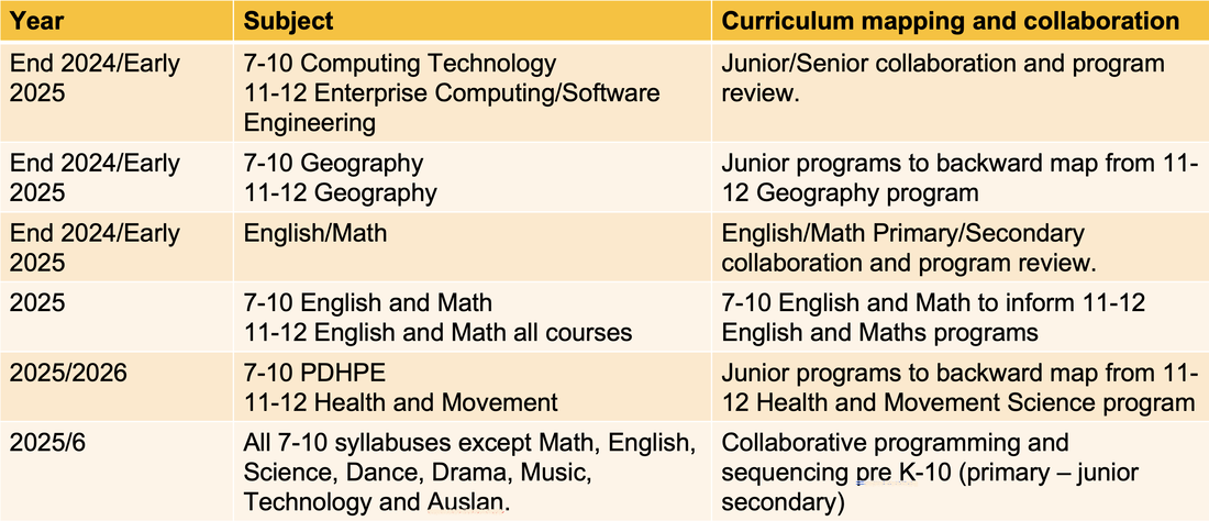 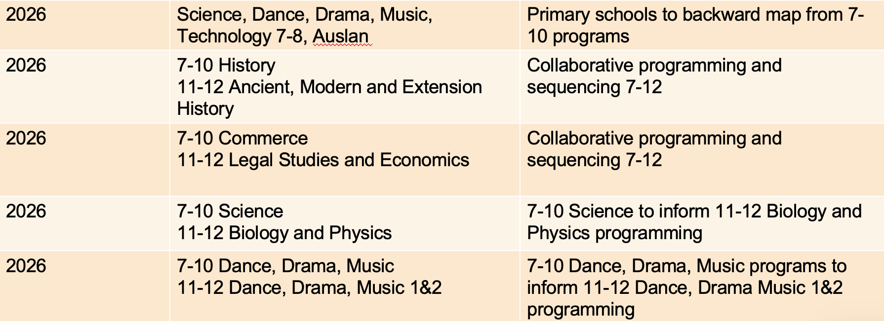 Primary to High School transition ensures that students feel supported and settle into high school well. Most schools have comprehensive transition programs to meet the social and emotional needs of students, but with curriculum reform upon us, it may be time to revisit primary and secondary connections and collaboration in terms of curriculum sequencing and programming. Why is Primary-Secondary curriculum sequencing important? Repetition of content In HSIE subjects, a common issue that arises is that students from partner primary schools may have already completed case studies that are covered in Year 7. For example in History, students have often already learnt about Ancient Egypt. Gaps in learning Identifying any content that may have been missed by individual students or groups of students is necessary to ensure that students have the assumed knowledge that forms a basis of their learning in Year 7. For example Geography was introduced as a separate subject in primary schools as part of the K-10 Geography syllabus in 2015, rather than being part of a HSIE syllabus. As this was a more complex syllabus for K-6 Geography it was common for there to be gaps in learning when students came into Year 7. Geography has again been incorporated into a HSIE syllabus as part of the current Curriculum Reform. Complexity of learning Part of the challenge when students come into Year 7 is providing work that is complex enough for them to be engaged and interested, but providing the right supports and scaffolds to ensure they manage with all the changes that high school brings - multiple subjects and teachers, assessment tasks, a much more varied schedule, independently looking after books and laptops, etc. It is possible for students to be overwhelmed with the new setting, but bored with the content. In an attempt to ease issues with 6-7 transition, often work provided in Year 7 is too simple and doesn't challenge students enough. Primary–Secondary curriculum sequencing provides an opportunity for discussion and collaboration to address some of these issues. 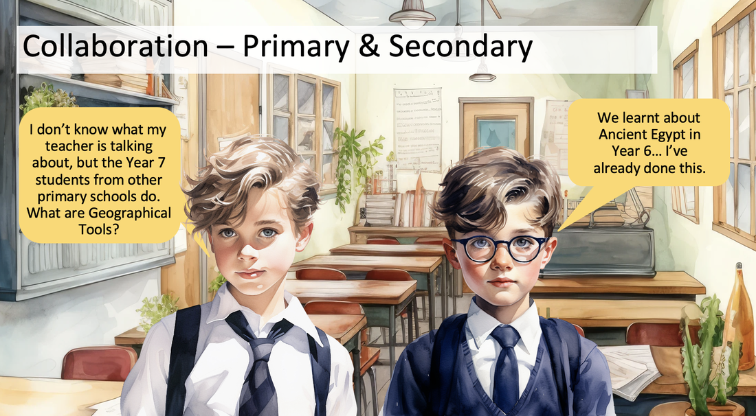 Primary Implementation Timeline: 2023 – English & Maths Early Stage 1 and Stage 1 implemented 2024 – English & Maths Stage 2 & 3 implemented 2027 – Creative Arts, HSIE, PDHPE, Science and Technology K-6 implemented. Secondary 7-10 Implementation Timeline: 2024 – English and Maths, Aboriginal, Classical and Modern Languages, Computing Technology implemented 2026 – Science, Dance, Drama, Music, Technology 7-8, Auslan implemented 2027 – PDHPE, Geography, History, Aboriginal Studies, Commerce, Visual Arts, Agricultural Tech, Engineering Tech, Marine and Aquaculture Tech implemented 2028 – Photographic Media, Child Studies, PASS, Visual and Motion Design, Work Education, Geography Elective, History Elective Industrial Tech, Design and Tech, Food Tech, Textiles Tech, Graphics Tech implemented Opportunities for collaboration English/Maths Both Primary & Secondary 7-10 are currently implementing the new syllabuses with programs and teaching and learning materials being developed. This provides an opportunity at the end of 2024 or beginning of 2025 for English/Maths Primary/Secondary collaboration and program review. Science, Dance, Drama, Music, Technology 7-8, Auslan Secondary 7-10 syllabuses for these subjects will be implemented in 2026. Primary schools will be implementing new syllabuses for these subjects in 2027. 2026 will provide an opportunity for high schools to provide feedback to primary schools about what's in their teaching and learning programs to inform program development in Stage 3. All other 7-10 subjects, including Geography and History Primary schools will be implementing syllabuses for Creative Arts, HSIE, PDHPE, Science and Technology K-6 in 2027. All remaining 7-10 syllabuses will be implemented in 2027 or 2028. This provides and opportunity for genuine collaborative sequencing and program development in 2025/6 for these subjects as syllabuses are finalised. 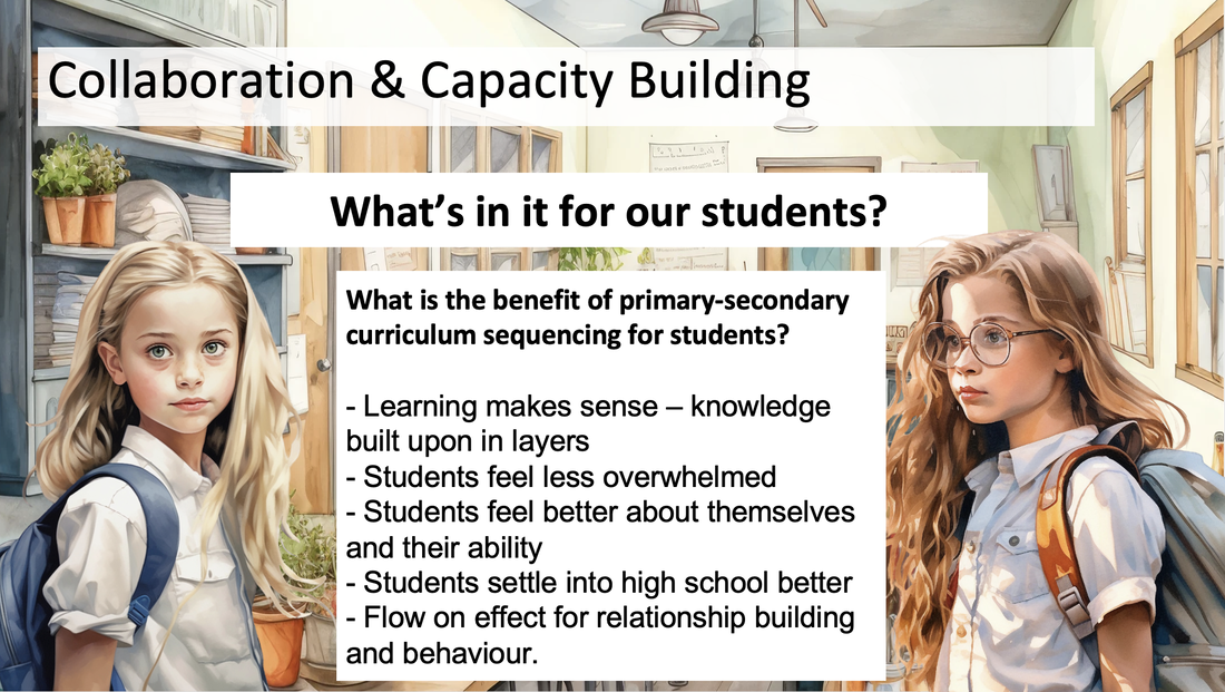 Why is collaboration important between high schools and primary schools? - Curriculum sequencing – flow of content/skills, particularly in the period Year 6-7 - Avoiding repetition of concepts/case studies - Ensuring academic rigour and challenge for students (not dumbing down Year 7) - Recognising differences in delivery between primary schools and determining how to address the differences. - Sharing curriculum adjustments implemented at primary schools. 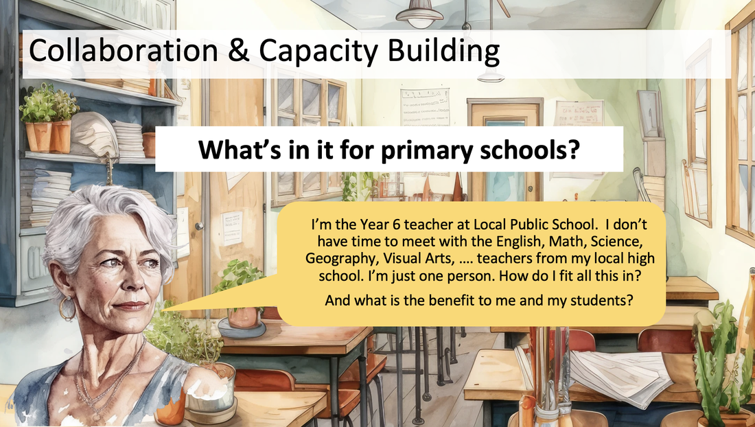 What challenges does this present? How can these be overcome?
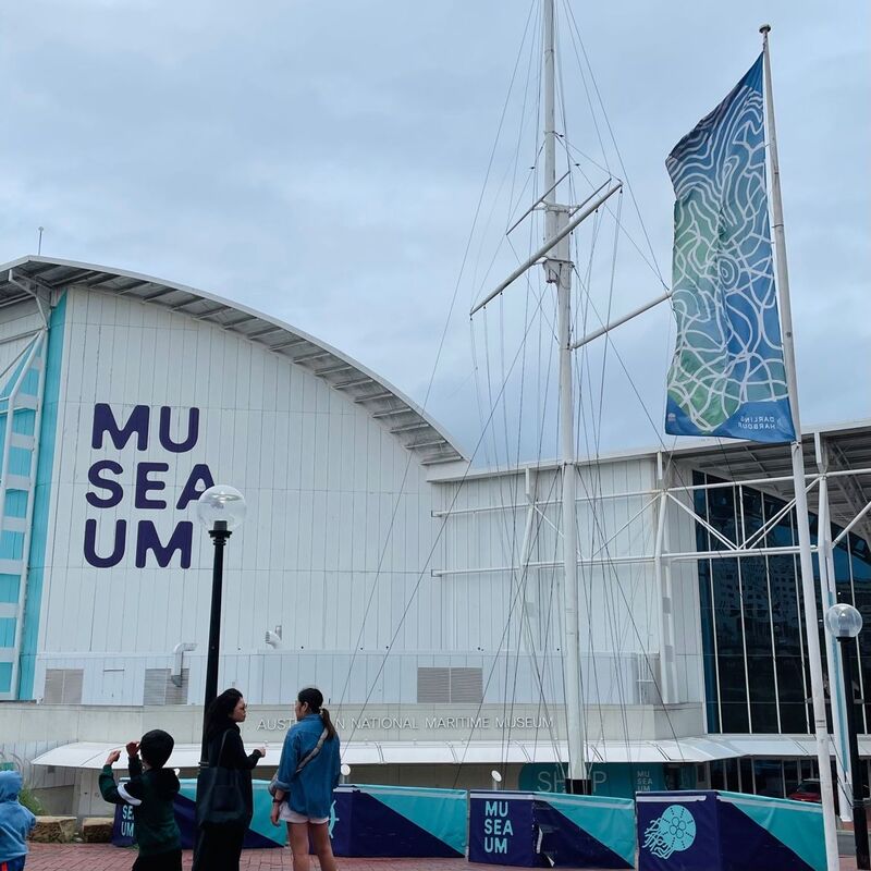
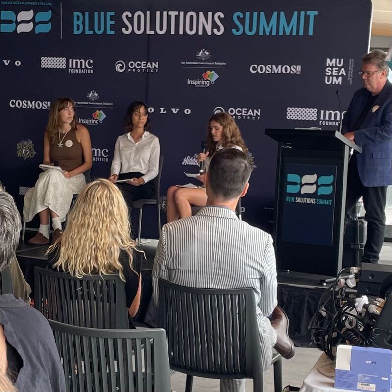
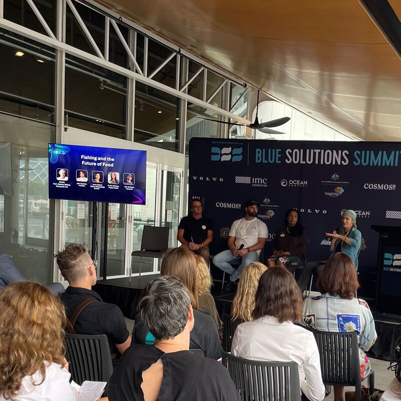
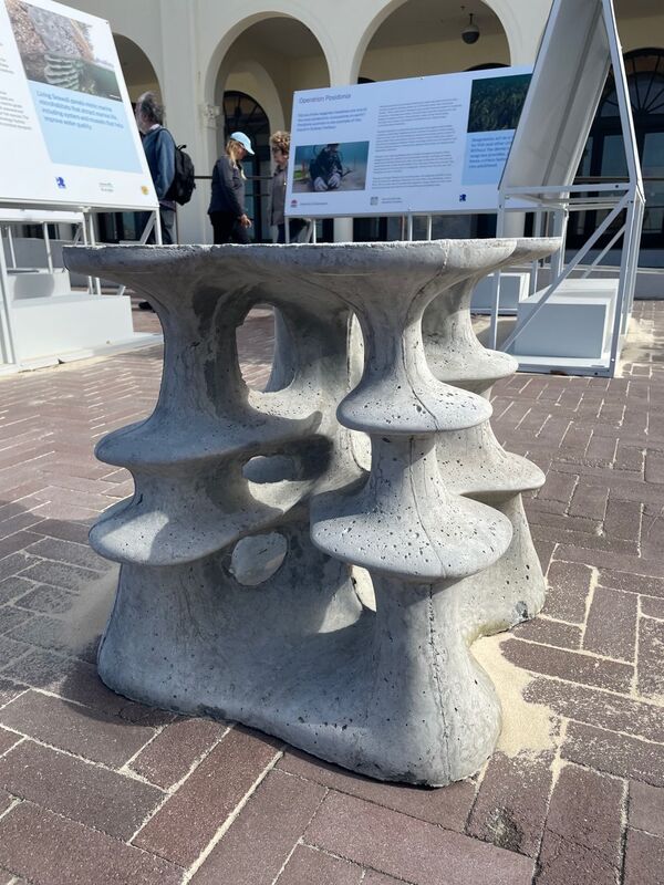
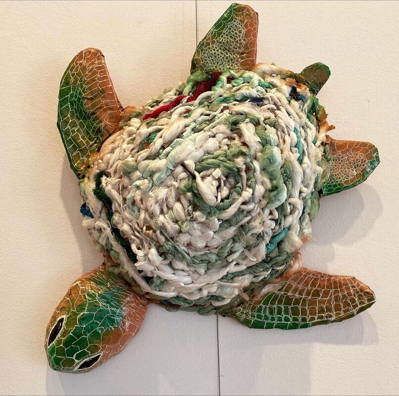
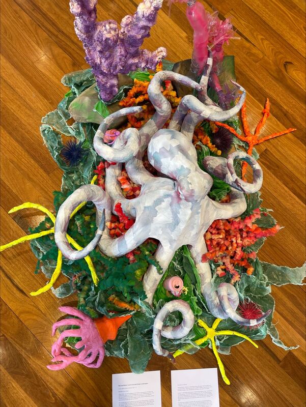
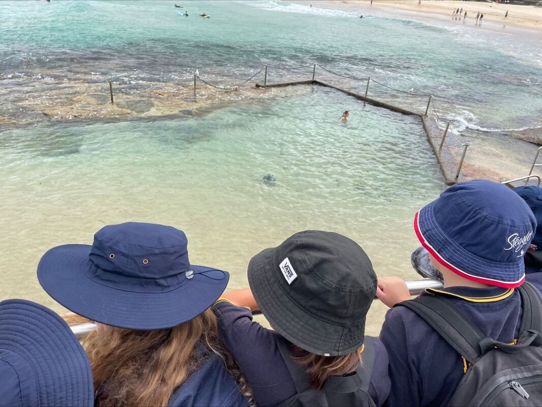
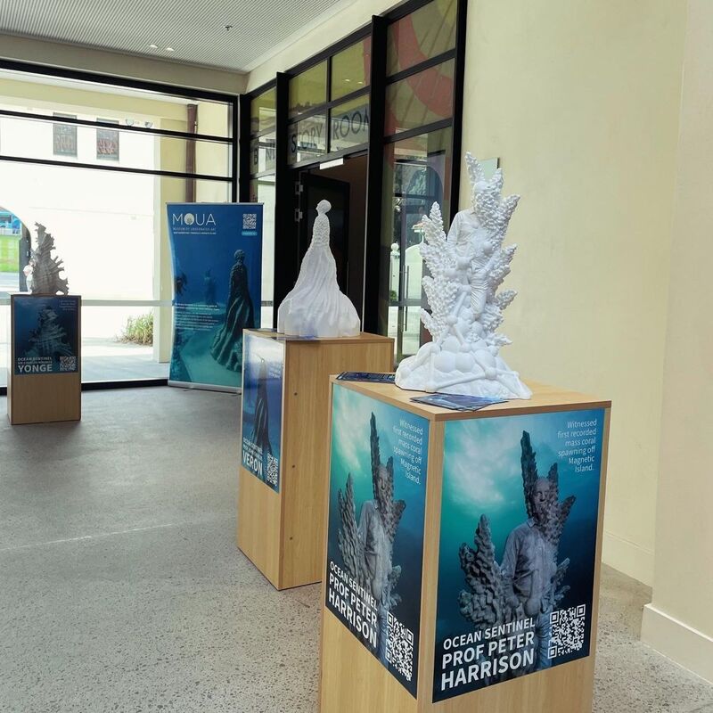
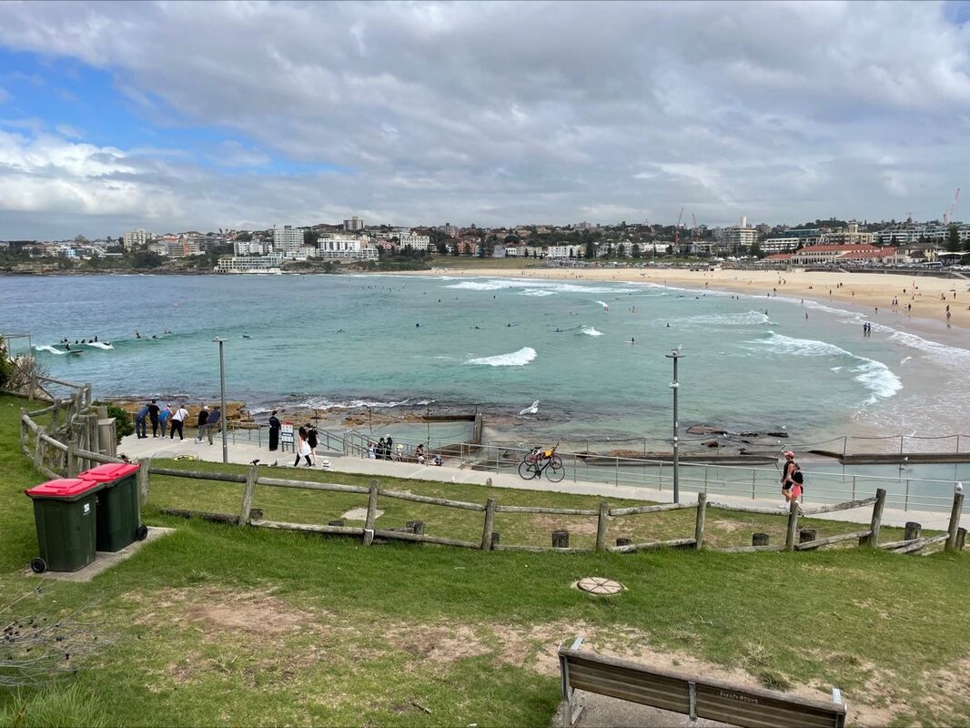
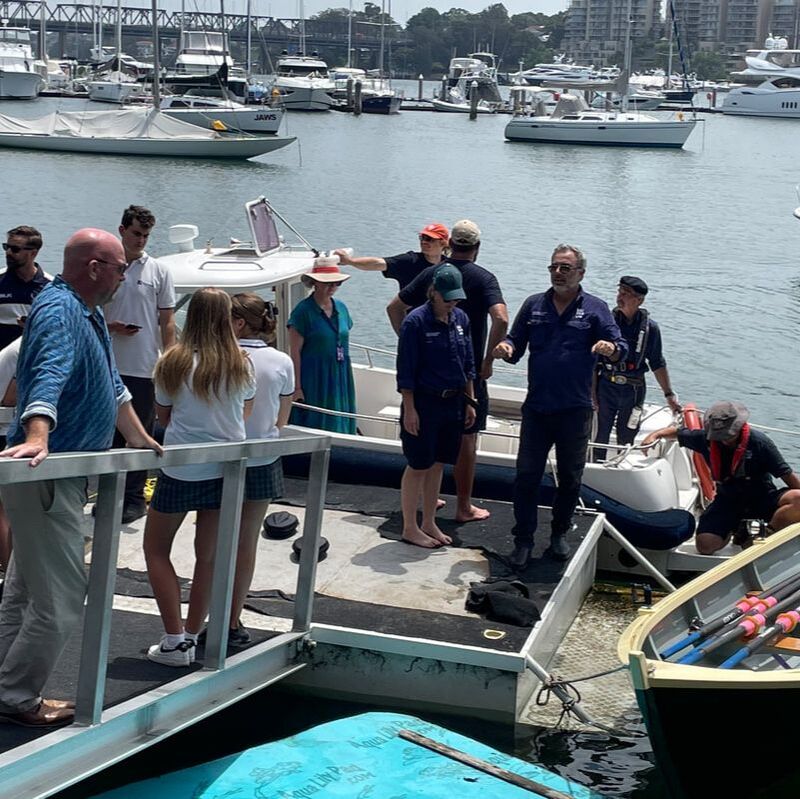
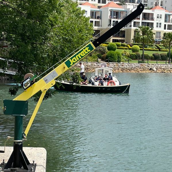
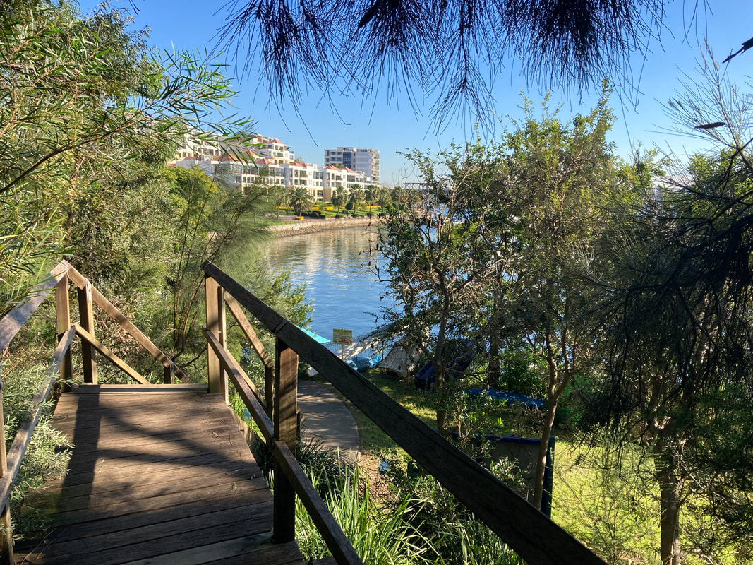
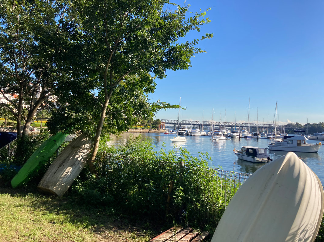
As always, the biggest issues are time and motivation. This is particularly the case for primary school teachers, who can't be expected to meet with a whole range of different specialist teachers individually. Structures need to be put in place that enable genuine sharing without placing any an reasonable burdens on teachers, but particularly primary school teachers. The use of staff development days or faculty planning time can be useful, but release time is key for initiatives like this to work. Even then, the reality is that teachers will still need to give up some time. For this reason, for the most part, initiatives like this should be done in short bursts, with small achievable objectives to be met. It takes time to build relationships between people in different schools, and as a result it can be valuable to have some key contacts at each school that work together regularly, that then bring in a larger number of staff to work together at various times. Staff turnover is another challenge to the longevity of primary-secondary collaboration initiatives. In this case, a project of a few weeks should enable schools to achieve collaboration on curriculum, without staff turnover being too much of an issue. I recently attended the Volvo Ocean Lovers Festival at the Australian National Maritime Museum and at Bondi. I paid to attend on a couple of the days and attended a couple of the days as a volunteer. Day 1 of the Volvo Ocean Lovers Festival was the Blue Solutions Summit at the Australian National Maritime Museum. Keynote speakers were: Dr. Lucy Buxton from Ocean Decade Australia, Julie Hutchinson from Volvo Car Australia, and James Valentine from Australian Broadcasting Company. There were three discussion panels: Ocean Innovation, Ocean Plastic and Pollution, and Fishing and the Future of Food. There were lots of discussions about research and programs to protect our marine environment, and innovations in a range of industries. There were productive discussions about issues of ocean pollution and plastic, and sustainability of the fishing industry. The Youth Advisory panel was a great example of student engagement and leadership with their discussion - Have we left it too late? The Blue Solutions Summit was a great opportunity to learn new things, engage with a wide range of experts in a range of fields, and do something genuinely enjoyable. A few questions raised and comments that I thought were worth more thought… - Where can you have the most impact? Get involved... - What do you do better than anyone else? Do that…. - You can’t easily change the world, but you can change your world. Be passionate... I volunteered during the Ocean Lovers Festival School Days and assisted with the school excursions at Bondi. Some excellent student artworks were on display at Litterati. These were artworks created from common items of marine pollution. There were displays and hands on activities from a range of organisations including Sydney Institute of Marine Science, SeaLife, the Australian National Maritime Museum, Underwater Earth, University of Sydney and Ocean Sentinels. There were a series of talks including from Emily Rowland, Ocean Youth Ambassador; Cay-Leigh Bartnicke, Science Curator, Australian National Maritime Museum; Associate Professor Rachael Gray, The University of Sydney; Megan Trethewy – Research Assistant: Project Restore, Sydney Institute of Marine Science. My favourite activity was run by the Australian National Maritime Museum for primary students using an underwater drone to explore the ocean pool at North Bondi. Further talks, displays and markets took place over the weekend. This event was informative and engaging and reinforced my belief in the importance of environmental education, particularly in schools, to bring about wider change. In the future this would be useful for a half day excursion for : - students in Year 10 Geography studying Environmental Change and Management using a coastal, catchment or harbour case study - students in Year 12 Geography studying the Great Southern Reef or Great Barrier Reef as a case study for Ecosystems At Risk/ Ecosystems and Global Biodiversity. On 7 December, a community event was held to celebrate the success of the Balmain Foreshore Project and to meet accountabilities related to funds received. The event was attended by representatives from the Australian National Maritime Museum, Sydney Institute of Marine Science, Living Seawalls, Transurban - West Connex Community Grants as well as teachers and students from the school. The event kicked off with a team of staff from the Australian National Maritime Museum towing the restored and fitted student-built St Ayles skiff and staff having a row around the bay. One of our staff on the Balmain Foreshore Project Team helped students demonstrate the use of the underwater drones for our guests, we showed our guests the new Living Seawall panels and the Jarrett backsaver crane and educational signage. The project was only successful as a result of a team of motivated, likeminded staff that came together regularly to assess progress, make adjustments to the program, engage with experts in a range of relevant fields and work towards keeping students engaged in the project. We were lucky enough to have ongoing support from a range of organisations who assisted us as we explored the directions of the project, as well as the logistics of installing the various components. The project wouldn't have been possible without the support of The Australian Museum, Living Seawalls, the Sydney Institute of Marine Science, the Australian National Maritime Museum and the Harding-Miller Foundation for their input during the project. The project was mostly funded by the Transurban through a community grant. The Balmain Foreshore Project website has also been launched, where you can read about the various components of the project as well as its links with teaching and learning: Balmain Foreshore Project
 This is one of several posts about our Balmain Foreshore Project. Read more... Balmain Foreshore Project - Introduction Gardening Below the Surface - Operation Posidonia Balmain Foreshore Project - Trial Activities Balmain Foreshore Project - Implementation Balmain Foreshore Project - Living Seawalls Balmain Foreshore Project - Living Seawalls: Pre-Installation Biodiversity Survey Balmain Foreshore Project - Launch and 2023 Reflection Quite a few people have reached out to me lately about what is available for teachers that are preparing for implementation of the new Stage 6 syllabus right now. As you probably already know, both the GTA book and the Kleeman book have not been released just yet, but are on their way. So here's some resources that you can get your hands on right away (this is literally a copy of some of the emails that I sent to people). NESA NESA has released support resources that can be found here (see screenshot attached):
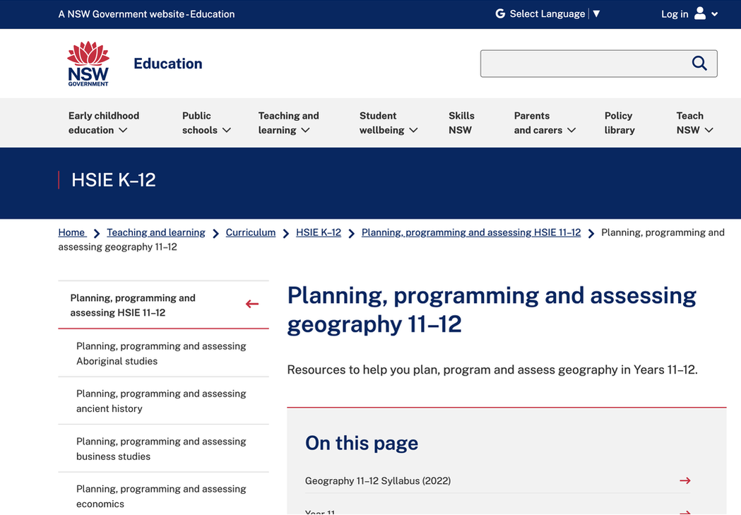
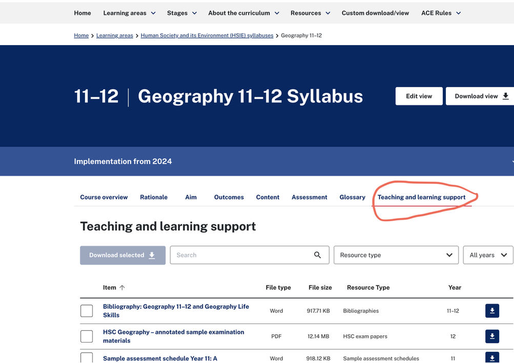 Department of Education The DoE has started releasing support material but they are only about 2/3 of the way through the Year 11 course (see screenshot attached):
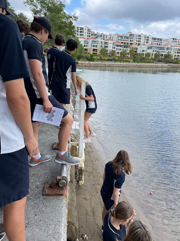
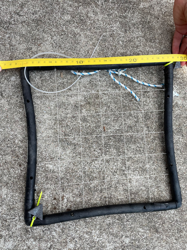
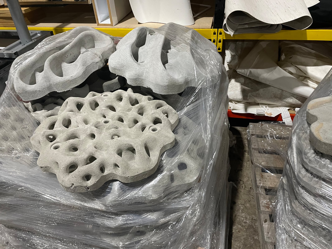
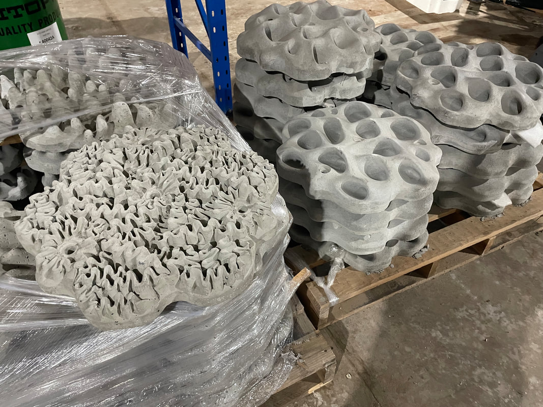
 Powerful Geography 1 In. the lead up to the release fo the Powerful Geography 1 resource, an Author's Blog has been created to provide support for programming, lesson planning and integrating fieldwork. There blog can be found here: www.powerfulgeography.weebly.com  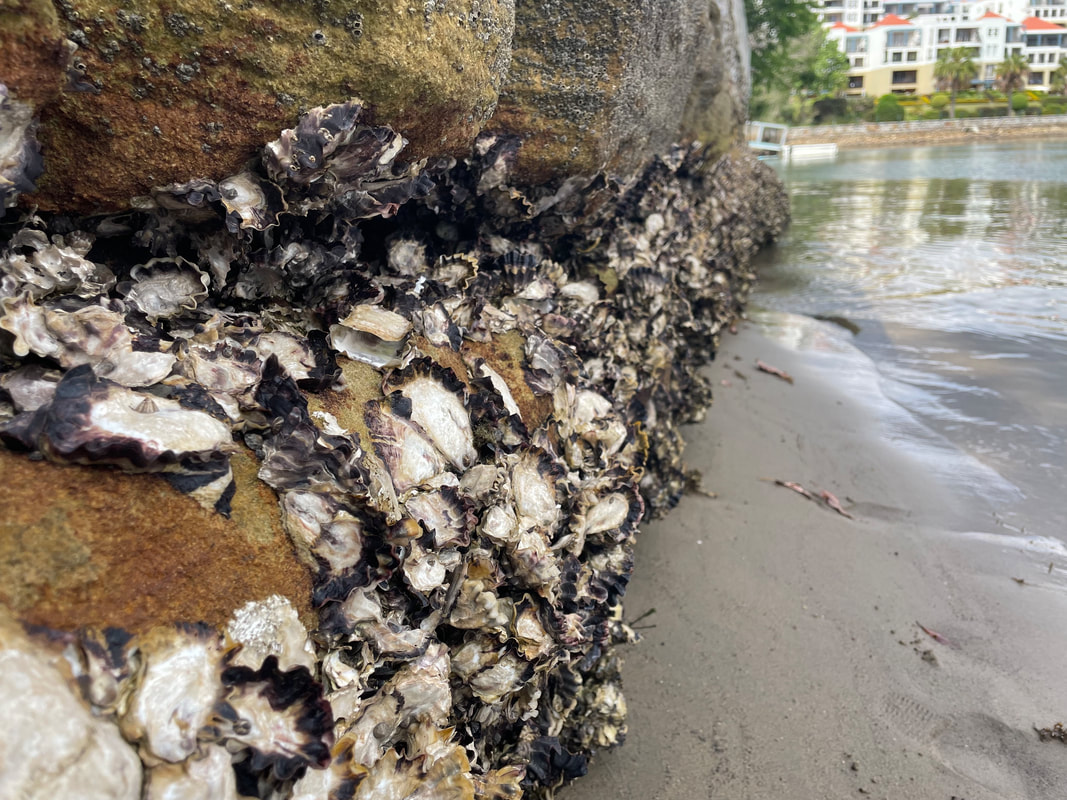 Our Balmain Foreshore Project continues with a pre-installation biodiversity survey of our school's seawall today. Dr Rosie Steinberg spent time teaching our staff and students how to undertake the biodiversity survey so that it can be repeated over time to assess the effectiveness of the Living Seawall panels in encouraging biodiversity. A seawall has been selected along the school's property for installation. Students accessed the site by ladder and in most places the water was ankle or knee deep. In a few spaces it was a little deeper, but no more than mid-thigh. We had multiple teachers on supervision to ensure safety. The survey involved a quadrat method. The quadrats were fairly simple in design - something similar to poly pipe used for irrigation with fishing line to create intersections. They measure 25 cm square.
The focus of the activity was an extended length of around 15 metres along the wall. 4 areas were identified for installation of the seawall panels, with control areas in between where panels would not be installed. The length of seawall is accessible at low tide, and sites were chosen for the panels along the oyster band and below (mid to low intertidal zones). Students worked in teams of 3-4 to undertake the survey. 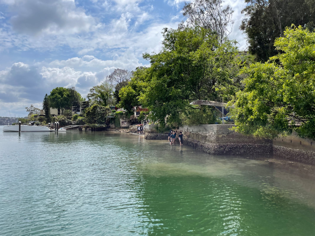 Students held a quadrat square along the wall, and then recorded the organisms found. This activity was repeated a number of times in areas that will have sea wall panels installed, as well as areas that will not (control sites). Students referred to the Living Seawalls Field Guide to identify Species groups - Molluscs, crustaceans - Mobile, Crustaceans - Barnacles, Ascidiacea (sea Squirts), Bryozoa, Porifea - Sponge, Polycheaete - Tubeworm, Algae - Erect Branching, Algae - Globose, Algae - Laminate, Algae - Articulated Calcareous, Algae - Filamentous, Algae - Encrusting, and Algae - Sheetlike. 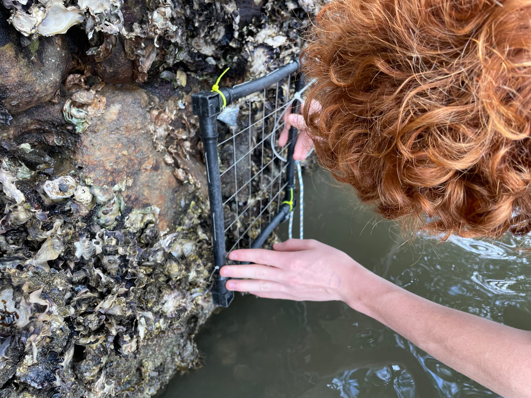 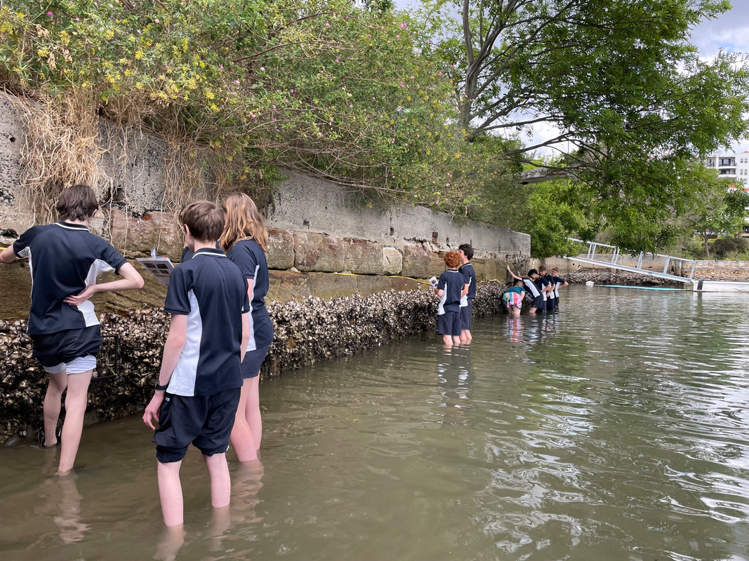 This is the first survey planned for this site. It is expected that this activity will be completed several times a year once the Living Seawall panels are installed.
I need to give a big shout out to Aria Lee the Living Seawalls Project Manager at the Sydney Institute of Marine Sciences (SIMs) who has been invaluable in helping us bring this part of our project together. This is one of several posts about our Balmain Foreshore Project. Read more... Balmain Foreshore Project - Introduction Gardening Below the Surface - Operation Posidonia Balmain Foreshore Project - Trial Activities Balmain Foreshore Project - Implementation Balmain Foreshore Project - Living Seawalls Balmain Foreshore Project - Living Seawalls: Pre-Installation Biodiversity Survey Over the last couple of weeks, the Manly Observer has been recording the appearance and removal of an industrial tyre at Long Reef and the actions of mostly young people in the community to relocate it. They removed the sand that had built up inside it to try to make it easier to move, but each time they took out a layer of sand they found a variety of fish, rays and juvenile sharks. In all, around 80 marine creatures were removed from the inside of the tyre. Read the full story here: How 80 dead creatures came to rest inside an industrial tyre on the Long Reef Shoreline 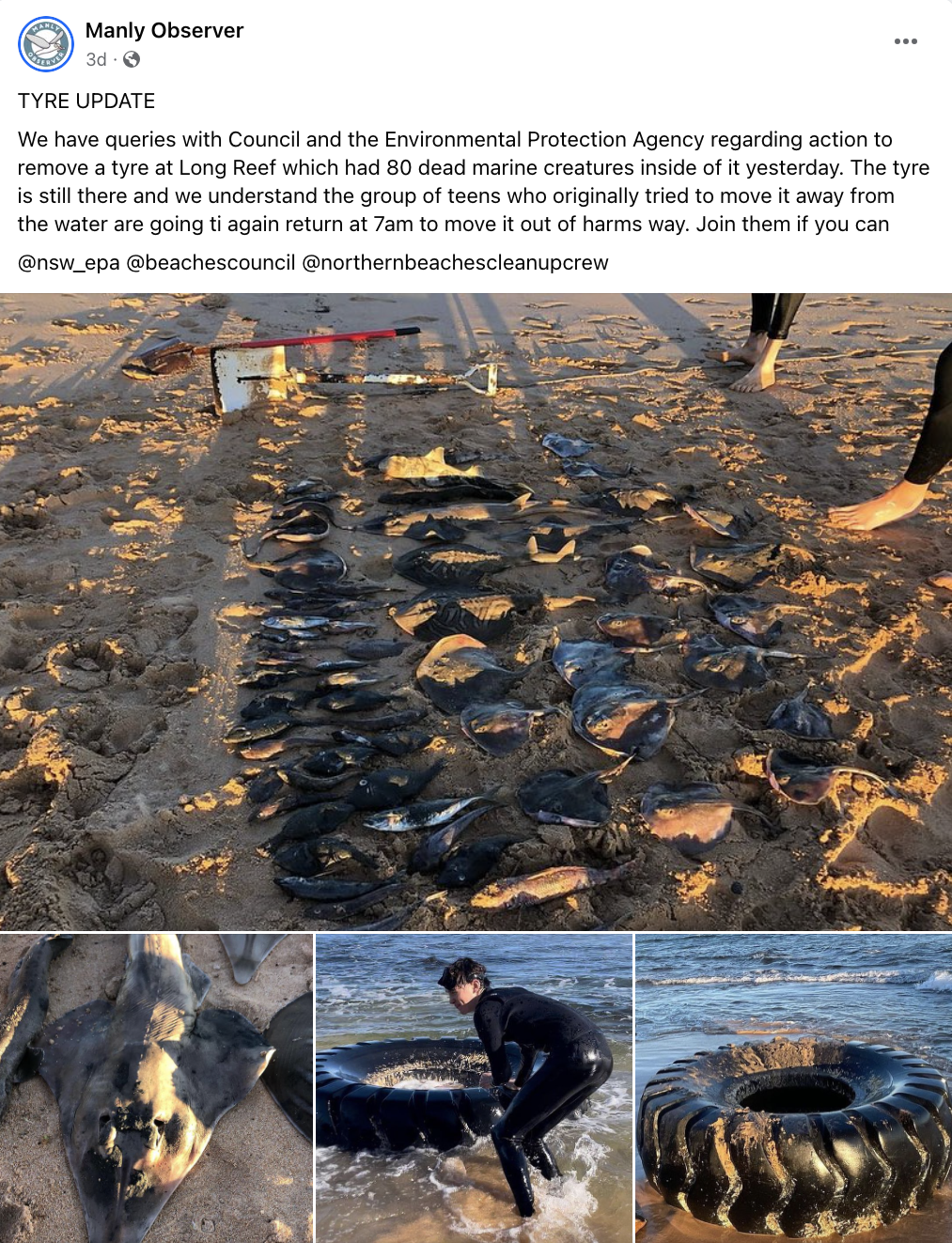 The reporters and community engaged in discussions about how so many marine creatures could have made their way inside the tyre. Some suggested that it was being used for shelter, and then as the tides went out animals became trapped. 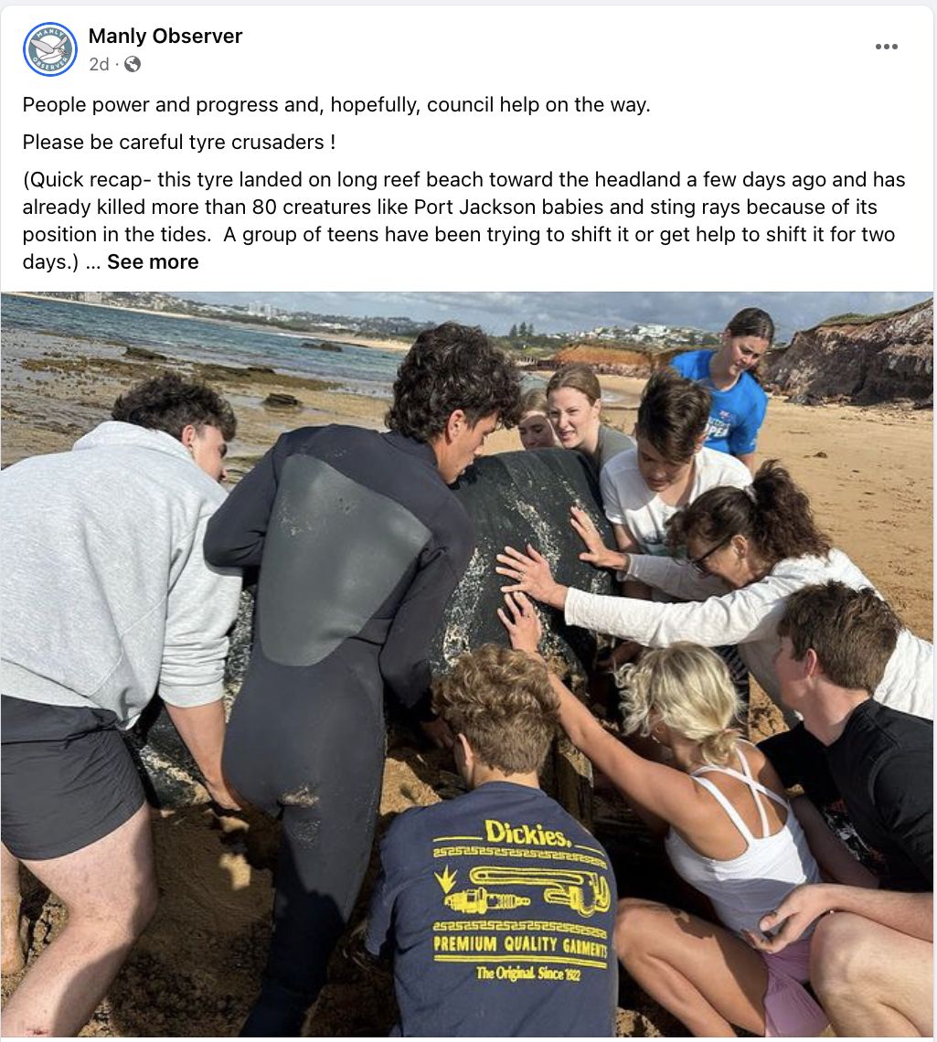 Eventually the group managed to move the tyre away from the shoreline, and it drew enough attention that the local council became involved the remove it from the beach entirely. 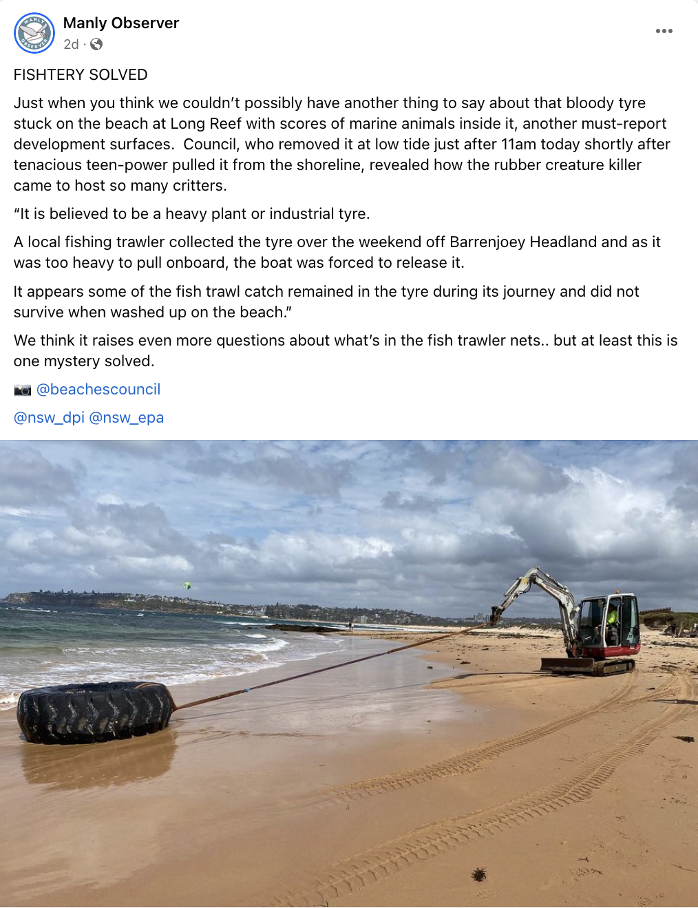 Council reported that a local fishing trawler had let them know that they had unintentionally pulled up the tyre out of the water, but it was too weighty to bring aboard the ship, and they released it back into the water. The creatures inside the tyre were most likely to have been bycatch, caught in the trawlers net.
This is a great little story to use in the classroom. Active Citizenship It highlights the importance of active citizenship in the most practical way. It shows that how young people can have an impact on their environment, work collaboratively and achieve something tangible that initially seems beyond their capacity. It demonstrates how collective action can get the attention of media, government and the community and bring about more change than the individuals are capable of by themselves. Geographic Investigation This story is a great way to talk to students about hypotheses, assumptions, using sources, and drawing conclusions. The teenagers began their own investigation of the tyre, found the dead creatures and assumed the tyre had caused the deaths. The tyre may have caused some of those deaths. The idea of fish getting caught on the low tide is entirely plausible, but doesn’t seem to account for the huge number of creatures found. Regardless, I love that some mostly incorrect assumptions resulted in these teenagers doing something great (removing rubbish from our oceans). Contacting additional sources – like the local council - led to the alternate and more plausible explanation of the involvement of the fishing trawler. Let’s hope these young people are now encouraged to find out more about trawling. Problem Solving and Mystery The way this story unfolded on social media was really interesting and engaging, and this could be replicated in a classroom by only providing some pieces of information at a time and allowing students to problem solve and eventually solve a mystery. Students could be presented with a range of scenarios to explore - the tyre in the water, the creatures in the tyre, the weight of the tyre, the encroaching tide, etc. Student could be asked to problem solve each step and be given roadblocks or positive outcomes dependent on the solution they come up with. Open ended questions could be provided to encourage deeper exploration of coastal environments, environmental issues and management strategies. The structure could almost be set up like a murder mystery, with clues along the way, and students trying to solve the crime. It is easy to fall into a trap of thinking that environmental issues are too big for an individual to have an impact. I have only recently had some conversations with students who felt they couldn’t make any real impact because the world’s problems were just too big. This is a great, short story to engage students with geography and show the impact that individuals and groups can have their local environment, but also that once that first job is one, there’s more to do! This week we picked up some Living Seawall panels to install on school property as part of the Balmain Foreshore Project. A section of our school property, along the water’s edge allows public access to the Bay Walk and is a thoroughfare accessed by members of the public. The project provides a unique opportunity for our school to contribute to environmental sustainability, teach students about their community responsibilities, and inform the public about environmental issues affecting the local community.
As part of this project, earlier in the year, students heard from the Aria Lee, Project Manager of Living Seawalls who told students about the research and development behind the concept of Living Seawalls, the locations where they can be found around Sydney Harbour and globally, and the ecological benefits of Living Seawalls.
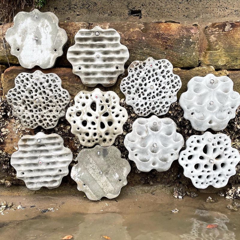
A few months ago our Balmain Foreshore Project team was excited to receive a substantial Westconnex Community Grant for continuation of the Balmain Foreshore Project. As part of the Westconnex Grant, funds have been allocated to purchase and install Living Seawall panels on the seawall on school property in an attempt to improve water quality and encourage greater biodiversity in the local waterway. Prior to installation we will be collecting baseline data to identify the diversity of species currently inhabiting the seawall, and we intend to set up a longitudinal study to investigate change over time in species diversity.
This is one of several posts about our Balmain Foreshore Project. Read more... Balmain Foreshore Project - Introduction Gardening Below the Surface - Operation Posidonia Balmain Foreshore Project - Trial Activities Balmain Foreshore Project - Implementation Balmain Foreshore Project - Living Seawalls Balmain Foreshore Project - Living Seawalls: Pre-Installation Biodiversity Survey Outcomes
The outcomes have not changed much from the current syllabus to the new draft Geography syllabus, other than some minor phrasing. In the current syllabus there are 6 outcomes for both Stage 4 and 5, and the same applies for the new draft. GE4-3 - explains how interactions and connections between people, places and environments result in change, and GE5-3 analyses the effect of interactions and connections between people, places and environments have both been discarded. In place of them the following has been included for Stage 4: describes how Aboriginal Peoples interact with Country, and for Stage 5: explains how Aboriginal Peoples interact with Country. I think that 4-2 and 4-3 could have been combined to create a new outcome, and 5-2 and 5-3 could have been combined. This would enable the outcomes to retain the meaning of the original outcomes and still allow for the inclusion of the new outcomes. Concepts There have been some minor changes to the descriptions of concepts for each stage. The main difference is in the presentation of the information, which in the current syllabus is part of the K-10 Concepts Continuum, but in the new draft is just present in a page and a half of text. This is generally a positive change which makes it easier to read and understand. Inquiry Skills and Tools Both the Geographical Inquiry Skills and Geographical Tools have been presented in the new draft Geography syllabus as a list, rather than in the Geographical Inquiry Skills Continuum or the Geographical Tools Continuum. In these cases this is a negative change. Geography was introduced as a separate syllabus for primary students with the current K-10 syllabus. The continuums allowed teachers to know which skills and tools that students would know when they entered high school. At this stage the K-6 HSIE syllabuses haven't been released, so it is unclear whether Geography will still have a separate syllabus (I suspect not). Regardless, it would be reasonable to expect that students would cover some geographical concepts, skills, tools and content in a HSIE syllabus. As a high school teacher how can I know what skills and tools students already know in Year 7? High school staff could obviously conduct pre-testing, but the continuums provided some clarity and also provided a connection between primary learning and high school learning, providing opportunities for collaborative teaching and learning activities across schools. Content My main concerns about this syllabus relate to the content. Firstly the "Thinking and working geographically" sections at the beginning of the content of each topic seem to be in the wrong place and don't tie closely enough to the content. In the current syllabus, the content is organised by dot point questions (mandatory) that provide dash point lists of subject matter (optional) that could be taught to provide more detail. In the new draft there are a series of dot points with directive terms that a too generic to tie in specifically with the content listed. These could be rephrased and placed more closely with the content that they relate to, or else left out for teachers to use their own discretion (drawing on sections at the beginning of the syllabus). The content has been cut significantly to make it clearer which parts of the syllabus are mandatory (headings and dot points) and which parts are optional (in the footnotes). While I appreciate that this is to achieve a more streamlined, simple syllabus, this could have more easily been achieved by improving teacher professional learning around the parts that are mandatory and optional in the current syllabus. The syllabus now seems overly simplified. Learning Across the Curriculum When the Australian Curriculum documents were first released they included general capabilities and cross curriculum priorities. In the NSW re-write of the Australian Curriculum, these were rebranded to Learning Across the Curriculum and included Cross-curriculum priorities (Aboriginal and Torres Strait Islander histories and cultures, Asia and Australia's engagement with Asia, Sustainability); General Capabilities (Critical and creative thinking, Ethical understanding, Information and communication technology capability, Intercultural understanding, Literacy, Numeracy, Personal and social capability); and Other learning across the curriculum areas (Civics and citizenship, Difference and Diversity and Work and enterprise). In the new draft syllabus, the old "Learning Across the Curriculum" will be known as "Capabilities and Priorities". It seems that this will include the other areas that NSW included in the current syllabus that were not in the Australian Curriculum, however there is insufficient detail at this stage to be sure. The new draft Geography syllabus does include a list of Capabilities and Priorities, nor does it include the coding of content that is included in the current syllabus to show where to include them. I would suggest that this area needs to be a little clearer - at the very least it needs to include a list of the Capabilities and Priorities. Creating written texts Geography easily lends itself to the inclusion of literacy and numeracy development. There are two sections of the new draft syllabus that describe the importance of teaching writing in Geography (page 5 and page 12). The written texts are specified as "descriptions, explanations, discussions, exposition and reports". As literacy is one of the General Capabilities, this seems like a bit of a double-up. Key Inquiry questions Key Inquiry Questions have been removed from the current syllabus. In the current syllabus the inclusion of outcomes, key inquiry questions and content is unnecessary. The removal of Key Inquiry Questions in the new draft Geography syllabus simplifies the topics and is a positive change. |