|
The cartoons below have been embedded from the Sydney Morning Herald and the Daily Telegraph.
Cartoons are a form of visual representation of ideas, views and concepts. It is important that students develop skills in interpreting cartoons. Interpreting cartoons involves knowledge of the context of the cartoon, identifying different issues being explored in the cartoon, identifying the techniques used by the artist, and considering the views or opinions that the artist is trying to convey. Basics: - What is the cartoon about? - Who is represented in the cartoon? Why? Knowledge of the context: - What events have happened? - Look at the date of the cartoon. What events had happened at the time the cartoon had been drawn? - Who are the key people/roles involved in the event/issue? Identifying issues explored: - What can you see in the cartoon? What words are used? - What concepts are being explored? Techniques: - Has the artist used symbolism, irony, analogy or exaggeration in communicating? - Is the cartoon persuasive? Views and opinions: - Can you identify the political views or perspective of the artist? - How are these views or perspective communicated? - What other opinions are there about this issue?
1 Comment
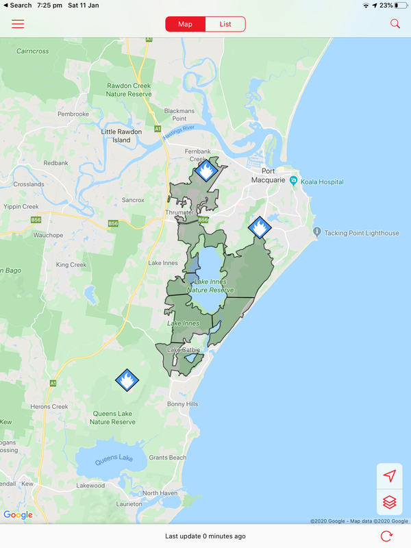
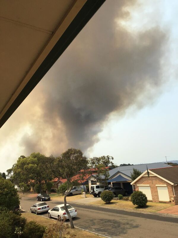
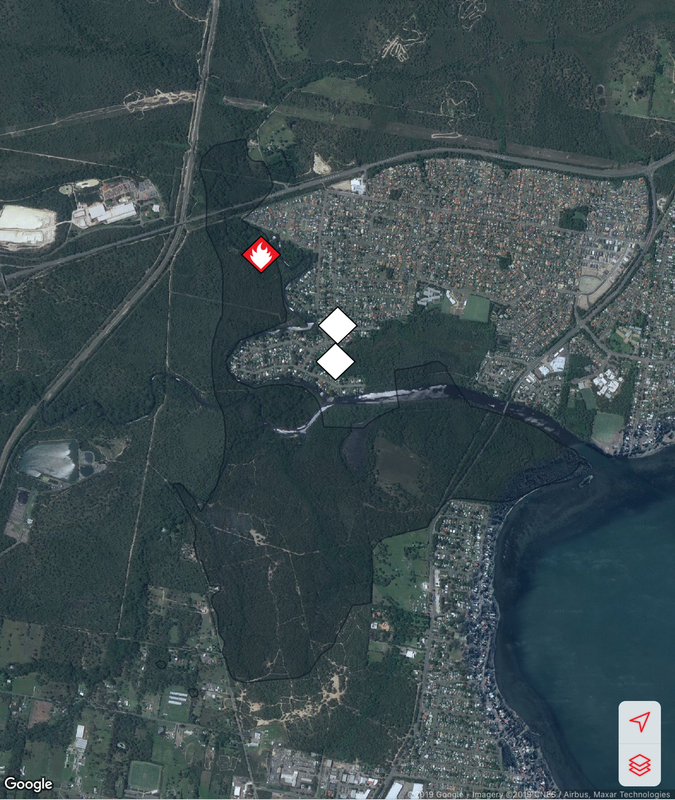
Fires around Port Macquarie, Lake Cathie and Lake Innes began in November 2019. As of 21 January the Crestwood Drive, Port Macquarie fire had burnt out 3572ha, while the connected Lindfield Park rd, Port Macquarie fire had burnt out 859ha.
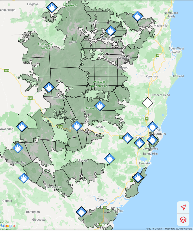
The Lake Innes Nature Reserve was home to a flourishing koala colony. Between 350 and 600 koalas are believed to have died in the fires around the Lake Innes area. The image on the left is a screenshot of the RFS Fires Near Me app showing the location and extent of the Port Macquarie fires. The screenshot on the right shows the size of the Port Macquarie fires in relation to other fires in the mid-North Coast region.
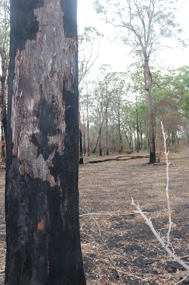
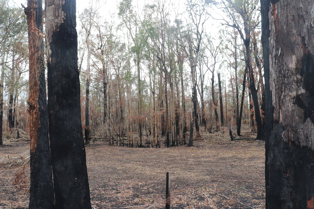
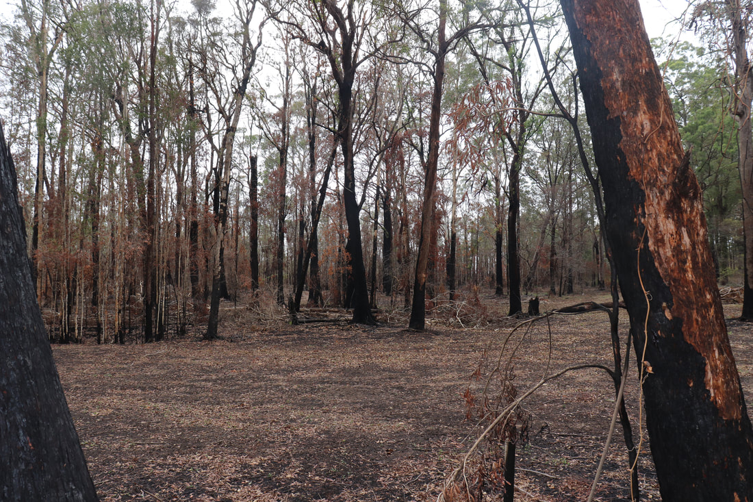
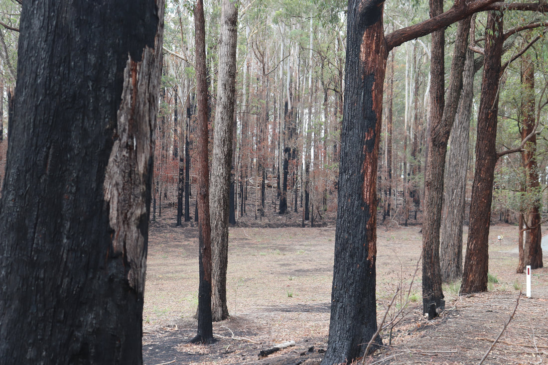
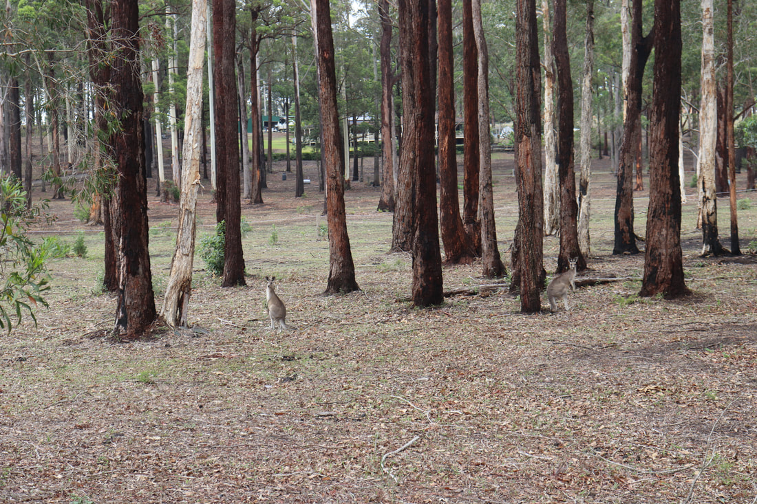
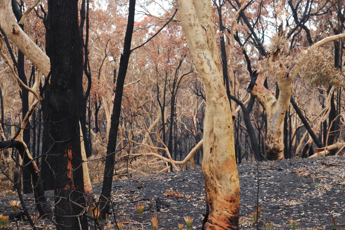
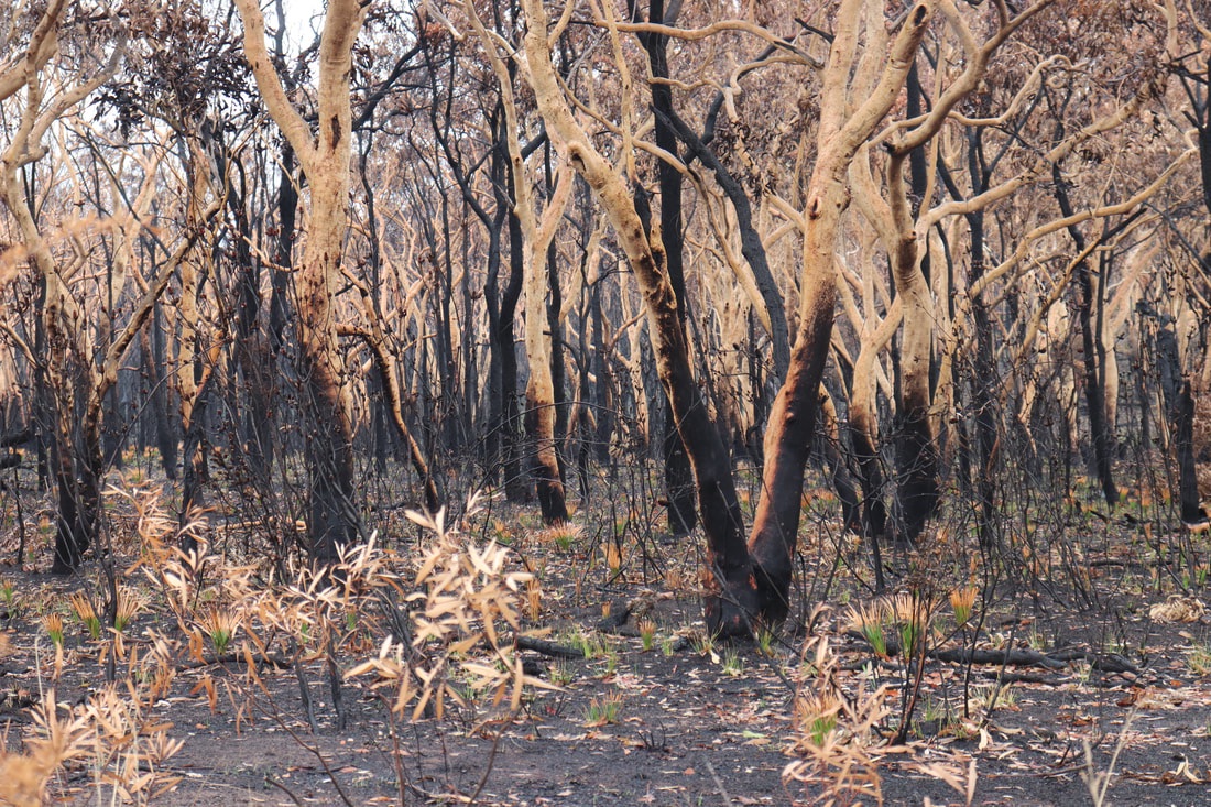
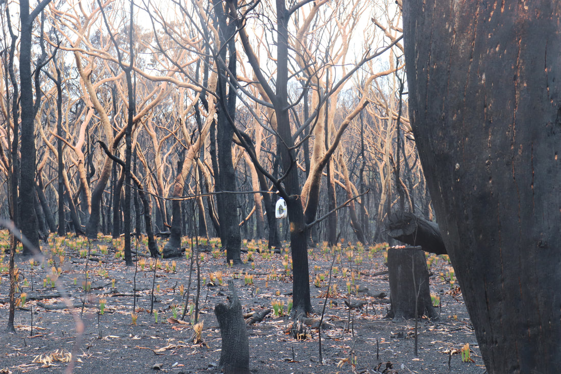
Photos below show the aftermath of the fire - taken on 17 January, 2020.
The post below from NSW National Parks and Wildlife Services indicate that while the fire around Lake Innes was extinguished, there remains risk for future fires flaring even several months later. The post below was posted on January 21.
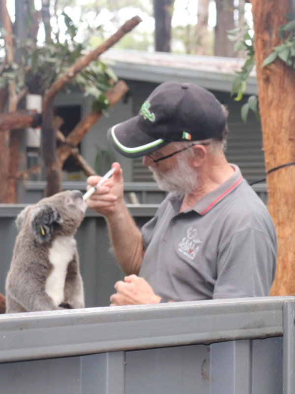
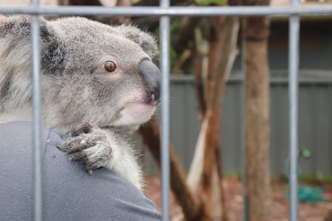
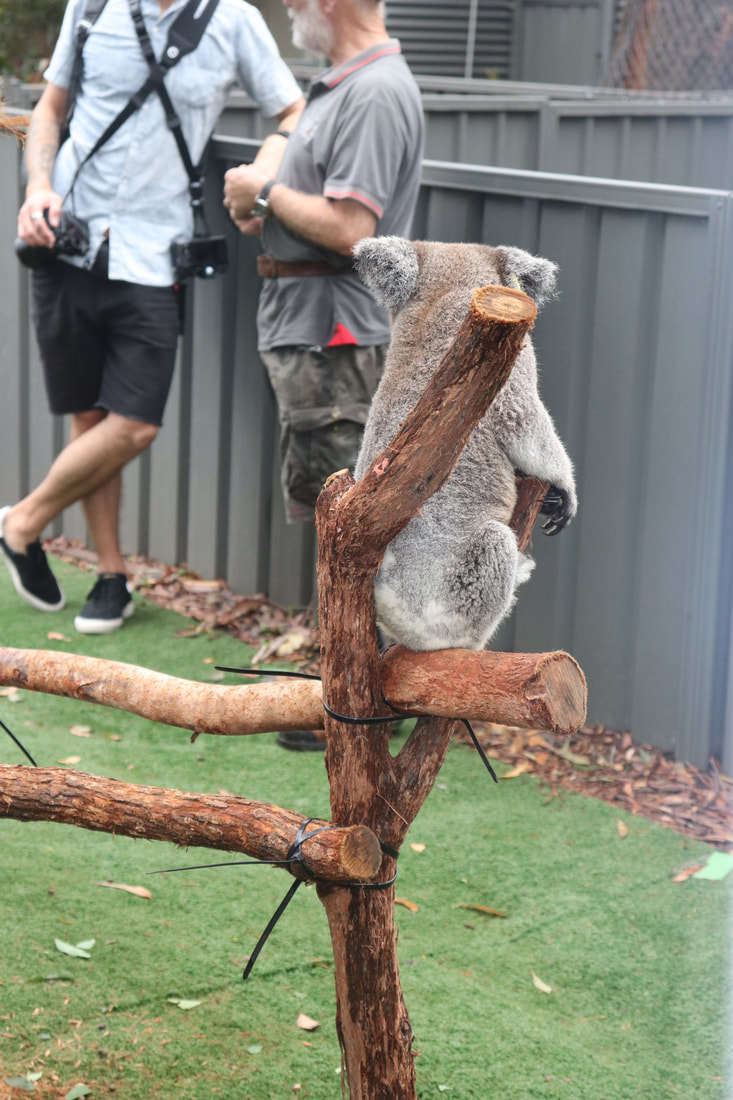
Port Macquarie Koala Hospital
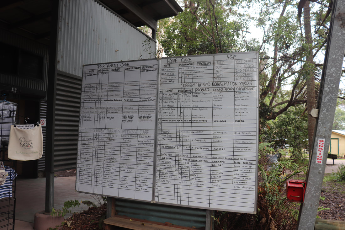
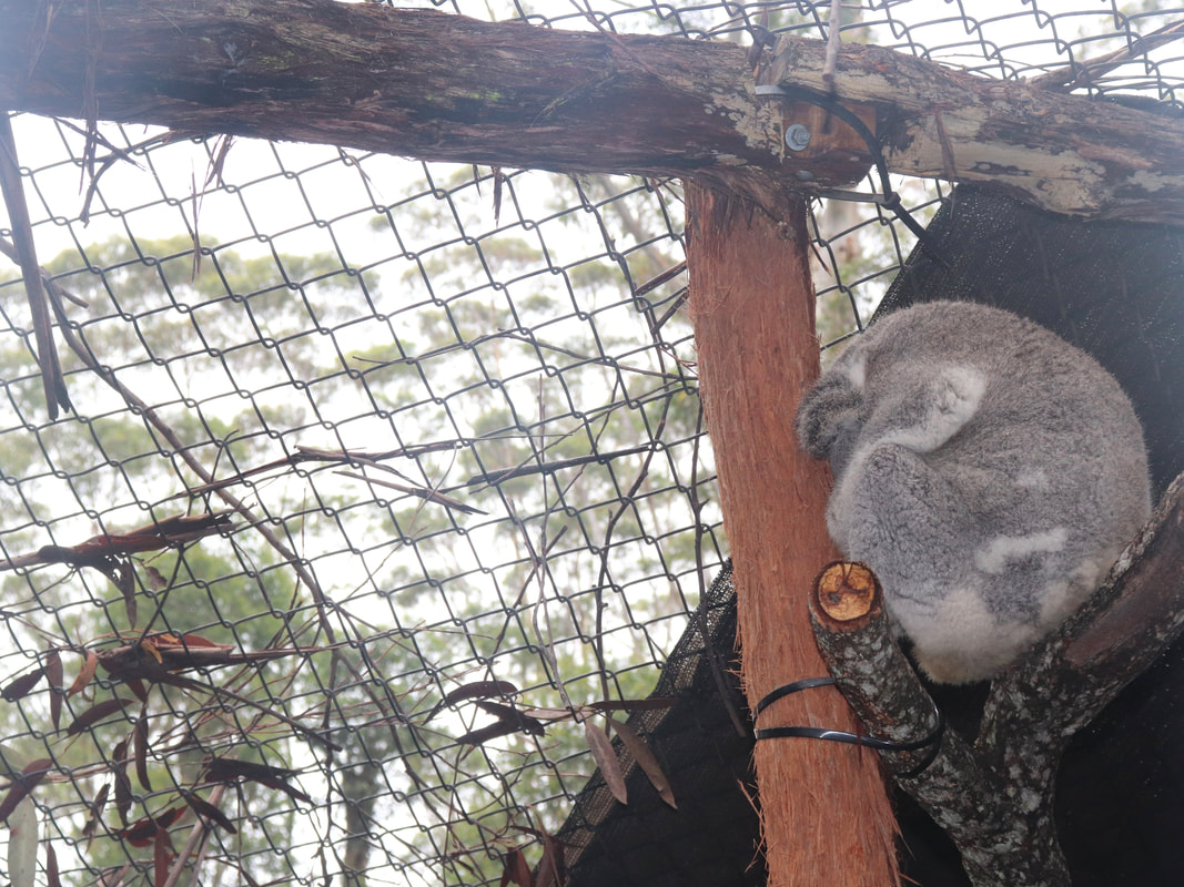
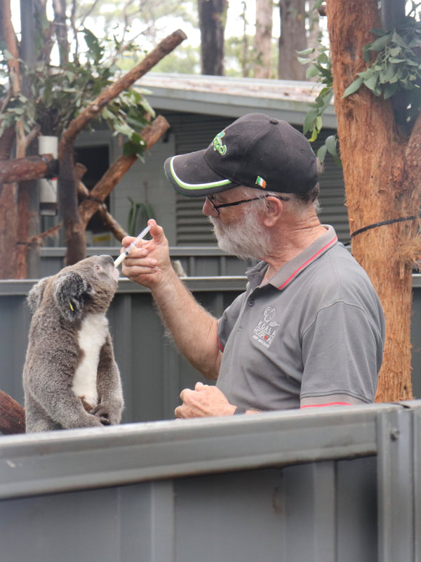
Following the fire a number of injured koalas required intensive care. The Port Macquarie Koala Hospital was inundated 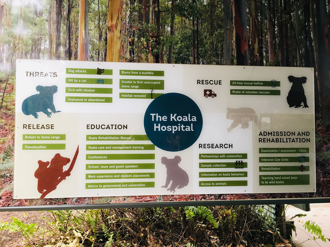
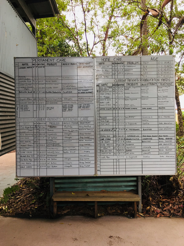
The Port Macquarie Koala Hospital has a large number of koalas in care. The least injured/ill koalas are available for public viewing, while those most injured are screened from public viewing for their own wellbeing. Below is an example of the management of koalas, their injury/illness and treatment.
Go Fund Me Campaign
Port Macquarie Koala Hospital set up a Go Fund Me Page to raise much needed funds to support care for injured koalas and to establish drinking stations and a breeding program for koalas in the region. The initial goal was for $25,000. By 21 January, the campaign had raised nearly $7.5 million dollars. The scope of the projects originally proposed have now been expanded in light of the huge amount of money raised. Port Macquarie Koala Hospital - Go Fund Me.
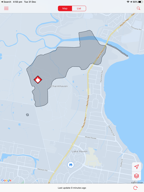
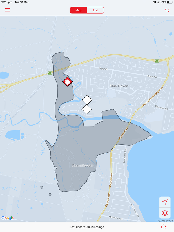
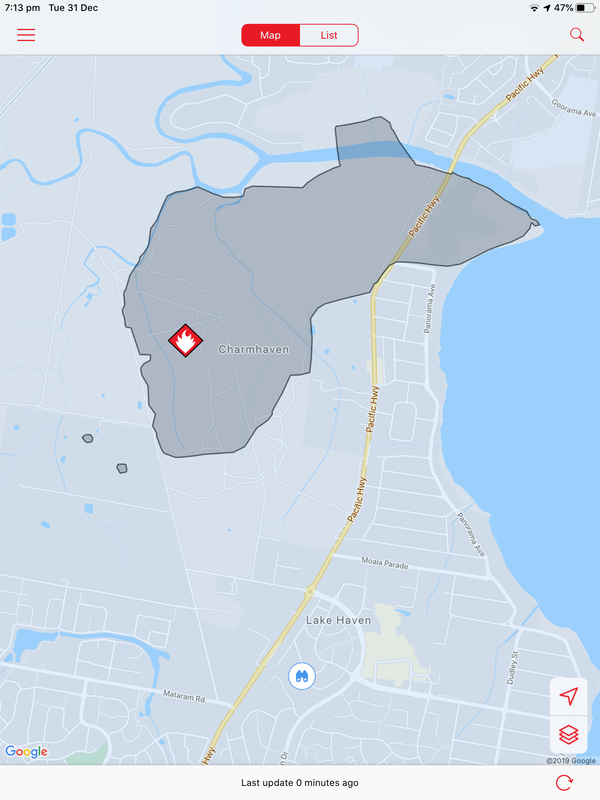
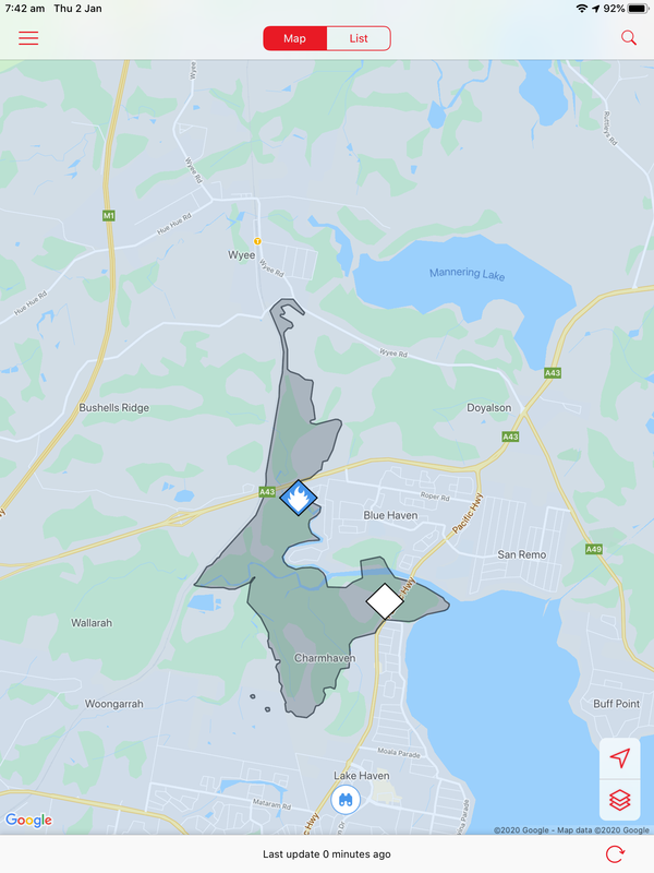
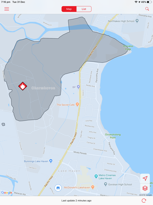
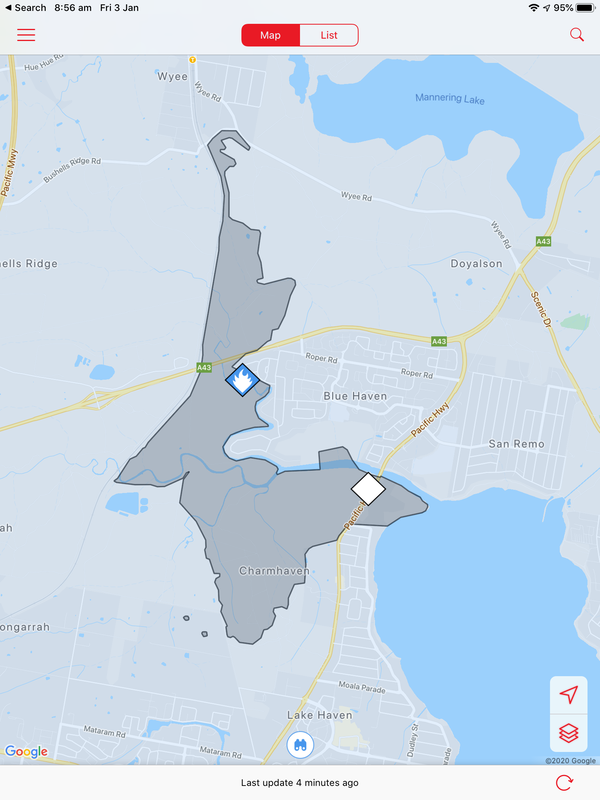
A bushfire started on December 31 at Charmhaven on the Central Coast and burned over several days. This is one of the smaller fires in The Australian Bushfires 2019-2020, but still burnt out 418ha of land. Local residents were issued with warnings and in some cases were evacuated. Two homes, located on Birdwood Drive and Arizona Drive were lost.
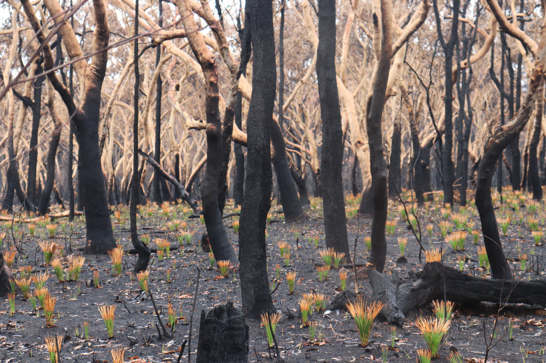
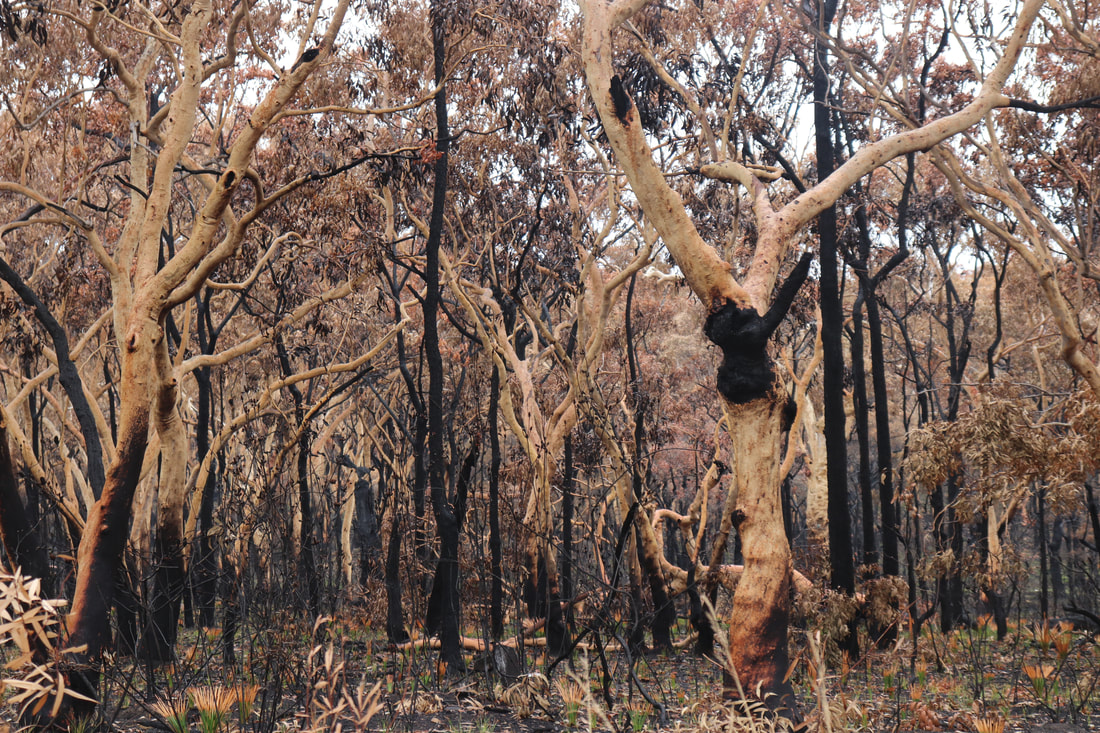
The photos below show the aftermath of the fire, taken on 18 January. There is some evidence of regrowth, but the fire-ground still smelt of smoke and was still hot underfoot.
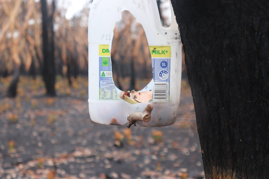
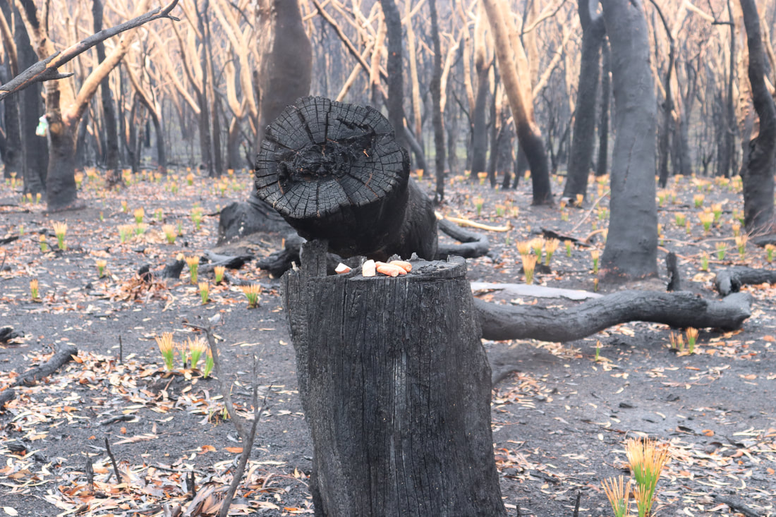
Community groups have attempted to rescue injured wildlife and provide food for them. Below are photos of food left in a hanging container and food left on a tree stump.
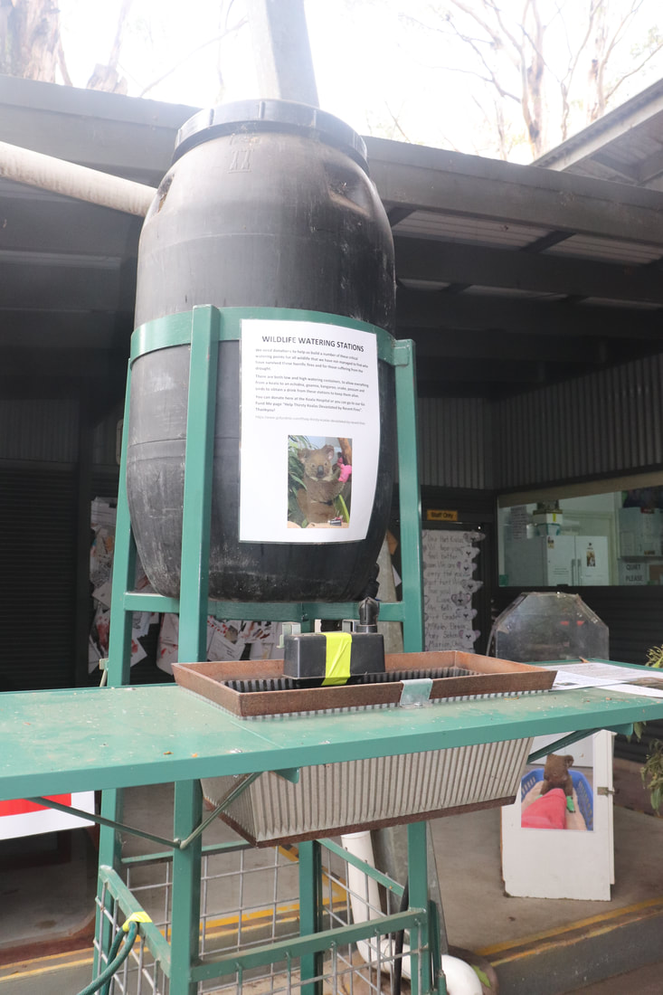
Coordination of feeding and watering stations has been aided by the using of spatial technologies such as Google maps.
A Water Our Wildlife CCWSAR Map has been developed to help volunteers know where feeding and watering stations have been set up, so that people can visit them independently and re-stock them.. 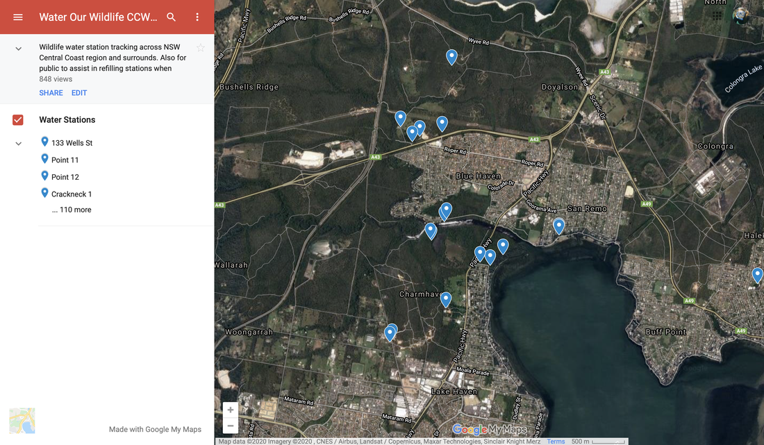
Embedded below is a series of tweets by Brendan, a local resident of Mallacoota. As the emergency unfolded, he published updates on the progress of the fires and the experiences of him and his family, and later on his community. The tweets included below are just from the first few days of the disaster. You can also listen to an interview with Brendan by clicking here.
Unlike a formal newspaper article or a television news story, this is a very personal account, describing one man's individual experiences. Activities - Create a list of the impacts of the fire on this particular person. - Create a list of impacts on the community of Mallacoota. - Use the hashtags #Mallacoota, #Australianbushfires and/or #bushfires to search Twitter. Explore the perspectives of other residents during the emergency. Add to your lists above, and write a short description of the accounts of these individuals. - Consider the language and the descriptions included in the accounts you have read. How do these differ from the language and descriptions in more formal pieces of writing or news such as newspaper articles or news reports? - As a geographer, what are the advantages of reading personal accounts of a natural disaster such as the Australian Bushfires? What are the disadvantages? - What steps could you take to verify the accounts of individuals on twitter or other forms of social media?
A range of spatial technologies have been used during and after the Australian Bushfires 2019-2020. Emergency Services have used apps to communicate with the public about the location of fires and the risk to the public. Members of the public have been able to refer to geospatial information about air quality and weather conditions, and following the fires, environmental groups have been able to use geospatial tools to communicate and coordinate locations of feeding and watering stations for wildlife.
MyFireWatch MyFireWatch is a collaboration between Edith Cowan University and Landgate and tracks bushfires. https://myfirewatch.landgate.wa.gov.au 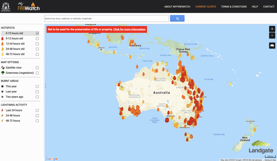 Current Bushfires Current Bushfires is the Queensland Government - Rural Fire Service website. https://www.ruralfire.qld.gov.au/map/Pages/default.aspx 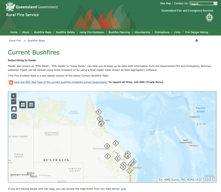 Air Quality Index Visual Map The Air Quality Index Visual Map uses Air Quality Monitoring stations to collect data about air quality and represent it spatially. Air Quality is categorised as Good, Moderate, Unhealthy for Sensitive Groups, Unhealthy, Very Unhealthy, Hazardous. http://aqicn.org/here/ 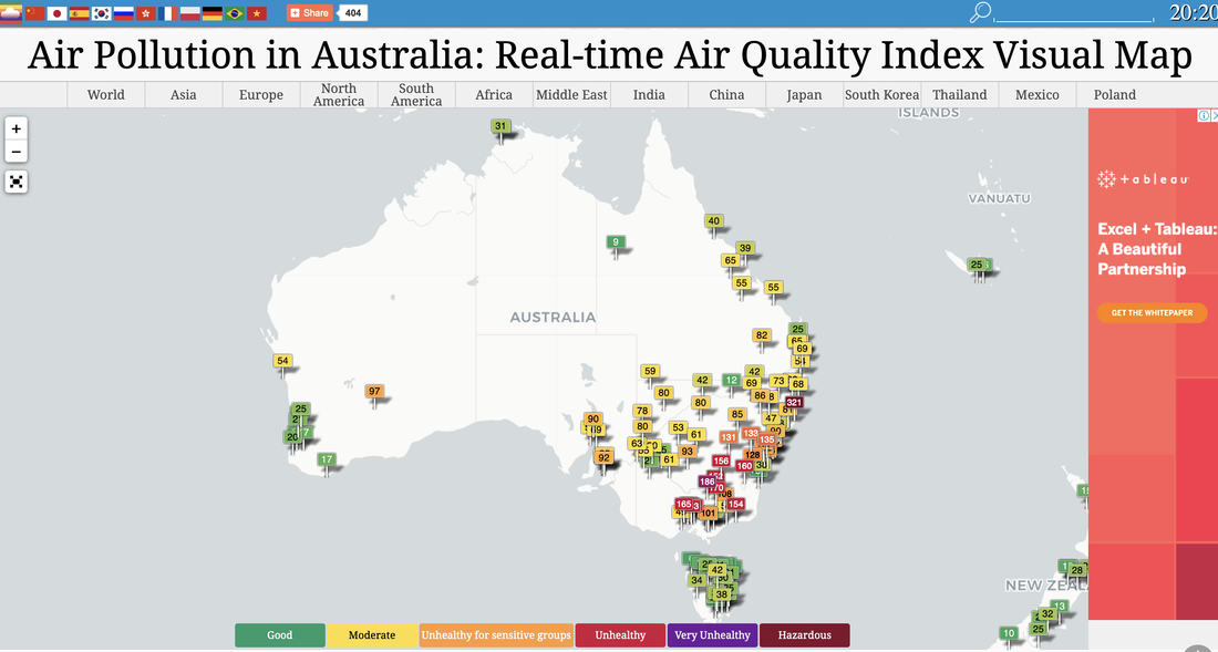 Bureau of Meteorology The Australian Bureau of Meteorology website provides up to date information about weather conditions that may impact on bushfires, such as temperature and wind. http://www.bom.gov.au/products/national_radar_sat.loop.shtml 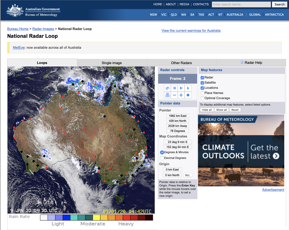 Water Our Wildlife CCWSAR Map The Central Coast Wildlife Search and Rescue created a google map to share information about feeding and watering stations to help surviving wildlife. This enables volunteers to independently visit sites for restocking. Water Our Wildlife CCWSAR Map 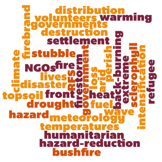 Some generic bushfire lesson plans and sequences: GTA NSW - Geography Alive - Bushfire Hazards in Australia Bushfire lesson plan - Australian Institute of Disaster Resilience Bushfire Education - Victorian Curriculum and Assessment Authority Preparing for an emergency - NSW Rural Fire Service Bushfires and grassfires - CFA, Victoria Learning about Bushfires - Victorian Curriculum and Assessment Authority
I recently received a copy of Australian Curriculum Geography - A diverse and connected world. This is a new resources from RIC Publications for teaching the Australian Curriculum for Year 6 students. The resource is designed for students and teachers around Australia, and addresses the Australian Curriculum (not the new NSW syllabus or any other variation).
The resource is more in the style of an activity book rather than a text book. The front section contains photocopiable black and white masters including a world map, a map of Asia, a map of Australia and South-East Asia and a map specifically of Bali. It also provides scaffolds for researching environmental changes, researching places and an interview recording sheet. The Geographical skills class record is a great addition to the resource. It is actually for teachers rather than students, and it allows teachers to record student progress in achieving skills. It also includes a grid which maps out how the book addresses skills, inquiry questions, general capabilities and cross curriculum priorities, so that teachers can teach without having to specifically worry about how or whether they have addressed these. The activities comprehensively cover each of the curriculum dot points and elaborations. It generally uses the specific examples in the curriculum rather than reinterpreting the elaborations. The resource provides comprehensive activities, additional links to websites and videos. It provides a list of relevant vocabulary words for each section as well as a column on some pages specifying how the activities relate to the Australian Curriculum including the elaborations, key inquiry questions, geographical inquiry and skills and geographical concepts. While the book is in black and white most pages are laid out in a way to reduce large chunks of text. Many of the pages contain clear maps, tables, graphs and drawings to make the pages look engaging. There are multiple choice quiz questions at the back of the book which relate to each the the Australian Curriculum elaborations. Answers to both the multiple choice and the written responses throughout the book are included. English Skills Practice Trial Booklets I also received copies of the English Skills Practice Trial booklets. for Years 1, 3 and 5. Given that Literacy is one of the General Capabilities in the Australian Curriculum these type of activity books can be useful for integrating literacy into teaching Geography and other HSIE subjects. They can give teachers a few different approaches for integrating literacy into our teaching. |
|||||||||||||||||||||||||||||||||||||||||||||||