|
There is a range of fieldwork techniques that can be used in studying catchment functioning. Some of these fieldwork techniques which relate specifically to the river include: - water quality - measuring changes in channel shape - velocity - discharge - material carried in the stream - biodiversity survey. Below are links to videos from Georges Riverkeeper explaining some relevant types of fieldwork. Below are duplicate activities for four different locations. These are intended as a single site fieldwork activity that you could fit into a single or double period if your school is located within walking distance of one of the fieldwork sites: Orphan School Creek, Chipping Norton Lake, Salt Pan Creek or Woronora River.
0 Comments
Students who have experienced significant difficulty completing the 7-10 Geography may consider completing the Life Skills course. For information about how to determine whether a student is suitable for a Life Skills course, and the processes that need to be followed (e.g. consultation with parents, etc), see the HSIE Life Skills course on the NESA website. Preparing for a student completing the Life Skills Preliminary Geography course can be daunting. In many ways it will be like running two courses in the one classroom, but there are ways to make it a bit easier. Here are a few hints and tips... Running two courses at onceWhile Life Skills content and outcomes don't match the mainstream course, there are enough links between the two courses that they can run in parallel. Essentially you will running two courses at once in your classroom. You will run your mainstream course with the majority of your students, and then address the outcomes and content of the Life Skills course at the same time with the one (or couple of) Life Skills student/s. Have a look at the Life Skills course and see where the content and outcomes match the mainstream course. Even if it means rearranging the order, design the delivery of the Life Skills course so that as much as possible you are delivering similar concepts and content at the same time. For example cover the Life Skills content related to recognising physical elements of environments at the same time as mainstream students address content related to biophysical environments at the beginning of the Biophysical Interactions topic. Or cover the Life Skills content on patterns of human activity, when the mainstream class is covering Population. This will mean that all students are part of the same conversations and discussions, but can be given different individual work. It may work out that the Life Skills student can also be involved in some aspects of class group activities, depending on the complexity of the tasks. Seeking supportMake sure that you access any support that you can from the school. This might be the Learning and Support Teacher (LaST) or a Student Learning Support Officer (SLSO). Not everyone is comfortable having a support teacher in the classroom, and you need to work with the person and establish a bit of a routine to make it work well. You will need to get used to having another instructor that might talk when you're asking the students to be quiet, or that repeats instructions, but if this is what has to happen for the student to engage in the work, then you have to deal.Don't expect them to design the resources for the student. Support staff are unlikely to be Geography trained. They might be able to give you some lesson ideas to engage the student, but you will need to design the actual resources. Lesson modificationsModifying class activities might be as simple as giving a few extra clues. For example, you might include a cloze passage in a lesson to help build student literacy skills and provide a quick recap of information. A Life Skills student may require the following modification: - extra time to complete the task (mainstream students might take 5-10 minutes, but Life Skills students may need considerably longer). - some extra clues (e.g. providing the first letter of the answer) - larger text and simplified layout to make it less daunting - one-on-one assistance from the classroom teacher or SLSO. Below is an example of a cloze passage that has been modified, including the downloadable files. 
Fieldwork It is possible to lead a Life Skills student through the same fieldwork skills and tools as the rest of your class. If you do activities outside with your class practicing soil testing, water testing, field sketches, etc, the student can still participate in much of this, but may not be able to analyse the results in the same way as the mainstream students. These activities also provide a great way of providing some mentoring and leadership opportunities for your mainstream students. They could take turns in being paired with the Life Skills student to model fieldwork techniques or assist in conducting tests. This is also a nice way to help your students to bond and teaches them some responsibility and understanding. Senior Geography Project and FieldworkThe SGP will need to be scaffolded heavily. You might choose to provide the student with some picture books or geographically themed magazine to help them identify topics they are interested in. Depending on the student's capabilities, it may be the case that the teacher ends up identifying a topic for the student. Unless the Life Skill student's parents are very engaged, it is likely to be easier to develop the SGP project around the school playground so that they can be guided through different parts of the project at school. It might be worth providing the student with a separate exercise book that they keep all their SGP notes, fieldwork, articles, etc in. The teacher or SLSO might find a couple of relevant websites and print them for the student. The SLSO could spend some time in class underlining key points and concepts and helping the student to write a couple of sentences about the topic. The completed assignment for a Life Skills student would include the student's SGP exercise book, as well as a short description on the project. The teacher would need to make a judgement based on the student's abilities regarding the length and depth required. Below: Excerpt from SGP program. Downloadable file below. 
Sourcing resourcesIt may be useful to look at resources for lower ages groups/stages. For example, if you are studying Biophysical Interactions you might choose to supplement your resources with activities from Stage 3 Water In the World and Landscapes and Landforms. You may also look at picture books and non-fiction books designed for late primary or early high school. Have a chat with your school librarian about the topics for Year 11 and ask them to find some suitable texts.
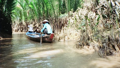
What is river regulation?River regulation refer to strategies and modifications to the natural flow of a river. This can include changes to improve navigations such as dredging or river widening, building of levees to protect populations in times of floods, construction of dams, and diversions for agriculture. How is the Mekong River regulated?In built up areas, some parts of the Mekong have been modified by having natural river beds replaced by cement. In rural areas, dwellings are built out into the river and the Mekong is used for a range of activities including washing, catching fish, rubbish and sewage disposal. While the Mekong has been modified and changed over time, the most significant changes have occurred in the past 20 years with the constructed of dams along the length of the river. Useful links: Mekong River Commission Mekong River nations defer dam decision Save the Mekong Power and responsibility: Mekong River Commission and Lower Mekong mainstream dams
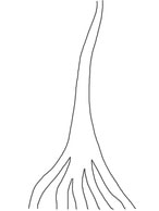
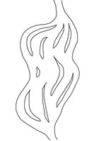
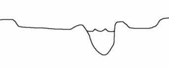
Biophysical Interactions A variety of factors affect the flow of rivers. These factors include climate, vegetation cover, soil, rock structure or ground covering, shape and slope of landforms. Atmopshere - Climate Climate has a direct impact on the way a river flows. At times of heavy rainfall a river will have greater volume of flow (more water flowing). At times of hot weather evaporation of water increases. This reduces the volume of water (less water flowing). Biosphere - Vegetation Vegetation absorbs water from soil to use in plant growth. Vegetation greatly reduces runoff. The less vegetation, the more abundant and rapid the runoff will be. A close plant cover will modify the violent affects of heavy rains. Vegetation growing in and on river channels may be regarded as a surface roughness which can slow the flow of the river (this is particularly important in times of flood). Lithosphere - Soil/Rock structure/Ground covering The ground surface surrounding a river will affect how much water will enter the river as run-off and groundwater. Together with vegetation, the ground cover type influences the amount of water that will infiltrate or run-off. Some soils or rock structures are highly permeable (they absorb water) and have a large water-holding capacity, e.g. coarse-grained sandstones and porous limestones. These rocks and soils can even out the groundwater discharge even during dry seasons. Other ground surfaces such as cement pathways, driveways and tarred roads greatly increase the amount of run-off because no water is able to infiltrate. This increased run-off generally known as stormwater enters drains and is directed to nearby creeks and rivers. Lithosphere - Landform shape and slope Slope greatly affects the amount of run-off which will occur and thus how much water will enter a river. Generally the steeper the slope, the more run-off. Flat areas (especially where marshes and lakes occur) tend to accumulate water and slow down the flow of water. Catchments which are bordered by or contain high, steep landforms are more likely to have greater volumes of water due to the occurrence of orographic rainfall (cool air travels across the land and warms up, it hits mountains and rises causing rainfall). The size of the catchment can also influence the volume of water flow. Small drainage basins (catchments) show a great increase of flow after rainfall, while large catchments are more able to absorb the effects of precipitation. True or false - A flow of water in a river in a larger catchment will be affected more by rainfall than a river in a smaller catchment. - An area with little or no vegetation is likely to have more run-off than an area with dense vegetation - An impermeable ground cover will allow water to soak into the surface. Rivers - Key Terms river source river mouth tributary delta pool cutoff riffle billabong/backswamp meander meander scar upstream downstream stream velocity river discharge stream capacity eyot wetland flood plain
The Mekong - Sensitivity to change Xayaburi Dam and the Fate of the Mekong An overview of the pros and cons of the Xayaburi dam in Laos. Read more... New Mekong Dam a Go, and a Blow to Megafishes? An indepth examination of the impacts of dams along the Mekong. Read more... Photos: Dams threaten Mekong River Megafishes A photo gallery from the National Geographic exploring the impact of dams on the Mekong. Read more... Why we shouldn't dam the worlds most productive river Zeb Hogan from the National Geographic describes how changes to the Mekong River are likely to drive many of the mega fish found in the river to extinction. Read more... Mekong countries at odds over Mega-dams Kirk Herbetson explores relations between Cambodia, Laos, Thailand and Vietnam Environmental issues in the Greater Mekong WWF outlines some of the greatest ecological issues in the Greater Mekong region including hydropower and infrastructure development, climate change, deforestation and degradation, wildlife trade. Read more... Exploring the Mekong's Uncertain Future Jeff Opperman writes a series of blogs about his trip along the Mekong, exploring the interconnected components of the environment and livelihoods of the people who liv Hydropower development in the Greater Mekong WWF examines how hydropower developments impact on sediment and nutrient transfer, impact on water flow and natural regulation, the relocation of loc Mekong giant catfishWWF explores threats to the Mekong giant catfish including dam developments, alterations to migration routes, dredging and over-fishing. Read more... Irrawaddy dolphins in the MekongWWF explores the reasons that the Irrawaddy dolphin is threatened. Threats include pollutants, fishing, hydropower developments and ecosystem degradation. Read more...
Management Regional Cooperation on Mekong in tatters WWF article outlining issues with management agreements between countr WWF - Solutions in the MekongWWF outlines some of the initiatives currently being put in place to address some of the issues in the Greater Mekong. These solutions include conservation efforts in threatened forests and rivers, ensuring that hydropower developments are sustainable, and strengthening law enforcement. Read more... Catalyzing sustainable hydropowerWWF is encouraging a 5 year ban on mainstream dams in the lower Mekong river to counter some of the many environmental costs of dams. Read more... River fieldwork Examples of fieldwork that can be conducting on rivers: - Measuring changes in channel shape - Measuring velocity at different parts of the river - Discharge - Material carried in the stream Examine fieldwork currently being conducted in the Mekong region: Stelar-S2S Whale and Dolphin Conservation Society - Irrawaddy dolphins fieldwork Sustainable Energy - Thoughts on fieldwork in Laos Mekong River Problem Based Learning The aim of this activity will be to identify a range of environmental problems affecting the Mekong River, and to explore possible solutions to some of these problems. Below is a very brief overview of the lesson sequence. The attached file contains much more detail includin scaffolding of the activities. Overview Lesson 1 Begin reading through the booklet of readings that you have been provided with. The readings all relate to issues impacting on the Mekong region. Summarise the articles in the table provided. Lesson 2 Continue reading and summarizing the articles provided. Pair work - Determine one underlying issue affecting the Mekong Region. Lesson 3 Create a flow chart which explores how your problem impacts on the biophysical environment. Individual work - Write a summary of how the Mekong Region is sensitive to change. Lesson 4 In pairs, suggest a range of solutions or management strategies to address your underlying problem. Design a management strategy that can be applied across countries, up and downstream to address the issues in the Mekong Region. Identify a range of professionals that you will need to employ to put your management plans into place. Lesson 5 Mekong overview and presentation of management plans.
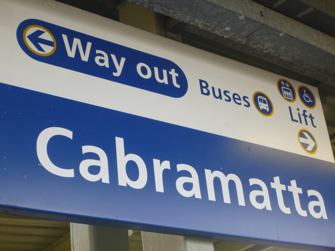
 We are all used to running geography fieldwork for the physical geography topics like Coastal Management, Land and Water Management, Biophysical Interactions and Ecosystems At Risk. There are various companies that run great excursions for these topics, but when you get to the human geography topics it isn't so easy to find pre-organised excursions. For my Year 11 Geography class I've taught the compulsory Population topic, and then Cultural Integration as one of the optional topics. We've examined the topic of refugees as part of an exploration of population movements, so I decided on a trip to Cabramatta to explore the impact of the Vietnamese community on this south-west Sydney suburb. I suggested this as an option on the online group Geography Teachers Online. As a result, I met up with a couple of teachers to thrash out some ideas about options for fieldwork. Some of the ideas we came up with were: - questionnaire of local residents - land use survey - urban transect of the Main Street - environmental survey - a photo essay based on cultural influences in the suburb - an interview with a local government representative/Councillor Cabramatta Library is located a short walk from the railway station. They offer a presentation on how the suburb has changed over time and are very obliging to school groups. They provide a half hour video on the development of Fairfield Local Government Area covering indigenous history, early colonial development, the market farms, education, rail development and migration. The presentation focuses on the Fairfield Local Government Area as a whole rather than Cabramatta itself, but this provides an excellent idea of the context in which Cabramatta developed. Following this there was a presentation on Cabramatta itself focusing on statistical information from the Census. It is also possible to organise a walking tour through the local council with a guide included, but they require about a months notice.
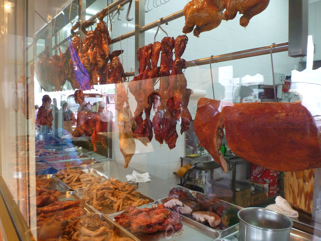
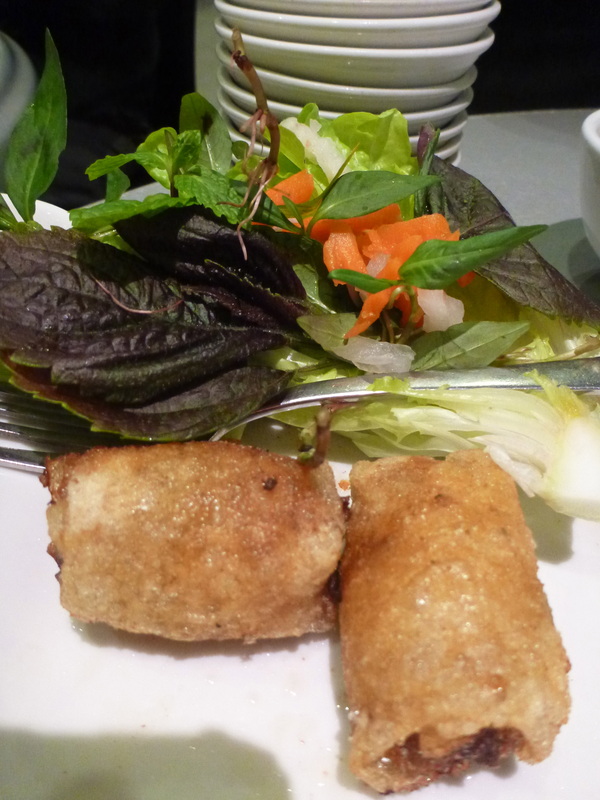
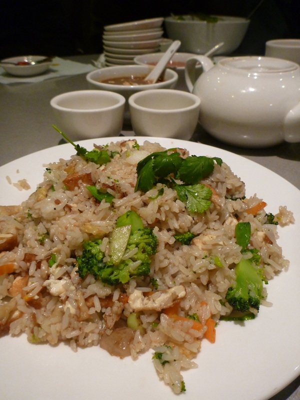
There are lots of opportunities for students to try different foods and drinks. For lunch, we went to Guan An Bau Troung, located on the main street, John St.The students all ordered a dish of their own and then I ordered a few different dishes for them to try and share. The food was really cheap and the servings were huge, even for boys who eat their weight in food in a single sitting. Obviously I had to check all the allergies, anaphylaxis risks involved, but I really think sharing a meal is a great bonding experience for a class.
 If you want to have a look at the fieldwork activities we used the Cabramatta Excursion page of the www.preliminarygeography.hsieteachers.com site.
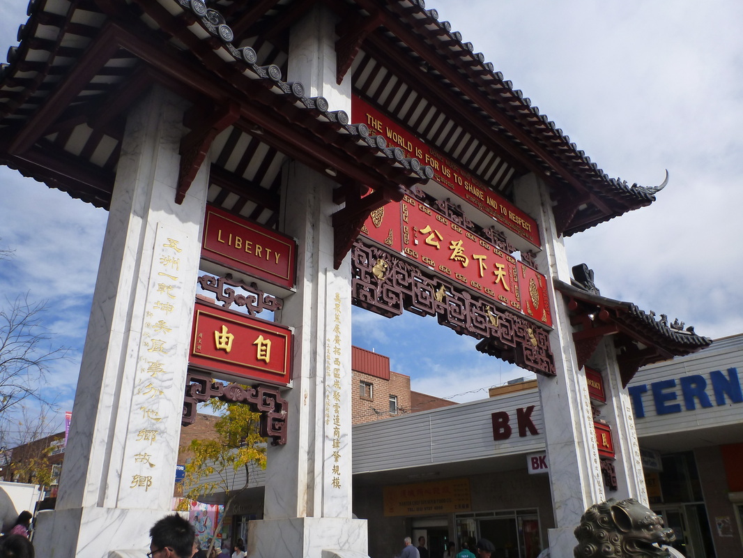
Back in the classroom we are going to analyse the field data a few different ways. - Students' field sketches will be scanned and shared. An analysis of the various cultural influences will be written. - We will create radar graphs from the environmental surveys - The questionnaire results will be shared amongst the class. Results will be tallied, and the implications of results considered. Is this community self-contained? Do residents spend most of their lives in and around the suburb? Is the ethnic background of residents still predominantly Vietnamese? The great thing about using Cabramatta as a fieldwork site in Year 11 is that is also a great case study for the following HSC year. You can refer back to it and draw on the students' experience when you are short on time and trying to maximise time in class. Cabramatta makes a great study for looking at ethnicity in Sydney as part of the Urban Places topic. You can find a summary of this part of the course that I wrote last year for HSC Online. Cabramatta – background information The Vietnamese community in Cabramatta developed following the acceptance of refugees from South East Asia following the Vietnam War. The refugees had suffered greatly prior to their arrival in Australia. Many had fought, witnessed the deaths of family members, and spent time in "re-education centres" as refugees. Upon arrival they struggled to settle into Australian society. Language barriers, racism, economic hardship, high unemployment rates combine to create an unfavourable set of circumstances. In the wake of Australia's new multicultural policy, the community recreated aspects of traditional Vietnamese life. The streetscape began to reflect the shapes and colours of Vietnam, the main street began to look like a market place with shop fronts being extended onto the streets, and cultural landmarks such as temples were constructed. Limited support services were provided for the Cabramatta community, and a drug and crime culture established itself in second generation Vietnamese-Australians. Many attempts were made to clean up the community with some success. Read about the Cabramatta Moon Festival. Dictionary of Sydney (Vietnamese) (This contains very detailed information about Vietnamese migration, Cabramatta, etc). View... Skwirk Cabramatta resources. View... One Day In Cabramatta. View... Fieldwork: Field sketch Environmental survey Photographic evidence Land use survey Shop front analysis Questionnaire Field sketch Draw two different field sketches of Cabramatta - one that shows the influence of Asian culture, and one which shows hints of European culture. Ensure that you annotate your field sketch. Click to revise how to do a field sketch. Environmental survey Examine the following environmental criteria and make a judgement about the main street of Cabramatta. This is a subjective task and requires you to make a judgement about what you think of the location and how it makes you feel. For each item you need to give a rating from 1 to 5 (tick the box). 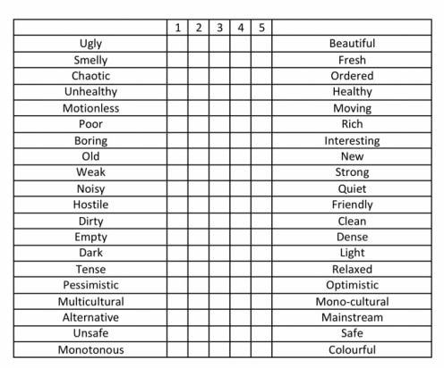 Photographic evidence During the day, take photographs that demonstrate: - Cabramatta’s European heritage - Cabramatta’s Vietnamese heritage - Multiculturalism - Different land use types.
Land use survey As you walk along the streets annotate your map indicating which land uses are present. Before you begin, fill in the key below with colours or symbols to represent each land use.  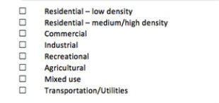 Reflection: - Describe how the different land uses are represented in discrete zones in the suburb of Cabramatta. - Explain why the commercial and medium/high density residential land uses are concentrated in particular areas. Shop analysis Complete an shop front analysis on at least 3 shops 1. Name of the shop 2. Are there any signs in another language visible at the front of the shop? Yes/ No 3. Does the architecture of the shop reflect Asian/Vietnamese culture? Yes/ No If yes, how? 4. What type of shop is it?Restaurant/Cafe Shopping (Retail) Groceries Entertainment Questionnaire 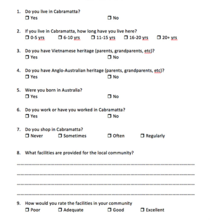
|
|||||||||||||||||||||||||||||||||||||||||||||||||


