|
The aim of this series of lessons is to allow students to apply their understanding of Liveability to a city design task. Students work in groups of 2-3 to design a small town, as the activity progresses they will reflect on what they have learnt in the Place and Liveability topic and apply it to their town. Phase 1: Design your town The first phase of this task involves designing the layout of the town. This will involve the initial road layout, agricultural land uses, some initial commercial land uses, power supply, and water storage. Provide some student choices so that you can provide a few variations in the first round of feedback. Provide students with a base page ( it may or may not have some geographical features on it such as mountains, coastline, rivers, etc). Also provide students with some blank, coloured pieces of paper, or you can copy the templates onto coloured paper - green (agricultural land), blue (water storage), pink (commercial), red (power supply), grey (roads). 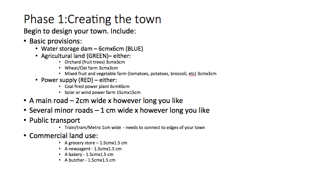
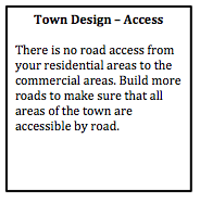
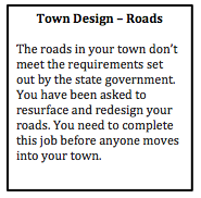
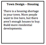
Design feedback This is an opportunity to provide some initial feedback to ensure the students get the basics right. Design the feedback so that it refers to the students as though they are members of the local council. For example, “The roads in your town don’t meet the requirements set out by the state government. You have been asked to resurface and redesign your roads. You need to complete this job before anyone moves into your town.”
Phase 2: Moving in... In the second phase of the task, students design the residential layout and density of the town. By placing a relatively small limit on the number of dwellings students have to focus on the layout of the town in the initial phases. 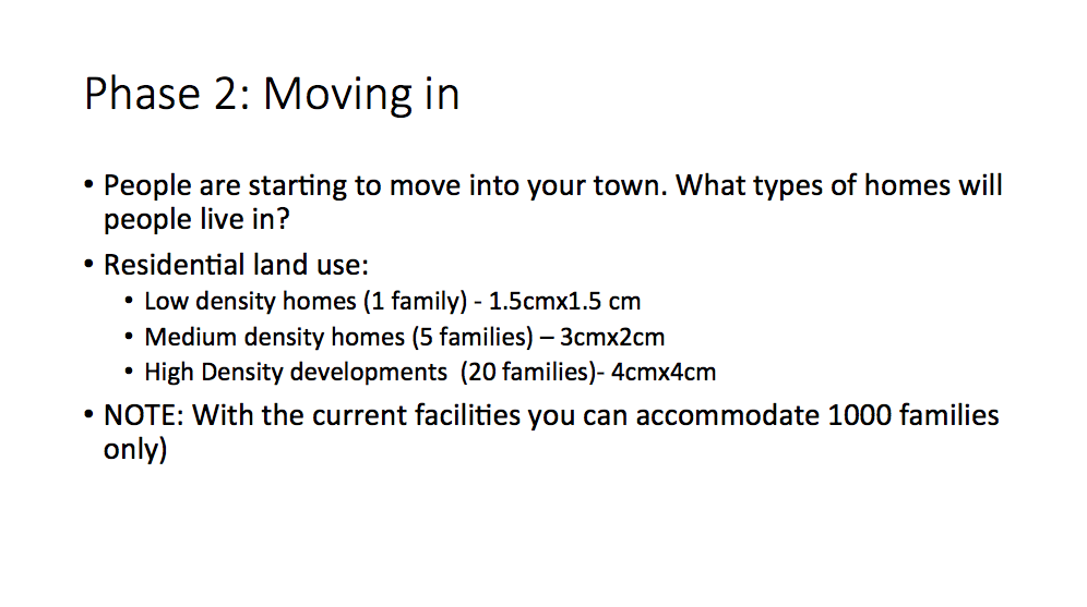
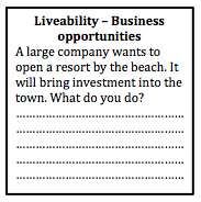
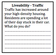
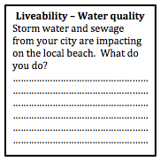
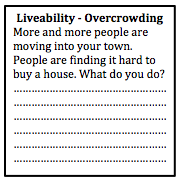
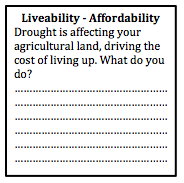
Town plan scenarios Provide students with some scenarios that will allow them to start to think about the liveability of their towns. By this stage some of the groups' conversations will have already addressed aspects of liveability, but they may not have actually considered in much depth. Students are required to write a brief description of how they addressed each scenario.
Phase 3: Enhancing liveability Students will need to respond to the scenarios above, and should have started to consider some of the additional needs of a community. As a class discuss the content related to liveability that you have already covered in class, and then provide students with time to make changes to their town plan.  Phase 3: Liveability Students spend some time reviewing their towns and providing initiatives and strategies to make their town more liveable. They also need to address the scenarios provided by the teacher. Writing task Students need to write a description of how their town addresses different aspects of sustainability. Peer feedback Students rotate around to visit other groups' town. They provide feedback on the liveability of each town and make suggestion on how to improve liveability for each town. Next... refer to Designing a Liveable City - Part 2.
1 Comment
This is part of a unit of work for Changing Places - Australia's Urban Future. Lesson 1: Australia's Projected Population Growth Lesson 2: Implications for Future Growth and Sustainability Lesson 3: Sydenham to Bankstown Urban Renewal Precinct Lesson 4: WestConnex - Sydney, Sustainability and Transport Lesson 4: Sydney Sustainability and Transport (Teacher's Notes) Lesson 5: The GreenWay Lesson 5: Deindustrialisation Lesson 6:: Create an infographic Lesson 7: Contributing to a Sustainable Urban Future Lesson 7: WestConnex - Protest Movements and Impacts Lesson 7: Conflict Over Dulwich Hill OR See the complete unit on the Changing Places website. Australia’s Population Australia’s population is continuing to become more urban and the population structure is aging. As Australia’s population grows, this will have implications for how Australian cities will continue to grow and how sustainable they will be. Issues of sustainability include access to water, affordability of food and the distance food travels to get on the plate, loss of habitat areas and species diversity and greenhouse gas emissions. Planning for Australia’s urban future, involves strategically planning for equitable and affordable access to services and infrastructure. It is imperative that we develop resilient communities that can cope with and manage changes in the future. Sydney The population of Greater Sydney (including the Blue Mountains and Central Coast) reached 5 million in June 2016. Last year, Sydney had the largest population growth of the capital cities. Sydney's Inner West For the purposes of this unit of work, the “Inner West” will be defined as the suburbs which are part of the Inner West Council. However, the Inner West is a very loosely defined term, which can be used to describe a much broader range of suburbs. According to the 2016 census, the Inner West of Sydney had a population of approximately 192,000, and a population density of approximately 55 persons per hectare. Lesson: Population growth Population Growth in Sydney Conduct your own research on population growth in Sydney. Create a summary including the location of the highest growth areas and the impact of migration on growth in Sydney. How can you ensure that the information you have gathered is reliable, free from bias and useful? Population Growth and Transport in Sydney In groups of 2-3 examine the current population projections for Sydney and consider the effectiveness of current transport infrastructure (include roads, rail, light rail, ferries, etc), taking into account commute times and traffic congestion. Suggest a range of different strategies to address transport issues in Sydney. Discuss with your group the pros and cons of each strategy. Devise a plan that you would put in place if you were Premier. Present your alternate plan to the class (include annotated maps, descriptions justifying your choices, references to economic, social and environmental sustainability of your choices). Sydney’s Inner West Use the Inner West Council Community Profile website: https://profile.id.com.au/inner-west Create an infographic that presents the main characteristics of the Inner West. You might include information about age, ethnicity, income, etc. Geographical Inquiry: Develop a set of questions to study change in Sydney’s Inner West. Your questions should encompass the issues of new transport infrastructure, population growth and increase in population density. Identify the geographical concepts that are relevant to your geographical inquiry. Identify fieldwork techniques that will be appropriate for your geographical inquiry. Outline the steps that you will undertake to complete your geographical inquiry. Set a schedule with dates by which to complete each part of the geographical inquiry.
This is part of a unit of work for Changing Places - Australia's Urban Future. Lesson 1: Australia's Projected Population Growth Lesson 2: Implications for Future Growth and Sustainability Lesson 3: Sydenham to Bankstown Urban Renewal Precinct Lesson 4: WestConnex - Sydney, Sustainability and Transport Lesson 4: Sydney Sustainability and Transport (Teacher's Notes) Lesson 5: The GreenWay Lesson 5: Deindustrialisation Lesson 6: Create an infographic Lesson 7: Contributing to a Sustainable Urban Future Lesson 7: WestConnex - Protest Movements and Impacts Lesson 7: Conflict Over Dulwich Hill OR See the complete unit on the Changing Places website. Population forecasts for continued and accelerating growth or urban areas have a range of implications for sustainability. Sustainability is development that meets the needs of the present population without endangering the capacity of future generations to meet their needs. Indicators of sustainability in urban areas include air and water quality, biodiversity, integration of green building initiatives, health and well being measures, employment rates, transport infrastructure and access to employment. Implications of growth of urban areas include loss of agricultural land, habitat areas and open space, increased pressure on transport infrastructure resulting in heavy flows of commuter traffic and traffic congestion. Planning for the future growth of urban centres in Australia needs to address the provision of:
Priority Precincts and increased density An increase in density of urban areas creates more compact, “efficient” urban areas. This allows for services and infrastructure to be provided for a greater number of people and can allow residents to access public transport more easily and become less reliant on cars. The State Government’s Priority Precinct Program encourages population growth and increased density in specified areas. The Sydenham to Bankstown Urban Renewal Corridor includes the Inner West suburbs of St Peters, Sydenham, Tempe, Marrickville, Dulwich Hill and Hurlstone Park. For further reading click: http://www.urbangrowth.nsw.gov.au/assets/Living-Cities/CfS-Discussion-Paper-Making-Great-Places-Density-Done-Well.pdf Connectivity and Infrastructure Public infrastructure such as hospital, police centres, schools, trains, buses and roads is required for cities to function effectively. Upgrades of schools include Ashfield Boys, Ashbury Public, Croydon Public, and the construction of NSW School of Languages at Petersham. An ambulance super centre is being built at Haberfield. Transport infrastructure includes the construction of the Metroline and the M4 East extension, M5 extension and the M4-5 link.
Post originally written in 2017, and updated March 2018. This is part of a unit of work for Changing Places - Australia's Urban Future. Lesson 1: Australia's Projected Population Growth Lesson 2: Implications for Future Growth and Sustainability Lesson 3: Sydenham to Bankstown Urban Renewal Precinct Lesson 4: WestConnex - Sydney, Sustainability and Transport Lesson 4: Sydney Sustainability and Transport (Teacher's Notes) Lesson 5: The GreenWay Lesson 5: Deindustrialisation Lesson 6: Create an infographic Lesson 7: Contributing to a Sustainable Urban Future Lesson 7: WestConnex - Protest Movements and Impacts Lesson 7: Conflict Over Dulwich Hill OR See the complete unit on the Changing Places website. The NSW Government has released a revised Sydenham to Bankstown Urban Renewal Strategy for public comment. The strategy will be implemented over 20 years and sees plans for urban consolidation and retail opportunities along the a new metro line which will replace the existing train line and link with the Metroline being built in Sydney's north west. It includes the creation of over 35,000 new homes. View the Sydenham to Bankstown Urban Renewal Corridor website. Priority Precincts where development will be concentrated include Campsie, Canterbury, Lakemba and Belmore. Developments in these areas will include buildings up to 25 storeys high. Marrickville will have an increase in homes of 84%, while Canterbury will increase by 208%. and Belmore will increase 128%. Some suburbs such as Dulwich Hill and Hurlstone Park have had a reduction in the number of new dwellings proposed compared to the previous plan released. View Changing Places: Conflict over development in Dulwich Hill. The existing rail line between Sydenham to Bankstown will be converted to a Metro line. During construction the rail line will not be in operation. It is anticipated that once completed, it will reduce wait times and travel times to the city. However, the existing rail line allows commuters to connect with the existing CityRail network and travel to locations such as Chester Hill, Villawood, Cabramatta and Liverpool, without having to change trains. Commuters can then change trains to connect with the rest of the CityRail network. It is unclear at this stage how the Metro line will interact with the existing City Rail and light rail networks.
Residents and community groups have expressed some concerns regarding the increased level of density and population. Concerns relate to inadequate parkland and open space, destruction of heritage architecture, new designs which are unsympathetic to the heritage nature of suburbs, and lack of supporting infrastructure. There has been limited information released regarding industrial and commercial zoning, and concerns have been raised regarding the sustainability of the development. The rezoning will also take place years before the Metro line will finished. Supporters of the developments state that high density is better for the environment than urban sprawl and increases connectivity and land values in the area. The renewal strategy announcement has come at a time when residents of the Inner West are already dealing with a large number of new developments and there is a perception that there is an inequitable system of planning in place. For example Council targets for new housing approvals have been exceeded in Canterbury, but many other council areas such as Hunters Hill, Warringah, Pittwater, Willoughby and Manly have not met their targets. There have been a range of issues associated with the WestConnex development such as compulsory acquisition and demolition of houses, encroaching on parks, noise and construction issues. The recently announced future sale of Canterbury Racecourse for development has also been an issue of contention. These issues combined are likely to make Inner West residents less persuadable when it comes to future developments. Lesson Activities: Define the terms low-density, medium-density and high-density. Describe the advantages and disadvantages of each type of housing. Examine: http://www.planning.nsw.gov.au/Plans-for-your-area/Priority-Growth-Areas-and-Precincts/Sydenham-to-Bankstown-Urban-Renewal-Corridor/Map Outline the changes that will occur in each Inner West suburb as a result of the Sydenham to Bankstown Planned Precinct. Assess how the new Metroline will support population growth in the Urban Activation Precincts. Extra resources: Residents, ex-pollies baulk at high density in revised Sydneham to Bankstown Urban Renewal Strategy. Planning experts say development should be embraced and not feared along Sydenham to Bankstown corridor. Sydney's tale of two suburbs: new analysis shows the wide spread of development. Metro's on the wrong track High rise to hell Open season on high rise Heritage, character face destruction Inner West needs nine new schools
This post was originally written in January 2017, and edited in March 2018. This is part of a unit of work for Changing Places - Australia's Urban Future. Lesson 1: Australia's Projected Population Growth Lesson 2: Implications for Future Growth and Sustainability Lesson 3: Sydenham to Bankstown Urban Renewal Precinct Lesson 4: WestConnex - Sydney, Sustainability and Transport Lesson 4: Sydney Sustainability and Transport (Teacher's Notes) Lesson 5: The GreenWay Lesson 5: Deindustrialisation Lesson 6: Create an infographic Lesson 7: Contributing to a Sustainable Urban Future Lesson 7: WestConnex - Protest Movements and Impacts Lesson 7: Conflict Over Dulwich Hill OR See the complete unit on the Changing Places website. Changing Places (Year 9) The Changing Places topic requires students to explain processes and influences that form and transform places and environments (GE5-2) and to assess management strategies for places and environments for their sustainability (GE5-5). The topic requires students to examine urbanisation, the impact of migration and strategies to address change in urban places and how they enhance sustainability. As a part of examining the causes and consequences of urbanisation, students will have investigated spatial distribution patterns of urbanisation (for example the influence of transport corridors), and the social, economic and environmental consequences of urbanisation (this could include traffic congestion, costs of tolls or costs of constructing new infrastructure, average times people spend commuting to work, the impact of car exhaust on air quality). In examining urban settlement patterns students will specifically address the impact of transportation networks in Australian and another country to explain differences in urban concentrations. While there is scope to deal with a range of issues and influences related to urbanisation and urban settlement, there is certainly an opportunity to develop a unit of work that develops students’ understanding in car dependence, traffic congestion, public transport, road networks, etc. to lead them to be able to examine this issue of the WestConnex development from a range of perspectives and with detailed background knowledge. In the last part of the Changing Places topic students investigate the management and planning of Australia’s urban future, including Australia’s population projections, implications for growth and sustainability, strategies to create sustainable urban places and ways for individuals and groups to become involved. WestConnex provides a great case study to examine this. Obviously you need to address the points at the national scale, but the WestConnex project impacts on such a large are of Sydney that you might find that many of your students are already engaged with (or at least aware of) the project in some way. Urban Places/ Urban Dynamics (Year 12) If you choose to do Sydney as a large city case study for Urban Places the WestConnex project could also tie into the - growth, development, future trends and ecological sustainability dot point. 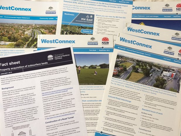 This is part of a unit of work for Changing Places - Australia's Urban Future. Lesson 1: Australia's Projected Population Growth Lesson 2: Implications for Future Growth and Sustainability Lesson 3: Sydenham to Bankstown Urban Renewal Precinct Lesson 4: WestConnex - Sydney, Sustainability and Transport Lesson 4: Sydney Sustainability and Transport (Teacher's Notes) Lesson 5: The GreenWay Lesson 5: Deindustrialisation Lesson 6: Create an infographic Lesson 7: Contributing to a Sustainable Urban Future Lesson 7: WestConnex - Protest Movements and Impacts Lesson 7: Conflict Over Dulwich Hill OR See the complete unit on the Changing Places website. Dulwich Hill is a suburb located in Sydney's Inner West, surrounded by Summer Hill, Hurlstone Park, Marrickville, Petersham, Lewisham and Earlwood. It experienced growth in the late 1800s following the introduction of the tram line, and as a result contains buildings with heritage architecture, particularly Federation architecture. The tram line through Dulwich Hill was not in use as public transport from the 1950s. The Inner West light rail extension in 2013 reconnected Dulwich Hill by rail with nearby suburbs and the city. For more details see my previous post Inner West Light Rail Extension. For more information about the history and development of Dulwich Hill, visit the Dulwich Hill section of the Marrickville historical society - Dulwich Hill - a history. The Sydenham to Bankstown Urban Renewal Strategy, encompasses the suburb of Dulwich Hill, rezoning for higher density and redevelopment of older buildings. Changes to zoning as part of this strategy can be seen on the Planning NSW website - Dulwich Hill Landuse Plan. The plan for Dulwich Hill includes 2000 more dwellings, with 3 storey development along Wardell Road, and unit developments from 3-5 storeys near the Dulwich Hill station. Higher density housing developments are zoned for around the Dulwich Hill light rail station (between 3-7 storeys). 8 storey developments will be allowed around Arlington Grove Light Rail station. View the Changing Places - Sydenham to Bankstown Urban Renewal Precinct post. The Save Dulwich Hill Community Group promotes issues related to the redevelopment of the suburbs and lobbies the government to preserve the heritage of suburb. Visit the Save Dully website to read more about their actions. You have been given the job of designing a new city. It will be located at Warnervale on the Central Coast between the M1 and the Pacific Highway. The aim of your city design is to plan the most liveable city possible. Task 1: Brainstorm your ideas and begin planning. Create a list or mind map of all the features that your city will need. At this stage you are just coming up with ideas. You may change your mind as your city design develops.
Task 2: Design your city plan You have been provided with an outline map. Use your mapping rules to begin designing your city. Include border, orientation (north point), a legend, a map title and scale. On your map label the M1 motorway, Sparks Road and the railway line. Draw and label all the key features of your city.  Task 3: Draw your CBD and a residential area.
Construct sketches of how you imagine your city will look like. Annotate your images with important features of your city (style of building, tree-lined streets, community spaces, retail spaces, etc). Task 4: Create a prospectus Write a report that addresses how you have created a "liveable" city. Refer to the questions outlined in Task 1 to help you structure your response. Scan your city plan and CBD and residential area drawings and include them in your prospectus. Examine the Urban Observatory website.
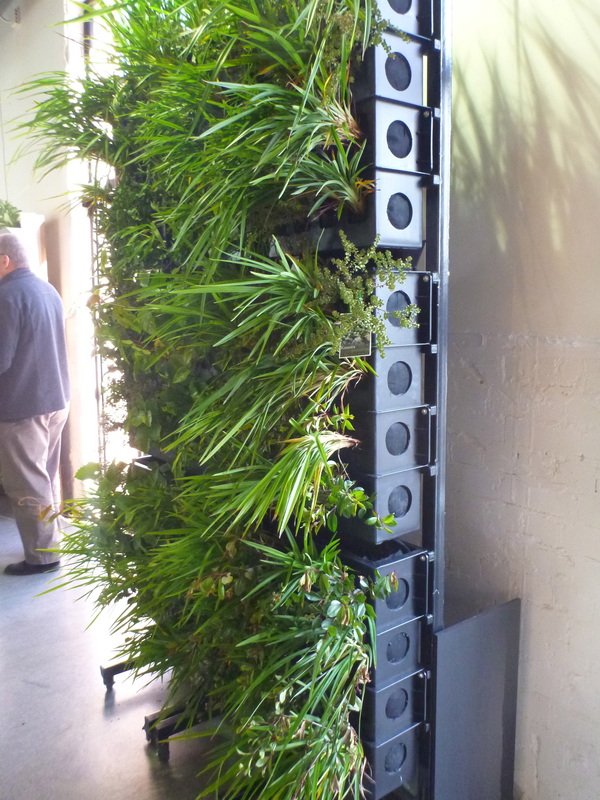
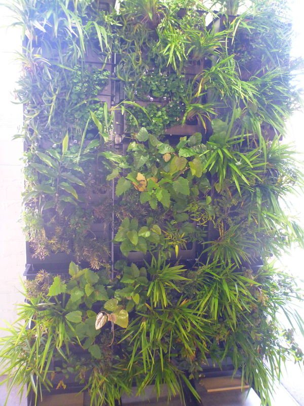
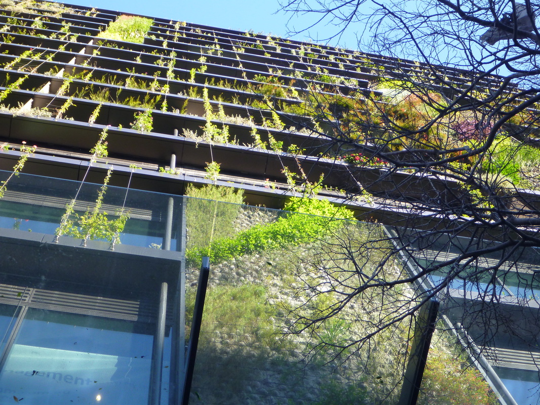
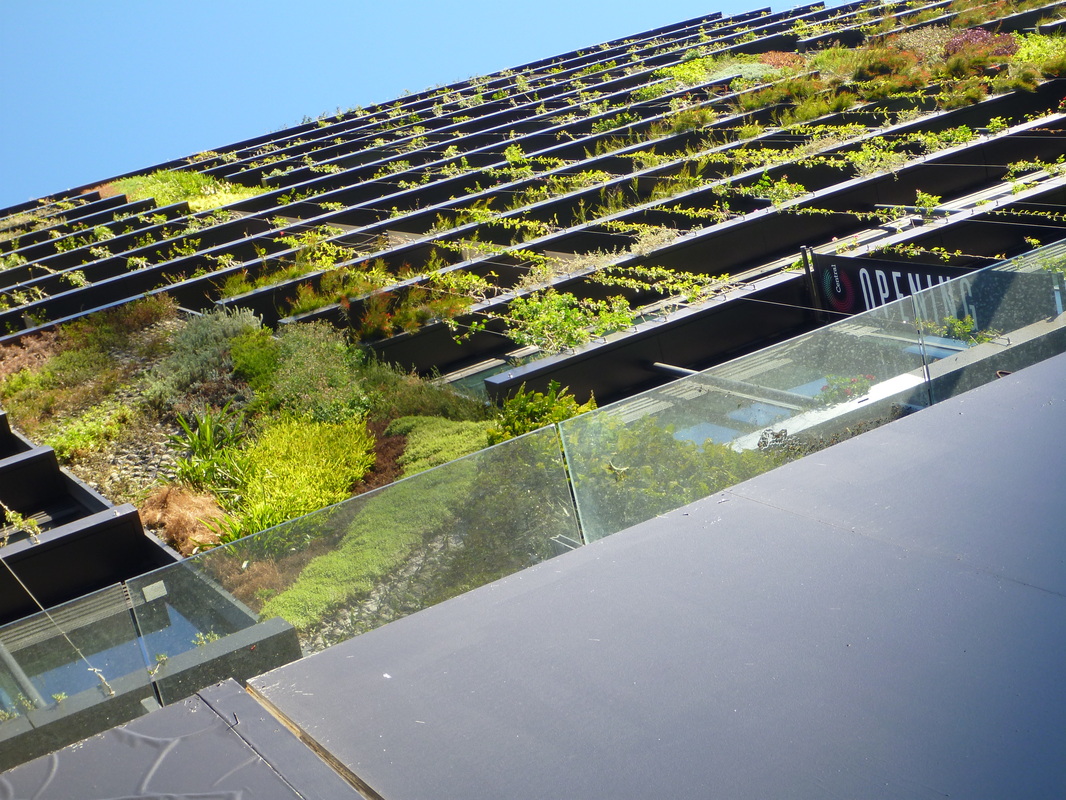
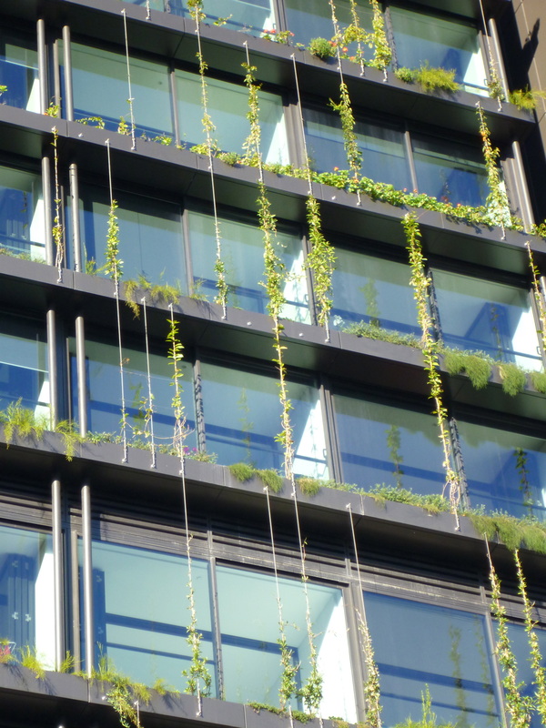
Compare London, Tokyo and New York. Compare different aspects of these cities by choosing different themes from the left hand menu. Population Density and housing density: Describe the population and housing density of London. Where are the densest areas? Are particularly dense areas in a particular part of the city?How is the density spread out across the city - does it spread out radially? is it north/south, etc. How do these results compare with New York and Tokyo? How would you account for the differences? Work - Commercial and Industrial: Describe where the commercial areas of the city are located. Where are the industrial areas located? How does this compare to New York and Tokyo? Account for the differences. Movement - Road speed, traffic and airports: How would you compare the road speeds and traffic evident between the three cities? Why would this be the case? How would it impact on the way the city functions? What information can we gather about the importance of the airports in New York and London? Account for the difference in flight numbers between the two cities. 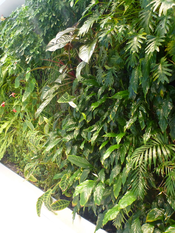 Above: Photo from the Central Park sales building. Yesterday I attended a forum on the use of green walls and roofs in Sydney. The forum was part of the Sydney Design series and put on by the Powerhouse Museum and City of Sydney Council. This was an examination of the issues associated with city living, the need for sustainability to be considered in city design, and the solutions offered by green roofs and walls. The presenters were Sacha Coles, a director at landscape architecture firm ASPECT Studios, professor Stuart White, Director of the Institute for Sustainable Futures, and Lucy Sharman, Senior Project Officer Green Roofs and Walls, City of Sydney. I will attempt to do justice to their ideas. What is a green roof? Structurally a green roof consists of waterproofing, a membrane, soil and plants. To be considered as a "green roof" over 30% of the surface must be covered in vegetation. What is a green wall? The definition of a green wall is less restrictive. It can be something being grown up a wall (such as a vine), planter boxes next to a wall with plants reaching up and along the wall, or a vertical forest installation such as the work of Patrick Blanc. Urbanisation and sustainability An increasing proportion of people live in the world's cities. Initially we can see this as exacerbating the world's environmental problems with issues of housing demands, increased pressure on food supply from the farmland on the periphery of the city, photochemical smog, loss of open space, storm water pollution, and a raft of other problems. However, we need to think of cities as centres of sustainability. The increased density associated with city living can actually mean that cities can provide viable sustainability solutions. Increased densities result in decreased car dependency, easier transport solutions, less need to lay new roads, electrical lines and water (unlike new developments in new suburban areas on the outskirts of cities) . Architectural innovations such as green walls and roofs can provide cities with the ability to improve their capacity to feed themselves, filter their water and waste, and moderate temperatures associated with the urban heat island effect. Globally some cities are already making a grey to green transition. These include Chicago, Basel, London, Stuttgart.
How can governments encourage GRW? Some cities around the world have begun introducing incentive program's to encourage GRW. These include: - subsidies - fee reductions - reduced storm water & levee fees - density bonuses - awards - education programs - technical support and advice - mandatory legislation In Sydney there are still some barriers to widespread use of GRW. It is still quite poorly understood, there are technical issues and cost barriers, and industry is not quick to embrace it.
In the City of Sydney currently:
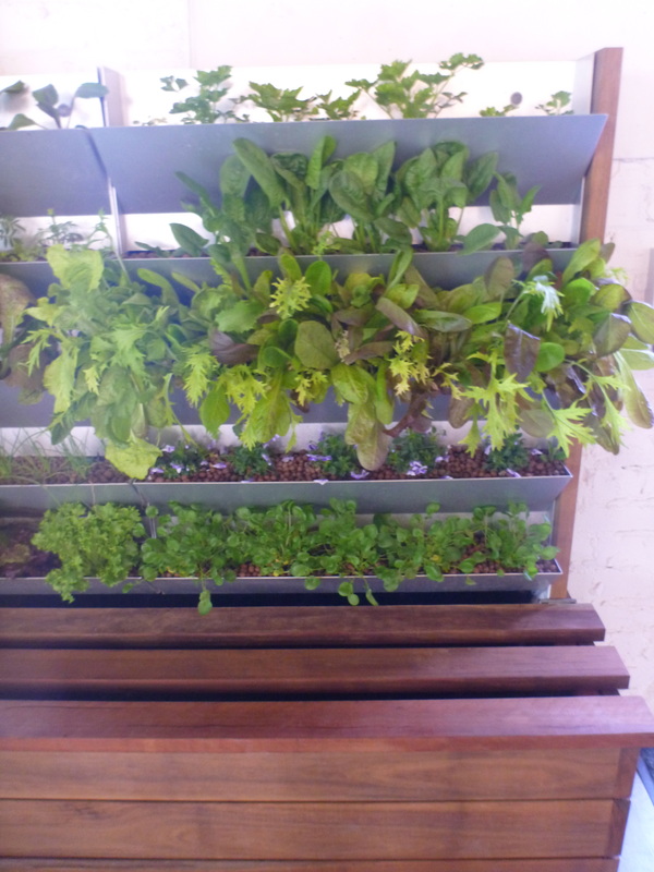
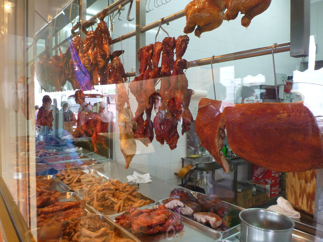
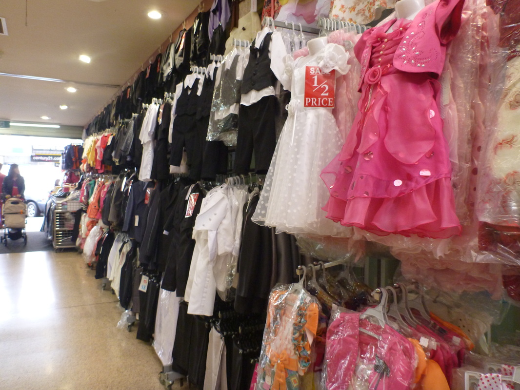
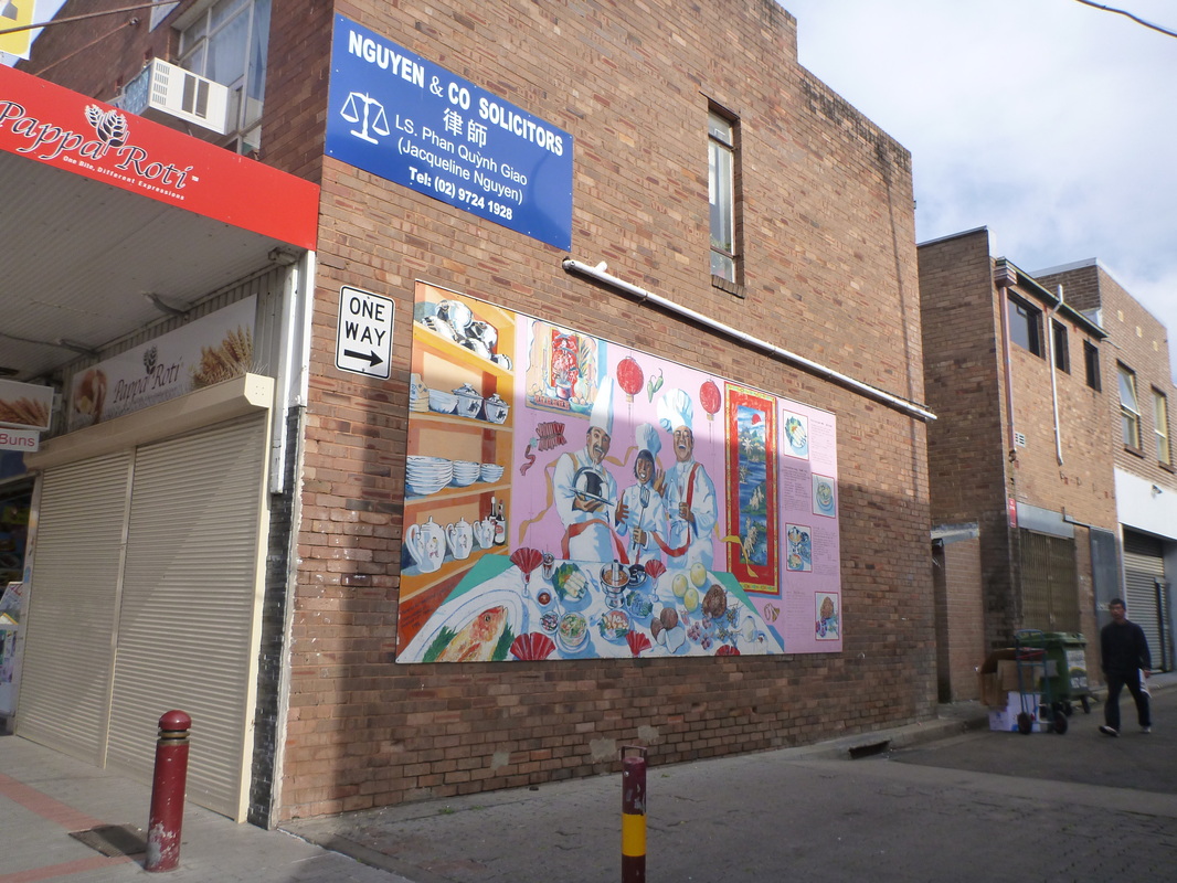
27 green walls 53 green roofs in Sydney 94,000msq At least one DA each week which incorporates a green wall or roof. Documents from the City of Sydney Council that support sustainability and Green roof and walls developments. - Sydney 2030 - Greening Sydney Plan 2012 - Green Roofs and Walls Strategy Check out other upcoming events at PowerHouse Museum as part of Sydney Design 2013. Relevance to the classroom So how can this information be integrated into the classroom? After all, this blog is supposed to be about teaching. If you are using Sydney as your large city case study in Year 12 Geography Urban Places, this fits in perfectly. I'm considering looking at Central Park specifically and how this development gives us some hope of the improved sustainability of development in the city. I will also tie it in with a number of other examples of development around the city. My previous blog about the Inner West Light Rail extension fits in well with this topic too. Click for lessons on Sustainability in Sydney for Yr 12. There is scope to look at cities and sustainability in the broad sense in Year 11 Geography when you are examining the Population topic and looking at social, economic and environmental impacts of population growth. This also ties in with some of the presentations at the Australian Geography Teachers Association Conference in January from Professor Peter Newman about the transformation of Cheonggyecheon River in Seoul and Singapore as a biophyllic city. You could also tie this in with Year 10 Geography Australia's Future as part of a broader discussion on sustainable development in Australia. Why not create a vertical garden in your classroom or somewhere in your school? Flower Power currently sell a frame and planters to create your own vertical garden. It is only about 1m by 1m and will cost about $300 to set up but it would be a great way to attract some attention to your faculty or even your school depending on the scale. You may even be able to access a grant from your local council.  We are all used to running geography fieldwork for the physical geography topics like Coastal Management, Land and Water Management, Biophysical Interactions and Ecosystems At Risk. There are various companies that run great excursions for these topics, but when you get to the human geography topics it isn't so easy to find pre-organised excursions. For my Year 11 Geography class I've taught the compulsory Population topic, and then Cultural Integration as one of the optional topics. We've examined the topic of refugees as part of an exploration of population movements, so I decided on a trip to Cabramatta to explore the impact of the Vietnamese community on this south-west Sydney suburb. I suggested this as an option on the online group Geography Teachers Online. As a result, I met up with a couple of teachers to thrash out some ideas about options for fieldwork. Some of the ideas we came up with were: - questionnaire of local residents - land use survey - urban transect of the Main Street - environmental survey - a photo essay based on cultural influences in the suburb - an interview with a local government representative/Councillor Cabramatta Library is located a short walk from the railway station. They offer a presentation on how the suburb has changed over time and are very obliging to school groups. They provide a half hour video on the development of Fairfield Local Government Area covering indigenous history, early colonial development, the market farms, education, rail development and migration. The presentation focuses on the Fairfield Local Government Area as a whole rather than Cabramatta itself, but this provides an excellent idea of the context in which Cabramatta developed. Following this there was a presentation on Cabramatta itself focusing on statistical information from the Census. It is also possible to organise a walking tour through the local council with a guide included, but they require about a months notice.
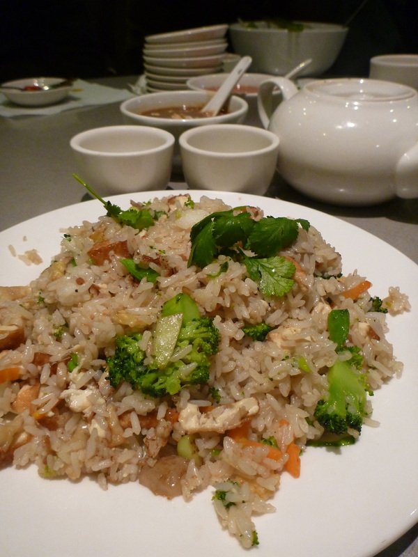
There are lots of opportunities for students to try different foods and drinks. For lunch, we went to Guan An Bau Troung, located on the main street, John St.The students all ordered a dish of their own and then I ordered a few different dishes for them to try and share. The food was really cheap and the servings were huge, even for boys who eat their weight in food in a single sitting. Obviously I had to check all the allergies, anaphylaxis risks involved, but I really think sharing a meal is a great bonding experience for a class.
 If you want to have a look at the fieldwork activities we used the Cabramatta Excursion page of the www.preliminarygeography.hsieteachers.com site.
Back in the classroom we are going to analyse the field data a few different ways. - Students' field sketches will be scanned and shared. An analysis of the various cultural influences will be written. - We will create radar graphs from the environmental surveys - The questionnaire results will be shared amongst the class. Results will be tallied, and the implications of results considered. Is this community self-contained? Do residents spend most of their lives in and around the suburb? Is the ethnic background of residents still predominantly Vietnamese? The great thing about using Cabramatta as a fieldwork site in Year 11 is that is also a great case study for the following HSC year. You can refer back to it and draw on the students' experience when you are short on time and trying to maximise time in class. Cabramatta makes a great study for looking at ethnicity in Sydney as part of the Urban Places topic. You can find a summary of this part of the course that I wrote last year for HSC Online. |
||||||||||||||||||||||||||||||||||||||||||||||||||