|
Residential areas
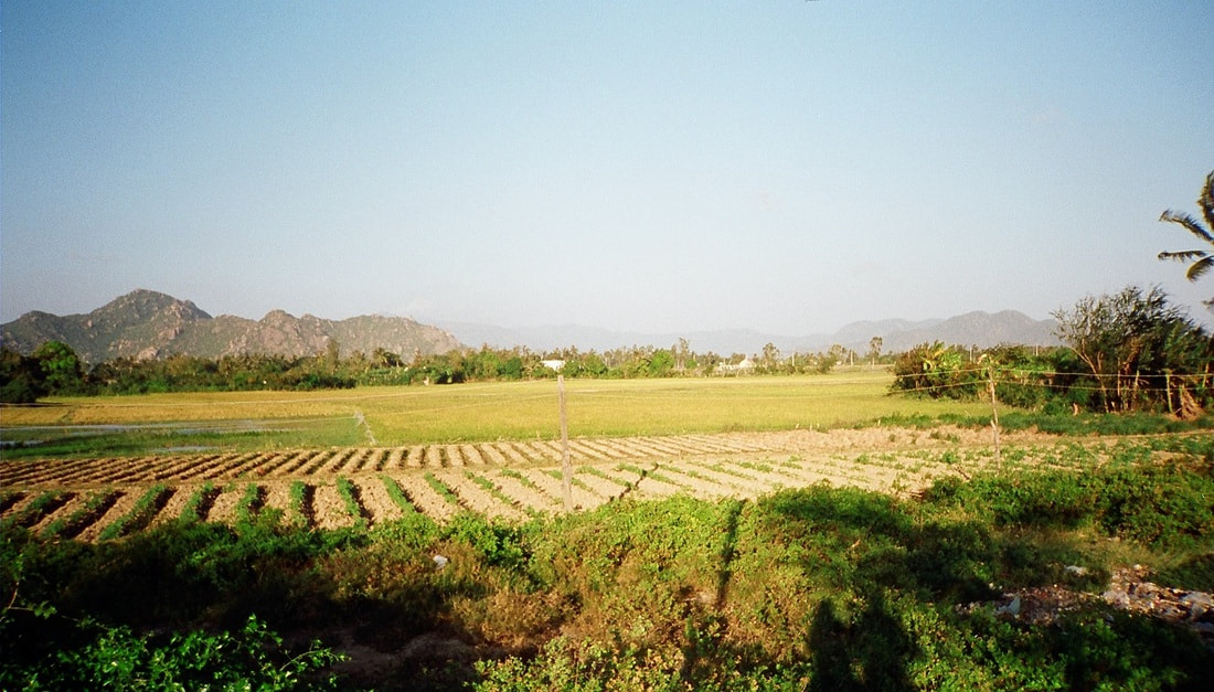
Stormwater pollution from urban areas Natural areas generally have the capacity to absorb large amounts of rainfall before runoff occurs. The absorbed water is retained as groundwater or drains into breeks and rivers over time, maintaining stream flow. When such areas area developed for residential and industrial uses, large areas previously able to absorb water are covered by impervious footpaths, roads and roofs. As runoff (stormwater) drains into the river system, it picks up a variety of pollutants and litter from urban areas. Sewerage system overflows Most water that enters our homes leaves as sewage, including effluent from flushing toilets and the water that goes down the drain from washing clothes, showering, preparing food, etc. Sewerage can include food scraps, oils, grease, paints, pesticides, solvents and preservatives. Sewerage is managed by Sydney Water. Sometimes sewers can overflow, and affect a number of freshwater creeks, particularly in the upper and central Georges River. The overflows can result in algal blooms, weed infestations, and fish kills. Impacts of developments Development along the shore of the river can cause a number of problems. Wave action on the foreshores of Botany Bay; and the threat to remnant vegetation along foreshore areas are significant. Sediment and erosion due to runoff from urban subdivisions are also a major problem. Recreation use Marine vessels discharge into the river and Botany Bay (including ballast water) and cause erosion on the banks. Jet skis and speed boats increase rates of erosion of river banks. Landfill areas There is inadequate management of leachate from existing and former landfill areas (rubbish dumps). Rural and agricultural use Runoff Agricultural runoff contains effluent from cattle and sheep, as well as any fertiliser or pesticides that have been used on the property. Traces of effluent contains high levels of nutrients such as phosphorous, and this can cause excessive growth of some aquatic weeds. Many native plants are not able to cope with the excess nutrients and are also killed. Pesticides can enter the food chain through bioaccumulation. The pesticides enter the waterway as runoff, are then absorbed by fish which are then eaten by other organisms. The poisons build up in larger animals causing death. Land clearing Land clearing destroys the habitat of native fauna and flora. The removal of vegetation exposes the soils to the actions of wind and water and makes it susceptible to erosion. Land clearing also reduces biodiversity. There are fewer species of plants, and as a result few species of animals will be attracted to the area. This can result in large scale pest infestations, and greater susceptibility to disease. Algal blooms Eutrophication can occur as a result of fertilisers in runoff. Blue-green algae (the common name given to several species of algae) can create scums on the surface of rivers. The toxins produced by the algae can be poisonous to humans and other animals. As it decomposes the algae uses oxygen which results in fish kills. Mining and Industrial Land use Industrial discharges In Botany Bay, the historic industrial discharges into the bay resulted in contamination of sediment on the bay floor. Industrial discharges can also result in fish kills, bioaccumulation or contamination of water and sediment. Mining induced subsidence Mining can result in the cracking of river beds, partial loss of surface flows, decline in water quality, release of gas reserves from underlying strata and increased rates of cliff-top collapse. Dredging Removing sand or other sediments from the floor of a bay or river can alter the river morphology (flow), and disturb floor dwelling aquatic species.
0 Comments
Biodiversity (or biological diversity): The variety of all life forms, comprising genetic diversity within a species, species diversity and ecosystem diversity
Biota: all living things including micro-organisms, plant and animals. Blue-Green algae: Microscopic bacteria. Under certain conditions (including high nutrients, warm still water, strong sunlight into the water) they can bloom into a dense and visible growth and become toxic. Deoxygenated: With most or all oxygen removed. Water becomes deoxygenated (i.e. loses its dissolved oxygen) for a number of reasons including stagnation, eutrophication and rising temperatures. De-snagging: The removal of fallen and dead branches from a watercourse. Dissolved oxygen: Oxygen in the water (which may be used by aquatic animals) Environmental flows: Flows of water, that are either protected or created for an environmental purpose. Eutrophication: Excessive levels of aquatic plant growth (including algae) resulting from raised levels of nutrients and other factors. Extraction: Water taken from rivers for off-stream use or for consumption. Faecal coliform: A type of bacteria found in faecal material of humans and other mammals. Faecal coliforms themselves generally do not make people sick. High levels indicate that water is likely to contain other micro-organisms that make people sick. Indicator (e.g. water quality, biological, ecological): Any physical, chemical or biological characteristic used as a measure of environmental quality. Introduced species: Species of plants or animals that are not native to Australia (also referred to as exotic or alien species). Natural flow regime: The likely pattern of flow before European settlement in Australia. In these guidelines, natural flow regime refers to the flow patterns without any regulation or extraction of water. Nutrients: Nutritional substances. Unnaturally high levels of nutrients, such as in a river below a sewage treatment plant, can encourage abnormally fast and prolific growth of algae in the water, or weed growth in the bush. Pathogen: Disease-causing organism. Point-source pollution: A single, identifiable source of pollution, such as a drain from an industrial site or sewage treatment plant (as opposed to non point-source or diffuse-source pollution-coming from many small sources over a large area). Potable water: Water fit for human consumption. Raw water: Surface or groundwater that has received no treatment to make it suitable for drinking. Salinity: The concentration of salts in soil or water, including sodium chloride (NaCl). Suspended solids: The smaller, lighter material such as clay, silt and fine sand carried in suspension in water. Turbidity: A measure of the amount of the light-scattering properties of water. It indicates how much silt, algae and other material is suspended in water. Highly turbid waters may look muddy, stain clothes, block irrigation sprays and pipes or harm aquatic organisms. Where is the Georges River Catchment located? The Georges River catchment covers approximately 960 square kilometres and about 800,000 people live in the catchment. The Georges River rises south of Appin near Campbelltown and flows downstream for 96 kilometres to enter Botany Bay at Sans Souci. A substantial part of the catchment is bushland contained in Heathcote National Park, the Holsworthy Army Base and on private and Crown land. The upper catchment includes the upper reaches of the Woronora River and Dam and the Upper Georges River, O'Hares Creek and Prospect Reservoir. The lower catchment includes the urban areas of Campbelltown, Liverpool, Bankstown, Sutherland, Kogarah, Kurnell, Botany and areas around Botany Bay There is a range of fieldwork techniques that can be used in studying catchment functioning. Some of these fieldwork techniques which relate specifically to the river include: - water quality - measuring changes in channel shape - velocity - discharge - material carried in the stream - biodiversity survey. Below are links to videos from Georges Riverkeeper explaining some relevant types of fieldwork. Below are duplicate activities for four different locations. These are intended as a single site fieldwork activity that you could fit into a single or double period if your school is located within walking distance of one of the fieldwork sites: Orphan School Creek, Chipping Norton Lake, Salt Pan Creek or Woronora River.
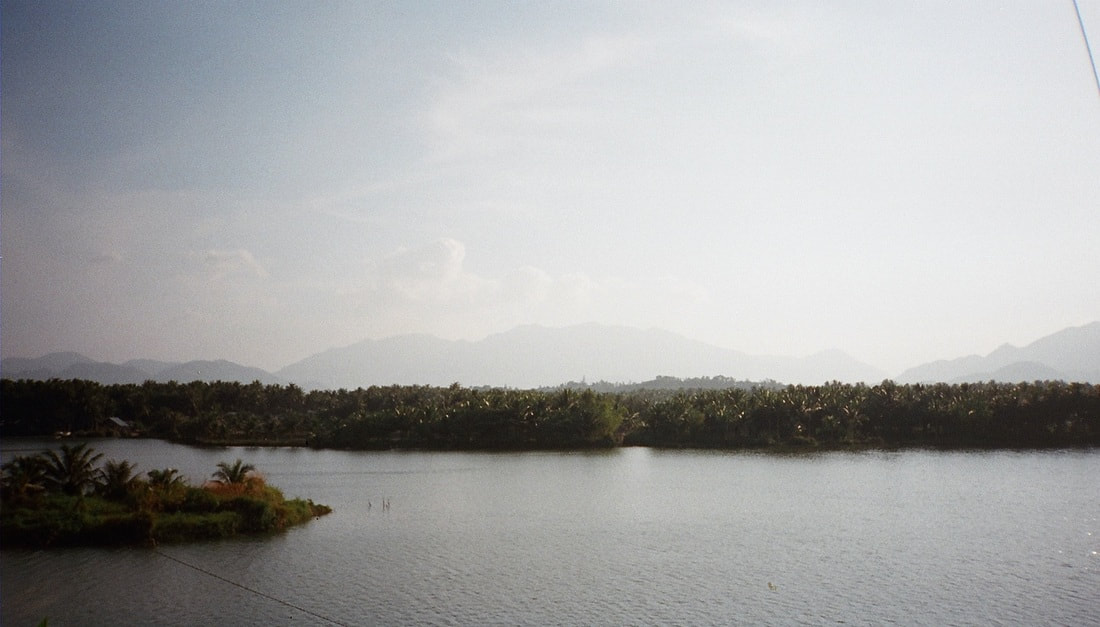
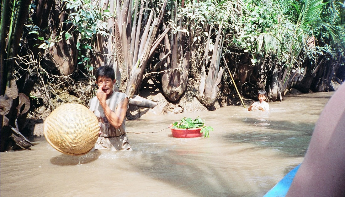
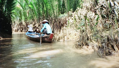
What is river regulation?River regulation refer to strategies and modifications to the natural flow of a river. This can include changes to improve navigations such as dredging or river widening, building of levees to protect populations in times of floods, construction of dams, and diversions for agriculture. How is the Mekong River regulated?In built up areas, some parts of the Mekong have been modified by having natural river beds replaced by cement. In rural areas, dwellings are built out into the river and the Mekong is used for a range of activities including washing, catching fish, rubbish and sewage disposal. While the Mekong has been modified and changed over time, the most significant changes have occurred in the past 20 years with the constructed of dams along the length of the river. Useful links: Mekong River Commission Mekong River nations defer dam decision Save the Mekong Power and responsibility: Mekong River Commission and Lower Mekong mainstream dams
Biophysical Interactions A variety of factors affect the flow of rivers. These factors include climate, vegetation cover, soil, rock structure or ground covering, shape and slope of landforms. Atmopshere - Climate Climate has a direct impact on the way a river flows. At times of heavy rainfall a river will have greater volume of flow (more water flowing). At times of hot weather evaporation of water increases. This reduces the volume of water (less water flowing). Biosphere - Vegetation Vegetation absorbs water from soil to use in plant growth. Vegetation greatly reduces runoff. The less vegetation, the more abundant and rapid the runoff will be. A close plant cover will modify the violent affects of heavy rains. Vegetation growing in and on river channels may be regarded as a surface roughness which can slow the flow of the river (this is particularly important in times of flood). Lithosphere - Soil/Rock structure/Ground covering The ground surface surrounding a river will affect how much water will enter the river as run-off and groundwater. Together with vegetation, the ground cover type influences the amount of water that will infiltrate or run-off. Some soils or rock structures are highly permeable (they absorb water) and have a large water-holding capacity, e.g. coarse-grained sandstones and porous limestones. These rocks and soils can even out the groundwater discharge even during dry seasons. Other ground surfaces such as cement pathways, driveways and tarred roads greatly increase the amount of run-off because no water is able to infiltrate. This increased run-off generally known as stormwater enters drains and is directed to nearby creeks and rivers. Lithosphere - Landform shape and slope Slope greatly affects the amount of run-off which will occur and thus how much water will enter a river. Generally the steeper the slope, the more run-off. Flat areas (especially where marshes and lakes occur) tend to accumulate water and slow down the flow of water. Catchments which are bordered by or contain high, steep landforms are more likely to have greater volumes of water due to the occurrence of orographic rainfall (cool air travels across the land and warms up, it hits mountains and rises causing rainfall). The size of the catchment can also influence the volume of water flow. Small drainage basins (catchments) show a great increase of flow after rainfall, while large catchments are more able to absorb the effects of precipitation. True or false - A flow of water in a river in a larger catchment will be affected more by rainfall than a river in a smaller catchment. - An area with little or no vegetation is likely to have more run-off than an area with dense vegetation - An impermeable ground cover will allow water to soak into the surface. Rivers - Key Terms river source river mouth tributary delta pool cutoff riffle billabong/backswamp meander meander scar upstream downstream stream velocity river discharge stream capacity eyot wetland flood plain
The Mekong - Sensitivity to change Xayaburi Dam and the Fate of the Mekong An overview of the pros and cons of the Xayaburi dam in Laos. Read more... New Mekong Dam a Go, and a Blow to Megafishes? An indepth examination of the impacts of dams along the Mekong. Read more... Photos: Dams threaten Mekong River Megafishes A photo gallery from the National Geographic exploring the impact of dams on the Mekong. Read more... Why we shouldn't dam the worlds most productive river Zeb Hogan from the National Geographic describes how changes to the Mekong River are likely to drive many of the mega fish found in the river to extinction. Read more... Mekong countries at odds over Mega-dams Kirk Herbetson explores relations between Cambodia, Laos, Thailand and Vietnam Environmental issues in the Greater Mekong WWF outlines some of the greatest ecological issues in the Greater Mekong region including hydropower and infrastructure development, climate change, deforestation and degradation, wildlife trade. Read more... Exploring the Mekong's Uncertain Future Jeff Opperman writes a series of blogs about his trip along the Mekong, exploring the interconnected components of the environment and livelihoods of the people who liv Hydropower development in the Greater Mekong WWF examines how hydropower developments impact on sediment and nutrient transfer, impact on water flow and natural regulation, the relocation of loc Mekong giant catfishWWF explores threats to the Mekong giant catfish including dam developments, alterations to migration routes, dredging and over-fishing. Read more... Irrawaddy dolphins in the MekongWWF explores the reasons that the Irrawaddy dolphin is threatened. Threats include pollutants, fishing, hydropower developments and ecosystem degradation. Read more...
Management Regional Cooperation on Mekong in tatters WWF article outlining issues with management agreements between countr WWF - Solutions in the MekongWWF outlines some of the initiatives currently being put in place to address some of the issues in the Greater Mekong. These solutions include conservation efforts in threatened forests and rivers, ensuring that hydropower developments are sustainable, and strengthening law enforcement. Read more... Catalyzing sustainable hydropowerWWF is encouraging a 5 year ban on mainstream dams in the lower Mekong river to counter some of the many environmental costs of dams. Read more... River fieldwork Examples of fieldwork that can be conducting on rivers: - Measuring changes in channel shape - Measuring velocity at different parts of the river - Discharge - Material carried in the stream Examine fieldwork currently being conducted in the Mekong region: Stelar-S2S Whale and Dolphin Conservation Society - Irrawaddy dolphins fieldwork Sustainable Energy - Thoughts on fieldwork in Laos Mekong River Problem Based Learning The aim of this activity will be to identify a range of environmental problems affecting the Mekong River, and to explore possible solutions to some of these problems. Below is a very brief overview of the lesson sequence. The attached file contains much more detail includin scaffolding of the activities. Overview Lesson 1 Begin reading through the booklet of readings that you have been provided with. The readings all relate to issues impacting on the Mekong region. Summarise the articles in the table provided. Lesson 2 Continue reading and summarizing the articles provided. Pair work - Determine one underlying issue affecting the Mekong Region. Lesson 3 Create a flow chart which explores how your problem impacts on the biophysical environment. Individual work - Write a summary of how the Mekong Region is sensitive to change. Lesson 4 In pairs, suggest a range of solutions or management strategies to address your underlying problem. Design a management strategy that can be applied across countries, up and downstream to address the issues in the Mekong Region. Identify a range of professionals that you will need to employ to put your management plans into place. Lesson 5 Mekong overview and presentation of management plans.
|
|||||||||||||||||||||||||

