|
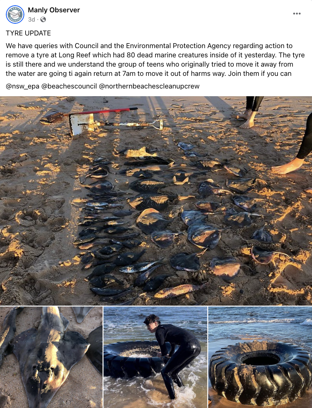
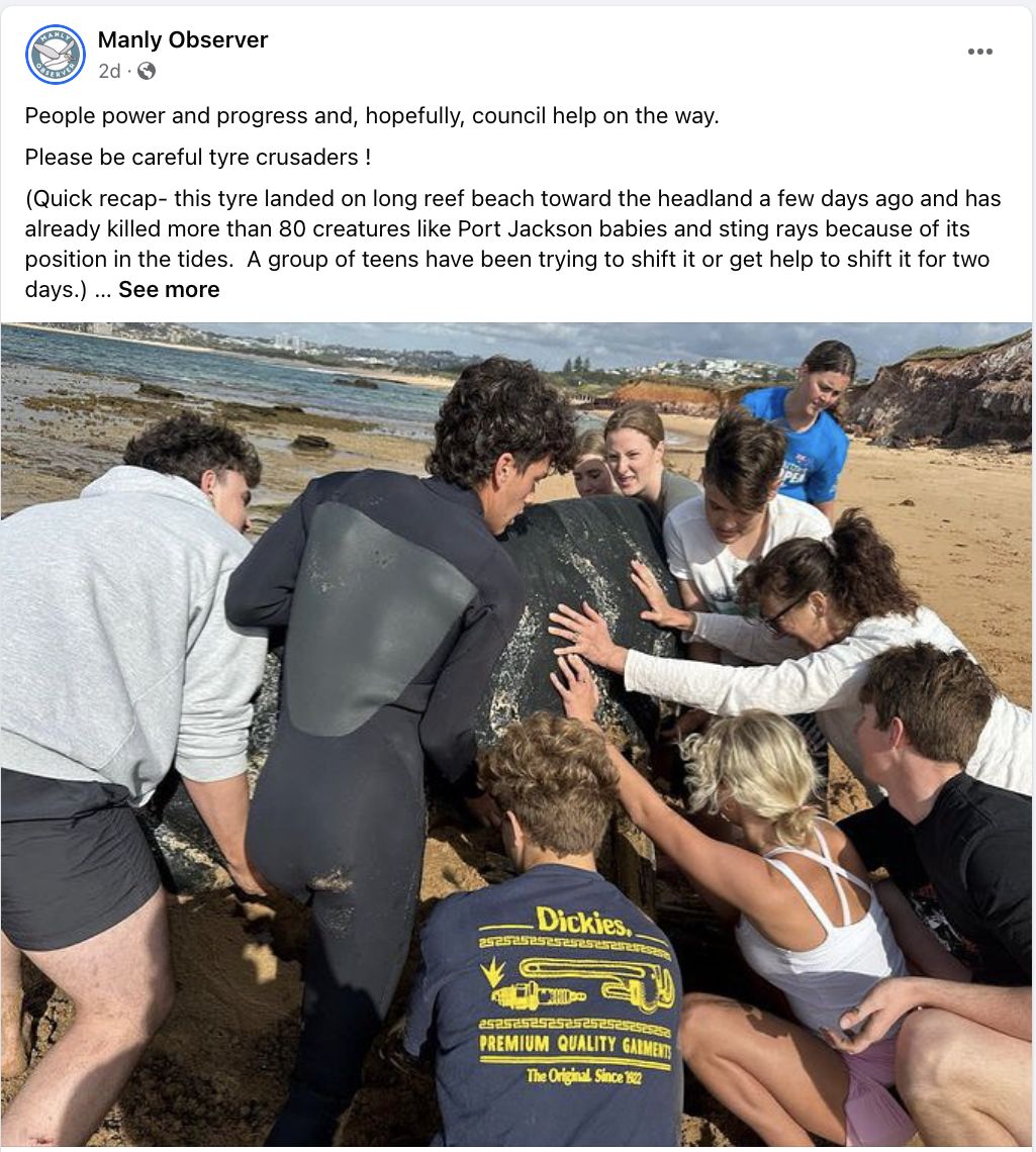
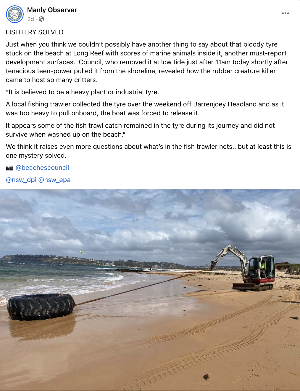
Over the last couple of weeks, the Manly Observer has been recording the appearance and removal of an industrial tyre at Long Reef and the actions of mostly young people in the community to relocate it. They removed the sand that had built up inside it to try to make it easier to move, but each time they took out a layer of sand they found a variety of fish, rays and juvenile sharks. In all, around 80 marine creatures were removed from the inside of the tyre. Read the full story here: How 80 dead creatures came to rest inside an industrial tyre on the Long Reef Shoreline The reporters and community engaged in discussions about how so many marine creatures could have made their way inside the tyre. Some suggested that it was being used for shelter, and then as the tides went out animals became trapped. Eventually the group managed to move the tyre away from the shoreline, and it drew enough attention that the local council became involved the remove it from the beach entirely. Council reported that a local fishing trawler had let them know that they had unintentionally pulled up the tyre out of the water, but it was too weighty to bring aboard the ship, and they released it back into the water. The creatures inside the tyre were most likely to have been bycatch, caught in the trawlers net.
This is a great little story to use in the classroom. Active Citizenship It highlights the importance of active citizenship in the most practical way. It shows that how young people can have an impact on their environment, work collaboratively and achieve something tangible that initially seems beyond their capacity. It demonstrates how collective action can get the attention of media, government and the community and bring about more change than the individuals are capable of by themselves. Geographic Investigation This story is a great way to talk to students about hypotheses, assumptions, using sources, and drawing conclusions. The teenagers began their own investigation of the tyre, found the dead creatures and assumed the tyre had caused the deaths. The tyre may have caused some of those deaths. The idea of fish getting caught on the low tide is entirely plausible, but doesn’t seem to account for the huge number of creatures found. Regardless, I love that some mostly incorrect assumptions resulted in these teenagers doing something great (removing rubbish from our oceans). Contacting additional sources – like the local council - led to the alternate and more plausible explanation of the involvement of the fishing trawler. Let’s hope these young people are now encouraged to find out more about trawling. Problem Solving and Mystery The way this story unfolded on social media was really interesting and engaging, and this could be replicated in a classroom by only providing some pieces of information at a time and allowing students to problem solve and eventually solve a mystery. Students could be presented with a range of scenarios to explore - the tyre in the water, the creatures in the tyre, the weight of the tyre, the encroaching tide, etc. Student could be asked to problem solve each step and be given roadblocks or positive outcomes dependent on the solution they come up with. Open ended questions could be provided to encourage deeper exploration of coastal environments, environmental issues and management strategies. The structure could almost be set up like a murder mystery, with clues along the way, and students trying to solve the crime. It is easy to fall into a trap of thinking that environmental issues are too big for an individual to have an impact. I have only recently had some conversations with students who felt they couldn’t make any real impact because the world’s problems were just too big. This is a great, short story to engage students with geography and show the impact that individuals and groups can have their local environment, but also that once that first job is one, there’s more to do!
0 Comments
A previous post written in 2014 described the impact that tourism was having on Venice. You can read this post here:
Tourism - Are we loving Venice to death? Part 1 The COVID-19 pandemic, and it's impact on global tourism since that post has resulted in a new range of impacts and an opportunity for reassessing the nature of tourism on the island. The pandemic has resulted in months of empty shops, restaurants and hotels. As Venice begins to open with some slight changes (more takeaways, outdoor dining, etc) a broader review of tourism on the island must be considered. The over tourism being experienced prior to the pandemic was pushing residents out due to rising house prices, grocery stores were being replaced with souvenir shops and accommodation was being replaced with Airbnbs. Large cruise ships were bringing in tourists who were only on Venice for day trips resulting in them rushing around to the see the main sights, congregating in concentrated areas, and economic benefits not being shared by the wider community. The pandemic has provided an opportunity for residents to reclaim the city, to try to make tourism more sustainable and diverse. Some of the suggestions being considered are limited access to attractions by introducing quotas and booking, and more regulation of tourist flows. Dates for consultation on the new draft syllabus for Senior Geography have recently been announced. To find about about the dates click to see the Geography and Geography Life Skills Stage 6 Draft Syllabus Consultation page.
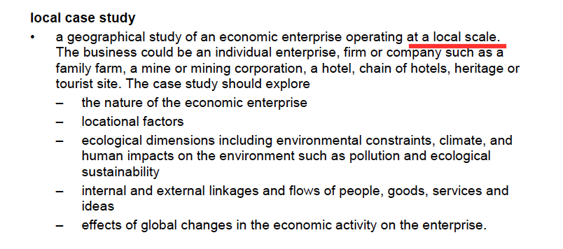
There are several documents worth reviewing prior to consultation sessions: - The Geography and Geography Life Skills Stage 6 syllabus review (released 2018) - Geography and Geography Life Skills Stage 6 Draft Directions for Syllabus Development (released for the consultation period July-September 2018) - Feedback from GTANSW and ACT Draft Directions At this stage four different options for course structure have been provided by NESA for review and consultation. The new syllabus draft that will be released just prior to the consultation meetings (22 July) is likely to be based on one of these models. Preliminary course All Preliminary options provided included a topic on The Nature of Geography, a Geographical Investigation and a Global Transformations topic. This last topic may be drawn from the Australian Curriculum and can be found at the Australian Curriculum (Global Transformations) page. Two of the proposed course structure options included Natural and Ecological Hazards, likely drawn from the Australian Curriculum (Natural and Ecological Hazards) topic. One option included Biophysical Interactions, likely drawn from the existing Stage 6 syllabus. One option includes a topic Physical Environments and Natural Hazards, possibly a melding of the existing Biophysical Interactions topic and the Australian Curriculum Natural and Ecological Hazards. HSC course Sustainable Places looks certain to be included in the HSC course, being in each of the 4 proposed options. This is one of the Australian Curriculum topics and the national version of the topic can be found on the Australian Curriculum (Sustainable Places) site. The Ecosystems at Risk topic has been retained in all four options, but in Option 4 to a lesser extent. Until the draft syllabus is released we won't know how much of the actual topic is likely to be changed or retained. Population Change is a topic in two of the proposed course structure options. The topics Human and Ecological Change, People and Economic Integration and Landcover transformation are each found in one option. It is possible that these will draw on the Australian curriculum topic Australian Curriculum (Landcover Transformation), or the existing People and Economy Activity topic. Overview - What we know so far... Preliminary course 3 topics and an investigation: - Nature of Geography - Global Transformations - One topic still to be announced - possibly some combination of Biophysical Interactions and Ecological Hazards or one or the other. - Geographical Investigation HSC course 3 (possibly 4) topics: - Sustainable Places - Ecosystems at Risk (but may be a shorter version of the current topic) - One topic (or possibly two) still to be announced. There are a few different options as to what this topic will be. This is the first time there has been change in the Senior Geography syllabus in NSW for many years. It is important that as many people get involved in the consultation sessions as possible. Make sure you attend and have your say. ****************************************************************************** Later edit following release of Draft Syllabus: Preliminary topics are: - Earth's Natural Systems - Human Systems - Human-Environment Interactions - Geographical Investigation HSC topics are: - Planning for Sustainability - Urban and Rural Places - Ecosystems and Global Biodiversity Great White Bear Tours uses custom built all terrain vehicles called Tundra Buggies. These allow unique access to the tundra environment around Churchill providing opportunities for viewing of a range of wildlife such as polar bears, arctic foxes, caribou and migratory birds. They operate tours in Spring, Summer and Autumn, and tours vary according to the seasons. In Spring they offer tours to see the Northern Lights (Aurora borealis), in Summer they operate bird watching and wildlife viewing tours and in Autumn/Fall they run Polar bear viewing tours. The company offer both one-day tours and multi-day tours. Visitors can choose to stay at the White Bear Tundra Lodge for multi-day trips. This is a custom-designed rolling hotel to enhance wildlife viewing opportunities. The lodge consists of five large units linked together - two sleeping units with shared sleeping quarters, bathroom and showers, and separate lounge, dining and kitchen facilities. The map below indicates the location of the White Bear Tundra Lodge in relation to Churchill. Examine the case study in more detail on the 12 Geography People and Economic Activity site: Nature of the economic enterprise Locational factors Ecological dimensions Internal and external linkages Effects of global changes Is Great White Bear Tours a local case study? The NSW Stage 6 Geography syllabus requires students to examine a local case study for the People and Economic Activity topic. Depending on the economic activity studied, common case studies are local vineyards, hotels, chocolatiers. The syllabus states, "a geographical study of an economic enterprise operating at a local scale." It does not specify that it has to be in Australia, or local to you/your school. While Great White Bear Tours is not "local" to anyone studying the NSW syllabus, it can be viewed as "local" in the sense that it operates within its local area (the tours run in a relatively small geographical area, in the immediate vicinity of the business site). Let's have a look at the references to the local case study in the syllabus... There are two uses of the the word local when referring to the case study in the content section of the syllabus. In the first example it refers to the case study operating at a local level. It does not specify that it needs to be local to you or your school. Below: Screen shot from the NSW Stage 6 syllabus (Content) It is referred to again later in the content section where it refers to an enterprise operating at a local scale. Again there is no reference to it being local to you or your school. Below: Screen shot from the NSW Stage 6 syllabus (Content) What about fieldwork? Fieldwork is an integral part of geographical inquiry and learning. It is a common practice for classes to do their fieldwork on their economic enterprise, particularly if they have chosen a case study close to the school. However, while it is common practice, it is not mandated. If we look what is mandated, the syllabus states that students need to identify methods such as "collecting and analysing field data about economic activity. Note that it doesn't state that the fieldwork has to be based on the economic enterprise (the local case study). In this way a class could conduct fieldwork on Tourism in general, but not their economic enterprise and still meet requirements. There are also many opportunities to conduct virtual fieldwork. Explore some fieldwork options on the Year 12 Geography, People and Economic Activity site:
Fieldwork: Hudson Bay Post originally written in 2017, and updated March 2018. This is part of a unit of work for Changing Places - Australia's Urban Future. Lesson 1: Australia's Projected Population Growth Lesson 2: Implications for Future Growth and Sustainability Lesson 3: Sydenham to Bankstown Urban Renewal Precinct Lesson 4: WestConnex - Sydney, Sustainability and Transport Lesson 4: Sydney Sustainability and Transport (Teacher's Notes) Lesson 5: The GreenWay Lesson 5: Deindustrialisation Lesson 6: Create an infographic Lesson 7: Contributing to a Sustainable Urban Future Lesson 7: WestConnex - Protest Movements and Impacts Lesson 7: Conflict Over Dulwich Hill OR See the complete unit on the Changing Places website. The NSW Government has released a revised Sydenham to Bankstown Urban Renewal Strategy for public comment. The strategy will be implemented over 20 years and sees plans for urban consolidation and retail opportunities along the a new metro line which will replace the existing train line and link with the Metroline being built in Sydney's north west. It includes the creation of over 35,000 new homes. View the Sydenham to Bankstown Urban Renewal Corridor website. Priority Precincts where development will be concentrated include Campsie, Canterbury, Lakemba and Belmore. Developments in these areas will include buildings up to 25 storeys high. Marrickville will have an increase in homes of 84%, while Canterbury will increase by 208%. and Belmore will increase 128%. Some suburbs such as Dulwich Hill and Hurlstone Park have had a reduction in the number of new dwellings proposed compared to the previous plan released. View Changing Places: Conflict over development in Dulwich Hill. The existing rail line between Sydenham to Bankstown will be converted to a Metro line. During construction the rail line will not be in operation. It is anticipated that once completed, it will reduce wait times and travel times to the city. However, the existing rail line allows commuters to connect with the existing CityRail network and travel to locations such as Chester Hill, Villawood, Cabramatta and Liverpool, without having to change trains. Commuters can then change trains to connect with the rest of the CityRail network. It is unclear at this stage how the Metro line will interact with the existing City Rail and light rail networks. Residents and community groups have expressed some concerns regarding the increased level of density and population. Concerns relate to inadequate parkland and open space, destruction of heritage architecture, new designs which are unsympathetic to the heritage nature of suburbs, and lack of supporting infrastructure. There has been limited information released regarding industrial and commercial zoning, and concerns have been raised regarding the sustainability of the development. The rezoning will also take place years before the Metro line will finished. Supporters of the developments state that high density is better for the environment than urban sprawl and increases connectivity and land values in the area. The renewal strategy announcement has come at a time when residents of the Inner West are already dealing with a large number of new developments and there is a perception that there is an inequitable system of planning in place. For example Council targets for new housing approvals have been exceeded in Canterbury, but many other council areas such as Hunters Hill, Warringah, Pittwater, Willoughby and Manly have not met their targets. There have been a range of issues associated with the WestConnex development such as compulsory acquisition and demolition of houses, encroaching on parks, noise and construction issues. The recently announced future sale of Canterbury Racecourse for development has also been an issue of contention. These issues combined are likely to make Inner West residents less persuadable when it comes to future developments. Lesson Activities: Define the terms low-density, medium-density and high-density. Describe the advantages and disadvantages of each type of housing. Examine: http://www.planning.nsw.gov.au/Plans-for-your-area/Priority-Growth-Areas-and-Precincts/Sydenham-to-Bankstown-Urban-Renewal-Corridor/Map Outline the changes that will occur in each Inner West suburb as a result of the Sydenham to Bankstown Planned Precinct. Assess how the new Metroline will support population growth in the Urban Activation Precincts. Extra resources: Residents, ex-pollies baulk at high density in revised Sydneham to Bankstown Urban Renewal Strategy. Planning experts say development should be embraced and not feared along Sydenham to Bankstown corridor. Sydney's tale of two suburbs: new analysis shows the wide spread of development. Metro's on the wrong track High rise to hell Open season on high rise Heritage, character face destruction Inner West needs nine new schools
This post was originally written in January 2017, and edited in March 2018.
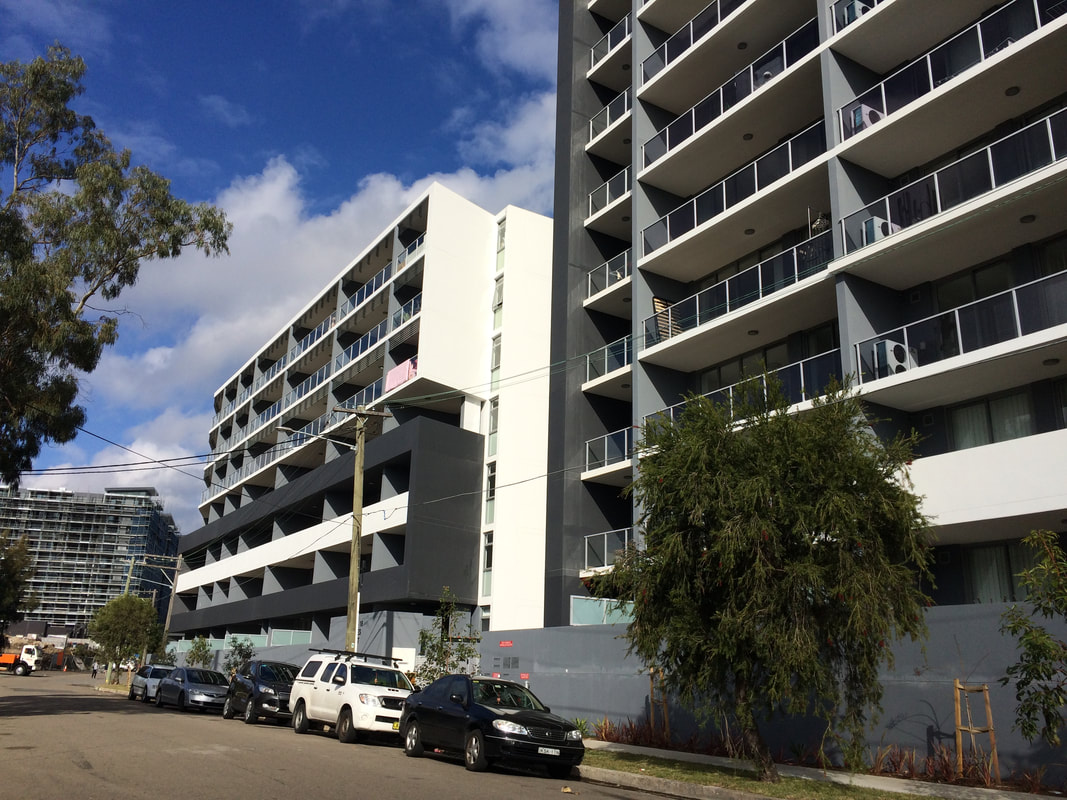
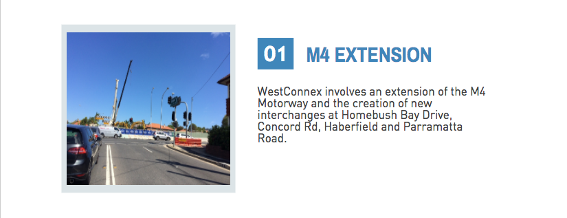
This is part of a unit of work for Changing Places - Australia's Urban Future. Lesson 1: Australia's Projected Population Growth Lesson 2: Implications for Future Growth and Sustainability Lesson 3: Sydenham to Bankstown Urban Renewal Precinct Lesson 4: WestConnex - Sydney, Sustainability and Transport Lesson 4: Sydney Sustainability and Transport (Teacher's Notes) Lesson 5: The GreenWay Lesson 5: Deindustrialisation Lesson 6: Create an infographic Lesson 7: Contributing to a Sustainable Urban Future Lesson 7: WestConnex - Protest Movements and Impacts Lesson 7: Conflict Over Dulwich Hill OR See the complete unit on the Changing Places website. Changing Places (Year 9) The Changing Places topic requires students to explain processes and influences that form and transform places and environments (GE5-2) and to assess management strategies for places and environments for their sustainability (GE5-5). The topic requires students to examine urbanisation, the impact of migration and strategies to address change in urban places and how they enhance sustainability. As a part of examining the causes and consequences of urbanisation, students will have investigated spatial distribution patterns of urbanisation (for example the influence of transport corridors), and the social, economic and environmental consequences of urbanisation (this could include traffic congestion, costs of tolls or costs of constructing new infrastructure, average times people spend commuting to work, the impact of car exhaust on air quality). In examining urban settlement patterns students will specifically address the impact of transportation networks in Australian and another country to explain differences in urban concentrations. While there is scope to deal with a range of issues and influences related to urbanisation and urban settlement, there is certainly an opportunity to develop a unit of work that develops students’ understanding in car dependence, traffic congestion, public transport, road networks, etc. to lead them to be able to examine this issue of the WestConnex development from a range of perspectives and with detailed background knowledge. In the last part of the Changing Places topic students investigate the management and planning of Australia’s urban future, including Australia’s population projections, implications for growth and sustainability, strategies to create sustainable urban places and ways for individuals and groups to become involved. WestConnex provides a great case study to examine this. Obviously you need to address the points at the national scale, but the WestConnex project impacts on such a large are of Sydney that you might find that many of your students are already engaged with (or at least aware of) the project in some way. Urban Places/ Urban Dynamics (Year 12) If you choose to do Sydney as a large city case study for Urban Places the WestConnex project could also tie into the - growth, development, future trends and ecological sustainability dot point. This is part of a unit of work for Changing Places - Australia's Urban Future. Lesson 1: Australia's Projected Population Growth Lesson 2: Implications for Future Growth and Sustainability Lesson 3: Sydenham to Bankstown Urban Renewal Precinct Lesson 4: WestConnex - Sydney, Sustainability and Transport Lesson 4: Sydney Sustainability and Transport (Teacher's Notes) Lesson 5: The GreenWay Lesson 5: Deindustrialisation Lesson 6: Create an infographic Lesson 7: Contributing to a Sustainable Urban Future Lesson 7: WestConnex - Protest Movements and Impacts Lesson 7: Conflict Over Dulwich Hill OR See the complete unit on the Changing Places website. Background: WestConnex overview M4-M5 Link Concept Design To bring Sydney together, WestConnex tears suburbs apart The development and construction of WestConnex has impacted and changed places. Large sections in the vicinity of Parramatta Rd in Ashfield and Concord and the western part of the suburb of Haberfield have been demolished to make way for the road development. You can read more about this here - West Connex's collision course into communities or in my previous posts. Impact at St Peters, Alexandria and Newtown Stage 2 of the WestConnex project involves the construction of a tunnel between St Peters and Kingsgrove. The King Street Gateway and the Campbell Road Green link are changing the nature of St Peters, Alexandria and Newtown. View the St Peters Overview. Links: Changes to St Peters can be seen in the link below. Sydney's WestConnex changes the face of St Peters - in pictures Information about the construction at St Peters can be found in the following article: WestConnex inflicts non-stop construction on St Peters for the next 3 weekends. The M4-M5 link tunnels will run underneath Newtown. Many Newtown business owners have begun protesting the development, worried that congestion and bottlenecks will negatively impact retail businesses, or alternatively that clearways along King St will kill business. The Newtown WestConnex Action Group has been formed. In Alexandria a new bridge is being constructed over the canal to allow movement of traffic from the St Peters interchange.
Links: Six tunnels will be built under Andre's house in Lorde St Newtown. "Write an email": Sydney residents get no more answers as WestConnex hits Alexandria. Official: WestConnex allowed to flout environmental laws. This is part of a unit of work for Changing Places - Australia's Urban Future.
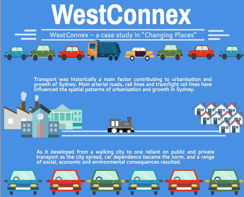
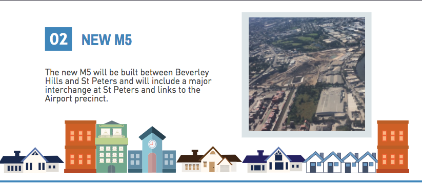
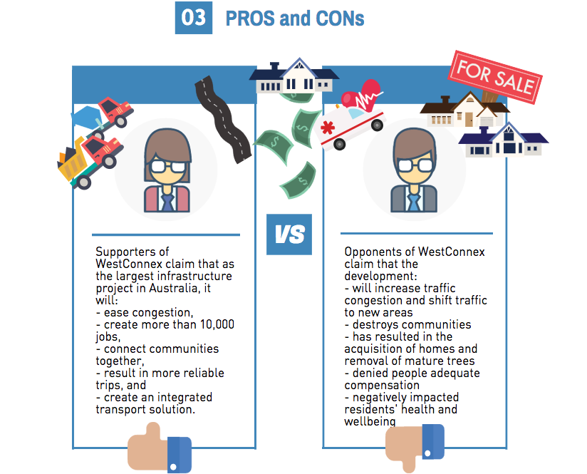
Lesson 1: Australia's Projected Population Growth Lesson 2: Implications for Future Growth and Sustainability Lesson 3: Sydenham to Bankstown Urban Renewal Precinct Lesson 4: WestConnex - Sydney, Sustainability and Transport Lesson 4: Sydney Sustainability and Transport (Teacher's Notes) Lesson 5: The GreenWay Lesson 5: Deindustrialisation Lesson 6: Create an infographic Lesson 7: Contributing to a Sustainable Urban Future Lesson 7: WestConnex - Protest Movements and Impacts Lesson 7: Conflict Over Dulwich Hill OR See the complete unit on the Changing Places website. Lesson Activity: Create an infographic Below is an infographic about the WestConnex. Create your own infographic using picktochart or a similar program. Your infographic should be on the topic of change in Sydney's Inner West. It should include themes such as transport, green space, housing, and land uses. This is part of a unit of work for Changing Places - Australia's Urban Future. Lesson 1: Australia's Projected Population Growth Lesson 2: Implications for Future Growth and Sustainability Lesson 3: Sydenham to Bankstown Urban Renewal Precinct Lesson 4: WestConnex - Sydney, Sustainability and Transport Lesson 4: Sydney Sustainability and Transport (Teacher's Notes) Lesson 5: The GreenWay Lesson 5: Deindustrialisation Lesson 6: Create an infographic Lesson 7: Contributing to a Sustainable Urban Future Lesson 7: WestConnex - Protest Movements and Impacts Lesson 7: Conflict Over Dulwich Hill OR See the complete unit on the Changing Places website. Dulwich Hill is a suburb located in Sydney's Inner West, surrounded by Summer Hill, Hurlstone Park, Marrickville, Petersham, Lewisham and Earlwood. It experienced growth in the late 1800s following the introduction of the tram line, and as a result contains buildings with heritage architecture, particularly Federation architecture. The tram line through Dulwich Hill was not in use as public transport from the 1950s. The Inner West light rail extension in 2013 reconnected Dulwich Hill by rail with nearby suburbs and the city. For more details see my previous post Inner West Light Rail Extension. For more information about the history and development of Dulwich Hill, visit the Dulwich Hill section of the Marrickville historical society - Dulwich Hill - a history. The Sydenham to Bankstown Urban Renewal Strategy, encompasses the suburb of Dulwich Hill, rezoning for higher density and redevelopment of older buildings. Changes to zoning as part of this strategy can be seen on the Planning NSW website - Dulwich Hill Landuse Plan. The plan for Dulwich Hill includes 2000 more dwellings, with 3 storey development along Wardell Road, and unit developments from 3-5 storeys near the Dulwich Hill station. Higher density housing developments are zoned for around the Dulwich Hill light rail station (between 3-7 storeys). 8 storey developments will be allowed around Arlington Grove Light Rail station. View the Changing Places - Sydenham to Bankstown Urban Renewal Precinct post. The Save Dulwich Hill Community Group promotes issues related to the redevelopment of the suburbs and lobbies the government to preserve the heritage of suburb. Visit the Save Dully website to read more about their actions. |
Categories
All
Archives
May 2024
|
||||||||
