|
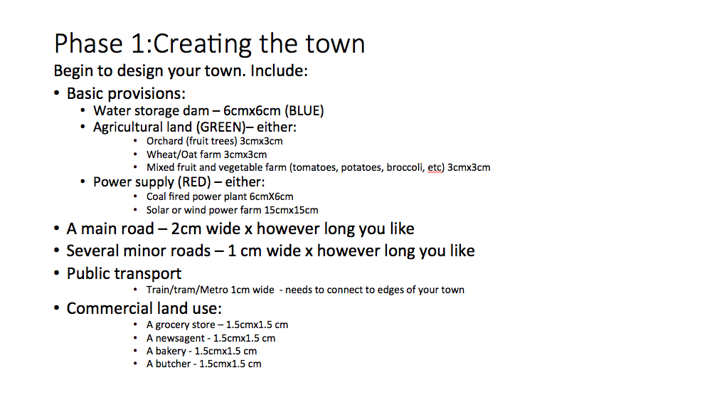
The aim of this series of lessons is to allow students to apply their understanding of Liveability to a city design task. Students work in groups of 2-3 to design a small town, as the activity progresses they will reflect on what they have learnt in the Place and Liveability topic and apply it to their town. Phase 1: Design your town The first phase of this task involves designing the layout of the town. This will involve the initial road layout, agricultural land uses, some initial commercial land uses, power supply, and water storage. Provide some student choices so that you can provide a few variations in the first round of feedback. Provide students with a base page ( it may or may not have some geographical features on it such as mountains, coastline, rivers, etc). Also provide students with some blank, coloured pieces of paper, or you can copy the templates onto coloured paper - green (agricultural land), blue (water storage), pink (commercial), red (power supply), grey (roads).
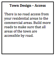
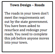
Design feedback This is an opportunity to provide some initial feedback to ensure the students get the basics right. Design the feedback so that it refers to the students as though they are members of the local council. For example, “The roads in your town don’t meet the requirements set out by the state government. You have been asked to resurface and redesign your roads. You need to complete this job before anyone moves into your town.” Phase 2: Moving in... In the second phase of the task, students design the residential layout and density of the town. By placing a relatively small limit on the number of dwellings students have to focus on the layout of the town in the initial phases.
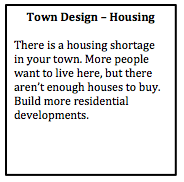
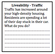
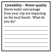
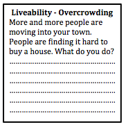
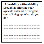
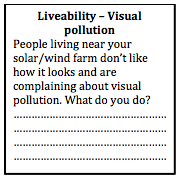
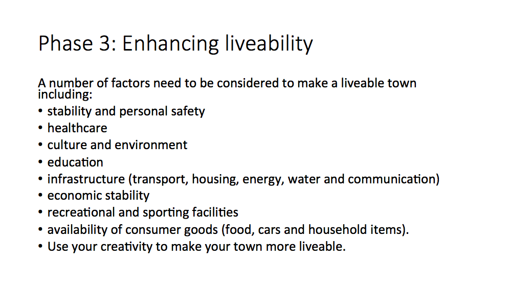
Town plan scenarios Provide students with some scenarios that will allow them to start to think about the liveability of their towns. By this stage some of the groups' conversations will have already addressed aspects of liveability, but they may not have actually considered in much depth. Students are required to write a brief description of how they addressed each scenario. Phase 3: Enhancing liveability Students will need to respond to the scenarios above, and should have started to consider some of the additional needs of a community. As a class discuss the content related to liveability that you have already covered in class, and then provide students with time to make changes to their town plan. Phase 3: Liveability Students spend some time reviewing their towns and providing initiatives and strategies to make their town more liveable. They also need to address the scenarios provided by the teacher. Writing task Students need to write a description of how their town addresses different aspects of sustainability. Peer feedback Students rotate around to visit other groups' town. They provide feedback on the liveability of each town and make suggestion on how to improve liveability for each town. Next... refer to Designing a Liveable City - Part 2.
1 Comment
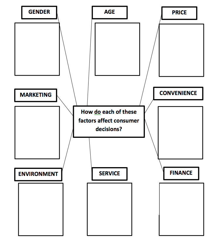
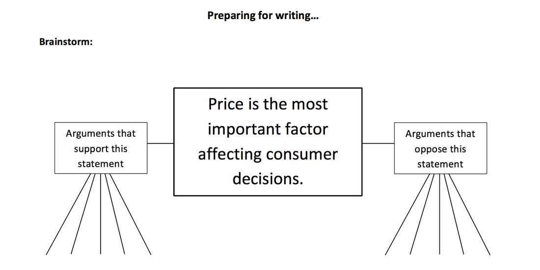
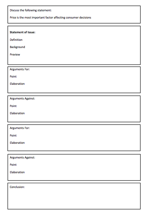
Discuss the following statement: Price is the most important factor affecting consumer decisions How do you write a discussion? Purpose: To examine issues from more than one perspective and make recommendations based on evidence. For example, are there other factors that also influence consumer decision? Structure: Opening statement presenting the issue Arguments, for and against, including evidence for different points of view (elaboration) Concluding statement and (optional) recommendation Language features: Use of words and phrases such as, however, thus, in addition, similarly, and in contrast. Use terms and phrases with strong modality for your best arguments, e.g. must, should. Use terms and phrases with weaker modality for weaker arguments, e.g. perhaps, may. Preparing for writing: Use the writing scaffold to structure your response.
I attended the Department of Education’s STEM Showcase (see the tweet feed at #STEMShowcase). In case you’ve been living under a rock – STEM is Science, Technology, Engineering and Maths. STEM is clearly a movement that is gaining momentum, and my question is where does geography fit into this? Or History? Or Commerce? I have been trying to think of a new acronym to get us in on this movement. If you have any ideas, please let me know. What occurred to me is how many of these STEM projects have very obvious crossovers with humanities subjects, particularly geography. This post will look at a few of the presentations that I saw today and some ideas of how humanities subjects could also be included.
Baulkham Hills High School – Weather TECH Students created a STEM project involving the construction of a weather station. This involved a design process, coding of the equipment, manufacturing the equipment with a 3D printer, and collecting and analysing weather data. In the Science faculty, this was undertaken as part of a student research project. In TAS, students developed skills in using CAD and CAM software and Arduino to design, code and create the equipment. In Maths, students' skills were developed in analysing and presenting the vast amount of weather data collected. Students (and teachers) successfully created a working model with equipment collecting weather data every second. The real world applications to agriculture were emphasised. In the new NSW Geography syllabus the WeatherTECH project would fit easily within the Water In the World topic, particularly Water resources and the Water cycle. It also addresses fieldwork requirements – using weather instruments. Examine the WeatherTECH project site. Bellingen High School - Survive the Shake The topic of this STEM project was earthquake proof buildings. Students designed, produced and evaluated a multi-storey building with a small fooprint, which was specified. Students were provided with a design process to follow which provided a scaffold to follow during project. Students were required to use cheap materials such as straws, toothpicks, marshmallows, etc to create a model of their buildings. Building designs were tested on an earthquake shake table created by the teachers. In the Science faculty, the project tied into content related to earthquake size and magnitude, damage and destruction and prediction of quakes. In Maths it tied in with content related to geometry, 3D design shapes and budgets. The construction of the buildings and the design process involved the TAS faculty. In the new NSW Geography syllabus the Survive the Shake project would fit into Landforms and Landscapes, particularly Geomorphic hazards. This could easily incorporate the inquiry based learning skills in the syllabus. Examine the Survive the Shake project site. Riverside Girls High – Post-Earth Survival The girls at Riverside completed a STEM project examining the requirements to sustain life. Students explored the universe and designed a colony suitable for sustaining life on another planet. Students focused on: What do humans need to survive? The project used a design process from the TAS faculty and this was used to determine project milestones. TAS introduced the students to the tools they would need to complete the project such as Sketch Up, 3D printing, etc. Students brainstormed what it would be like if they were locked inside their house and had to stay there for 2-3 years. What would they need? What would they have to change? Students collected data on energy and water use in their own homes. From a Maths perspective students had to develop problem solving and reasoning skills, as well as data analysis. The project also incorporated the EcoMuve program from Harvard University. Assessment and presentation involved peer review and feedback. In the new NSW syllabus the Post-Earth Survival project would fit into Place and Liveability, particularly Influences and perceptions. This could also incorporate the inquiry based learning skills in the syllabus. Examine the Post-Earth Survival project site. Promoting Geography and boosting numbers A lot of time, effort and money is being spent on promoting STEM to our students. As Geography teachers, we are constantly looking for ways to promote our subject and boost senior numbers. There are plenty of ways to do this, but I think getting involved in STEM projects or at least other cross curriculum projects might be one idea that is worth a bit more consideration. I recently received a copy of Australian Curriculum Geography - A diverse and connected world. This is a new resources from RIC Publications for teaching the Australian Curriculum for Year 6 students. The resource is designed for students and teachers around Australia, and addresses the Australian Curriculum (not the new NSW syllabus or any other variation).
The resource is more in the style of an activity book rather than a text book. The front section contains photocopiable black and white masters including a world map, a map of Asia, a map of Australia and South-East Asia and a map specifically of Bali. It also provides scaffolds for researching environmental changes, researching places and an interview recording sheet. The Geographical skills class record is a great addition to the resource. It is actually for teachers rather than students, and it allows teachers to record student progress in achieving skills. It also includes a grid which maps out how the book addresses skills, inquiry questions, general capabilities and cross curriculum priorities, so that teachers can teach without having to specifically worry about how or whether they have addressed these. The activities comprehensively cover each of the curriculum dot points and elaborations. It generally uses the specific examples in the curriculum rather than reinterpreting the elaborations. The resource provides comprehensive activities, additional links to websites and videos. It provides a list of relevant vocabulary words for each section as well as a column on some pages specifying how the activities relate to the Australian Curriculum including the elaborations, key inquiry questions, geographical inquiry and skills and geographical concepts. While the book is in black and white most pages are laid out in a way to reduce large chunks of text. Many of the pages contain clear maps, tables, graphs and drawings to make the pages look engaging. There are multiple choice quiz questions at the back of the book which relate to each the the Australian Curriculum elaborations. Answers to both the multiple choice and the written responses throughout the book are included. English Skills Practice Trial Booklets I also received copies of the English Skills Practice Trial booklets. for Years 1, 3 and 5. Given that Literacy is one of the General Capabilities in the Australian Curriculum these type of activity books can be useful for integrating literacy into teaching Geography and other HSIE subjects. They can give teachers a few different approaches for integrating literacy into our teaching. I was lucky enough to attend the first ever TM Geography a couple of weeks ago. The teachmeet was held at Saint Ignatius' College on Monday 5 and was hosted by Jessica Lonard. Using infographics in assessment Jessica Lonard, our host, began the presentations with a presentation on how to use infographics in assessment of student learning. The room was decorated with examples of her students' work. There are a range of programs that can be used to create these infographics. One of the easiest is Picktochart. Other programs include Infogr.am, visual.ly, and easel.ly. For further information you might like to check out 10 free tools for creating infographics. Spotlight - ABS Sharon McLean presented a session on Spotlight from the Australian Bureau of Statistics which I have discussed in a previous blog: Australia's Population. This program brings population statistics about Australia to life by presenting them in a fun interactive voiced by Shaun Micallef. Flipping the geography classroom Ryan Gill presented a session about the challenges and successes of flipping his classroom including creating the videos, winning over parents and keeping students engaged. Flipping the classroom is a strategy where students are exposed to new material outside of the classroom through the use of videos, readings, etc and then class time is used to consolidate the new learning through activities such as discussions, problem solving and debates. Google Tour builder Mick Law from Contour Education showed us the latest and greatest mapping tools, concentrating mainly on the new Google Tour Builder. This seems to be a much simpler way to create a virtual tour than through Google Earth. Nearpod Kate Corcoran showed us how she uses Nearpod in her classroom. Nearpod is a program that allows you to set up interactive quizzes and surveys and enables sharing between groups. Students log into a group and can access the resources that the teacher has made available to them on their devices. The teacher can control the students' screen while they are part of the group. Thinglink Thinglink is a site which enables you to create interactive images. Di Laycock showed us how you can add comments, images, videos and music to create a multimedia experience from a still image. Creating virtual field sites
I went through the process of creating a virtual field site to give students access to field sites which they would not otherwise be able to experience. This is done by combining videos, photos, google tours, and links to articles all combined with the use of a blog site or website builder like weebly. Twitter: #tmgeography Yesterday I attended the NSW Geography Teachers Association Annual Professional Development Day. The big focus of the day was on Australian Curriculum. We were lucky enough to have two speakers from ACARA Susan Caldis and Tracey McAskill. Susan has been a bit of a one-woman show over the past couple of years doing all the Geography teachers events and keeping everyone up to date. This blog post is a summary of the information from ACARA. As we know, all states in Australia but NSW are using the curriculum documents as written by ACARA and have begun implementation already. ACARA is calling the next 18 months "implementation mode" for the rest of Australia in relation to geography. Reviewing the curriculum ACARA undertook a detailed consultation process in the development of the Geography curriculum. From within NSW, the BOS collected submissions, organisations within the DEC held video conferences, detailed submissions were written by DEC officers, HSIE and Social Science faculties and teachers made submissions, and online surveys were completed. Expert groups were gathered in each of the states and territories. Existing syllabus documents were examined and compared from around Australia. Similarities and differences were mapped. International geography experts have had a role in critiquing the curriculum including Professor Catling, Professor David Lambert and Dr Rita Gardner. After a series of reviews, the new Geography curriculum for Foundation (Kindergarten) to Year 10 has now been finalised. The Senior Geography curriculum has just been released but is not finalised. It is anticipated that during the first phases of implementation an assessment and review of ACARA's curriculum will take place to determine successes and weaknesses and any further tweaks required. Structure and rationale In ACARA's Geography curriculum each year is organised under the following headings: a year level description, key inquiry questions, content descriptions and achievement standards. The Content for each year has 2 main strands: "enquiry and skills" and "knowledge and understanding". These strands help to organise the curriculum. In each 7-10 year group there are 2 units of work. In addition there are 7 key concepts that weave through the geography curriculum (place, space, environment, interconnection, sustainability, scale and change). View more detail about the seven concepts. View the Australian Curriculum for Geography. One of the big issues for discussion amongst teachers has been the balance between physical and human geography in the new curriculum. Many have stated that there is an over-emphasis on human geography. While the understanding of physical geography is implied, it does not appear to be explicitly taught in the secondary years (at least not much). The new curriculum does not have a division of human and physical geography topics. Rather the human and physical geography are intertwined throughout the topics. Units of work can be done in any order within a Year and content can be chunked or rearranged to enable teachers to ensure the best understanding of the topic. The elaborations in the curriculum are not mandatory, but rather just ideas about how to cover content. It may be the case that you cover more physical geography for the students to gain a more thorough understanding of the knowledge and understanding components. The scale of case studies in the new curriculum ranges from personal to regional, national and global. Despite the Cross-curriculum priorities of Asia and Australia's Engagement with Asia it was emphasised that teachers need to balance the focus on Asia with coverage of the rest of the world. The development of students' knowledge of the world develops from K-10. The earlier years focus more on the local case studies, while in late primary school students begin to look at regional and global case studies as well, particularly in the southern hemisphere. Students continue to develop their global knowledge in year 7-10. Despite references in the curriculum to specific countries, teachers do not have to focus on these examples but can use their own. View the development of geography from Foundation to 10. View the Scope and Sequence. The new curriculum tries to incorporate emerging trends and provides flexibility for fieldwork opportunities within each topic. It has a futures focus, and encourages students to consider their involvement in the world. How can I contribute? What are my responsibilities? What is my place in the world? How can I make the world a better place? There are many opportunities for enquiry-based learning and Problem Based Learning. ACARA does not specify the hours of teaching for each subject, but rather this decision is made by the states and territories. Work sample portfolios Portfolios of student work have been made available on the Australian Curriculum website. They can be found at the beneath the Achievement Standards on the Australian Curriculum website. The samples can be used a toll for moderation to help teachers decide to what extent student have met the achievement standards. For those teachers undergoing the accreditation process they also serve as a model of how to annotate work. Some time in the near future I will write about how all this will impact on NSW, but in short, there's certainly no rush for me to get something out there about it. It's a long way off for us. More to come later...
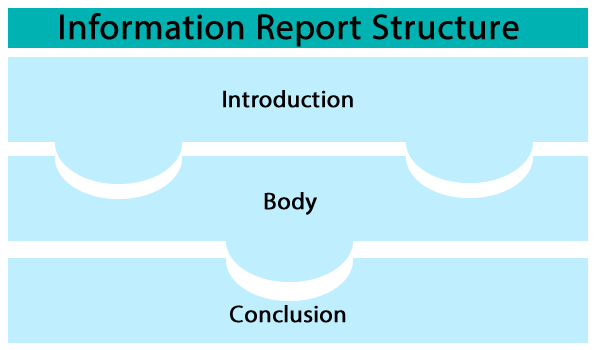
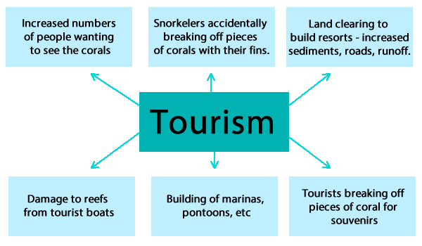
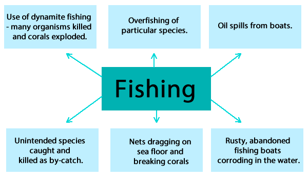
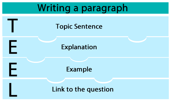
My Year 7 class are currently learning about coral reefs. We have already covered a fair bit of the content, and I thought it might be a good time to cover some specific literacy skills. I wanted to get the students to write a report on threats to coral reefs. If I was to tell my class this directly a few of them could get straight onto the task, however, most of the class would find this task quite daunting. In the first part of the lesson I showed a short video about threats to coral reefs. The students were asked to write down any threats to reefs as they were discussed, I also wrote dot points on the board. We ended up with a fairly comprehensive list of threats, without being overly technical. When the video was finished, we discussed the main themes from the video. As a class, we examined the dot points on the board and tried to categorise the dot points into themes. We put different symbols next to the points to indicate themes. For example, one of the themes was tourism, so dot points such as snorkellers breaking coral, forest cleared to build resorts and damage to reefs from tourist boats, were all allocated the same symbol. We ended up with about about 5 or 6 themes, each with several associated dot points. A few examples: After discussion, we wrote an introduction as a class. We underlined the key terms in the question and discussed what they meant. The students offered up a range of possible sentences that we could use in our introduction. We settled on a few that were general, used some vaguely sophisticated language and key terms from the question. We discussed the key elements of a paragraph. We have completed a similar task earlier in the year. It took a little while for the class to remember the TEEL structure but eventually one of the students pulled out a handout from Visual Arts. They are clearly doing something similar in VA, but it was surprising that they didn't automatically transfer the information from one subject to another, or remember covering it in Geography before. It was just another reminder how often we need to reinforce these literacy skills. I suggested that we should write our first paragraph about the impact of tourism on coral reefs. Each student had to write their own topic sentence. We discussed that the topic sentence needed to be a general statement that gave the reader a sense of what the rest of the paragraph would be about. I asked a few of the students to write their topic sentences on the board and we discussed the pros and cons of each example. Students made suggestions about how to improve the topic sentences.
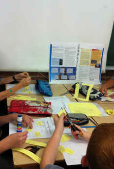
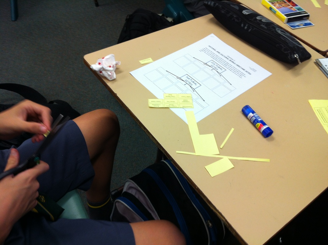
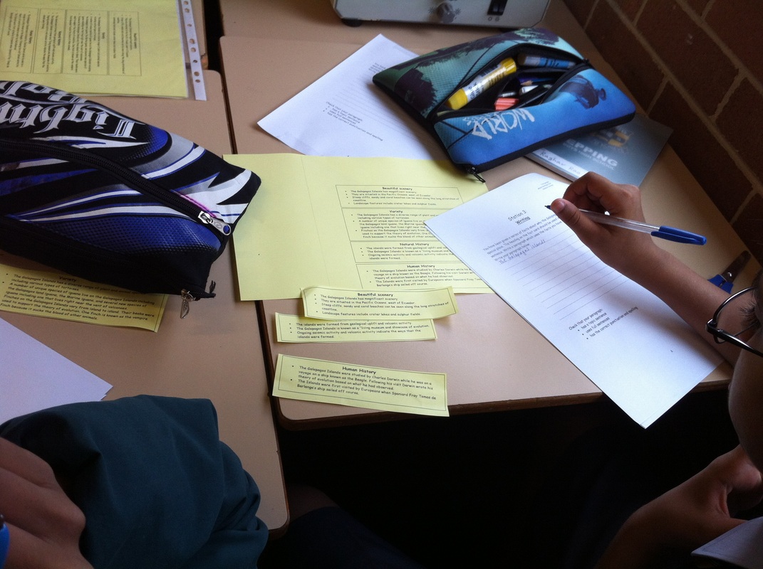
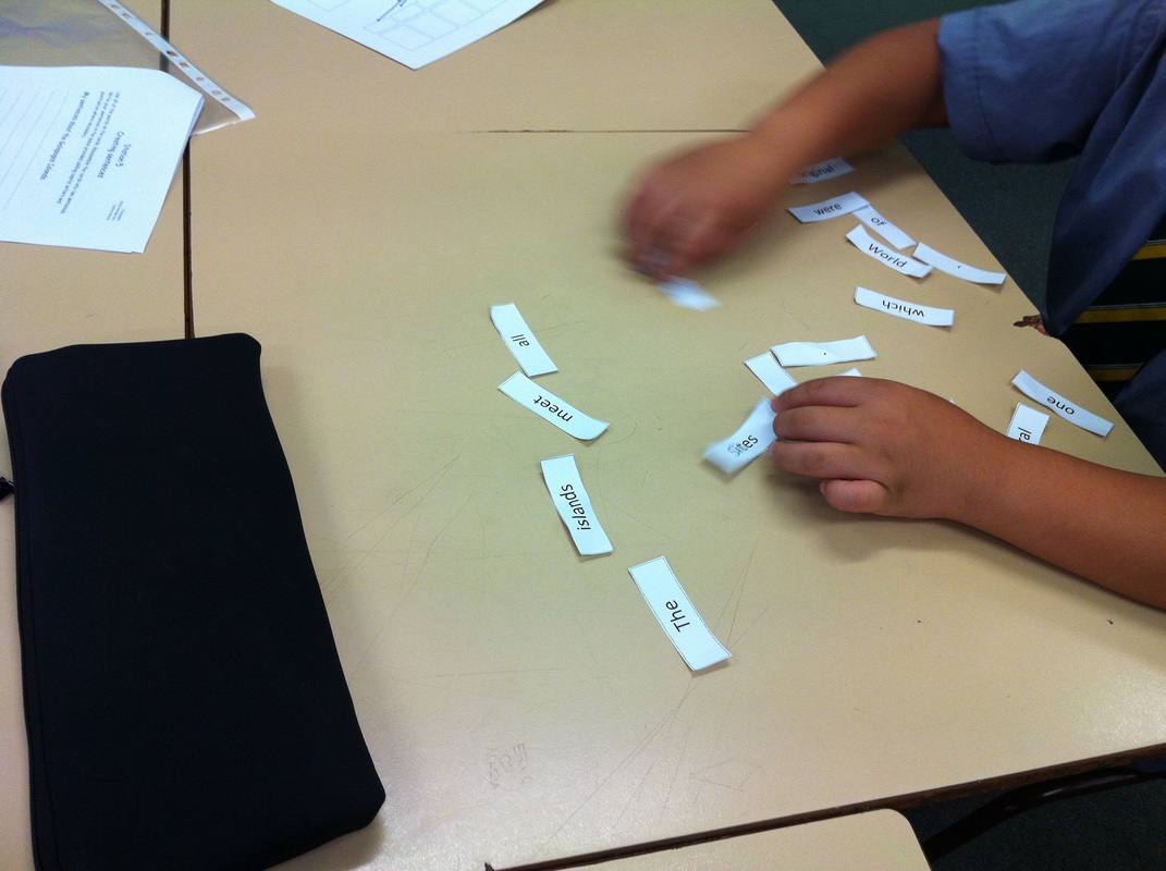
We repeated the process for the other sentences required for the first paragraphs. The second body paragraph was on the impact of fishing on coral reefs. The class shared their topic sentences again. They were then required to write the rest of the paragraph by themselves without assistance. A few students were asked to read out their paragraphs after the students had been given sufficient time. I gave the students two other topics to write paragraphs about without assistance: removal of mangroves and climate change. We discussed the requirements of a conclusion: refocus the reader on the question, bring together all of the main points of the report and provide a brief summary of the report. Students offered a few appropriate sentences to include in their conclusions and then discussed the pros and cons of each sentence. Student were then required to write their own conclusion. Students were given 5 minutes to re-read their work and make any edits. It was suggested that they check their work for capital letters at the beginning of sentences and for proper nouns, consistent use of tense and use of appropriate key terms. The list of criteria could be changed easily based on the students and their needs. See the student activities. I think teachers often find it hard to find interesting ways to integrate literacy into lessons. You’ll still occasionally hear discussion of “watering down the curriculum”, but I think these days most people are onboard with the idea that literacy and numeracy are the responsibility of all teachers. It is great to see that this idea has been cemented in the Australian Curriculum in the General Capabilities, and in the new NSW syllabuses in “Learning across the curriculum” content. A few years ago, I developed a lesson template that was based on a stations activity rotation. This was part of a much bigger project with a team of great colleagues, that involved developing a lesson sequence based around literacy needs. More on that another day… This activity integrated literacy based activities with the content of World Heritage Sites. Students are placed in groups of 4-5, depending on how big your class is. It has six stations that the students move around to after a set time (about 7-8 minutes give or take).
Station 4
Students are given a series of words, each on a separate piece of paper. They must use all of the words provided, and arrange them in the correct order to make a sentence. They must also correctly place the punctuation marks. Station 6
I usually find that students quite enjoy this lesson. I know it isn’t brain surgery, but it covers some of the content and addresses literacy in several different ways. The activities can obviously be changed to suit the needs of your particular students. As I teach all boys, the fact that the activity requires a lot of movement really engages them, and I actually enjoy how this lesson unfolds.
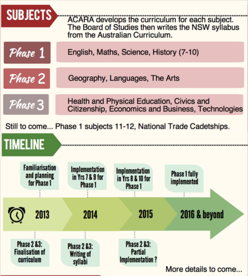
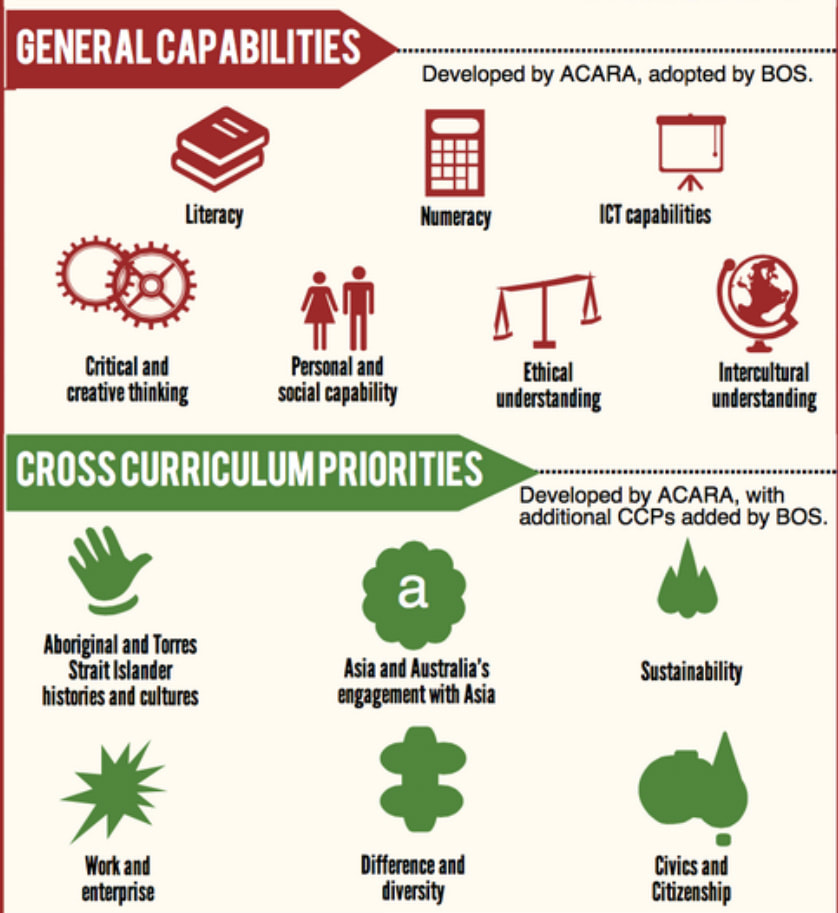
The Department of Education and Communities has put together a number of online training courses to guide staff through the implementation of the New NSW Syllabus' incorporating the Australian Curriculum. There are a number of generic online modules that would be useful for all staff, regardless of faculty. There are also a number of online modules available specifically for staff from English, Maths, Science and History. These can be accessed through the staff portal. From the staff portal (staff.det.nsw.edu.au), click on Curriculum resources, click on AC - NSW syllabuses for the Australian Curriculum, and then click on Professional Learning. The generic course are: The learner and the new curriculum Teaching and the new curriculum For help accessing the courses, view the access guide. The General Capabilities have been developed by ACARA and then incorporated into the new NSW syllabus documents. These are: - Critical and creative thinking - Ethical understanding - Information and communication technology capability - Intercultural understanding - Literacy - Numeracy - Personal and social capability In developing your programs you should consider lesson ideas and activity that develop a range of these capabilities. Want more information? Project Based Learning and the Australian Curriculum "General Capabilities" Australian Curriculum and the General Capabilities - the role of the Teacher Librarian Cross curriculum priorities have been developed by ACARA and incorporated into the new NSW syllabus documents. These are: - Aboriginal and Torres Strait Islander histories and cultures - Asia and Australia's engagement with Asia - Sustainability Other learning across the curriculum Other areas have been identified by the Board of Studies for attention in NSW. These are: - Civic and Citizenship - Difference and diversity - Work and enterprise Want more information? Book lists for the Australian Curriculum Cross Curriculum Priorities. Some important aspects of the new syllabuses include the provision of resources and more detailed guidance for teaching students with a variety of needs.
Planning for diversity Student diversity and the Australian Curriculum Meeting the needs of all students Adjustments and the Australian Curriculum Students with disabilities Making adjustments Examples of adjustments for students with disabilities are currently being developed and should be available soon for examination. EAL/D Making adjustments Teacher resources Gifted and Talented Making adjustments |
Categories
All
Archives
May 2024
|
||||||||||||||||||||||||||||||||||||||||||||||||||||||||||||||||
