|
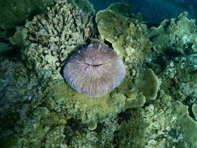
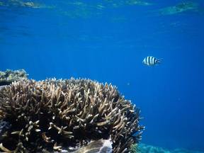
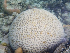
•Coral Reefs support a large number of plants and animals. •Coral Reefs are built by millions of tiny animals called polyps. •Some coral polyp species receive more than 60% of their food from algae. •Each coral colony begins life as a single polyp, which then reproduces itself as a single polyp, which then reproduces itself by budding or by dividing. Types of coral reefs There are eight main categories of corals: branching, corals with meandering ridges and valleys, massive or thick colonies, thin plates and crusts, solitary/isolated/free-living corals, coral with large, daytime expanded polyps, column corals and blue/fir/organ pipe/lace corals. Some examples of coral are found below:
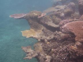
Where are coral reefs found? Special conditions are needed for reef-building corals. Coral reefs will only grow in waters warmer than 18oC, and no deeper than 50metres. Therefore coral reefs are limited to clear, shallow tropical seas found either side of the equator. Corals may not develop properly in waters that receive freshwater runoff or sediments from rivers.
0 Comments
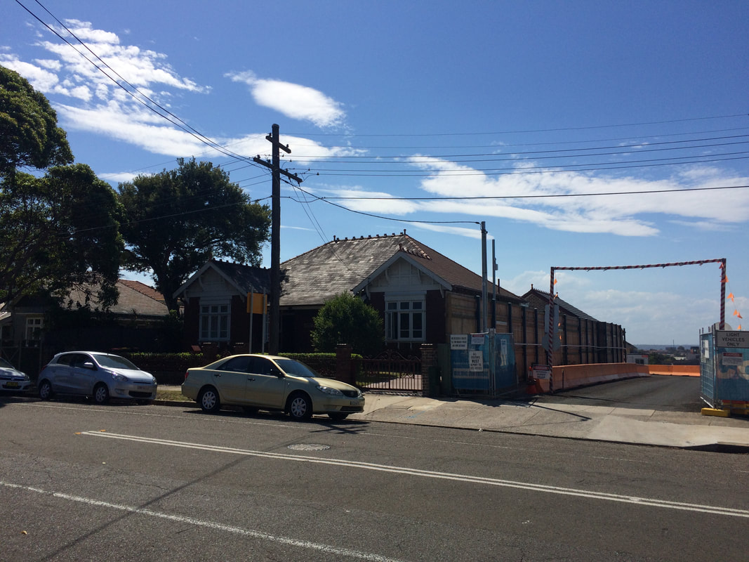
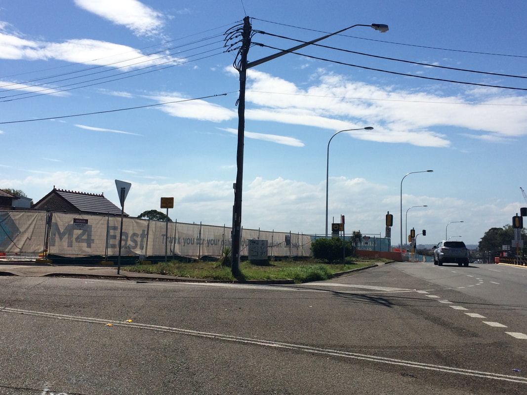
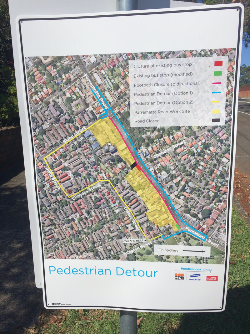
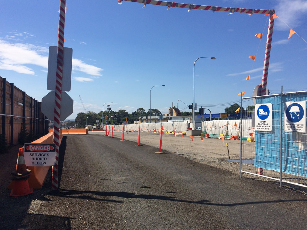
This is part of a unit of work for Changing Places - Australia's Urban Future. Lesson 1: Australia's Projected Population Growth Lesson 2: Implications for Future Growth and Sustainability Lesson 3: Sydenham to Bankstown Urban Renewal Precinct Lesson 4: WestConnex - Sydney, Sustainability and Transport Lesson 4: Sydney Sustainability and Transport (Teacher's Notes) Lesson 5: The GreenWay Lesson 5: Deindustrialisation Lesson 6: Create an infographic Lesson 7: Contributing to a Sustainable Urban Future Lesson 7: WestConnex - Protest Movements and Impacts Lesson 7: Conflict Over Dulwich Hill OR See the complete unit on the Changing Places website. Stage 1 of the WestConnex project involves the widening of the M4, a connection between Parramatta Road and the City West Link and new connections at Concord Road. A tunnel will run from the end of the current M4 to the City West Link, M4 East concept design WestConnex Stage 1 WestConnex interactive map Ashfield A section of Ashfield along Parramatta Road was acquired and demolished for WestConnex. The exit to the M4 tunnel will be opposite Bunnings Warehouse near the crossroads of Frederick St/ City West Link and Parramatta Road. Link: WestConnex plan jeered by Ashfield residents Save Ashfield Park Rally Haberfield Some of the issues raised in relation to WestConnex in Haberfield include home acquisitions, destruction of heritage architecture, noise and vibrations for homes adjacent to construction sites, changes to traffic flows and the impact of all of these factors on the nature of the suburb. Links: Haberfield homes acquired for building of WestConnex Three month closure of Ramsay Street Haberfield Talking WestConnex and Mike Baird ignoring compulsory aquisition reforms WestConnex private contractors sell items from heritage homes ahead of demolition WestConnex unused land should be handed back say inner west residents. Residents in Haberfield and Beverley Hills claim WestConnex work is cracking walls of houses near motorway construction sites. What we are facing is the destruction of Haberfield
This is part of a unit of work for Changing Places - Australia's Urban Future.
Lesson 1: Australia's Projected Population Growth Lesson 2: Implications for Future Growth and Sustainability Lesson 3: Sydenham to Bankstown Urban Renewal Precinct Lesson 4: WestConnex - Sydney, Sustainability and Transport Lesson 4: Sydney Sustainability and Transport (Teacher's Notes) Lesson 5: The GreenWay Lesson 5: Deindustrialisation Lesson 6: Create an infographic Lesson 7: Contributing to a Sustainable Urban Future Lesson 7: WestConnex - Protest Movements and Impacts Lesson 7: Conflict Over Dulwich Hill OR See the complete unit on the Changing Places website. Stage 5 Geography - Changing Places In the previous 7-10 syllabus in Environment Issues there was a section of content where students were asked to investigate individual, groups and government responses to an issue. In the new NSW syllabus this has been removed. However, in Stage 4 Changing Places the issue of WestConnex protests (or some other protests) can be used to address the inquiry questions:
Students can examine transport networks as both a cause and consequence of urbanisation (see previous post - WestConnex - Sydney, Sustainability and Transport) Students can also use it to examine the following content dot points:
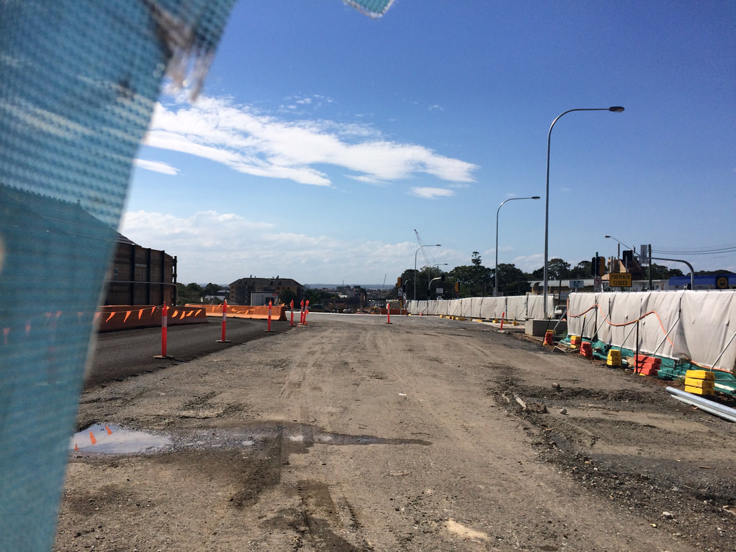
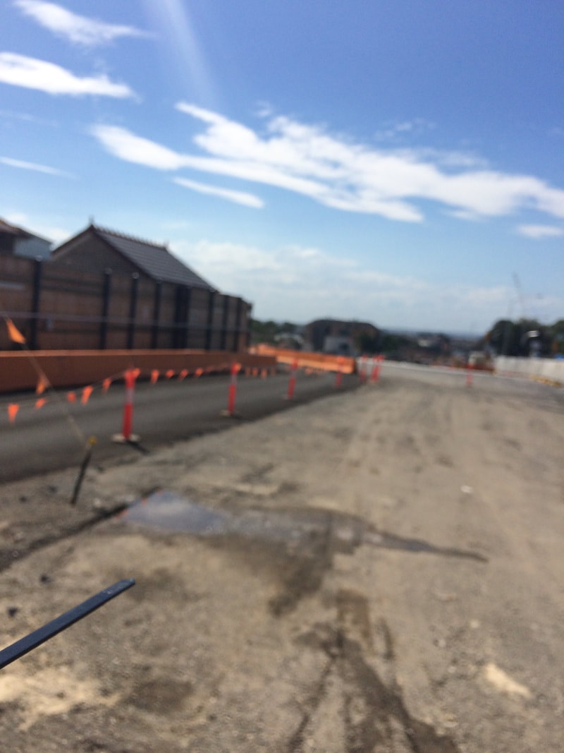
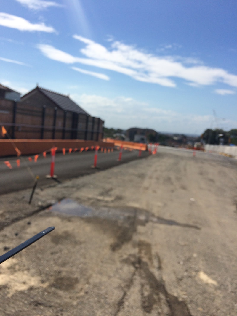
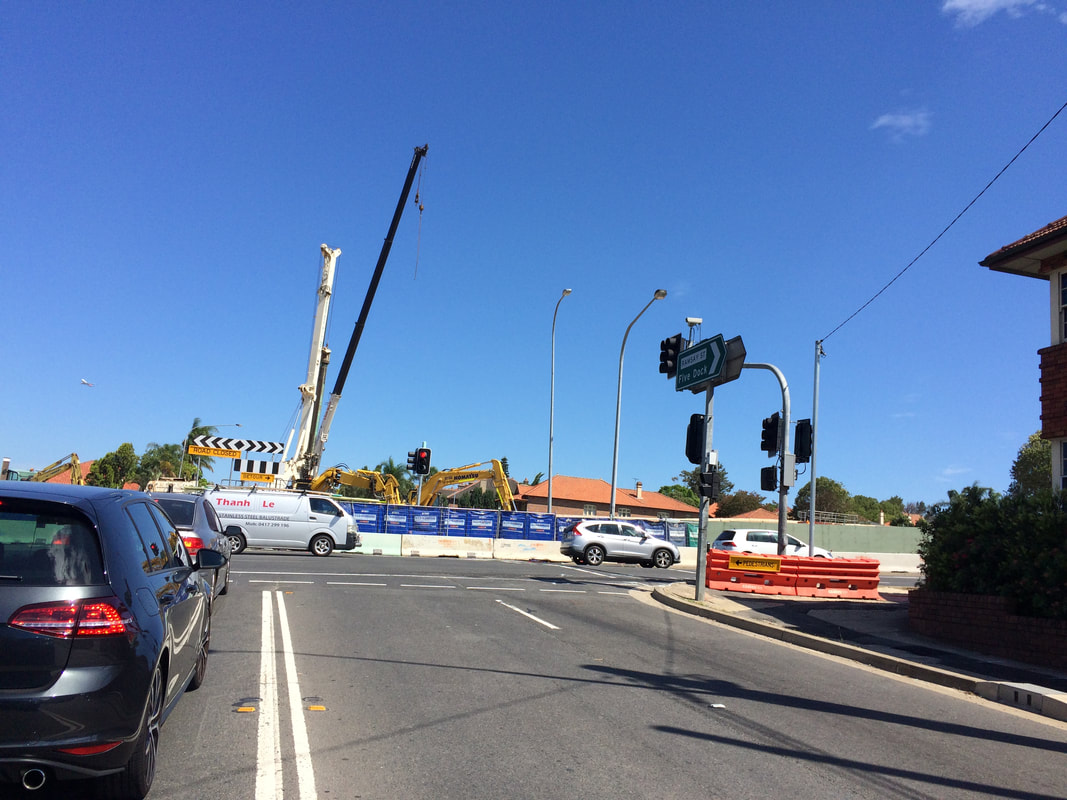
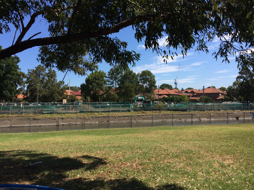
Below: The St Peters West Connex site.
Stage 6 Geography - Urban Places/Urban Dynamics In a previous post I wrote about how WestConnex could be used as a way of exploring growth, development, future trends and ecological sustainability for a Sydney case study in the urban dynamics section of the HSC course. Another way this issue could be used in this course would be to use it to explore the culture of place of a suburb like Haberfield. There have been a variety of articles regarding the nature of the suburb in terms of heritage architecture, noise, and street life, and how this has and will change as a result of WestConnex. There are also a number of articles regarding the development site at St Peters and the removal of established trees on Sydney Park. This could also be used as a way to ask problematic questions such as: - What is the cost of development?, - What kind of Sydney do we really want? - Do the benefits to the city/commuters outweigh the costs to others? - Will the project really releive traffic in the long term? 
Students can do this through the lense of community protests to examine how different groups and individuals perceive how WestConnex (both a consequence of and a response to urbanisation - i.e a response to traffic congestion, the need for transport infrastructure) impacts their community and/or environment. In the previous syllabus there was a lot of scope to do activities such as mock council meetings, mock letters to Members of Parliament, etc. A simple search on Youtube brings up many recorded meetings regarding the project. This is an ideal scenario to use in class to reenact (or participate in) this process. While NESA/BOSTES has not completed a rewrite of the Civics and Citizenship Australian Curriculum, we can assume it will be relatively similar based on the rewrites of 7-10 History and Geography. In Civics and Citizenship (AC) students examine how citizens participate in direct action and lobbying (Year 8) and how and why individuals and groups participate in and contribute to civic life (Year 9). This provides a perfect example to explore these kinds issues and to build on student knowledge in Civics and Citizenship. Resources Below is a list of links to articles and websites related to WestConnex protests. You will notice that some of these are from media outlets such as Green Left Weekly and Alt Media. In a previous post on WestConnex most of the links I provided were government websites. The two posts together provide a more balanced approach to the issue and any lesson to students should include a range of perspectives and encouraging students to do their own analysis and make their own conclusions. WestConnex: Protesters clash with Police over 800 tree-deaths Protesting businesses in Newtown and Enmore stick it to WestConnex Haberfield homes acquired for building of WestConnex Three month closure of Ramsay Street Haberfield Talking WestConnex and Mike Baird ignoring compulsory aquisition reforms WestConnex private contractors sell items from heritage homes ahead of demolition Clover Moore supports protesters at 24-hour-a-day camping blockade... WestConnex protesters arrested as Sydney Park trees come down. Protesters Clash with WestConnex workers How the 15.4b WestConnex will affect Sydney residents Baird's new protest laws used against WestConnex protesters Protests grow over WestConnex Stop WestConnex WestConnex Action Group
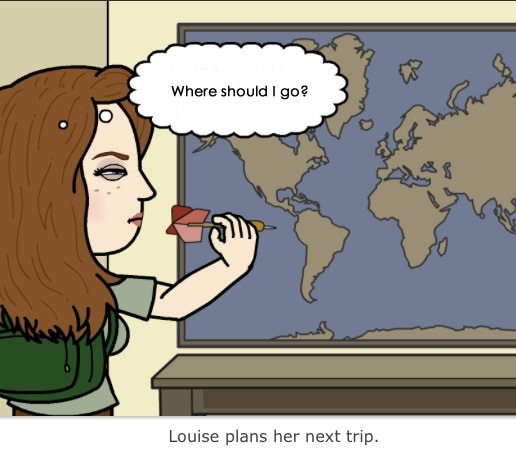 Choosing destinations. You have been given two locations that you must include in your trip. What other cities or towns would you like to visit? Why? What activities would you like to undertake at each location? Create a mind map using wordle, or bubbl.us which answers the questions above. (If you don't want to use one of these applications you can try to create it in Word or another program you are familiar with.) You must include 15 activities across the 5 locations.
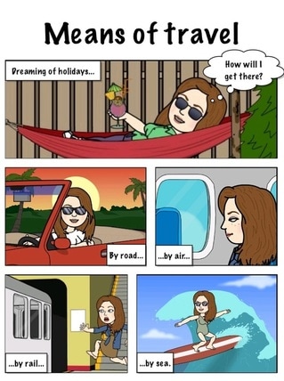
Task: Create a travel brochure for one European location that you would like to visit. In doing so, use Abobe Fireworks or Photoshop to edit images. You may choose to use Publisher, Word or PowerPoint to create your brochure. Make sure that you save your brochure as you will need to use the file in a later task. Ensure that you only use images which are copyright free. Keep a seperate file showing where you got each image from. Organising travel Create your travel itinerary Now it is time to make the decisions about exactly where you want to go and how long you will spend at each location. Your itinerary will need to include:
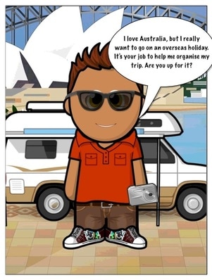
Include at least one ecotourism activity or eco-accommodation. Keep in mind your budget and time constraints: $15,000 each and 6 weeks. Present your itinerary as a detailed table (include the dot point above). Create a separate table which outlines how you will allocate your budget. Create a map using Google Maps or Google Earth which shows the journey you will take. Exclude your flight to and from Sydney on your map so that you can show a high level of detail. Planning a trip You will have to consider the following issues when planning your trip: official requirements and documents, language issues, medical issues, culture, political instability and insurance. Passport Examine this site: https://www.passports.gov.au/Web/index.aspx Describe the process of applying for a passport. Create a passport for your self. Use a comic site (such as bitstrips, weemee, etc) to create an image of yourself. Make sure you use a fake address and personal details. It is not wise to use a real photograph of yourself or to include your personal details. Visa Examine this site: http://www.dfat.gov.au/visas/ What visas will you need to apply for? What dates will you be entering and leaving each country? Travel warnings Examine this site: http://www.smartraveller.gov.au/zw-cgi/view/Advice/ Examine the travel warnings for each of the countries you will be visiting. What precautions will you need to take in each of these countries? Create a table which includes all of the information that you have collected. Medical requirements Read about travel insurance here: http://www.smartraveller.gov.au/tips/insurance.html What health issues do people generally face when they are travelling? What risks do you face travelling in the countries that you have chosen? Will any of the activities that you undertake put you at risk of harm? Language issues When you travel to a non-English speaking country you will need to learn how to get around and how to ask for help. Create a bilingual comic involving you asking for directions to the Eiffel Tower. (Paris - English and French) OR Create a bilingual comic involving you asking for directions to the Brandenburg Gate. (Berlin - English and German). Your comic must have a minimum of 6 frames. 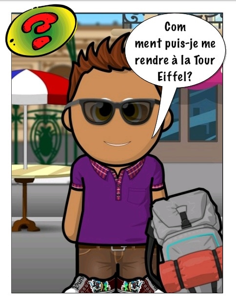 tI have recently been running a few sessions with high schools to help with programming for the new NSW Geography syllabus incorporating the Australian Curriculum. As the year is coming to a close, and I am running out of time, I thought I would just make this available in case people want to share it or go through it with their faculties. This might be a useful resource to use for one of the last Staff Development Days or your first day back (take note Social Science/HSIE Head Teachers). If you are at a Department of Education school you can find this course on MyPL by searching for its title: Introduction to the 7-10 Geography syllabus: - Session 1 - the basic framework. Download the file to use with your staff (edit/change whatever you like).
Why teach Geography? Given the number of teachers who teach Geography in 7-10, that aren't specifically trained in it (or perhaps interested in it), I think it is worth starting any discussion with "Why teach Geography?". Ask teachers to consider the importance of examining and promoting this subject to the individual, the community and the world. If you can encourage the staff that aren't all that engaged in Geography to develop an interest in it, then they will be much more successful in teaching the subject and engaging their students. Geography in Primary - impacts on your teaching in high school For the first time, students will be studying Geography in primary school as a stand alone subject. Most Year 7 units that are currently taught begin with "What is Geography", "What is a Geography tool/skill?", "What are the features of maps", etc. Once the new syllabus is fully implemented, students will have already covered this introductory information in primary school. So this is the first thing that will need to go. In primary school the students will have already been introduced to geographical concepts, tools, and the geographical inquiry process. Keep in mind, this may not be the case for 2017 for all students, but from 2018, you should expect that students have this prior knowledge. Obviously, do some pretesting to get an idea of the depth of students' knowledge. Components of the syllabus Continuums of learning This syllabus introduces a series of continuums of learning for students. There are three continuums: Geographical concepts, Inquiry skills and Geographical tools. These provide you with a snapshot of the learning the takes place in each stage from Early Stage 1 to Stage 5. In the previous syllabus students followed a Research Action Plan. This has been simplified in the new syllabus to a Geographical Inquiry. Students undertake a Geographical Inquiry from Early Stage 1 up to Stage 5, but as students move through the stages the process becomes more complex. However, regardless of the complexity, there are three main stages to a Geographical Inquiry - Acquiring geographical information, processing geographical information and communicating geographical information. Geographical Tools include five main categories - Maps, Fieldwork, Graphs and Statistics, Spatial Technologies and Visual Representations. In the previous syllabus, these were generally what we referred to as skills. There has been some shifting of skills/tools from the previous syllabus and the addition of some new tools. The biggest difference is in Stage 5, where in Spatial Technologies students will be expected to be proficient in virtual maps, satellite maps, global positioning systems (GPS), geographic information systems (GIS), remote sensing data and augmented reality. If this is something which staff find a little daunting, keep in mind that you could delay implementing a couple of these items until 2018, Year 10 to allow a little bit of extra time for upskilling. This way you would still be covering them for the students in Stage 5. Once teaching feeling comfortable with their own skills levels and knowledge, you might then look at shifting it earlier in the stage. Outcomes One of a major differences bewteen the new NSW syllabus and the Australian Curriculum is the integration of outcomes, which in NSW we are used to. Outcomes decribe the essential learning. You MUST cover outcomes. These must be the starting points for designing your lessons, excursions, project based learning, problem based learning, assessments and reports. There should really be a huge arrow pointing at the outcomes for each topic saying "Start here!!". Key Inquiry Questions The new NSW syllabus has included key inquiry questions which drive student learning. This inquiry strand runs parallel to the development of content knowledge. Students will use their inquiry skills (see the continuum discussed above) and geographical tools to undertake geographical inquiries. This is an opportunity for students to explore problematic knowledge, and to develop critical and creative thinking, ethical understanding, personal and social capability (some of the Learning Across the Curriculum areas), Stage statements: The stage statements provide a description of what we want student to have acheived by the end of the stage. Stage statements can be used as a reference point for student acheivement. They may also be useful in making judgements about individual students in terms of decisions related to Learing and Support, Life Skills or opportunities for acceleration. If the student is performing well above or below the stage statement this will indicate that adjustments, modifications or a different course is required. Content The content is the detailed information to be covered in each topic. Each of the dot points is compulsory, while the dash points are suggested ways that you may choose to approach the dot point (not mandatory). You may come up with other ways to approach the dot point if you choose. Life Skills A specific Geography Life Skills course has been provided which could run parallel to a mainstream class. Topics, outcomes and content are similar. This will make it easier to implement if you have one Life Skills students in a mainstream class, as you will be able to use some of the basic information prepared for your mainstream class and heavily modify it, rather than create resources on a completely different topic as was the case with the provious Life Skills course. Icons and symbols The content has a series of codes and symbols throughout. The Australian Curriculum Codes are indicated after the dot points (e.g. ACHGK048). Generally teachers don't really need to worry about these, as the NSW syllabus is the absolute authority. However, if you are looking for resources shared from around Australia, it may be useful to know the Australian Curriculum code. Icons and abbreviations are also used to indicate appropriate content where tools and Learning Across the Curriculum can be covered.
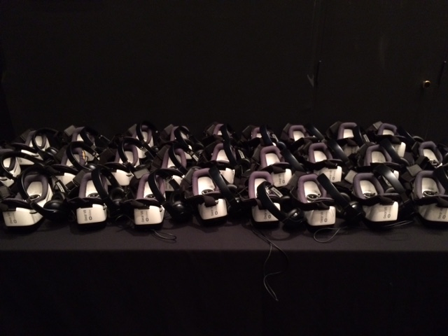
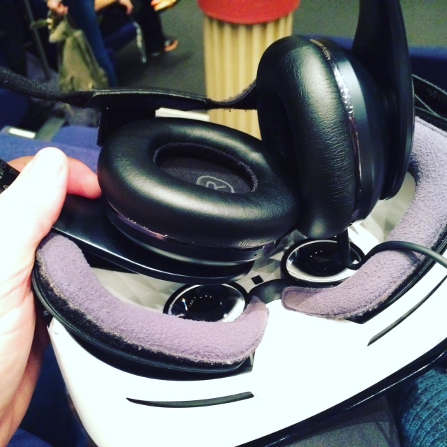
The Australian Museum is currently hosting two David Attenborough Virtual Reality experiences - one on the Great Barrier Reef and one on prehistoric life in oceans. It used a Gear VR headset and headphones to provide this experience. Inside the headset was a Samsung device which provided the audiovisual stimulus. This operated very similarly to the cheaper models you can buy on Ebay (see a previous post - Google Cardboard - bringing virtual reality to your classroom) however this more sophisticated set fits to your face without having to hold it, has padding around the eyes and the head phones are quite good quality. This is clearly a more superior virtual reality experience than the Google Cardboard, but I think that is to be expected given the obvious price difference. The two experiences were relatively short, but were successful in giving the viewer a feeling of being immersed, particularly the First Life presentation which had slightly longer continuous sections in full 360 view. The experiences were part documentary, part virtual reality immersion experience. The Great Barrier Reef experience began with the viewer flying out to part of the reef on a helicopter. By moving your head to the left you could see the back rotor blades and by looking up you could see top rotor blades. The view in front and below was of the reef from above. The footage included of the Great Barrier Reef demonstrated the scale of some of the reef structures and the diversity and number of organisms. The experience has some documentary-style sections where coral polyps and reef building are explained. This provides a short, but effective session aimed to develop the awareness of the viewer about the reef and ends with a call to action for us to act on climate change and protection of the reef. The First Life session was in the style of computer rendered animations. At first I was aware of the difference between this style as compared with the previous 360 video style of the Great Barrier Reef session, but after a short time I forgot about it. This session has longer periods of the 360 immersive experience and it works quite well. You actually get the sensations of feeling like you are moving and some of the quick movements of the species are very effective in making you feel like you are present in the experience. As I have discussed in a previous post, this is an emerging technology that still has a long way to go before it is truly valuable to educational outcomes, other than just purely addressing engagement. The sessions were very good, but require greater length and detail to be really useful in an educational setting. Regardless, I think this is a really powerful technique, and these particular sessions give us a real idea of what the future of documentary making is going to be. If get the chance - go and have a look.
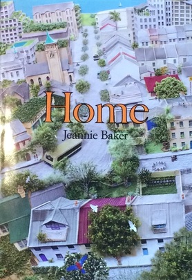
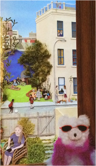
Australian Museum Using picture books to integrate Geography and History into Stage 1 – Home by Jeannie Baker8/22/2016
http://www.jeanniebaker.com/book/home/ Introductory activities: Front cover: Does this place look like your neighbourhood or community? Do any of these houses look like your house? Do any of these backyards look like your backyard? Does this look like a nice place to live? Why or why not? The story begins with a pregnant woman and her husband moving into a home, and traces the steps of Tracy, their daughter's, life. The window frame and the wall around it provide clues to show that time is passing - a card celebrating the birth of a new baby, a mug with "I am 4" on it, a note about her 10th birthday, and on it goes. The documenting of time passing provides a opportunity to begin to explore the historical concept of change and continuity and develop skills in sequencing events. This would need to be accompanied with explicit teaching of days of the week and months, and also holidays, events celebrated by students and their families. Activity: Students are provided with images representing Tracy's age and are asked to cut them out and glue them in the correct sequence. Students bring in photos of their childhood with the ages written on them and sequence them to create a timeline. The teacher uses photos of the class or school throughout the year to create a timeline as a wall display. See this pinterest post: https://au.pinterest.com/pin/205547170466044607/ The geographical concept of place is explored in terms of their unique characteristics, the value we place on places, and human influences. We see the way Tracy and her family interact and influence their own backyard, and we get an idea about how they value their place by the activities and experiences they have there. We see how the community begins to value place as the neighbourhood changes into a thriving place for people to relax, interact and work. Activity: Students identify their favourite places around the school and at home. Why do they like these places the most? How do different places make you feel? Are some places safe places? The geographical concept of change is an obvious theme throughout this book. The backyard develops from an empty, barren space into a shady, green oasis. We see the neighbourhood develop from a run down, graffitied area into a green, friendly community. The smash repairs develop into a local park, the demolition of a large building opens up the view of a lake and parkland, old buildings are renovated and new buildings are constructed. We have glimpses of the development of the city, but much of this is hidden by the greening, leafy community. Activity: Students take photographs of a change occurring in their school or local environment (excursion) and label them. This could be repeated several times so that there is a visual record of the change. Student examine historical photos of their suburb and compare them with contemporary photos. A study of the illustrations provides an opportunity to introduce the geographical concept of scale. There is enough visual interest and complexity to simply concentrate on the changes that occur within the family backyard. This could then be extended to looking at what can be seen on the street corner opposite and the main street. This enables discussion about a community, suburb or local scale. In the background of the illustration you can see the city skyline, this could be used to introduce the scale of the town or large city. Activity: Students are given a template with different sized circles. They use the template to draw images of their house, their street, their community, their city, their country and the world (starting from smallest to biggest). This could then be repeated with images of themselves, their immediate family and their extended family. See this pinterest post: https://au.pinterest.com/pin/451274825131466444/ While the story only examines a timespan of approximately 25 years, it does provide a chance to begin to explore the historical concept of changes and continuities in family life and the local community over time. The story comes full circle when the main character gets married and has her own child. We can begin to introduce the historical concept of empathetic understanding by asking why the yard of the family home looked so different when they first moved in to how it looked at the end of the story. Why did Tracy's parents live differently at that time in history to the way they live now? Activity: Students bring in artefacts, or treasured family objects (perhaps a photograph if it is really treasured) and recount family stories. They ask other students questions about their objects. While the geographical concept of sustainability is not expected to be addressed in Stage 1, this story has a clear message encouraging communities to bring back native plants and animals, and to better understand and care for places.
Outcomes:
Communicates an understanding of change and continuity in family life using appropriate historical terms. Identifies and describes significant people, events, places and sites in the local community over time. Inquiry questions: How has family life changed or remained the same over time? How can we show that the present is different from or similar to the past? How do we describe the sequence of time? It would also be quite easy to make links to the English, Maths and Art syllabuses. Virtual reality is an artificial, computer generated recreation of a real life situation or a simulation of an imagined or created environment (like a virtual tour). The view feels immersed in the experience. David Attenborough’s virtual reality experience has shown us the relevance of this type of activity to the study of geography and coral reefs specifically. http://www.hsieteachers.com/home/attenboroughs-vr-experience-at-the-australian-museum Hear David Attenborough talk about his virtual reality experience: https://www.youtube.com/watch?v=BqSotmvj12k&feature=youtu.be My Google Cardboard class set arrived on Friday. Google have designed a really cost effective way to allow people to access virtual reality. As a kid of the 80s, I remember using my Mattel View Master to look at scenes from movies and TV shows. Google Cardboard kind of works the same way, except that instead of using slide cards you use your phone to view the experience. Before I get too far into this, virtual reality is by no means a substitute for fieldwork, and I think we are a long way off before anyone could even try to claim that. This is just a fun activity, with the potential to enhance learning in the future as the apps and technology develops. There are a range of different headsets that you can buy to experiment with virtual reality, There are different brands, materials, sizes and quality. As a first foray into this world, I have gone for pretty much the cheapest option available. In my opinion, if you are intending to use it in your classes, you are going to want to get one of the cheaper models so that you can have more of them for your students, and so that it isn't such a big deal if they get broken. The Google Cardboard in the image below cost about $2.00 on ebay. The other headset featured cost about $10-15 dollars, and was purchased from Typo. So what do you need? - A viewer - A smartphone (for each viewer, so you might have to ask the students to download the app and use their own phones). - A range of virtual reality apps downloaded (you will need to do some research to find the right one for your topic and students). Below: A version of Google Cardboard available on Ebay for about $5. 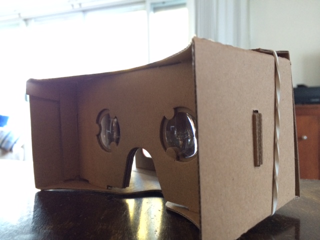 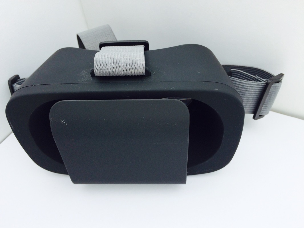 There are a few apps that you can use to access the experiences: - Google Cardboard - Youtube (use 360 videos) - Street View - Within Affordable access to virtual reality experiences is relatively new, and the apps and experiences are really only beginning to become available. When you open the apps, you will see a split screen with two images that are roughly the same, but shown at slightly different angles. When you place your phone inside the Google Cardboard and look at it through the lenses it will give the impression of being 3 dimensional. This will enable your students to feel like they are immersed in the environment. Youtube 360 The simplest way to use virtual reality is Youtube 360. Simply go to Youtube and search “coral 360 video”. A range of options will come up that you can use with or without head sets. These have been generally designed for tourists, but may be an easy way to begin to introduce virtual reality if you are a little apprehensive. The benefit of using Youtube 360 is that you can use it on your desktop computer/laptop if you don’t have access to personal devices.
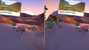
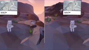
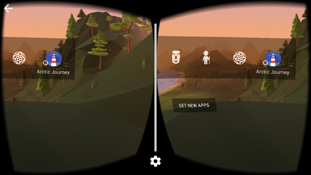 The Google Cardboard app is really quite interesting, and provides a number of examples that give you an idea of what the potential will be, but in terms of education, in my opinion it is not all the valuable just yet. What it does show is what the potential is. The screenshots below show an example of an Arctic environment. When you select different items in the scene a popup appears providing some basic information about the feature. Given the right scene or environment, and the right level of information this could be useful in an educational sense if it were developed further.
A couple of the great virtual experiences are the ones where you are immersed in a real environment (rather than a cartoon-like environment). Street View enables you to explore places with the full 360 degrees. Click Explore, Choose a location, and click the Google Cardboard icon. You do really feel like you are part of the place. This could be valuable in helping students develop an appreciate of the places you are studying, and to get a better understanding of what those places are actually like
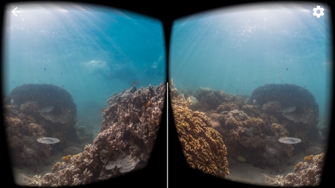 Virtual reality lesson 1 Use Google Streetview to examine a range of sites around the Great Barrier Reef and Coral Triangle. Choose specific sites, eg, several locations around Lizard Island, or Kimbe Bay. Compare the two main virtual field sites. Students can make judgements about the quality of the corals, the colours of the corals, etc. Students may try to identify specific types of coral to compare complexity and biodiversity (although this may be a bit too complicated). Students can use this as a form of observation to be backed up with secondary data
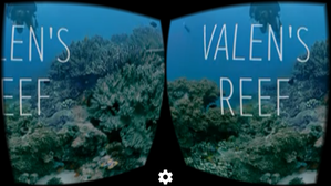
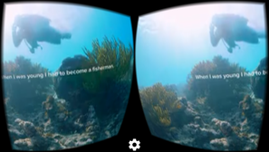
Open the Within app. Select Valen’s Reef. This presentation follows a local fisherman explaining the pressures on him and his local reef. A narrative is provided over the footage of the reef and the island Students can maneuver around the scene to access 360o views. Students will feel immersed in the scene and the story. Virtual reality lesson 2 - Valen's Reef Students view Valen’s Reef, using the Within app. A couple of quick questions:
Discovery VR app The Discovery VR app has a number of presentations that relate to Geography generally, and a series “Sharks Among Us” which can be tied in with Marine Environments generally or coral reefs. Examine Google Cardboard here: https://vr.google.com/cardboard/
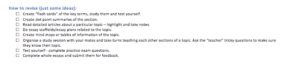
You can follow Google Classroom on twitter at @GoogleVR. Following on from the Legal Studies revision planner is a Geography planner to guide student revision. For my class, I allocated Ecosystems At Risk and Urban Places two weeks each and only gave People and Economic Activity 1 week – this was because my class won't have done the the PEE case study by the time of the Trials. In this planner I have allocated 2 weeks revision for each topic and a week for skills revision. Depending on your students it is also a really good time to emphasise with students the importance of getting the balance right between study, their part-time job, socialising, eating right and exercising. If they can set up the right routines now, they will find it easier to cope when the Trials and HSC exams are on. 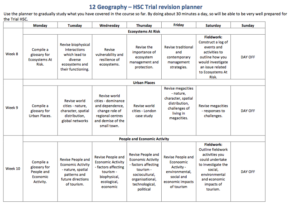 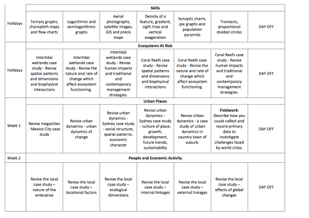
 BOSTES announced today that the new Elective 7-10 Geography syllabus is to be implemented in 2017. The remainder of this year is for familiarisation and planning.
Similarly to the new 7-10 Geography syllabus incorporating the Australian curriculum, it includes the Learning Across the Curriculum areas as well as the key geographical concepts of place, space, interconnections, environment, scale, sustainability and change. It includes a concepts continuum outlining which aspects of each concept should be covered in each stage. The geographical inquiry skills continuum and geographical tools continuum have also been included. The Elective course provides opportunity of geographical inquiry. The Stage statements for both Stage 4 and 5 have a whole paragraph emphasising the importance of geographical inquiry. There is an emphasis on problematic knowledge, with students required to investigate challenges, collect primary and secondary data, propose solutions and actions. Students are also required to investigate challenges from a range of different perspectives. Several of the topics allow for the exploration of an investigative study. Interestingly the Elective course is focused almost solely on outcomes and content. The Mandatory Geography course also has inquiry questions to guide each topic and a content focus, neither of which are present in the Elective syllabus. The topics in the new Elective Geography course are: - Physical Geography - Primary Production - Australia's Neighbours - Interactions and Patterns Along a Transcontinental Transect - Oceanography - Global Citizenship - Political Geography - School-developed Option A Life Skills course has been provided as part of the Elective course which aligns with topics of the mainstream course. This will make it manageable for teachers to deliver the Life Skills course within a mainstream classroom. Information is provided on reporting and to guide assessment in both the mainstream and Life Skills course. The syllabus and support documentation can be found on BOSTES: http://www.boardofstudies.nsw.edu.au/syllabus_sc/geography.html |
||||||||||||||||||||||||||||||||||