|
This is part of a unit of work for Changing Places - Australia's Urban Future. Lesson 1: Australia's Projected Population Growth Lesson 2: Implications for Future Growth and Sustainability Lesson 3: Sydenham to Bankstown Urban Renewal Precinct Lesson 4: WestConnex - Sydney, Sustainability and Transport Lesson 4: Sydney Sustainability and Transport (Teacher's Notes) Lesson 5: The GreenWay Lesson 5: Deindustrialisation Lesson 6: Create an infographic Lesson 7: Contributing to a Sustainable Urban Future Lesson 7: WestConnex - Protest Movements and Impacts Lesson 7: Conflict Over Dulwich Hill OR See the complete unit on the Changing Places website. Population forecasts for continued and accelerating growth or urban areas have a range of implications for sustainability. Sustainability is development that meets the needs of the present population without endangering the capacity of future generations to meet their needs. Indicators of sustainability in urban areas include air and water quality, biodiversity, integration of green building initiatives, health and well being measures, employment rates, transport infrastructure and access to employment. Implications of growth of urban areas include loss of agricultural land, habitat areas and open space, increased pressure on transport infrastructure resulting in heavy flows of commuter traffic and traffic congestion. Planning for the future growth of urban centres in Australia needs to address the provision of:
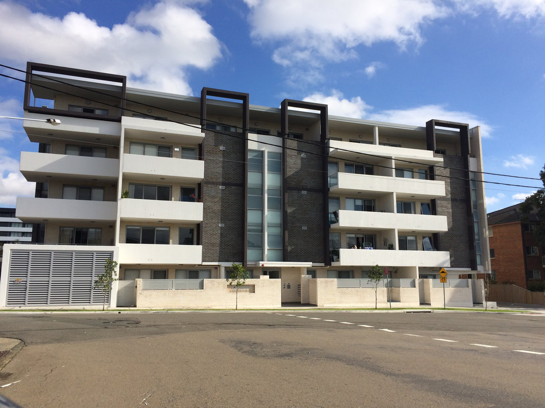
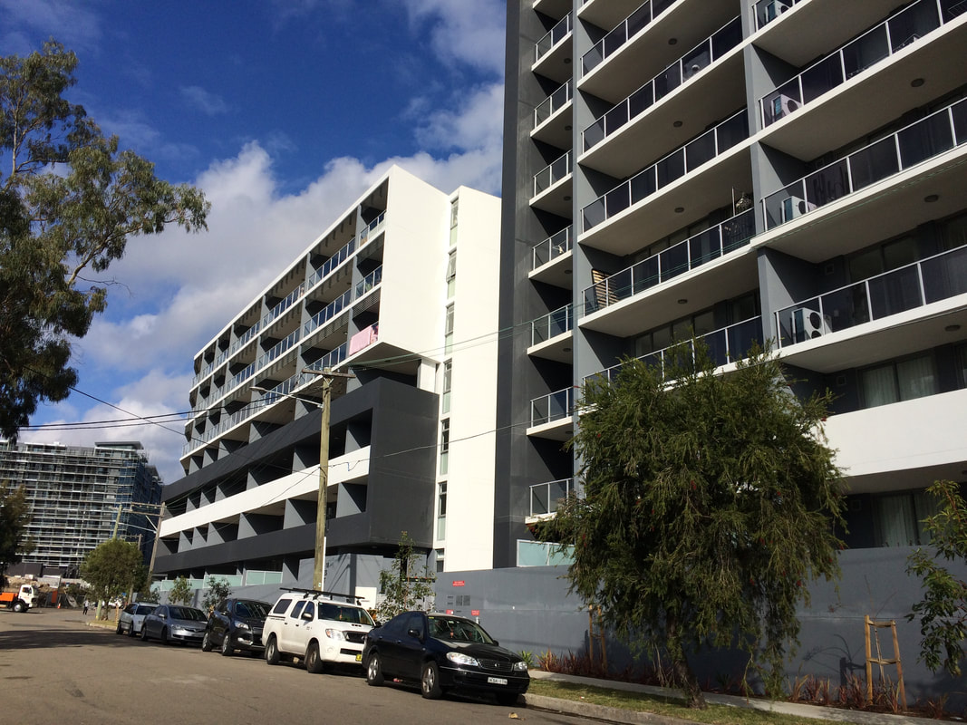
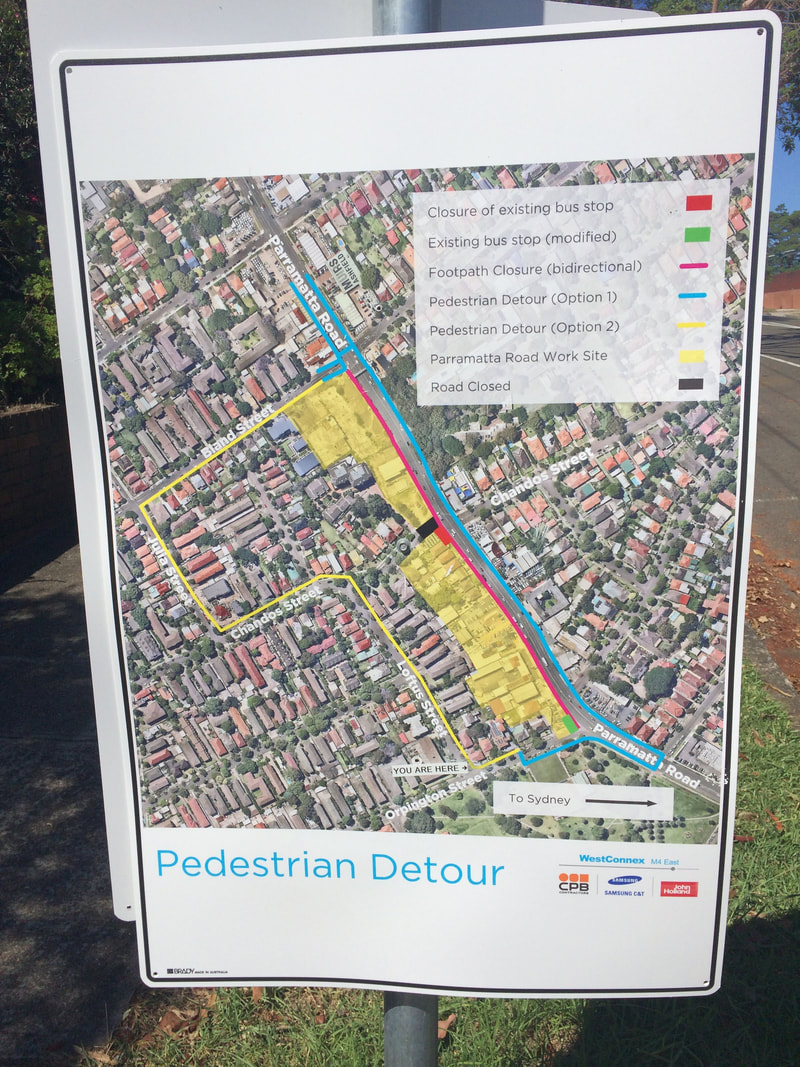
Priority Precincts and increased density An increase in density of urban areas creates more compact, “efficient” urban areas. This allows for services and infrastructure to be provided for a greater number of people and can allow residents to access public transport more easily and become less reliant on cars. The State Government’s Priority Precinct Program encourages population growth and increased density in specified areas. The Sydenham to Bankstown Urban Renewal Corridor includes the Inner West suburbs of St Peters, Sydenham, Tempe, Marrickville, Dulwich Hill and Hurlstone Park. For further reading click: http://www.urbangrowth.nsw.gov.au/assets/Living-Cities/CfS-Discussion-Paper-Making-Great-Places-Density-Done-Well.pdf Connectivity and Infrastructure Public infrastructure such as hospital, police centres, schools, trains, buses and roads is required for cities to function effectively. Upgrades of schools include Ashfield Boys, Ashbury Public, Croydon Public, and the construction of NSW School of Languages at Petersham. An ambulance super centre is being built at Haberfield. Transport infrastructure includes the construction of the Metroline and the M4 East extension, M5 extension and the M4-5 link.
0 Comments
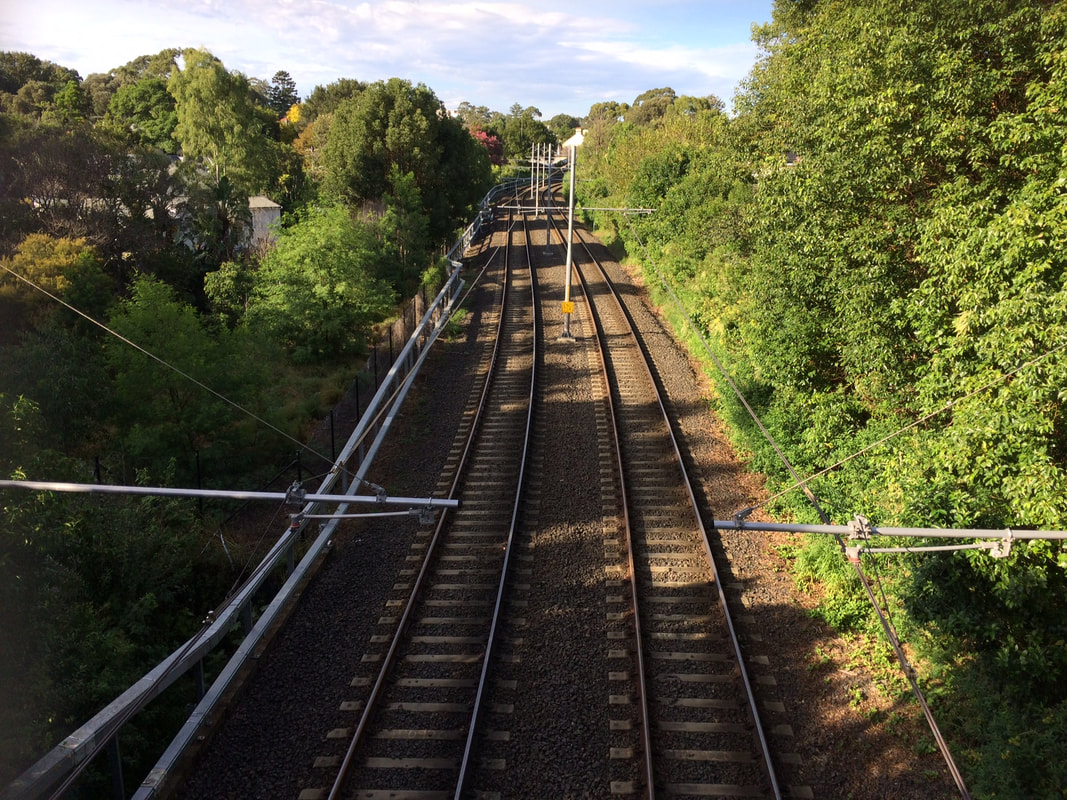
Post originally written in 2017, and updated March 2018. This is part of a unit of work for Changing Places - Australia's Urban Future. Lesson 1: Australia's Projected Population Growth Lesson 2: Implications for Future Growth and Sustainability Lesson 3: Sydenham to Bankstown Urban Renewal Precinct Lesson 4: WestConnex - Sydney, Sustainability and Transport Lesson 4: Sydney Sustainability and Transport (Teacher's Notes) Lesson 5: The GreenWay Lesson 5: Deindustrialisation Lesson 6: Create an infographic Lesson 7: Contributing to a Sustainable Urban Future Lesson 7: WestConnex - Protest Movements and Impacts Lesson 7: Conflict Over Dulwich Hill OR See the complete unit on the Changing Places website. The NSW Government has released a revised Sydenham to Bankstown Urban Renewal Strategy for public comment. The strategy will be implemented over 20 years and sees plans for urban consolidation and retail opportunities along the a new metro line which will replace the existing train line and link with the Metroline being built in Sydney's north west. It includes the creation of over 35,000 new homes. View the Sydenham to Bankstown Urban Renewal Corridor website. Priority Precincts where development will be concentrated include Campsie, Canterbury, Lakemba and Belmore. Developments in these areas will include buildings up to 25 storeys high. Marrickville will have an increase in homes of 84%, while Canterbury will increase by 208%. and Belmore will increase 128%. Some suburbs such as Dulwich Hill and Hurlstone Park have had a reduction in the number of new dwellings proposed compared to the previous plan released. View Changing Places: Conflict over development in Dulwich Hill. The existing rail line between Sydenham to Bankstown will be converted to a Metro line. During construction the rail line will not be in operation. It is anticipated that once completed, it will reduce wait times and travel times to the city. However, the existing rail line allows commuters to connect with the existing CityRail network and travel to locations such as Chester Hill, Villawood, Cabramatta and Liverpool, without having to change trains. Commuters can then change trains to connect with the rest of the CityRail network. It is unclear at this stage how the Metro line will interact with the existing City Rail and light rail networks.
Residents and community groups have expressed some concerns regarding the increased level of density and population. Concerns relate to inadequate parkland and open space, destruction of heritage architecture, new designs which are unsympathetic to the heritage nature of suburbs, and lack of supporting infrastructure. There has been limited information released regarding industrial and commercial zoning, and concerns have been raised regarding the sustainability of the development. The rezoning will also take place years before the Metro line will finished. Supporters of the developments state that high density is better for the environment than urban sprawl and increases connectivity and land values in the area. The renewal strategy announcement has come at a time when residents of the Inner West are already dealing with a large number of new developments and there is a perception that there is an inequitable system of planning in place. For example Council targets for new housing approvals have been exceeded in Canterbury, but many other council areas such as Hunters Hill, Warringah, Pittwater, Willoughby and Manly have not met their targets. There have been a range of issues associated with the WestConnex development such as compulsory acquisition and demolition of houses, encroaching on parks, noise and construction issues. The recently announced future sale of Canterbury Racecourse for development has also been an issue of contention. These issues combined are likely to make Inner West residents less persuadable when it comes to future developments. Lesson Activities: Define the terms low-density, medium-density and high-density. Describe the advantages and disadvantages of each type of housing. Examine: http://www.planning.nsw.gov.au/Plans-for-your-area/Priority-Growth-Areas-and-Precincts/Sydenham-to-Bankstown-Urban-Renewal-Corridor/Map Outline the changes that will occur in each Inner West suburb as a result of the Sydenham to Bankstown Planned Precinct. Assess how the new Metroline will support population growth in the Urban Activation Precincts. Extra resources: Residents, ex-pollies baulk at high density in revised Sydneham to Bankstown Urban Renewal Strategy. Planning experts say development should be embraced and not feared along Sydenham to Bankstown corridor. Sydney's tale of two suburbs: new analysis shows the wide spread of development. Metro's on the wrong track High rise to hell Open season on high rise Heritage, character face destruction Inner West needs nine new schools
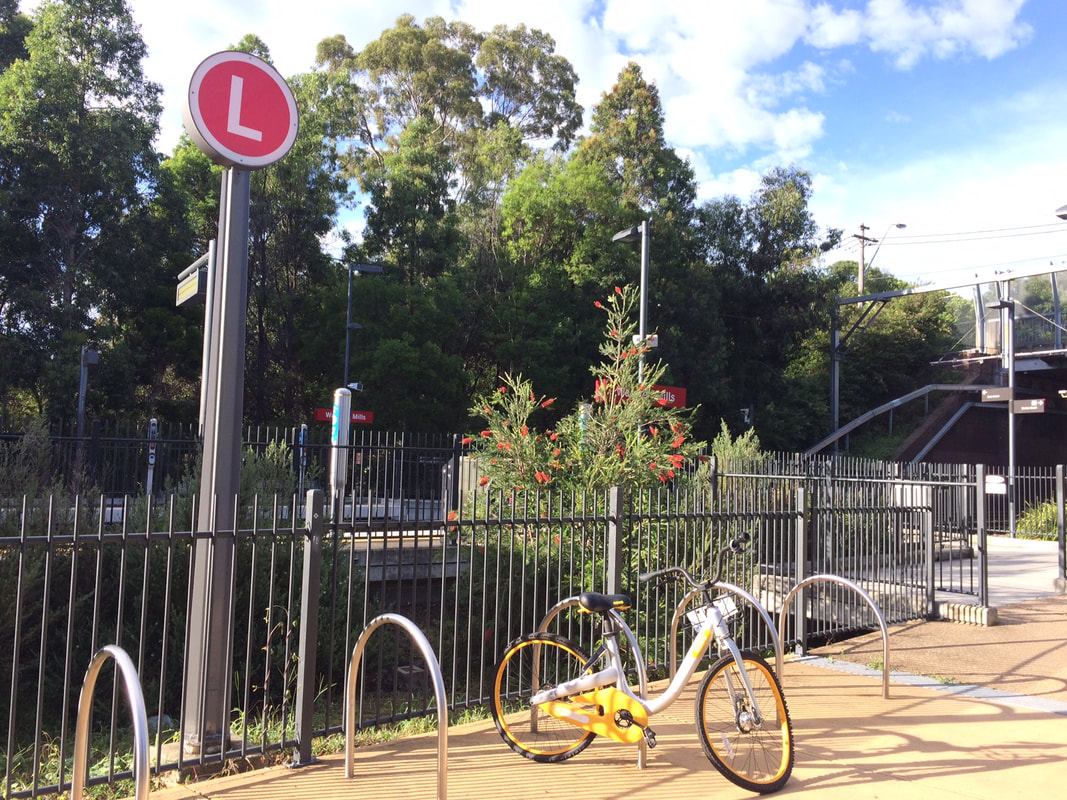
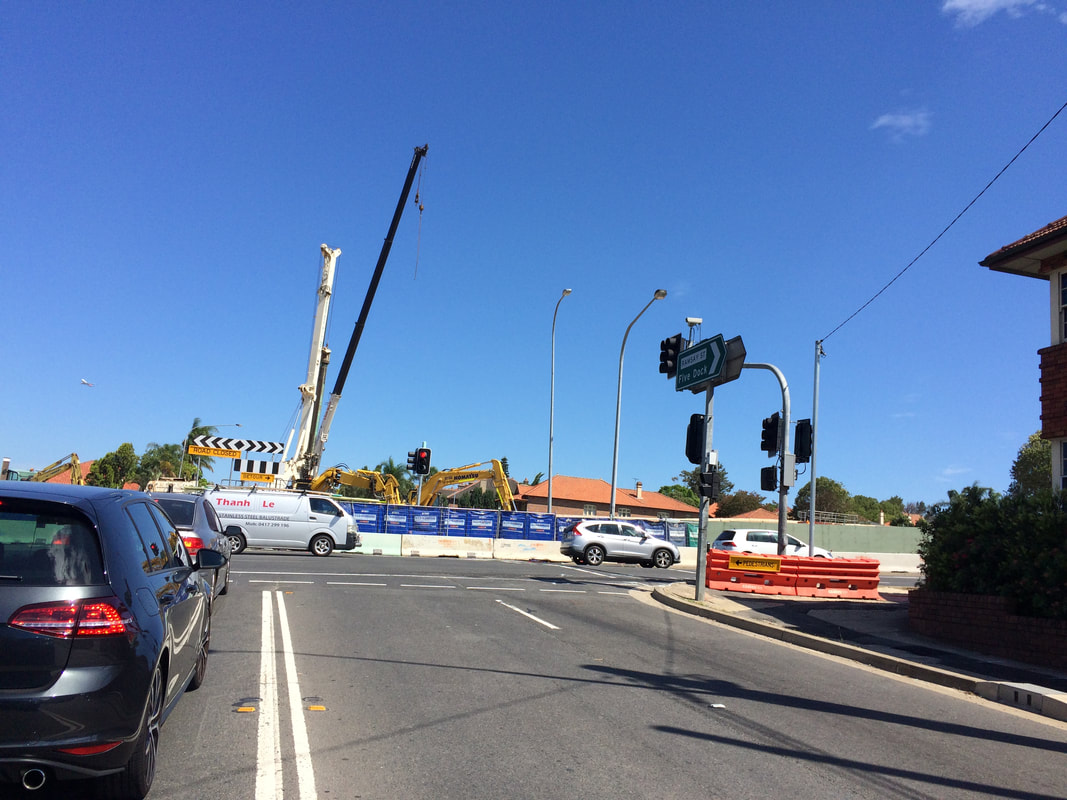
This post was originally written in January 2017, and edited in March 2018. This is part of a unit of work for Changing Places - Australia's Urban Future. Lesson 1: Australia's Projected Population Growth Lesson 2: Implications for Future Growth and Sustainability Lesson 3: Sydenham to Bankstown Urban Renewal Precinct Lesson 4: WestConnex - Sydney, Sustainability and Transport Lesson 4: Sydney Sustainability and Transport (Teacher's Notes) Lesson 5: The GreenWay Lesson 5: Deindustrialisation Lesson 6: Create an infographic Lesson 7: Contributing to a Sustainable Urban Future Lesson 7: WestConnex - Protest Movements and Impacts Lesson 7: Conflict Over Dulwich Hill OR See the complete unit on the Changing Places website. Changing Places (Year 9) The Changing Places topic requires students to explain processes and influences that form and transform places and environments (GE5-2) and to assess management strategies for places and environments for their sustainability (GE5-5). The topic requires students to examine urbanisation, the impact of migration and strategies to address change in urban places and how they enhance sustainability. As a part of examining the causes and consequences of urbanisation, students will have investigated spatial distribution patterns of urbanisation (for example the influence of transport corridors), and the social, economic and environmental consequences of urbanisation (this could include traffic congestion, costs of tolls or costs of constructing new infrastructure, average times people spend commuting to work, the impact of car exhaust on air quality). In examining urban settlement patterns students will specifically address the impact of transportation networks in Australian and another country to explain differences in urban concentrations. While there is scope to deal with a range of issues and influences related to urbanisation and urban settlement, there is certainly an opportunity to develop a unit of work that develops students’ understanding in car dependence, traffic congestion, public transport, road networks, etc. to lead them to be able to examine this issue of the WestConnex development from a range of perspectives and with detailed background knowledge. In the last part of the Changing Places topic students investigate the management and planning of Australia’s urban future, including Australia’s population projections, implications for growth and sustainability, strategies to create sustainable urban places and ways for individuals and groups to become involved. WestConnex provides a great case study to examine this. Obviously you need to address the points at the national scale, but the WestConnex project impacts on such a large are of Sydney that you might find that many of your students are already engaged with (or at least aware of) the project in some way. Urban Places/ Urban Dynamics (Year 12) If you choose to do Sydney as a large city case study for Urban Places the WestConnex project could also tie into the - growth, development, future trends and ecological sustainability dot point.  This is part of a unit of work for Changing Places - Australia's Urban Future. Lesson 1: Australia's Projected Population Growth Lesson 2: Implications for Future Growth and Sustainability Lesson 3: Sydenham to Bankstown Urban Renewal Precinct Lesson 4: WestConnex - Sydney, Sustainability and Transport Lesson 4: Sydney Sustainability and Transport (Teacher's Notes) Lesson 5: The GreenWay Lesson 5: Deindustrialisation Lesson 6: Create an infographic Lesson 7: Contributing to a Sustainable Urban Future Lesson 7: WestConnex - Protest Movements and Impacts Lesson 7: Conflict Over Dulwich Hill WestConnex Stage 1 (M4 East) Stage 1 of the WestConnex project involves the widening of the M4, a connection between Parramatta Road and the City West Link and new connections at Concord Road. A tunnel will run from the end of the current M4 to the City West Link. Ashfield and Haberfield A section of Ashfield along Parramatta Road was acquired and demolished for WestConnex. The exit to the M4 tunnel will be near the crossroads of Frederick St/ City West Link and Parramatta Road. A large sections of Haberfield has been acquired to allow the WestConnex to link directly with the City West Link. Stage 2 (New M5) Stage 2 of the WestConnex project involves the construction of a tunnel between St Peters and Kingsgrove. St Peters, Alexandria and Newtown A traffic interchange is under construction next to Sydney Park. This will feed traffic into Edgeware and Enmore Roads and King Street, Newtown. Campbell Street and Euston Road will be widened. Stage 3 (M4-M5 Link) Stage 3 will involve an underground tunnel from Victoria Rd, east of the Iron Cove Bridge to St Peters. Balmain and Rozelle While Stage 3 of WestConnex is being finalized , recent announcements suggested that the former Balmain Tigers Club on Victoria Rd at Rozelle, will be used as a dive site. Further details have not yet been released. For more detail about WestConnex view previous blog posts: Lesson 4: West Connex Update 1: Ashfield and Haberfield Lesson 4: WestConnex Update 2: St Peters, Alexandria, Newtown Lesson Activity: WestConnex and Sustainability Examine the WestConnex development from a range of different perspectives. Develop a criteria to assess the project for economic, social and environmental sustainability. Include maps showing where the WestConnex project is located and the changes to landuse along the corridor (for example, acquisitions and demolitions, new open spaces). What might you change to improve the economic, social and environmental sustainability of the project? Consider the following: - What is the overall cost of development (economic, social, environmental)? - What kind of Sydney do we really want? - Do the benefits to the city/commuters outweigh the costs to others? Light Rail Extension A key issue in sustainability is its car-dependence. Every improvement in public transport is a step towards improving Sydney's sustainability. The 2013 Inner West Light Rail Extension involved utilising former freight lines to extend light rail services from Lilyfield to Dulwich Hill. The light rail now extends from Lilyfield into the CBD, and commuters can also connect to the Inner West rail line at Summer Hill or Stanmore. The extension of the light rail line through the Inner West involved a 5.6 km line extension and the construction of stops at Leichhardt North, Hawthorne, Marion, Taverners Hill, Lewisham West, Waratah Mills, Arlington, Dulwich Grove and Dulwich Hill Interchange. Metroline The existing rail line between Sydenham to Bankstown will be converted to a Metro line. During construction the rail line will not be in operation. It is anticipated that once completed, it will reduce wait times and travel times to the city. However, the existing rail line allows commuters to connect with the existing CityRail network and travel to locations such as Chester Hill, Villawood, Cabramatta and Liverpool, without having to change trains. Commuters can then change trains to connect with the rest of the CityRail network. It is unclear at this stage how the Metro line will interact with the existing City Rail and light rail networks. Lesson Activity: Metroline Determine the advantages and disadvantages of replacing the existing train line with the Metroline.
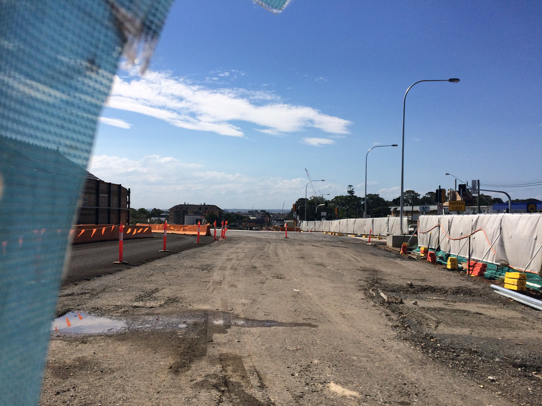
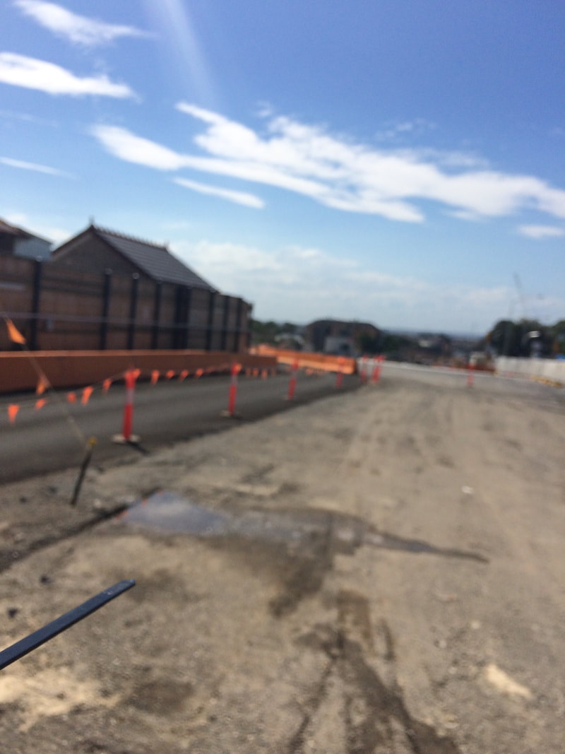
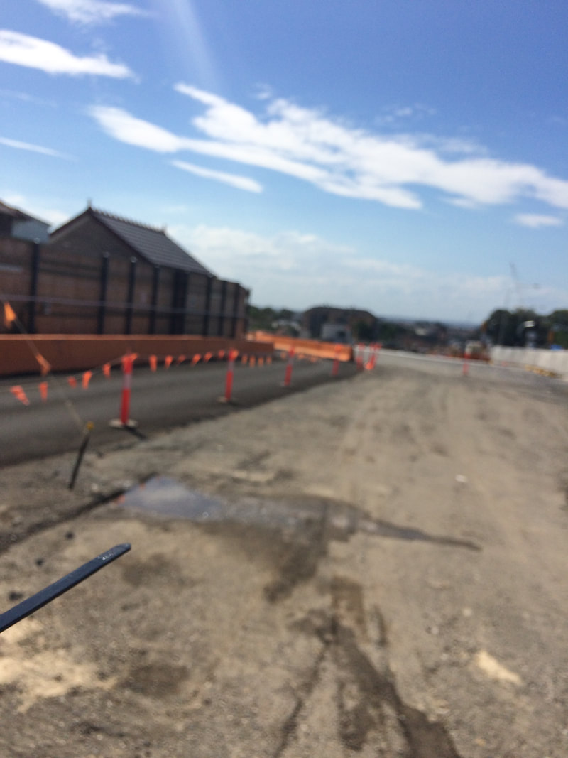
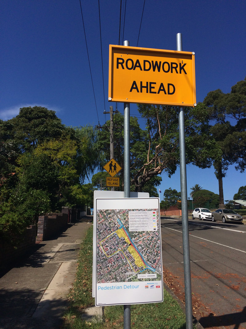
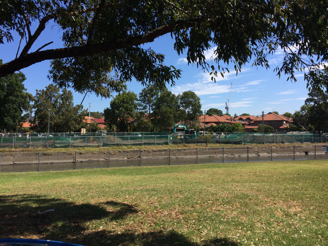
This is part of a unit of work for Changing Places - Australia's Urban Future. Lesson 1: Australia's Projected Population Growth Lesson 2: Implications for Future Growth and Sustainability Lesson 3: Sydenham to Bankstown Urban Renewal Precinct Lesson 4: WestConnex - Sydney, Sustainability and Transport Lesson 4: Sydney Sustainability and Transport (Teacher's Notes) Lesson 5: The GreenWay Lesson 5: Deindustrialisation Lesson 6: Create an infographic Lesson 7: Contributing to a Sustainable Urban Future Lesson 7: WestConnex - Protest Movements and Impacts Lesson 7: Conflict Over Dulwich Hill OR See the complete unit on the Changing Places website. Background: WestConnex overview M4-M5 Link Concept Design To bring Sydney together, WestConnex tears suburbs apart The development and construction of WestConnex has impacted and changed places. Large sections in the vicinity of Parramatta Rd in Ashfield and Concord and the western part of the suburb of Haberfield have been demolished to make way for the road development. You can read more about this here - West Connex's collision course into communities or in my previous posts. Impact at St Peters, Alexandria and Newtown Stage 2 of the WestConnex project involves the construction of a tunnel between St Peters and Kingsgrove. The King Street Gateway and the Campbell Road Green link are changing the nature of St Peters, Alexandria and Newtown. View the St Peters Overview. Links: Changes to St Peters can be seen in the link below. Sydney's WestConnex changes the face of St Peters - in pictures Information about the construction at St Peters can be found in the following article: WestConnex inflicts non-stop construction on St Peters for the next 3 weekends. 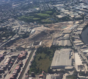 The M4-M5 link tunnels will run underneath Newtown. Many Newtown business owners have begun protesting the development, worried that congestion and bottlenecks will negatively impact retail businesses, or alternatively that clearways along King St will kill business. The Newtown WestConnex Action Group has been formed. In Alexandria a new bridge is being constructed over the canal to allow movement of traffic from the St Peters interchange.
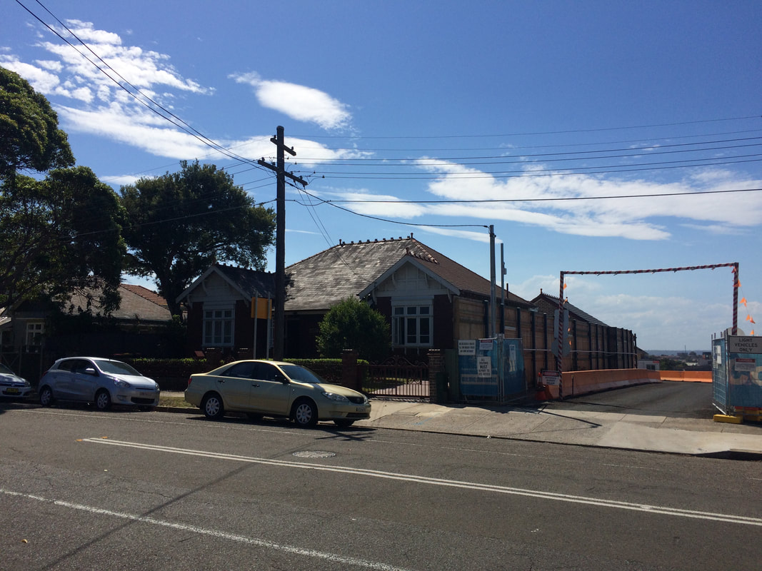
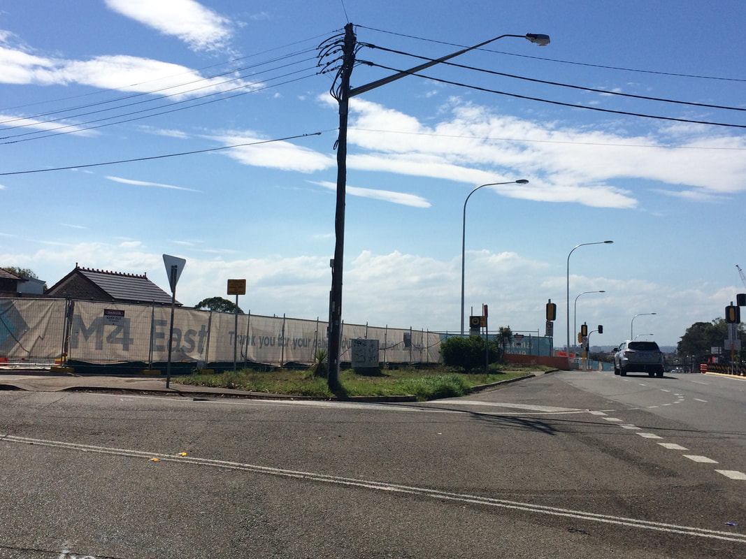
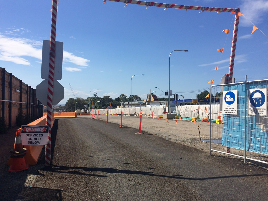
Links: Six tunnels will be built under Andre's house in Lorde St Newtown. "Write an email": Sydney residents get no more answers as WestConnex hits Alexandria. Official: WestConnex allowed to flout environmental laws. This is part of a unit of work for Changing Places - Australia's Urban Future. Lesson 1: Australia's Projected Population Growth Lesson 2: Implications for Future Growth and Sustainability Lesson 3: Sydenham to Bankstown Urban Renewal Precinct Lesson 4: WestConnex - Sydney, Sustainability and Transport Lesson 4: Sydney Sustainability and Transport (Teacher's Notes) Lesson 5: The GreenWay Lesson 5: Deindustrialisation Lesson 6: Create an infographic Lesson 7: Contributing to a Sustainable Urban Future Lesson 7: WestConnex - Protest Movements and Impacts Lesson 7: Conflict Over Dulwich Hill OR See the complete unit on the Changing Places website. Lesson Activity: Create an infographic Below is an infographic about the WestConnex. Create your own infographic using picktochart or a similar program. Your infographic should be on the topic of change in Sydney's Inner West. It should include themes such as transport, green space, housing, and land uses. 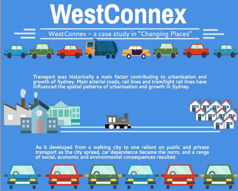 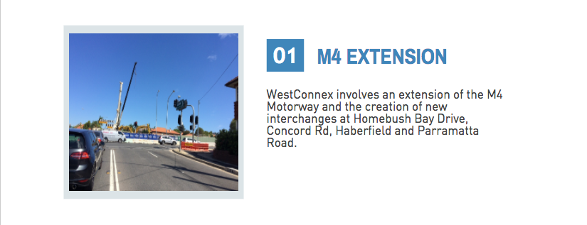 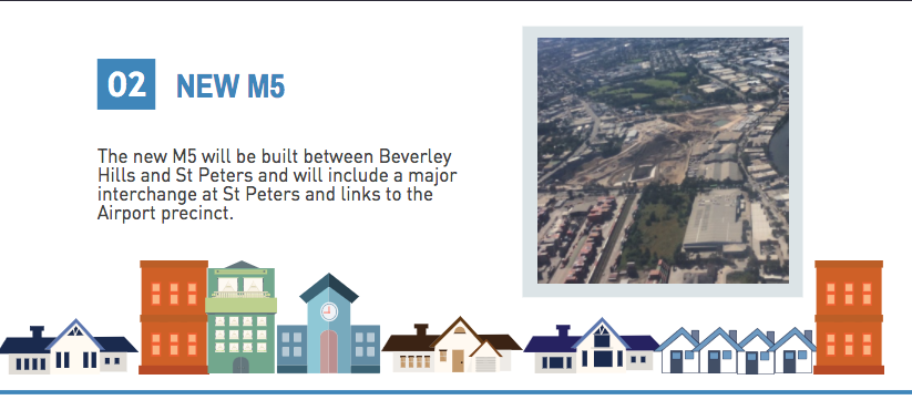 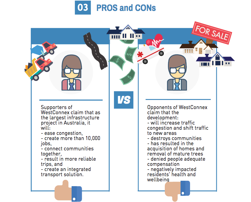 This is part of a unit of work for Changing Places - Australia's Urban Future. Lesson 1: Australia's Projected Population Growth Lesson 2: Implications for Future Growth and Sustainability Lesson 3: Sydenham to Bankstown Urban Renewal Precinct Lesson 4: WestConnex - Sydney, Sustainability and Transport Lesson 4: Sydney Sustainability and Transport (Teacher's Notes) Lesson 5: The GreenWay Lesson 5: Deindustrialisation Lesson 6: Create an infographic Lesson 7: Contributing to a Sustainable Urban Future Lesson 7: WestConnex - Protest Movements and Impacts Lesson 7: Conflict Over Dulwich Hill OR See the complete unit on the Changing Places website. Dulwich Hill is a suburb located in Sydney's Inner West, surrounded by Summer Hill, Hurlstone Park, Marrickville, Petersham, Lewisham and Earlwood. It experienced growth in the late 1800s following the introduction of the tram line, and as a result contains buildings with heritage architecture, particularly Federation architecture. The tram line through Dulwich Hill was not in use as public transport from the 1950s. The Inner West light rail extension in 2013 reconnected Dulwich Hill by rail with nearby suburbs and the city. For more details see my previous post Inner West Light Rail Extension. For more information about the history and development of Dulwich Hill, visit the Dulwich Hill section of the Marrickville historical society - Dulwich Hill - a history. The Sydenham to Bankstown Urban Renewal Strategy, encompasses the suburb of Dulwich Hill, rezoning for higher density and redevelopment of older buildings. Changes to zoning as part of this strategy can be seen on the Planning NSW website - Dulwich Hill Landuse Plan. The plan for Dulwich Hill includes 2000 more dwellings, with 3 storey development along Wardell Road, and unit developments from 3-5 storeys near the Dulwich Hill station. Higher density housing developments are zoned for around the Dulwich Hill light rail station (between 3-7 storeys). 8 storey developments will be allowed around Arlington Grove Light Rail station. View the Changing Places - Sydenham to Bankstown Urban Renewal Precinct post. The Save Dulwich Hill Community Group promotes issues related to the redevelopment of the suburbs and lobbies the government to preserve the heritage of suburb. Visit the Save Dully website to read more about their actions. This is part of a unit of work for Changing Places - Australia's Urban Future. Lesson 1: Australia's Projected Population Growth Lesson 2: Implications for Future Growth and Sustainability Lesson 3: Sydenham to Bankstown Urban Renewal Precinct Lesson 4: WestConnex - Sydney, Sustainability and Transport Lesson 4: Sydney Sustainability and Transport (Teacher's Notes) Lesson 5: The GreenWay Lesson 5: Deindustrialisation Lesson 6: Create an infographic Lesson 7: Contributing to a Sustainable Urban Future Lesson 7: WestConnex - Protest Movements and Impacts Lesson 7: Conflict Over Dulwich Hill OR See the complete unit on the Changing Places website. Stage 1 of the WestConnex project involves the widening of the M4, a connection between Parramatta Road and the City West Link and new connections at Concord Road. A tunnel will run from the end of the current M4 to the City West Link, M4 East concept design WestConnex Stage 1 WestConnex interactive map Ashfield A section of Ashfield along Parramatta Road was acquired and demolished for WestConnex. The exit to the M4 tunnel will be opposite Bunnings Warehouse near the crossroads of Frederick St/ City West Link and Parramatta Road. Link: WestConnex plan jeered by Ashfield residents Save Ashfield Park Rally Haberfield Some of the issues raised in relation to WestConnex in Haberfield include home acquisitions, destruction of heritage architecture, noise and vibrations for homes adjacent to construction sites, changes to traffic flows and the impact of all of these factors on the nature of the suburb. Links: Haberfield homes acquired for building of WestConnex Three month closure of Ramsay Street Haberfield Talking WestConnex and Mike Baird ignoring compulsory aquisition reforms WestConnex private contractors sell items from heritage homes ahead of demolition WestConnex unused land should be handed back say inner west residents. Residents in Haberfield and Beverley Hills claim WestConnex work is cracking walls of houses near motorway construction sites. What we are facing is the destruction of Haberfield
This is part of a unit of work for Changing Places - Australia's Urban Future.
Lesson 1: Australia's Projected Population Growth Lesson 2: Implications for Future Growth and Sustainability Lesson 3: Sydenham to Bankstown Urban Renewal Precinct Lesson 4: WestConnex - Sydney, Sustainability and Transport Lesson 4: Sydney Sustainability and Transport (Teacher's Notes) Lesson 5: The GreenWay Lesson 5: Deindustrialisation Lesson 6: Create an infographic Lesson 7: Contributing to a Sustainable Urban Future Lesson 7: WestConnex - Protest Movements and Impacts Lesson 7: Conflict Over Dulwich Hill OR See the complete unit on the Changing Places website. Stage 5 Geography - Changing Places In the previous 7-10 syllabus in Environment Issues there was a section of content where students were asked to investigate individual, groups and government responses to an issue. In the new NSW syllabus this has been removed. However, in Stage 4 Changing Places the issue of WestConnex protests (or some other protests) can be used to address the inquiry questions:
Students can examine transport networks as both a cause and consequence of urbanisation (see previous post - WestConnex - Sydney, Sustainability and Transport) Students can also use it to examine the following content dot points:
Below: The St Peters West Connex site.
Stage 6 Geography - Urban Places/Urban Dynamics In a previous post I wrote about how WestConnex could be used as a way of exploring growth, development, future trends and ecological sustainability for a Sydney case study in the urban dynamics section of the HSC course. Another way this issue could be used in this course would be to use it to explore the culture of place of a suburb like Haberfield. There have been a variety of articles regarding the nature of the suburb in terms of heritage architecture, noise, and street life, and how this has and will change as a result of WestConnex. There are also a number of articles regarding the development site at St Peters and the removal of established trees on Sydney Park. This could also be used as a way to ask problematic questions such as: - What is the cost of development?, - What kind of Sydney do we really want? - Do the benefits to the city/commuters outweigh the costs to others? - Will the project really releive traffic in the long term? 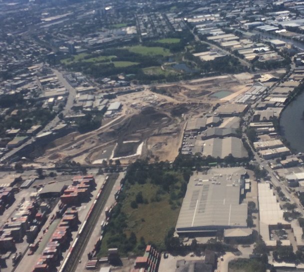
Students can do this through the lense of community protests to examine how different groups and individuals perceive how WestConnex (both a consequence of and a response to urbanisation - i.e a response to traffic congestion, the need for transport infrastructure) impacts their community and/or environment. In the previous syllabus there was a lot of scope to do activities such as mock council meetings, mock letters to Members of Parliament, etc. A simple search on Youtube brings up many recorded meetings regarding the project. This is an ideal scenario to use in class to reenact (or participate in) this process. While NESA/BOSTES has not completed a rewrite of the Civics and Citizenship Australian Curriculum, we can assume it will be relatively similar based on the rewrites of 7-10 History and Geography. In Civics and Citizenship (AC) students examine how citizens participate in direct action and lobbying (Year 8) and how and why individuals and groups participate in and contribute to civic life (Year 9). This provides a perfect example to explore these kinds issues and to build on student knowledge in Civics and Citizenship. Resources Below is a list of links to articles and websites related to WestConnex protests. You will notice that some of these are from media outlets such as Green Left Weekly and Alt Media. In a previous post on WestConnex most of the links I provided were government websites. The two posts together provide a more balanced approach to the issue and any lesson to students should include a range of perspectives and encouraging students to do their own analysis and make their own conclusions. WestConnex: Protesters clash with Police over 800 tree-deaths Protesting businesses in Newtown and Enmore stick it to WestConnex Haberfield homes acquired for building of WestConnex Three month closure of Ramsay Street Haberfield Talking WestConnex and Mike Baird ignoring compulsory aquisition reforms WestConnex private contractors sell items from heritage homes ahead of demolition Clover Moore supports protesters at 24-hour-a-day camping blockade... WestConnex protesters arrested as Sydney Park trees come down. Protesters Clash with WestConnex workers How the 15.4b WestConnex will affect Sydney residents Baird's new protest laws used against WestConnex protesters Protests grow over WestConnex Stop WestConnex WestConnex Action Group |
|||||||||||||||