|
This is part of a unit of work for Changing Places - Australia's Urban Future. Lesson 1: Australia's Projected Population Growth Lesson 2: Implications for Future Growth and Sustainability Lesson 3: Sydenham to Bankstown Urban Renewal Precinct Lesson 4: WestConnex - Sydney, Sustainability and Transport Lesson 4: Sydney Sustainability and Transport (Teacher's Notes) Lesson 5: The GreenWay Lesson 5: Deindustrialisation Lesson 6:: Create an infographic Lesson 7: Contributing to a Sustainable Urban Future Lesson 7: WestConnex - Protest Movements and Impacts Lesson 7: Conflict Over Dulwich Hill OR See the complete unit on the Changing Places website. Australia’s Population Australia’s population is continuing to become more urban and the population structure is aging. As Australia’s population grows, this will have implications for how Australian cities will continue to grow and how sustainable they will be. Issues of sustainability include access to water, affordability of food and the distance food travels to get on the plate, loss of habitat areas and species diversity and greenhouse gas emissions. Planning for Australia’s urban future, involves strategically planning for equitable and affordable access to services and infrastructure. It is imperative that we develop resilient communities that can cope with and manage changes in the future. Sydney The population of Greater Sydney (including the Blue Mountains and Central Coast) reached 5 million in June 2016. Last year, Sydney had the largest population growth of the capital cities. Sydney's Inner West For the purposes of this unit of work, the “Inner West” will be defined as the suburbs which are part of the Inner West Council. However, the Inner West is a very loosely defined term, which can be used to describe a much broader range of suburbs. According to the 2016 census, the Inner West of Sydney had a population of approximately 192,000, and a population density of approximately 55 persons per hectare. Lesson: Population growth Population Growth in Sydney Conduct your own research on population growth in Sydney. Create a summary including the location of the highest growth areas and the impact of migration on growth in Sydney. How can you ensure that the information you have gathered is reliable, free from bias and useful? Population Growth and Transport in Sydney In groups of 2-3 examine the current population projections for Sydney and consider the effectiveness of current transport infrastructure (include roads, rail, light rail, ferries, etc), taking into account commute times and traffic congestion. Suggest a range of different strategies to address transport issues in Sydney. Discuss with your group the pros and cons of each strategy. Devise a plan that you would put in place if you were Premier. Present your alternate plan to the class (include annotated maps, descriptions justifying your choices, references to economic, social and environmental sustainability of your choices). Sydney’s Inner West Use the Inner West Council Community Profile website: https://profile.id.com.au/inner-west Create an infographic that presents the main characteristics of the Inner West. You might include information about age, ethnicity, income, etc. Geographical Inquiry: Develop a set of questions to study change in Sydney’s Inner West. Your questions should encompass the issues of new transport infrastructure, population growth and increase in population density. Identify the geographical concepts that are relevant to your geographical inquiry. Identify fieldwork techniques that will be appropriate for your geographical inquiry. Outline the steps that you will undertake to complete your geographical inquiry. Set a schedule with dates by which to complete each part of the geographical inquiry.
1 Comment
This is part of a unit of work for Changing Places - Australia's Urban Future. Lesson 1: Australia's Projected Population Growth Lesson 2: Implications for Future Growth and Sustainability Lesson 3: Sydenham to Bankstown Urban Renewal Precinct Lesson 4: WestConnex - Sydney, Sustainability and Transport Lesson 4: Sydney Sustainability and Transport (Teacher's Notes) Lesson 5: The GreenWay Lesson 5: Deindustrialisation Lesson 6: Create an infographic Lesson 7: Contributing to a Sustainable Urban Future Lesson 7: WestConnex - Protest Movements and Impacts Lesson 7: Conflict Over Dulwich Hill OR See the complete unit on the Changing Places website. Population forecasts for continued and accelerating growth or urban areas have a range of implications for sustainability. Sustainability is development that meets the needs of the present population without endangering the capacity of future generations to meet their needs. Indicators of sustainability in urban areas include air and water quality, biodiversity, integration of green building initiatives, health and well being measures, employment rates, transport infrastructure and access to employment. Implications of growth of urban areas include loss of agricultural land, habitat areas and open space, increased pressure on transport infrastructure resulting in heavy flows of commuter traffic and traffic congestion. Planning for the future growth of urban centres in Australia needs to address the provision of:
Priority Precincts and increased density An increase in density of urban areas creates more compact, “efficient” urban areas. This allows for services and infrastructure to be provided for a greater number of people and can allow residents to access public transport more easily and become less reliant on cars. The State Government’s Priority Precinct Program encourages population growth and increased density in specified areas. The Sydenham to Bankstown Urban Renewal Corridor includes the Inner West suburbs of St Peters, Sydenham, Tempe, Marrickville, Dulwich Hill and Hurlstone Park. For further reading click: http://www.urbangrowth.nsw.gov.au/assets/Living-Cities/CfS-Discussion-Paper-Making-Great-Places-Density-Done-Well.pdf Connectivity and Infrastructure Public infrastructure such as hospital, police centres, schools, trains, buses and roads is required for cities to function effectively. Upgrades of schools include Ashfield Boys, Ashbury Public, Croydon Public, and the construction of NSW School of Languages at Petersham. An ambulance super centre is being built at Haberfield. Transport infrastructure includes the construction of the Metroline and the M4 East extension, M5 extension and the M4-5 link.
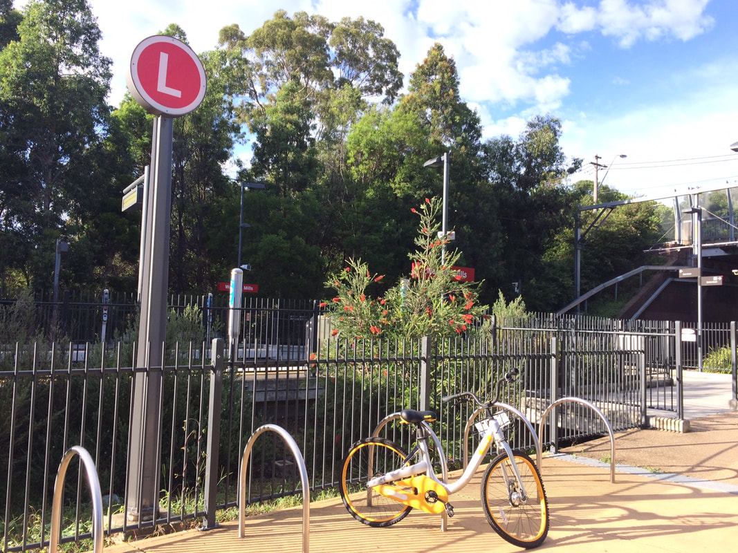
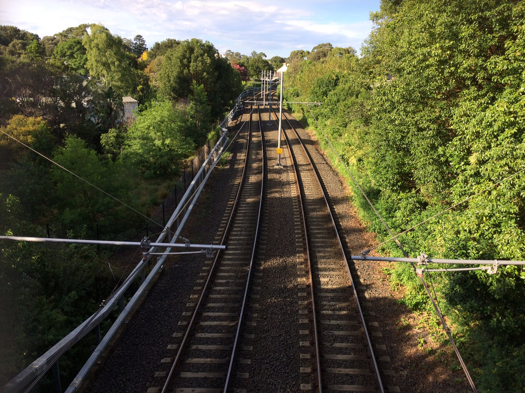
This is part of a unit of work for Changing Places - Australia's Urban Future. Lesson 1: Australia's Projected Population Growth Lesson 2: Implications for Future Growth and Sustainability Lesson 3: Sydenham to Bankstown Urban Renewal Precinct Lesson 4: WestConnex - Sydney, Sustainability and Transport Lesson 4: Sydney Sustainability and Transport (Teacher's Notes) Lesson 5: The GreenWay Lesson 5: Deindustrialisation Lesson 6: Create an infographic Lesson 7: Contributing to a Sustainable Urban Future Lesson 7: WestConnex - Protest Movements and Impacts Lesson 7: Conflict Over Dulwich Hill WestConnex Stage 1 (M4 East) Stage 1 of the WestConnex project involves the widening of the M4, a connection between Parramatta Road and the City West Link and new connections at Concord Road. A tunnel will run from the end of the current M4 to the City West Link. Ashfield and Haberfield A section of Ashfield along Parramatta Road was acquired and demolished for WestConnex. The exit to the M4 tunnel will be near the crossroads of Frederick St/ City West Link and Parramatta Road. A large sections of Haberfield has been acquired to allow the WestConnex to link directly with the City West Link. Stage 2 (New M5) Stage 2 of the WestConnex project involves the construction of a tunnel between St Peters and Kingsgrove. St Peters, Alexandria and Newtown A traffic interchange is under construction next to Sydney Park. This will feed traffic into Edgeware and Enmore Roads and King Street, Newtown. Campbell Street and Euston Road will be widened. Stage 3 (M4-M5 Link) Stage 3 will involve an underground tunnel from Victoria Rd, east of the Iron Cove Bridge to St Peters. Balmain and Rozelle While Stage 3 of WestConnex is being finalized , recent announcements suggested that the former Balmain Tigers Club on Victoria Rd at Rozelle, will be used as a dive site. Further details have not yet been released. For more detail about WestConnex view previous blog posts: Lesson 4: West Connex Update 1: Ashfield and Haberfield Lesson 4: WestConnex Update 2: St Peters, Alexandria, Newtown Lesson Activity: WestConnex and Sustainability Examine the WestConnex development from a range of different perspectives. Develop a criteria to assess the project for economic, social and environmental sustainability. Include maps showing where the WestConnex project is located and the changes to landuse along the corridor (for example, acquisitions and demolitions, new open spaces). What might you change to improve the economic, social and environmental sustainability of the project? Consider the following: - What is the overall cost of development (economic, social, environmental)? - What kind of Sydney do we really want? - Do the benefits to the city/commuters outweigh the costs to others? Light Rail Extension A key issue in sustainability is its car-dependence. Every improvement in public transport is a step towards improving Sydney's sustainability. The 2013 Inner West Light Rail Extension involved utilising former freight lines to extend light rail services from Lilyfield to Dulwich Hill. The light rail now extends from Lilyfield into the CBD, and commuters can also connect to the Inner West rail line at Summer Hill or Stanmore. The extension of the light rail line through the Inner West involved a 5.6 km line extension and the construction of stops at Leichhardt North, Hawthorne, Marion, Taverners Hill, Lewisham West, Waratah Mills, Arlington, Dulwich Grove and Dulwich Hill Interchange. Metroline The existing rail line between Sydenham to Bankstown will be converted to a Metro line. During construction the rail line will not be in operation. It is anticipated that once completed, it will reduce wait times and travel times to the city. However, the existing rail line allows commuters to connect with the existing CityRail network and travel to locations such as Chester Hill, Villawood, Cabramatta and Liverpool, without having to change trains. Commuters can then change trains to connect with the rest of the CityRail network. It is unclear at this stage how the Metro line will interact with the existing City Rail and light rail networks. Lesson Activity: Metroline Determine the advantages and disadvantages of replacing the existing train line with the Metroline.
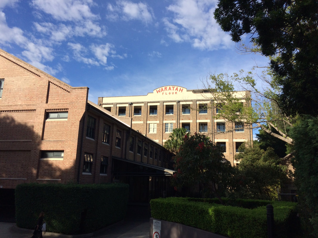
This is part of a unit of work for Changing Places - Australia's Urban Future. Lesson 1: Australia's Projected Population Growth Lesson 2: Implications for Future Growth and Sustainability Lesson 3: Sydenham to Bankstown Urban Renewal Precinct Lesson 4: WestConnex - Sydney, Sustainability and Transport Lesson 4: Sydney Sustainability and Transport (Teacher's Notes) Lesson 5: The GreenWay Lesson 5: Deindustrialisation Lesson 6: Create an infographic Lesson 7: Contributing to a Sustainable Urban Future Lesson 7: WestConnex - Protest Movements and Impacts Lesson 7: Conflict Over Dulwich Hill OR See the complete unit on the Changing Places website. Sydney’s Inner West is still experiencing deindustrialization as industrial land users continue to move further west. Zoning for high density residential developments has exacerbated the increase in land values of industrial properties in Inner West suburbs. As a result some of the last remnants of the suburbs’ blue collar, industrial working class history are being redeveloped. Old waterfront industrial sites such as Rozelle Bay and White Bay have already been rezoned as part of the Bays Precinct urban renewal initiative. Recent rezoning for high density residential housing in suburbs such as Marrickville and Dulwich Hill will see a decline in small industries in coming years.
Fieldwork: Visit Marrickville, and take photographs that show evidence of change occurring. Examine the main street, Marrickville rd. Conduct an environmental survey on the main street. Conduct a landuse survey of Marrickville. Use an outline map of the suburb, and shade in different colours to represent different landuses (yellow – low density residential, brown – high density residential, red – commercial, grey - industrial, blue – public facilities/institutions, green – recreation). Compare your landuse survey to the proposed plans for Marrickville and describe the landuse changes that will take place. Lesson Activity: Deindustrialisation Choose one suburb that will be changed by the Planned Precincts. Create a digital map that shows the existing density of the suburb, and another map which shows the proposed density of the suburb. Use Google Maps to help you create your map. Use flowcharts and mind maps to visually represent the changes that are occurring in Sydney’s Inner West. You may choose to group your ideas around specific suburbs or developments.
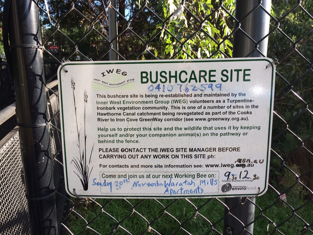
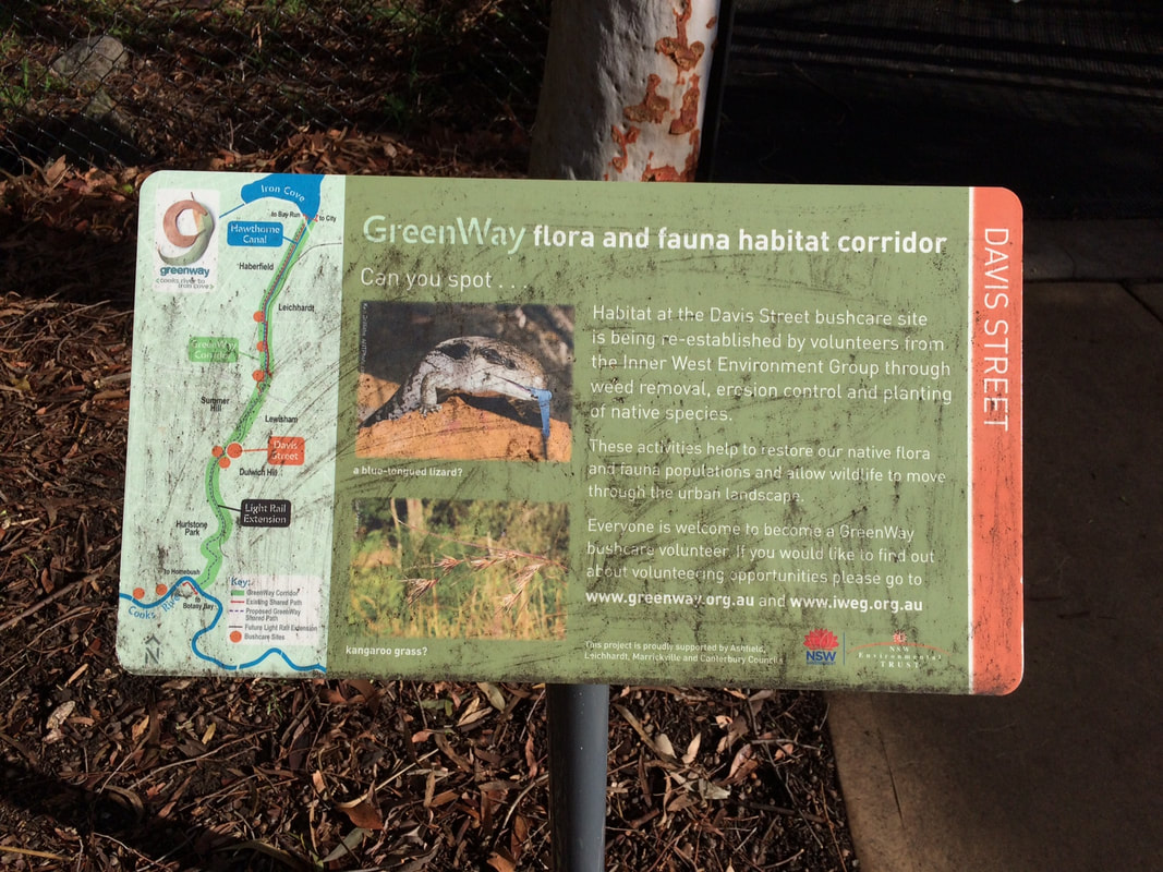
This is part of a unit of work for Changing Places - Australia's Urban Future. Lesson 1: Australia's Projected Population Growth Lesson 2: Implications for Future Growth and Sustainability Lesson 3: Sydenham to Bankstown Urban Renewal Precinct Lesson 4: WestConnex - Sydney, Sustainability and Transport Lesson 4: Sydney Sustainability and Transport (Teacher's Notes) Lesson 5: The GreenWay Lesson 5: Deindustrialisation Lesson 6: Create an infographic Lesson 7: Contributing to a Sustainable Urban Future Lesson 7: WestConnex - Protest Movements and Impacts Lesson 7: Conflict Over Dulwich Hill OR See the complete unit on the Changing Places website. Community groups lobbied for the continuation of a Greenway Trail along the light rail corridor to link up with the Cooks River cycleway. The Cooks River to Iron Cove GreenWay is a green corridor following the route of the Rozelle to Dulwich Hill light rail line. It is shared pedestrian and cyleway that links the Cooks River Cycleway and the Iron Cove BayRun. The combination of both light rail and the Greenway encourages public transport use and cycling/walking both for recreation and commuting, reducing some of the car dependence in this part of Sydney. In addition to providing opportunities for residents to choose cycling and walking as an alternative to car travel, it also provides a habitat corridor, linking several bushcare sites in the Inner West. 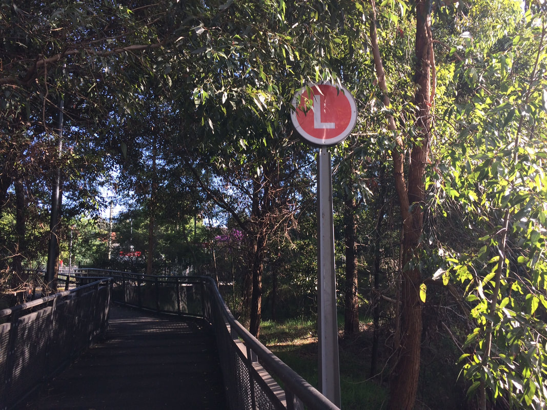 Fieldwork: Visit a site along the GreenWay. Walk along the greenway and choose 3 separate locations to complete an environmental survey. Compare the results of the 3 surveys. Explain how the Greenway contributes to the sustainability of the Inner West.
This is part of a unit of work for Changing Places - Australia's Urban Future. Lesson 1: Australia's Projected Population Growth Lesson 2: Implications for Future Growth and Sustainability Lesson 3: Sydenham to Bankstown Urban Renewal Precinct Lesson 4: WestConnex - Sydney, Sustainability and Transport Lesson 4: Sydney Sustainability and Transport (Teacher's Notes) Lesson 5: The GreenWay Lesson 5: Deindustrialisation Lesson 6: Create an infographic Lesson 7: Contributing to a Sustainable Urban Future Lesson 7: WestConnex - Protest Movements and Impacts Lesson 7: Conflict Over Dulwich Hill OR See the complete unit on the Changing Places website. Social Movements Social movements can provide residents of a community with a means of influencing their local environment. They provide a way for residents to communicate opinions on planning and other matters to the formal planning structures and organisations, and to intervene in the formal political system. Activities of social movements can include letter-writing campaigns, protest meetings, and media campaigns. Social movements can be important agents of urban change and can empower local communities. An example of a social movement is the urban cycling movement which aims to reduce car dependence and improve sustainability of transport, increase safety on roads for cyclists and encourage a collective increase in personal health and wellbeing through exercise. 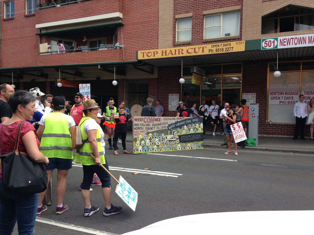 Resident Action Groups Resident Action Groups are a form of social movement at a smaller scale, and usually involve issues of a short term nature. RAGs often tend to be localized and single-focused. Although these groups are usually designed to force significant changes in society as a whole, they can at times bring about change at a smaller scale. Unlike social movements more generally, RAGs are more obviously limited and can be interpreted as having NIMBY (not in my backyard) motives. Recent transport infrastructure development and proposals for high density throughout the Inner West of Sydney have created an increase in the number of RAGs and concentrated the patterns of RAGs around development sites. There are currently a large number of Resident Action Groups in the Inner West of Sydney protesting and lobbying against WestConnex and increased development. Examples include Rozelle Against WestConnex, Save Dully, and Newtown WestConnex Action Group. Rozelle Against WestConnex The Rozelle Against WestConnex group lobbies against WestConnex in general, but more specifically the Rozelle Interchange in the vicinity of the Rozelle Goods Yard, as well as the tunnels running below Denison and Darling Streets. This will involve acquisition and demolition of homes and businesses and creation of 12-metre high, unfiltered smoke stacks. Save Dully The Save Dulwich Hill Community Group promotes issues related to the redevelopment of the suburbs and lobbies the government to preserve the heritage of suburb. Visit the Save Dully website to read more about their actions. Dulwich Hill experienced growth in the late 1800s following the introduction of the tram line, and as a result contains buildings with heritage architecture, particularly Federation architecture. The Sydenham to Bankstown Urban Renewal Strategy, encompasses the suburb of Dulwich Hill, rezoning for higher density and redevelopment of older buildings. Save Dully is lobbying to ensure that the historic and diverse nature of Dulwich Hill is preserved. Newtown WestConnex Action Group The M4-M5 link tunnels will run underneath Newtown. Many Newtown business owners have begun protesting the development, worried that congestion and bottlenecks will negatively impact retail businesses, or alternatively that clearways along King St will kill business. The Newtown WestConnex Action Group has been formed. In Alexandria a new bridge is being constructed over the canal to allow movement of traffic from the St Peters interchange. Lesson Idea: Individual and community action Examine the ways that individuals and communities have contributed to the political process and discussions about the WestConnex project. Write a paragraph about 5 actions taken by individuals and communities. Do you think these have been effective? Do you think these actions are justified? What other actions could individuals or communities take? Examine a video of a council meeting about West Connex (try a simple search on Youtube). Consider how the different groups and individuals perceive how WestConnex impacts their community and/or environment. Choose a persona from one of the following: local resident, local councilor, construction worker, urban planner. Write a series of tweets that you might compose to tell your feelings and opinions about the issue. Take photographs of a site that will be or has been affected by WestConnex. You may use Google Street View if you are not close by to a relevant site. Annotate the photographs showing how features of the environment have changed or will change as a result of the WestConnex development. Assess how the changes to the site will impact on its environmental quality. Obtain aerial photographs of the Inner West of Sydney (these may be screen shots from Google Maps). Visually represent the changes that are taking place in the area. Annotate the aerial photographs showing locations affected by Planned Precincts, WestConnex and the Metroline. Include detail about the types of changes that are going to take place. Fieldwork: Questionnaire
Conduct a questionnaire on residents that live in the Inner West of Sydney. Design 8-10 questions to ask. Some examples:
|
|||||||||||||||||