|
Examine the Urban Observatory website.
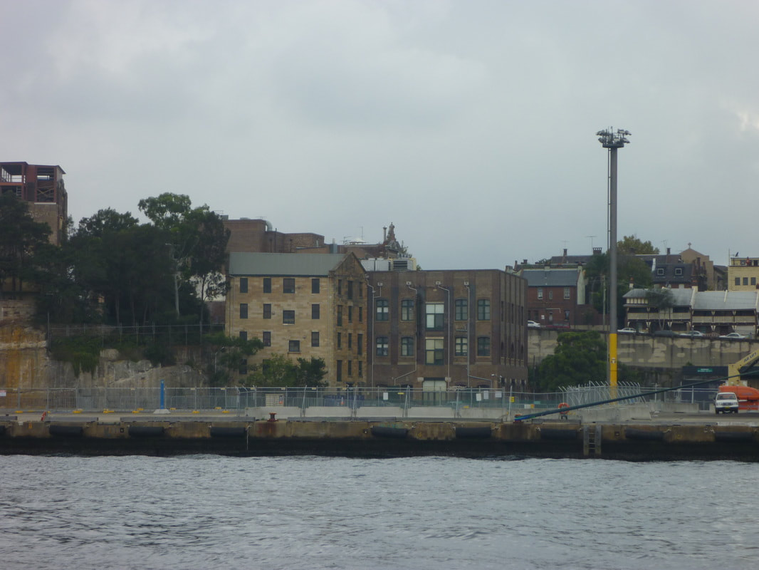
Compare London, Tokyo and New York. Compare different aspects of these cities by choosing different themes from the left hand menu. Population Density and housing density: Describe the population and housing density of London. Where are the densest areas? Are particularly dense areas in a particular part of the city?How is the density spread out across the city - does it spread out radially? is it north/south, etc. How do these results compare with New York and Tokyo? How would you account for the differences? Work - Commercial and Industrial: Describe where the commercial areas of the city are located. Where are the industrial areas located? How does this compare to New York and Tokyo? Account for the differences. Movement - Road speed, traffic and airports: How would you compare the road speeds and traffic evident between the three cities? Why would this be the case? How would it impact on the way the city functions? What information can we gather about the importance of the airports in New York and London? Account for the difference in flight numbers between the two cities.
0 Comments
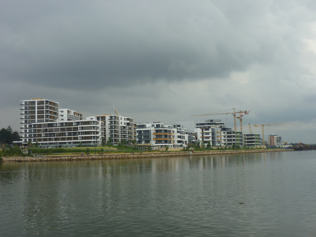
Your task is to create a presentation for your class which explains how one land use (residential, commercial or industrial) has changed over time. You must discuss each of the following: economic character, nature and location. Your presentation must include:
- statistics which support your key points - at least two maps (to show change over time) - an article which supports what you are stating You must prepare and distribute a two page handout. Your presentation should go for 8-10 minutes and should include a range of simulus (visual aids, etc). Articles: Paying huge Sydney prices for tiny places. Read more... 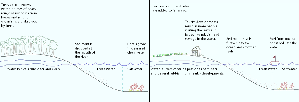 Population pressure
Increased population pressures on mainland North Queensland have resulted in increased levels of pollution and physical activities related to tourism on the reef area. Tourism The outstanding beauty of the reef attracts millions of tourists each year. The pressure placed on the reef as a result of tourism includes developments on the shoreline (and associated sewage, rubbish) increase boating activity (including oil spills, coral breakage as a result of boat propellers), and tourist activities (breaking corals while snorkelling, walking on reefs, accessing sensitive areas). Agriculture (particularly Sugar cane farming) Agriculture, especially sugar cane farming on the mainland, has resulted in increased sediment and fertiliser run-off from cane farms. In recent years, a downturn in global prices for sugar cane has resulted in farmers using greater amounts of chemicals. These chemicals run off into coastal streams and result in algal blooms and eutrophication in some areas of fringing coral near the mainland. Sugar cane farmers apply fertilisers containing Nitrogen (N) and Phosphorous (P). Many put on extra fertiliser in case of heavy rain (so it is not all washed away). The introduction of bananas as a crop in the area further increased the use of fertilisers. Of all fertilisers applied, only a third is absorbed by the crops. The rest is either evaporated, enters groundwater or runs off into nearby rivers or canals. Sugar cane crops need water to be drained away quickly. If the crops are left in water the roots will rot. As a result canals were built to drain water away quickly from the crops in case of heavy rain. These canals, or drains, reverse the cycle of how wetlands are meant to function. Rather than regulate and slow the flow of water, the water is quickly moved away from the site and into main river systems. The water rushes off the land carry fertiliser, soil, pesticides, etc. Actually pinpointing the sources of sediment is difficult, but it is believed that most is coming from land which has been tilled and let lie fallow. Sediment is also coming from bank erosion. Since European settlement erosion has accelerated due to clearing of land (less tree to stabilise soil). Due to erosion the river can erode into paddocks. There is believed to be four times more sediment reaching the coast than prior to European settlement, and in some places it is closer to 40 times. Fishing Recreational and commercial fishing have had major impacts on the reef. Commercial prawn fishing accounts of a large proportion of Queensland's Fisheries output. Approximately 6 million kgs of prawns area harvested in a good year. Recreational fishing in the General Use zones of the Great Barrier Reef Marine Park (GBRMP) accounts for 75% of the fin fish taken from the reef each year. Commercial fishing includes fishing for crayfish, finfish, reef fish, barramundi and tuna. An examination of one net which washed ashore showed it contained 14 turtles, a shark and a dugong. Gamefishing has long been an important industry in North Queensland. Pisciculture is a trend involving raising fish in fish farms (e.g. tiger prawns and barrmundi). Dredging Dredging is removing sediment from the bottom of a river bed, harbour, etc and placing it elsewhere. Links: Abbot Point: Dredging dumping permitted within Great Barrier Reef waters Abbot Point approval: Tour operators disappointed by Great Barrier Reef dredge spoil decision Approval of Galilee mega mine leaves Reef strategy in tatters. Landuse impacts on Great Barrier Reef water quality and ecosystem condition Dredging set to swamp decades of Great Barrier Reef protection WWF - Queensland resources sector needs leadership Management of the Coral Triangle Government Collaboration The six nations of the Coral Triangle came together in 2009 to form the Coral Triangle Initiative on Coral Reefs, Fisheries and Food Security. The countries use national coordinating committees, learning networks, regional exchanges, capacity building workshops to come together to share their knowledge and expertise. The Coral Triangle Support Partnership (CTSP) is an initiative run in collaboration with WWF, The Nature Conservancy, Conservation International and USAid, among other groups. It is a 5 year, $32 million program designed to support the governments of Indonesia, Malaysia, Papua New Guinea, Philippines,mSolomon Islands and Timor-Leste. The initiative is aimed at addressing over-fishing, destructive fishing practices, pollution and climate change. CTSP assists in setting up and managing Marine Protected Areas, to conserve reefs and fish, protect shorelines, improve fisheries catches for locals, and enhance quality of life for communities. Each of the six nations has a National plan of Action which is aligned with the Regional Plan of Action set out by the CTI. Sustainable fishing Fishing practices are regulated, management practices align with stock distribution, spawning areas and migration routes are monitored and regulated. Malaysia - 5.5 million hectares of marine ecosystems under protection. - Training of wildlife wardens to manage coastal resources - Stopped issuing permits for export of endangered humphead wrasse, and buy back systems to buy out the species from fish farms. - Maliangian Handicraft Workshop - provide alternative lifestyle options to fishing. Papua New Guinea - Empower local communities and their traditional laws - Workshops, field trips, training - Locally Managed Marine Areas - Manus Environmental Communities Network - share best practice with communities - Milne Bay - fishermen trained and engaged in environmental monitoring, find raising and reporting. - Mahonia Na Dari Research and Conservation Centre - The Mahonia Na Dari Research and - Conservation Centre is a non-government organisation that develops marine environmental conservation education for children and local communities around Kimbe Bay, Papua New Guinea. Solomon Islands - Volunteer rangers in Western Provincetown monitor and tag turtle populations using their skills in water acrobatics and free diving. - Development of Best Practice Guidelines - Building the capacity of local groups such as the Gizo Marine Conservation Area Management Committee and the Tetepare Descendants Association - Tetepare Island - ecotourism, local rangers, gather data, patrol the island, monitor harvesting and confiscate illegal catches. Philippines - 20,000 hectares of Marine Protected Areas. - Government to map and plan ways to increase fish numbers for the future. - Mangrove planting projects Timor-Leste - Establishment of Niño Konis Santana National Park - Community awareness -workshops, film screenings, hands-on training, - Surveys of coastlines WWF Infographic - Marine protected areas in the Coral Triangle A map showing the Marine Protected Areas (MPAs), Coral Triangle boundaries, value of fisheries, subsidies paid to commercial fisheries, and funding required to support MPAs. See more... New hope for fisheries development in the Pacific. Financing marine protected areas. Coral Triangle Center Protecting marine turtles in the Indo-Pacific. Building a sustainable live reef food fish trade Promoting sustainable tuna fisheries in the Coral Triangle Tackling fisheries bycatch Effectiveness Malaysia - Traders continued to keep wrasse in "grow out" cages Papua New Guinea- difficult to coordinate as there are diverse systems of traditional law. Solomon Islands - geographical spread- managed by local communities. Lack of technical skills, scientific data, and resources such as equipment and fuel can hinder management. Complex clan structures and customary land ownership. Philippines - vulnerable communities Timor-Leste -limited information of reefs make it difficult for planning and decision-making. Something's fishy Legal and Policy gaps in the management of the live reef food fish trade in the Coral Triangle.
Location
Human impacts
Below is an infographic embedded that explores the destruction and overfishing of reefs of the Philippines 
From Visually. WWF has created an Infographic exploring seafood caught in the Coral Triangle. It incorporates a map showing the value of the tuna industry and live reef food fish industry, as well as levels of over fishing in the region. See the infographic... Links to explore human impacts on the Coral Triangle: Coastal development destroying reefs off Phuket An overview of shark utilisation in the Coral Triangle region. Problems in the Coral Triangle Climate change, reefs and the Coral Triangle
Links:
Coral Triangle facts WWF - Coral Triangle Coral Triangle Initiative Fishing for a fair deal in the Pacific and why the EU must change their game. Click to view a range of article on the Coral Triangle from the Guardian. WWF Infographic - Turtles in the Coral TriangleAn infographic showing the life cycle of turtles, threats to turtles, statistics on survival rates, and protection statuses of different species. See more... 
From Visually.
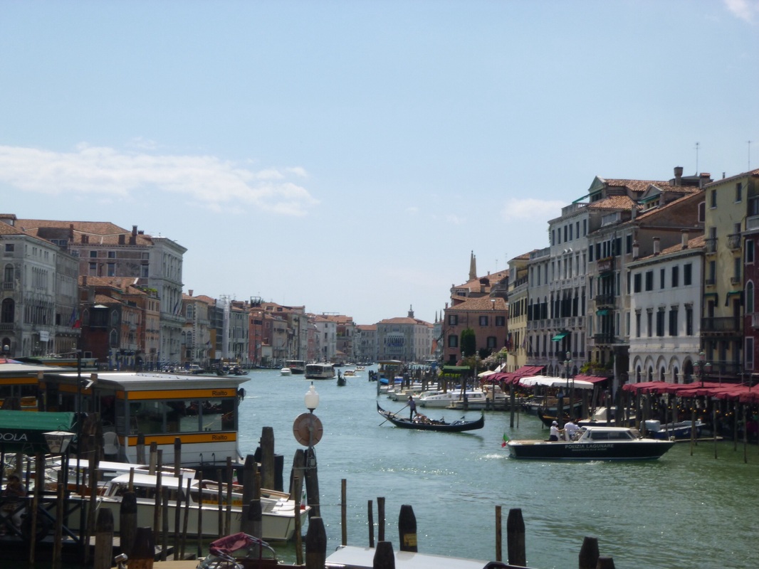
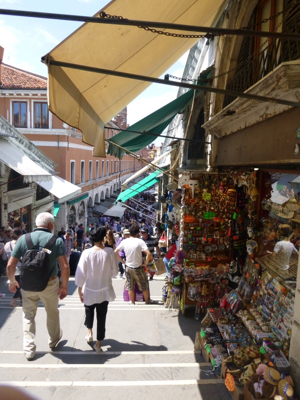
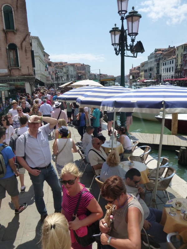
For more resources to support 12 Geography - People and Economic Activity (Tourism), see the Economic Activity site.
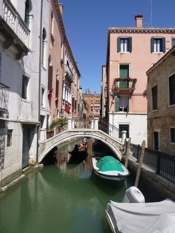
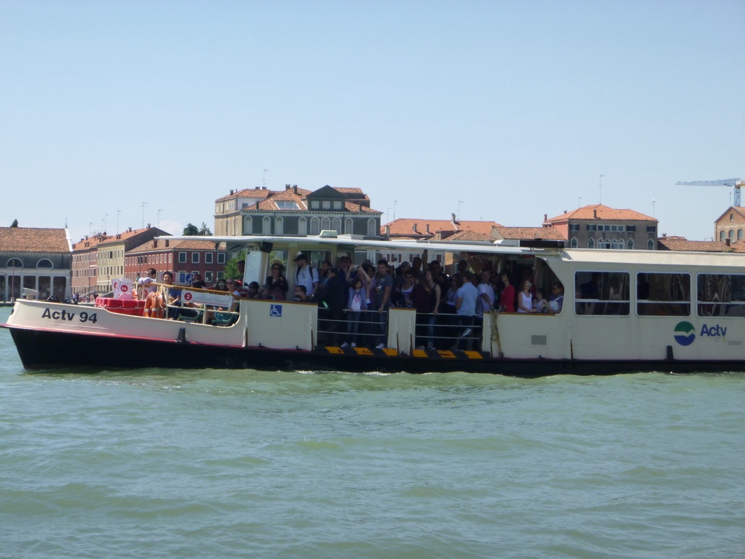
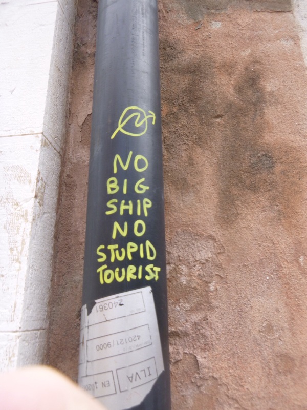
Edit: An update for this topic has been posted in a new post Tourism - Are we loving Venice to death? Part 2. In teaching, you don't have time to do everything and know everything you need to. That is why it is imperative that you make use of other teachers' knowledge. A Professional Learning Network will allow you to get the most up-to-date resources, best advice and time saving tips. I am currently faculty where only one or two of us use social networking for education purposes. Most of faculty don't really use it at all. This post is really for people who are in this category. If you found this post through twitter or Facebook or the like, then you aren't going to learn anything new here. People you already know I have always found it amazing that some people in a faculty or school will share everything while others will share nothing. My theory is that if you want to encourage other people to share then you need to show them how it is done. Start with your faculty and any teachers you already know - share your email address and ensure that you swap resources regularly. Once you start emailing copies of some of your handouts, programs, etc other teachers will start doing the same. For older staff introduce them to shared drives, cloud storage or whatever will work to get them sharing. Keep in mind that some people may not share because the technological side of things is too daunting. Make it easy for them and try not to get frustrated - otherwise you may miss out on a great resource. Professional Associations Join groups like GTANSW, EBE, WESSSTA and MESSTA. Each group will have strengths and weaknesses and may focus more heavily on one subject or specific year groups. The more memberships you have the greater your exposure to all of this information. Also the more you get involved the more you can influence these groups to provide anything that you think is missing. Click on the titles below to find out more about each association: Geography Teachers Association of NSW History Teachers Association of NSW Western Sydney Social Science Teachers Association Inc Legal Studies Association of NSW Inc Economic and Business Educators Social Networking Social networking, particularly twitter is a great way to connect with other teachers locally and from around the world. You can use social networking to connect with specialists in your field. For example, if you are a History teacher you might subscribe or follow @archaeologynews and get the most recent updates about excavations around the world. You might also find it useful to subscribe or follow general blogs or tweets about teaching in general. DEC and TAFE staff can use Maang/Yammer, but I think most educators prefer Twitter. There are also a range of Facebook groups for teachers of certain subjects. A particularly active group is Geography Teachers Online, but there are many others. Don't forget to use tools like Skype and Google hangouts to connect with people and share ideas. Corporate feeds Subscribe to corporate feeds from the DEC and BOSTES. You can do this using your email, Twitter, Facebook or a range of other social networking sites. You can also subscribe to organisations related to your specific subject such as WWF or Greenpeace. Unions You should also have a good knowledge of your rights and responsibilities. You can do this by staying up to date with union news through email subscriptions, the regular hard-copy publications and meetings at your school and within your region. When you first begin your career it can seem expensive to be part of the union, but it is important that you make yourself aware of what it offers. You should also download a copy of the most recent Award as this sets out core hours you need to be on the premises, breaks that you are entitled to, behaviours that are acceptable, etc. For the NSW Teachers Federation (DEC schools) visit the website: http://www.nswtf.org.au/ For the Independent Education Union for NSW/ACT (non-DEC schools) visit their website: http://www.ieu.asn.au The most important point in all of this is to share your ideas and be open to the ideas of others.
I was lucky enough to attend the first ever TM Geography a couple of weeks ago. The teachmeet was held at Saint Ignatius' College on Monday 5 and was hosted by Jessica Lonard. Using infographics in assessment Jessica Lonard, our host, began the presentations with a presentation on how to use infographics in assessment of student learning. The room was decorated with examples of her students' work. There are a range of programs that can be used to create these infographics. One of the easiest is Picktochart. Other programs include Infogr.am, visual.ly, and easel.ly. For further information you might like to check out 10 free tools for creating infographics. Spotlight - ABS Sharon McLean presented a session on Spotlight from the Australian Bureau of Statistics which I have discussed in a previous blog: Australia's Population. This program brings population statistics about Australia to life by presenting them in a fun interactive voiced by Shaun Micallef. Flipping the geography classroom Ryan Gill presented a session about the challenges and successes of flipping his classroom including creating the videos, winning over parents and keeping students engaged. Flipping the classroom is a strategy where students are exposed to new material outside of the classroom through the use of videos, readings, etc and then class time is used to consolidate the new learning through activities such as discussions, problem solving and debates. Google Tour builder Mick Law from Contour Education showed us the latest and greatest mapping tools, concentrating mainly on the new Google Tour Builder. This seems to be a much simpler way to create a virtual tour than through Google Earth.  Nearpod Kate Corcoran showed us how she uses Nearpod in her classroom. Nearpod is a program that allows you to set up interactive quizzes and surveys and enables sharing between groups. Students log into a group and can access the resources that the teacher has made available to them on their devices. The teacher can control the students' screen while they are part of the group.  Thinglink Thinglink is a site which enables you to create interactive images. Di Laycock showed us how you can add comments, images, videos and music to create a multimedia experience from a still image.  Creating virtual field sites I went through the process of creating a virtual field site to give students access to field sites which they would not otherwise be able to experience. This is done by combining videos, photos, google tours, and links to articles all combined with the use of a blog site or website builder like weebly. Twitter: #tmgeography   What is sustainability? Sustainability is development which meets the needs of the present population without endangering the capacity of future generation to meet their needs. It incorporates three main principles: economic development, environment protection and social and cultural well-being. Each of these three principle is considered equally important, and act as a criteria to judge new development against. View sustainability infographic. Central Park, Ultimo Central Park is a development on the site of the old Kent Brewery at Ultimo. The development has been hailed as the next step in sustainable design. It has incorporated a grand-scale eco-design from its inception, includes vast areas of public space, is pedestrian friendly, and has retained some heritage elements. It has done all this while at the same time creating what will be a booming commercial and residential area in the heart of Australia's busiest city. Grand-scale Eco-design The design of several of the buildings incorporate huge vertical gardens designed by Patrick Blanc. Frames of growing plants are being constructed around the walls and roofs or the buildings. Eventually as they growing the gardens on the walls and roofs will grow into each other to cover the buildings. An issue associated with the creation of GRW is rhe need for water. It is important that they do not just create another burden on water. In Central Park they have installed a water recycling system to be used to water plants. Green roofs and walls - City of Sydney. Read more... Planting the town green. Read more... David Suzuki's vision for a sustainable city Parking spots make way for bus lanes. 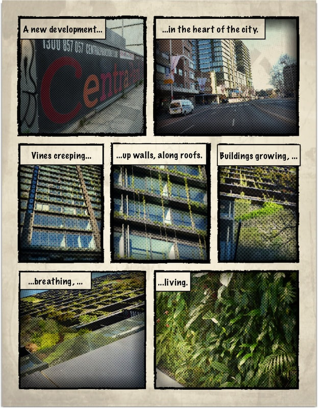 |