|
A range of spatial technologies have been used during and after the Australian Bushfires 2019-2020. Emergency Services have used apps to communicate with the public about the location of fires and the risk to the public. Members of the public have been able to refer to geospatial information about air quality and weather conditions, and following the fires, environmental groups have been able to use geospatial tools to communicate and coordinate locations of feeding and watering stations for wildlife.
MyFireWatch MyFireWatch is a collaboration between Edith Cowan University and Landgate and tracks bushfires. https://myfirewatch.landgate.wa.gov.au 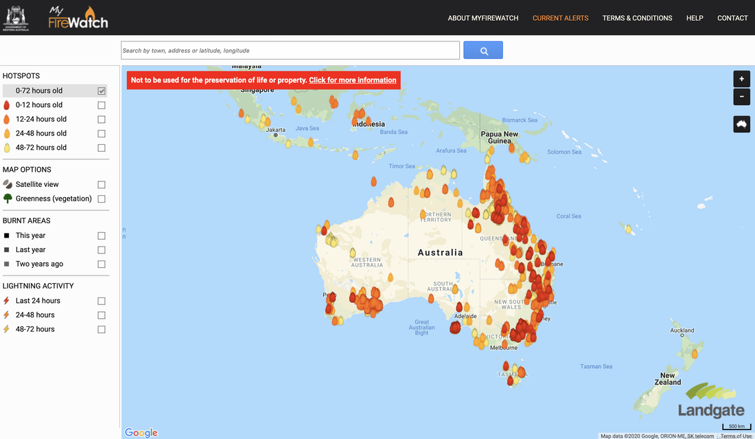 Current Bushfires Current Bushfires is the Queensland Government - Rural Fire Service website. https://www.ruralfire.qld.gov.au/map/Pages/default.aspx 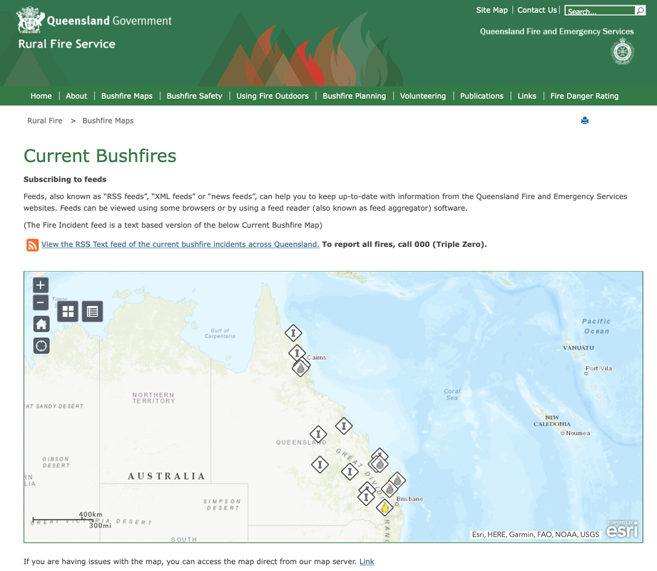 Air Quality Index Visual Map The Air Quality Index Visual Map uses Air Quality Monitoring stations to collect data about air quality and represent it spatially. Air Quality is categorised as Good, Moderate, Unhealthy for Sensitive Groups, Unhealthy, Very Unhealthy, Hazardous. http://aqicn.org/here/ 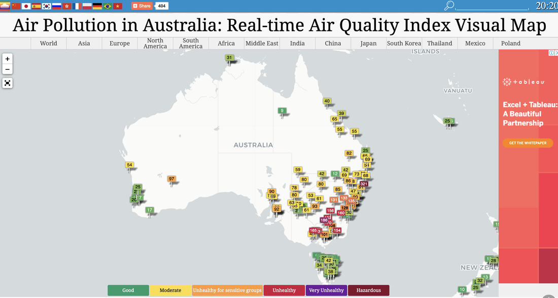 Bureau of Meteorology The Australian Bureau of Meteorology website provides up to date information about weather conditions that may impact on bushfires, such as temperature and wind. http://www.bom.gov.au/products/national_radar_sat.loop.shtml 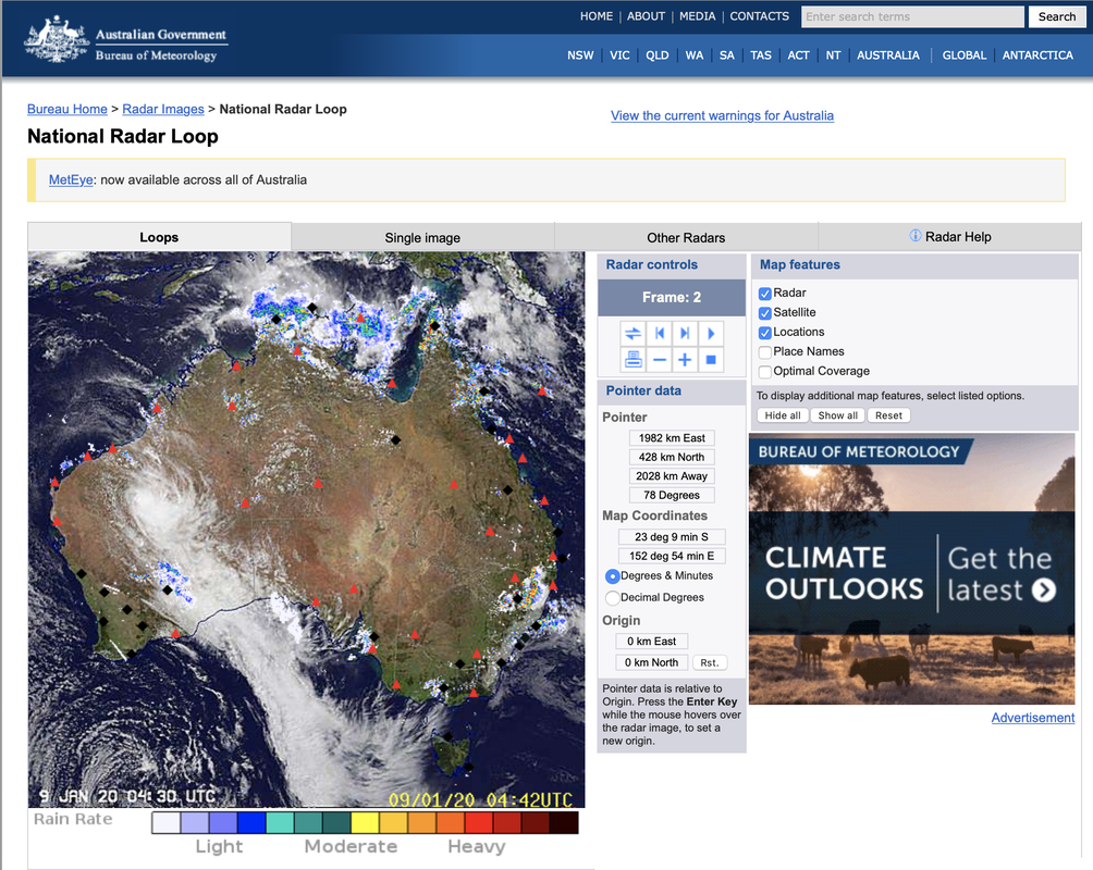 Water Our Wildlife CCWSAR Map The Central Coast Wildlife Search and Rescue created a google map to share information about feeding and watering stations to help surviving wildlife. This enables volunteers to independently visit sites for restocking. Water Our Wildlife CCWSAR Map 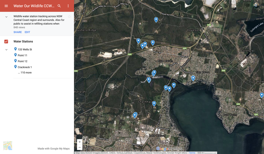
0 Comments
Your comment will be posted after it is approved.
Leave a Reply. |