0 Comments
A previous post written in 2014 described the impact that tourism was having on Venice. You can read this post here:
Tourism - Are we loving Venice to death? Part 1 The COVID-19 pandemic, and it's impact on global tourism since that post has resulted in a new range of impacts and an opportunity for reassessing the nature of tourism on the island. The pandemic has resulted in months of empty shops, restaurants and hotels. As Venice begins to open with some slight changes (more takeaways, outdoor dining, etc) a broader review of tourism on the island must be considered. The over tourism being experienced prior to the pandemic was pushing residents out due to rising house prices, grocery stores were being replaced with souvenir shops and accommodation was being replaced with Airbnbs. Large cruise ships were bringing in tourists who were only on Venice for day trips resulting in them rushing around to the see the main sights, congregating in concentrated areas, and economic benefits not being shared by the wider community. The pandemic has provided an opportunity for residents to reclaim the city, to try to make tourism more sustainable and diverse. Some of the suggestions being considered are limited access to attractions by introducing quotas and booking, and more regulation of tourist flows. Concerns have been raised regarding the development of a Canterbury Racecourse Masterplan by Canterbury-Bankstown Council, with claims that at this early stage of planning, successive steps have been put in place to limit consultation. The Council has recently held a Community Voice Panel, and is due to hold another on 24 March. Local residents had to apply to be part of this process and were required to address the following criteria:
Issues raised about the consultation process include: - late notification of acceptance onto the panel, - advertising one set of dates and then changing the session to other dates, - running the sessions remotely and simultaneously using multiple sources of technology making it difficult for some sections of community to participate (e.g. elderly residents) - leading conversations away from discussions about conservation - not consulting traditional owners or elders - requiring participants to sign a non-disclosure statement to attend one of the sessions. Residents are concerned that strategies in this round of consultation have effectively limited consultation, and tried to ensure that further communication about the process is limited to exclude anyone beyond the original group. The development of the Canterbury Racecourse Masterplan comes at a time when the moratorium on development of the racecourse has recently expired, the existing racecourse car park is likely to be decommissioned, heritage restrictions of Ashbury are being reviewed, former light industrial land on Milton street Ashbury has been demolished and rezoned for six-storey apartments, the intersection of Milton street and Georges River road is being upgraded, and the Sydenham to Bankstown Urban Renewal Corridor is being developed. There has already been recent, substantial high-rise housing development along Canterbury road, some of which breached the council’s own development controls at the time. For further information about Canterbury Park racecourse, refer to the following:
Canterbury Park racecourse - The Dictionary of Sydney Canterbury Racecourse - State Heritage Inventory Listing What is crisis teaching? Crisis teaching involves implementing a rapid change to lesson delivery methods to meet a short-term educational need in a time of crisis. As we head into Week 1 of Term 3, many students and teachers have been in some form of lockdown or isolation for around 4 weeks. The prospect of maintaining quality teaching and learning while looking after our own mental and physical health during the COVID pandemic is a challenge at best. Most schools have had to begin the process of teaching remotely for a fortnight prior to school holidays due to parents choosing to keep students at home. This unprecedented rush for remote learning has meant that schools have had to make decisions about how to quickly flip their teaching instruction to a new format, all at a time when most teachers are stressed and exhausted as a result of what's happening in the community and the world more broadly. 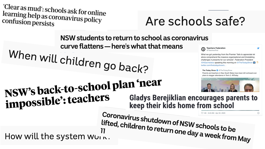 As we begin Term 3, we head into a fairly uncertain term with the prospect of a longer period of remote learning. Schools will make decisions about how to deliver remote learning - paper work booklets picked up or posted home, video conferencing sessions, online learning, one on one phone calls, or a combination. At this time it is a good opportunity to review some key principles of E-Learning for those schools who will deliver online learning.. 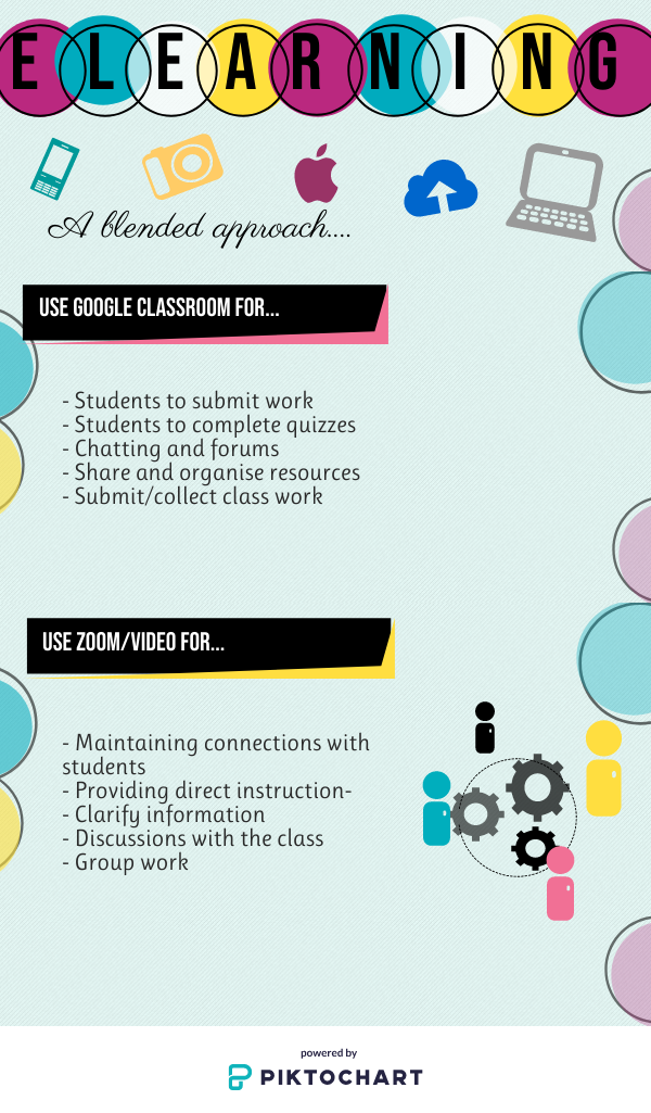 Hints and Tips for Online Learning Design for the long-term – It is likely that we will be teaching online for most of this term. When designing your resources, plan in such a way that you can reuse the items in coming years, rather than just for this experience. Use and reuse existing resources as much as possible. If you choose to prerecord sections of your lessons these could be useful in the long term - if the session provides overviews of concepts, skills or processes then you may choose to use them again, but if the prerecorded session is describing to students what activities you want them to complete, or include information that is specific to particular students or this particular time, then you are unlikely to use them again. Focus on engagement – While it is important to cover course content, ensure that your teaching allows for collaboration, social interaction, group and independent work. In doing so, you may choose to use a variety of technology tools and limit text based presentation/resources to improve engagement by using audio visual enhancement – images, graphics, video production. Overestimate timing – both the time to create online resources and the time for students to complete work online are likely to be longer than you initially anticipate. Be realistic about the time required for students to complete tasks and ensure that your expectations are appropriate and fair. Manage your time (and your students') - Find ways to manage your time effectively. This may include locking out time for online engagement – e.g. timetable, or locking out time for resource development. Use an online calendar as part of your teaching and learning – planning, scheduling posts, etc. If you receive a number of queries from students, consider using public posts to address issues in case other students are also considering asking the same thing. Save time by sharing resources with your colleagues, and using online resources rather than creating everything from scratch - websites, online journals, digital libraries, eBooks. Communicate clearly with students about what is required - Be clear about what work needs to be submitted, when, and how. Provide checklists for students – what is required to be finished each week? Provide overviews of structure and content. While the tone of communication in online platforms needs to be appropriate for teacher student interactions, it should be relatively personal and conversational so that it is easy to understand for students, encourages social interaction and is engaging. Digital organisation - set up systems for file management (both for the faculty/teacher and the students). It will be a lot easier if you can find what you need easily. Set up systems of folders, processes for submission to allow easier online marking. Ensure that you Google Classroom (or any other program) is easy to navigate and that students can easily find resources (e.g. you may choose to use (banners, menus, maps, inventories, clear directions). Learning and support - Provide opportunities for students to practice/rehearse skills, scaffold to support learning and assessment and incorporate peer feedback/assessment and self-assessment to edit. Online Learning Models Models of online or remote learning can provide a cycle or rhythm to follow or just a combination of different types of lesson delivery. Examples include combinations of : - direction instruction - collaborative learning - guided instruction, and - independent learning How does this differ from how you teach online? Do you like the model? what are the advantages and disadvantages of the model? Do you have a rhythm or routine in the way you do your lessons (e.g. one lesson direction instruction, one lesson group work, one lesson research....etc)? How might a model like this assist you when some students are at school and some students are at home? Residential areas
Stormwater pollution from urban areas Natural areas generally have the capacity to absorb large amounts of rainfall before runoff occurs. The absorbed water is retained as groundwater or drains into breeks and rivers over time, maintaining stream flow. When such areas area developed for residential and industrial uses, large areas previously able to absorb water are covered by impervious footpaths, roads and roofs. As runoff (stormwater) drains into the river system, it picks up a variety of pollutants and litter from urban areas. Sewerage system overflows Most water that enters our homes leaves as sewage, including effluent from flushing toilets and the water that goes down the drain from washing clothes, showering, preparing food, etc. Sewerage can include food scraps, oils, grease, paints, pesticides, solvents and preservatives. Sewerage is managed by Sydney Water. Sometimes sewers can overflow, and affect a number of freshwater creeks, particularly in the upper and central Georges River. The overflows can result in algal blooms, weed infestations, and fish kills. Impacts of developments Development along the shore of the river can cause a number of problems. Wave action on the foreshores of Botany Bay; and the threat to remnant vegetation along foreshore areas are significant. Sediment and erosion due to runoff from urban subdivisions are also a major problem. Recreation use Marine vessels discharge into the river and Botany Bay (including ballast water) and cause erosion on the banks. Jet skis and speed boats increase rates of erosion of river banks. Landfill areas There is inadequate management of leachate from existing and former landfill areas (rubbish dumps). Rural and agricultural use Runoff Agricultural runoff contains effluent from cattle and sheep, as well as any fertiliser or pesticides that have been used on the property. Traces of effluent contains high levels of nutrients such as phosphorous, and this can cause excessive growth of some aquatic weeds. Many native plants are not able to cope with the excess nutrients and are also killed. Pesticides can enter the food chain through bioaccumulation. The pesticides enter the waterway as runoff, are then absorbed by fish which are then eaten by other organisms. The poisons build up in larger animals causing death. Land clearing Land clearing destroys the habitat of native fauna and flora. The removal of vegetation exposes the soils to the actions of wind and water and makes it susceptible to erosion. Land clearing also reduces biodiversity. There are fewer species of plants, and as a result few species of animals will be attracted to the area. This can result in large scale pest infestations, and greater susceptibility to disease. Algal blooms Eutrophication can occur as a result of fertilisers in runoff. Blue-green algae (the common name given to several species of algae) can create scums on the surface of rivers. The toxins produced by the algae can be poisonous to humans and other animals. As it decomposes the algae uses oxygen which results in fish kills. Mining and Industrial Land use Industrial discharges In Botany Bay, the historic industrial discharges into the bay resulted in contamination of sediment on the bay floor. Industrial discharges can also result in fish kills, bioaccumulation or contamination of water and sediment. Mining induced subsidence Mining can result in the cracking of river beds, partial loss of surface flows, decline in water quality, release of gas reserves from underlying strata and increased rates of cliff-top collapse. Dredging Removing sand or other sediments from the floor of a bay or river can alter the river morphology (flow), and disturb floor dwelling aquatic species. Biodiversity (or biological diversity): The variety of all life forms, comprising genetic diversity within a species, species diversity and ecosystem diversity
Biota: all living things including micro-organisms, plant and animals. Blue-Green algae: Microscopic bacteria. Under certain conditions (including high nutrients, warm still water, strong sunlight into the water) they can bloom into a dense and visible growth and become toxic. Deoxygenated: With most or all oxygen removed. Water becomes deoxygenated (i.e. loses its dissolved oxygen) for a number of reasons including stagnation, eutrophication and rising temperatures. De-snagging: The removal of fallen and dead branches from a watercourse. Dissolved oxygen: Oxygen in the water (which may be used by aquatic animals) Environmental flows: Flows of water, that are either protected or created for an environmental purpose. Eutrophication: Excessive levels of aquatic plant growth (including algae) resulting from raised levels of nutrients and other factors. Extraction: Water taken from rivers for off-stream use or for consumption. Faecal coliform: A type of bacteria found in faecal material of humans and other mammals. Faecal coliforms themselves generally do not make people sick. High levels indicate that water is likely to contain other micro-organisms that make people sick. Indicator (e.g. water quality, biological, ecological): Any physical, chemical or biological characteristic used as a measure of environmental quality. Introduced species: Species of plants or animals that are not native to Australia (also referred to as exotic or alien species). Natural flow regime: The likely pattern of flow before European settlement in Australia. In these guidelines, natural flow regime refers to the flow patterns without any regulation or extraction of water. Nutrients: Nutritional substances. Unnaturally high levels of nutrients, such as in a river below a sewage treatment plant, can encourage abnormally fast and prolific growth of algae in the water, or weed growth in the bush. Pathogen: Disease-causing organism. Point-source pollution: A single, identifiable source of pollution, such as a drain from an industrial site or sewage treatment plant (as opposed to non point-source or diffuse-source pollution-coming from many small sources over a large area). Potable water: Water fit for human consumption. Raw water: Surface or groundwater that has received no treatment to make it suitable for drinking. Salinity: The concentration of salts in soil or water, including sodium chloride (NaCl). Suspended solids: The smaller, lighter material such as clay, silt and fine sand carried in suspension in water. Turbidity: A measure of the amount of the light-scattering properties of water. It indicates how much silt, algae and other material is suspended in water. Highly turbid waters may look muddy, stain clothes, block irrigation sprays and pipes or harm aquatic organisms. Where is the Georges River Catchment located? The Georges River catchment covers approximately 960 square kilometres and about 800,000 people live in the catchment. The Georges River rises south of Appin near Campbelltown and flows downstream for 96 kilometres to enter Botany Bay at Sans Souci. A substantial part of the catchment is bushland contained in Heathcote National Park, the Holsworthy Army Base and on private and Crown land. The upper catchment includes the upper reaches of the Woronora River and Dam and the Upper Georges River, O'Hares Creek and Prospect Reservoir. The lower catchment includes the urban areas of Campbelltown, Liverpool, Bankstown, Sutherland, Kogarah, Kurnell, Botany and areas around Botany Bay There is a range of fieldwork techniques that can be used in studying catchment functioning. Some of these fieldwork techniques which relate specifically to the river include: - water quality - measuring changes in channel shape - velocity - discharge - material carried in the stream - biodiversity survey. Below are links to videos from Georges Riverkeeper explaining some relevant types of fieldwork. Below are duplicate activities for four different locations. These are intended as a single site fieldwork activity that you could fit into a single or double period if your school is located within walking distance of one of the fieldwork sites: Orphan School Creek, Chipping Norton Lake, Salt Pan Creek or Woronora River.
The cartoons below have been embedded from the Sydney Morning Herald and the Daily Telegraph.
Cartoons are a form of visual representation of ideas, views and concepts. It is important that students develop skills in interpreting cartoons. Interpreting cartoons involves knowledge of the context of the cartoon, identifying different issues being explored in the cartoon, identifying the techniques used by the artist, and considering the views or opinions that the artist is trying to convey. Basics: - What is the cartoon about? - Who is represented in the cartoon? Why? Knowledge of the context: - What events have happened? - Look at the date of the cartoon. What events had happened at the time the cartoon had been drawn? - Who are the key people/roles involved in the event/issue? Identifying issues explored: - What can you see in the cartoon? What words are used? - What concepts are being explored? Techniques: - Has the artist used symbolism, irony, analogy or exaggeration in communicating? - Is the cartoon persuasive? Views and opinions: - Can you identify the political views or perspective of the artist? - How are these views or perspective communicated? - What other opinions are there about this issue?
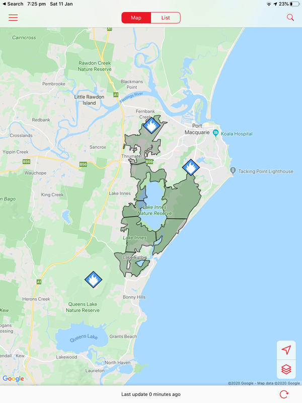
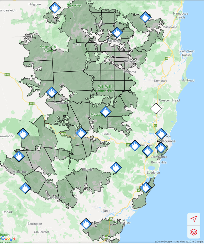
Fires around Port Macquarie, Lake Cathie and Lake Innes began in November 2019. As of 21 January the Crestwood Drive, Port Macquarie fire had burnt out 3572ha, while the connected Lindfield Park rd, Port Macquarie fire had burnt out 859ha.
The Lake Innes Nature Reserve was home to a flourishing koala colony. Between 350 and 600 koalas are believed to have died in the fires around the Lake Innes area. The image on the left is a screenshot of the RFS Fires Near Me app showing the location and extent of the Port Macquarie fires. The screenshot on the right shows the size of the Port Macquarie fires in relation to other fires in the mid-North Coast region.
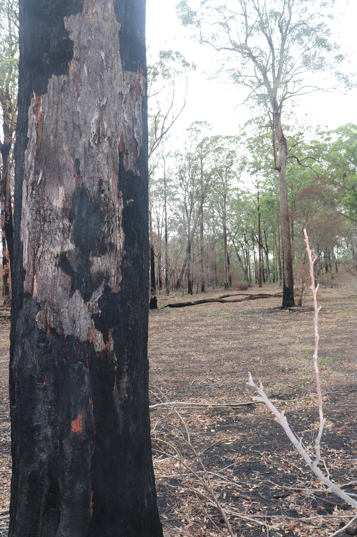
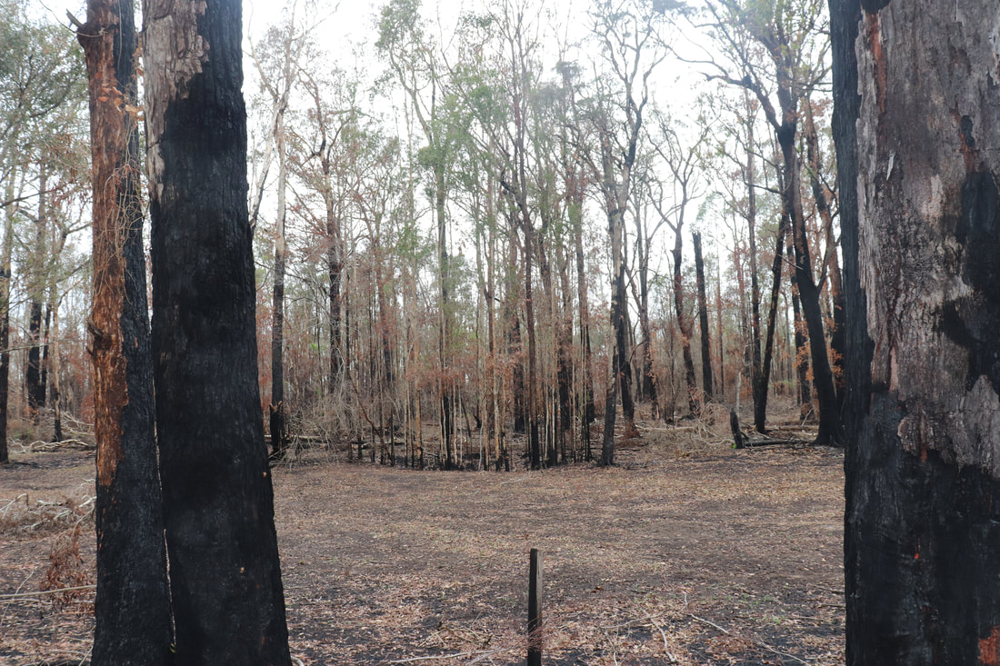
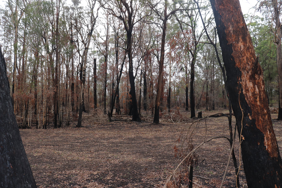
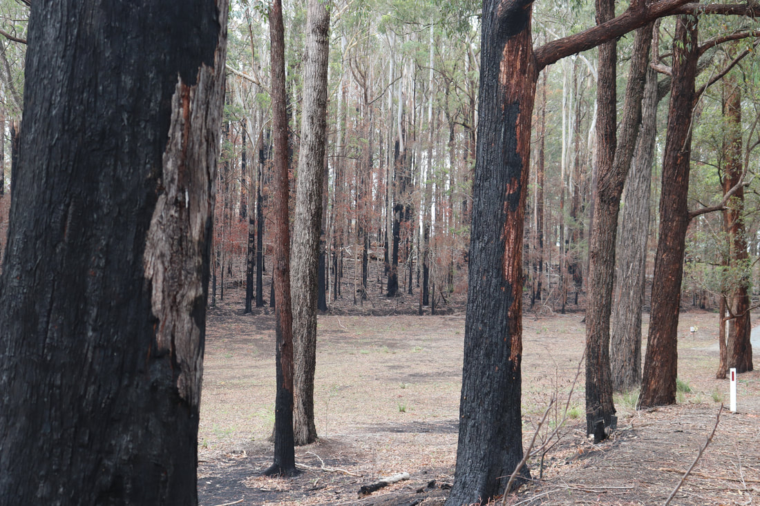
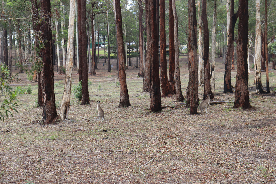
Photos below show the aftermath of the fire - taken on 17 January, 2020.
The post below from NSW National Parks and Wildlife Services indicate that while the fire around Lake Innes was extinguished, there remains risk for future fires flaring even several months later. The post below was posted on January 21.
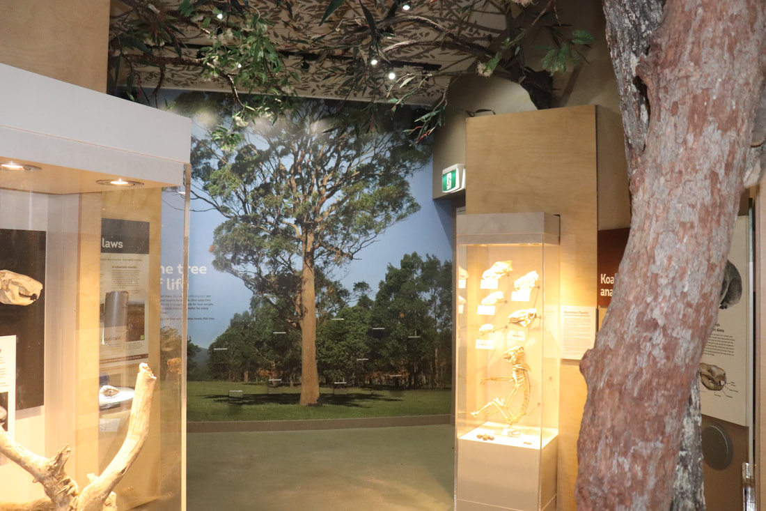
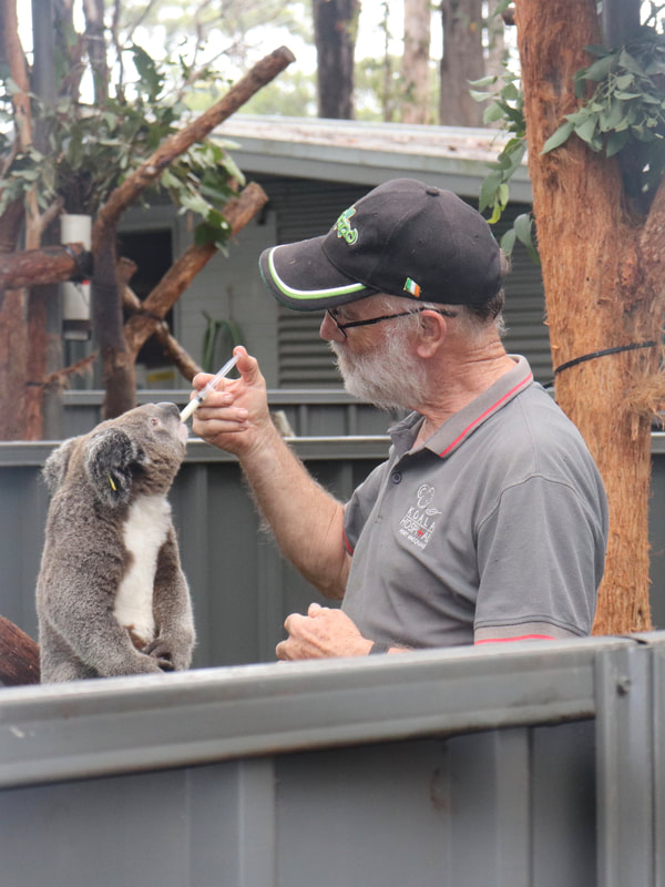
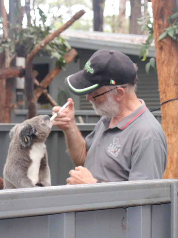
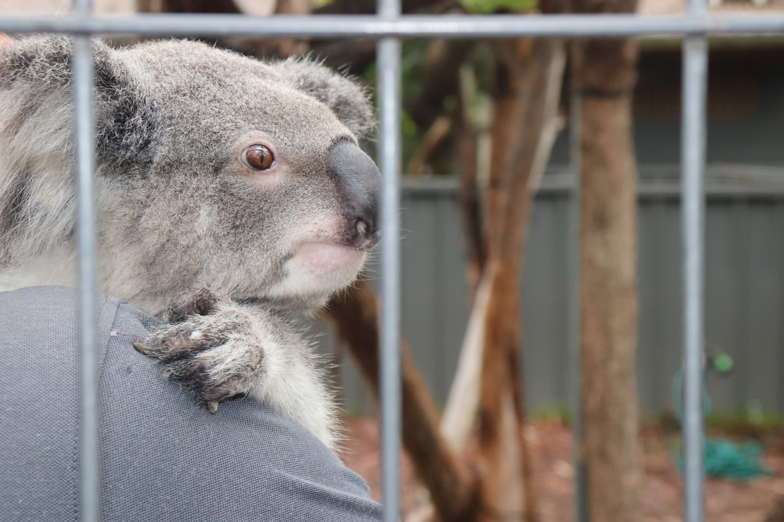
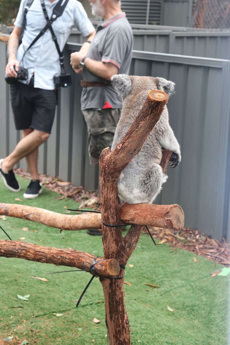
Port Macquarie Koala Hospital
Following the fire a number of injured koalas required intensive care. The Port Macquarie Koala Hospital was inundated 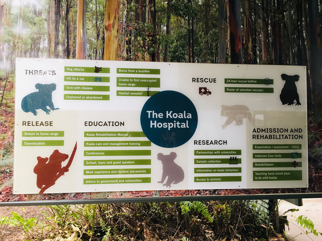
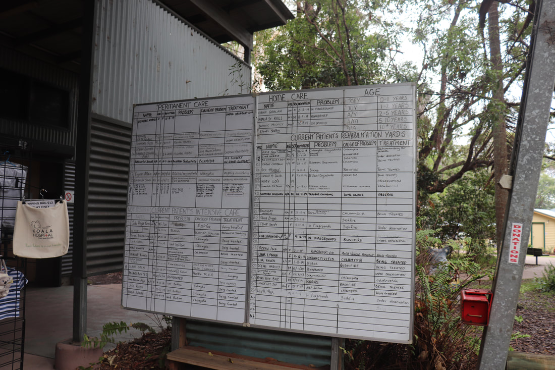
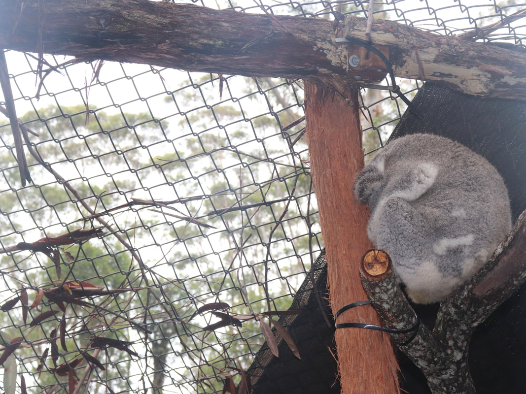
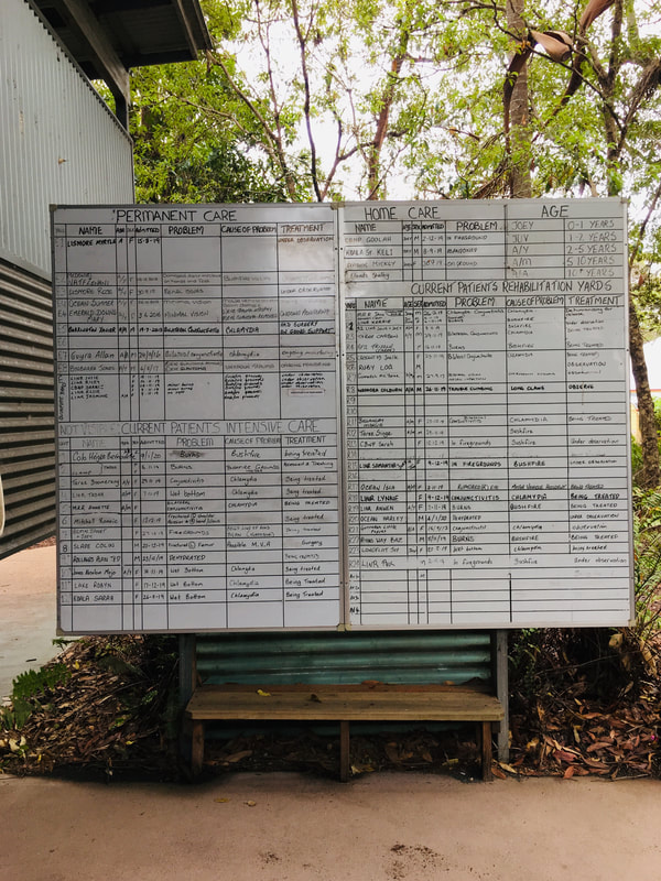
The Port Macquarie Koala Hospital has a large number of koalas in care. The least injured/ill koalas are available for public viewing, while those most injured are screened from public viewing for their own wellbeing. Below is an example of the management of koalas, their injury/illness and treatment.
Go Fund Me Campaign
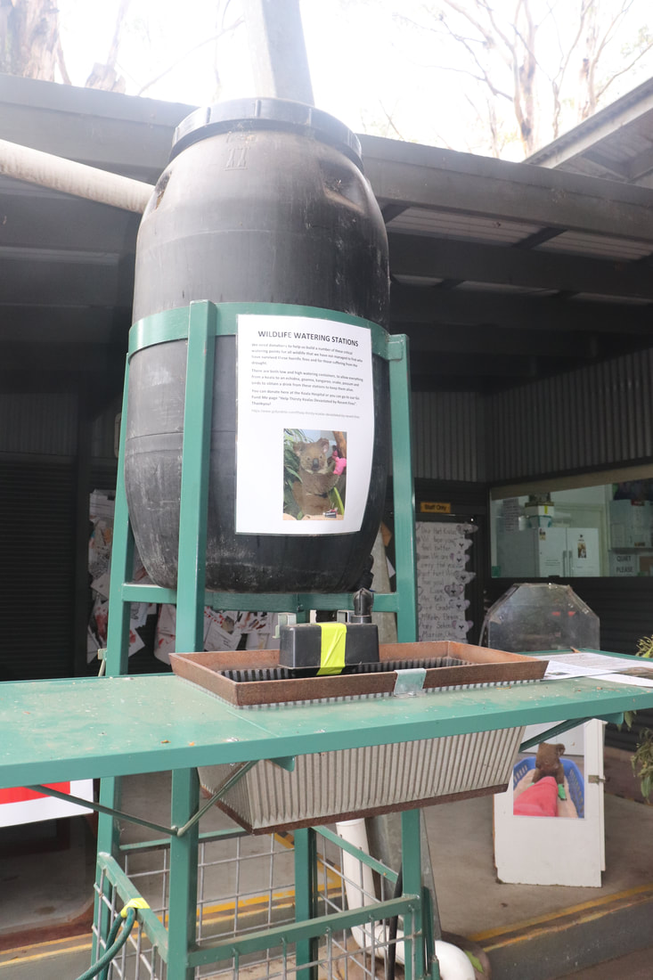
Port Macquarie Koala Hospital set up a Go Fund Me Page to raise much needed funds to support care for injured koalas and to establish drinking stations and a breeding program for koalas in the region. The initial goal was for $25,000. By 21 January, the campaign had raised nearly $7.5 million dollars. The scope of the projects originally proposed have now been expanded in light of the huge amount of money raised. Port Macquarie Koala Hospital - Go Fund Me. |
|||||||||||||||||||||||||