Underwater Writing Devices Depending on the types of activities you are going to do (and how often you will be doing them) you might like to invest in underwater slates or clipboards. This means that while students are snorkelling they can be taking notes - perhaps about their location, types of organisms, or number of species observed or a particular underwater geological feature. View underwater writing devices: Dip N Dive - Under Water Writing Devices
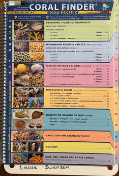
You may also like to use an online field guide such as: Marine Life Identification Guide from Snorkeling Report. However, keep in mind that you probably don't want students and teachers using their phones/laptops while wet or near the water, so this might be more useful for checking fieldwork results back in the classroom. 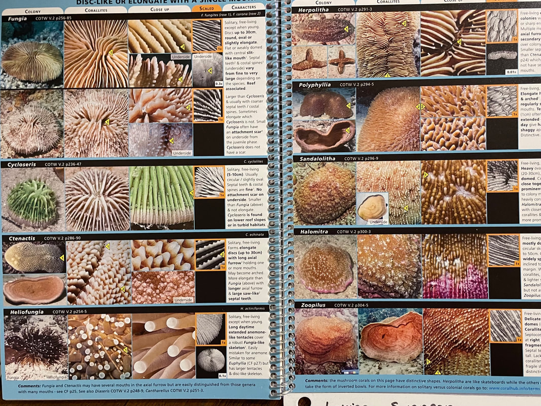 Quadrat sampling A simple quadrat square can be made from pvc piping and corners, to use to do quadrat sampling. Students gently lay down a quadrat square underwater (being careful not to disturb anything growing). They can either take a photograph to examine later or make notes about what they see within the square. For example, they might make note of the number of seaweed or seagrass species within the square, or the number of sea urchins within the square, or the variety of species. This activity should be repeated a number of times. Students can determine average calculations of a general location and then compare it with another location, or repeat the activity at another time to determine change over time. Measurements and colour analysis Students can use a ruler and colour chart to explore corals, seagrasses or seaweeds. In the case of corals, colour is an important indicator of coral health. 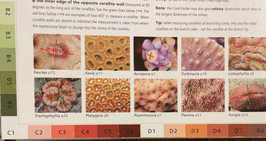 Underwater photography and videography
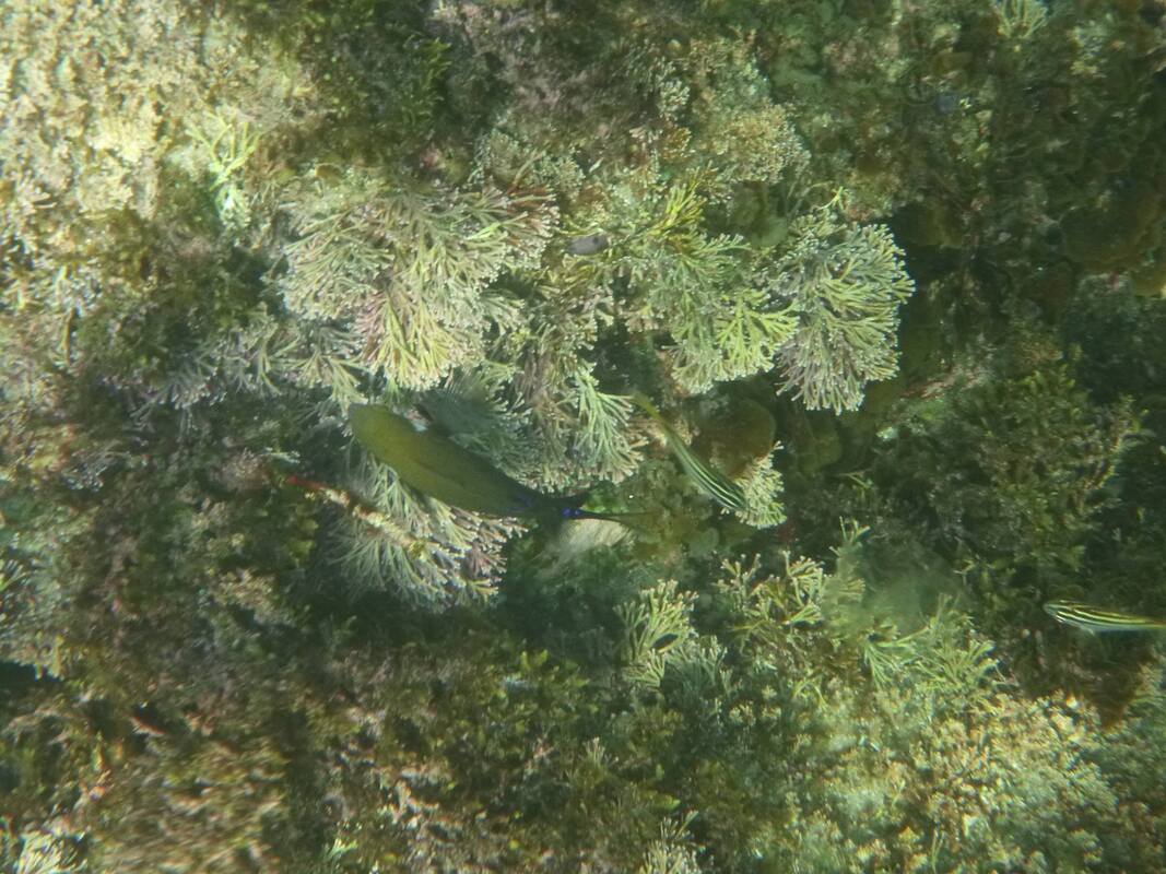
Students can easily take photographs and videos of the fieldwork site. These can be shared and compared with their classmates. In-built GPS will help to geotag the photos, or a GPS logger can be used. Photos and video can be used to identify different species, examine data on abundance of species, or explore human impacts. Photos can be added to locations on digital maps using Scribblemaps. There are a couple of relatively cheap underwater cameras you can buy. Be prepared - if they are used regularly, they will get broken, and most likely they get water in them (also meaning they will be broken). I have bashed more underwater cameras into rocks than I care to admit. There used to be a wide variety available, but there aren't too many on the market these days. If you are going to get a student to take photos, make sure you get a wrist guard with a floatation device attached in case they drop it. Another good option to to use a hair elastic attached to the camera strap to that it doesn't get lost. For around $600-700 you can get basic model underwater camera from Olympus: Olympus TG-6 Tough Underwater Camera (Black). There are lots of other options for underwater cameras available, but they tend to be very expensive. Probably the easiest option is to use a GoPro, with a waterproof case attached with either a velcro wrist band or a strap around your chest or head. Even though the GoPro11 is advertised as waterproof, I was advised to also get a waterproof case. There are also some masks that you can buy so that you can attach the Go Pro directly to the mask. GoPro HERO11 Black Action Waterproof Camera GoPro Protective Housing GoPro Hand + Wrist Strap Body Glove Adult's Arid 2 Piece Set Blue & Black Mapping Students can use a basic outline map of the field site to demonstrate features which relate to human impacts on the reef. Students might mark on a map stormwater drains, stairs or entry points, boat ramps, pools, jetties, etc. Students may use the map to identify where they observed particular species in the field site. Students might map areas of natural vegetation surrounding the field site.
0 Comments
It has been great to hear a change in tone and implied respect in the few bits of communication we have had regarding education with the recent change of state government. It has been a long time since we have had communication that didn't feel like we are being reprimanded, misled or gaslighted. One fo the key messages we are being told is that there will be a concerted effort to try to reduce teacher administration so that we - as teachers and schools - can focus on the key to education - teaching and learning.
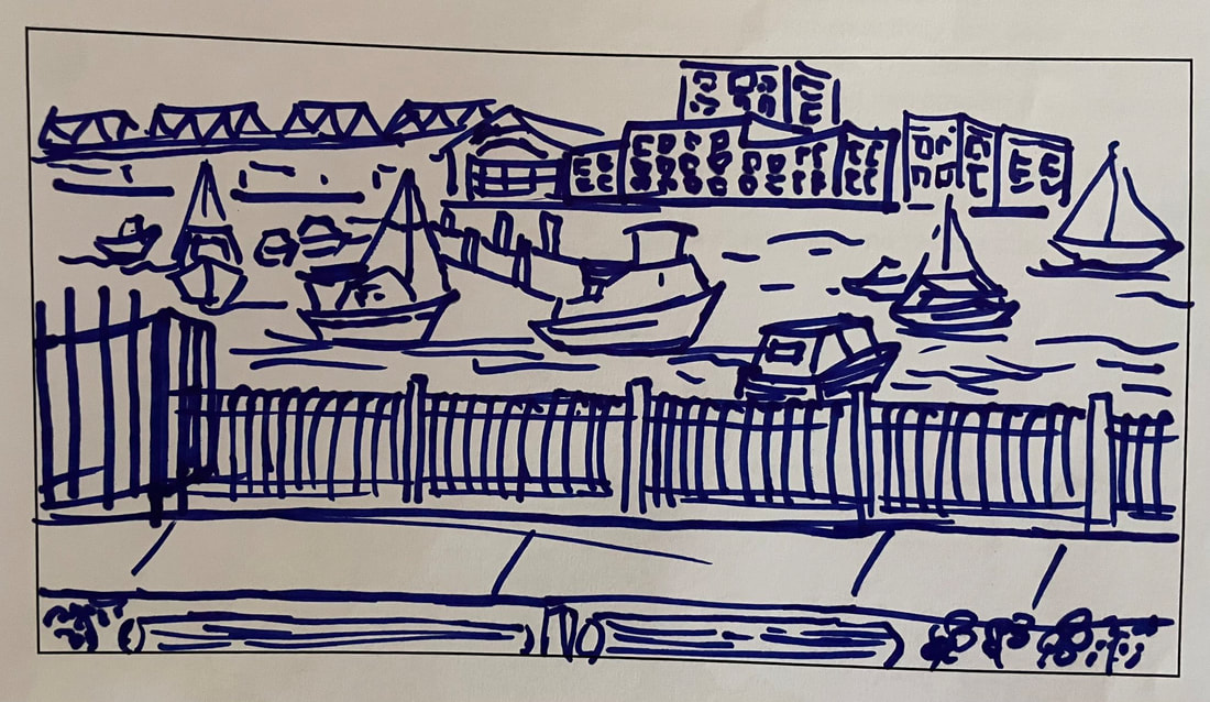
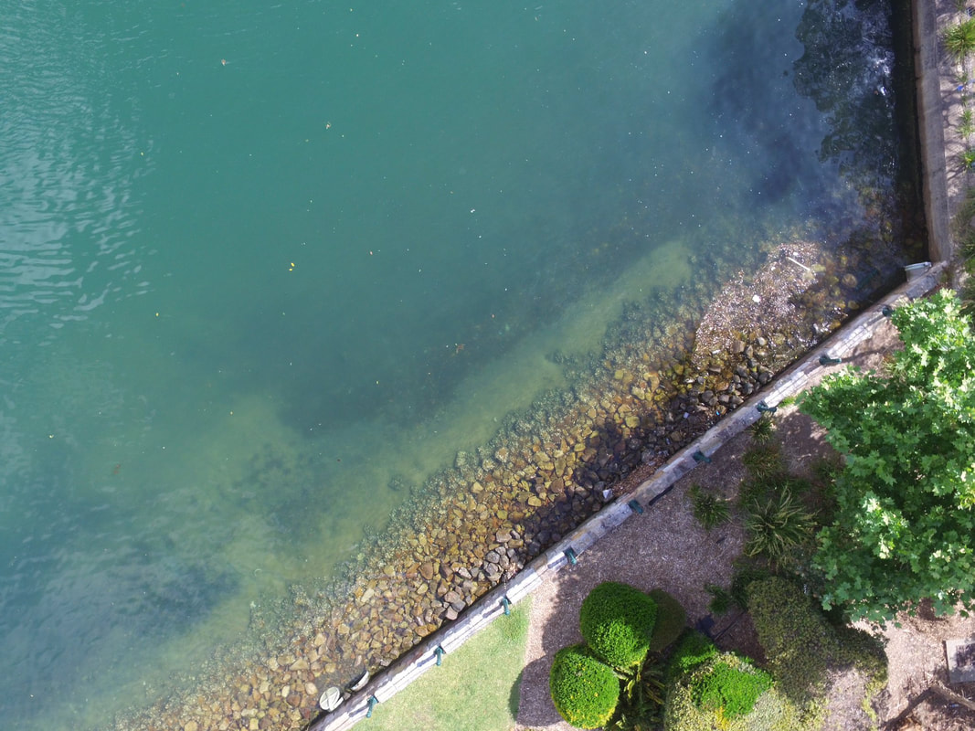
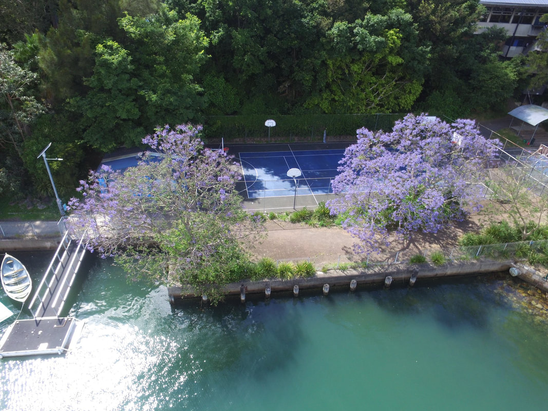
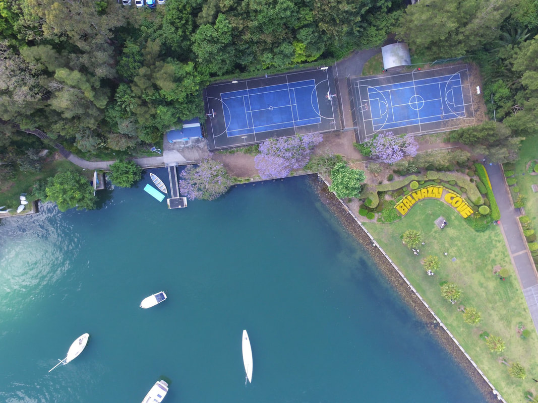
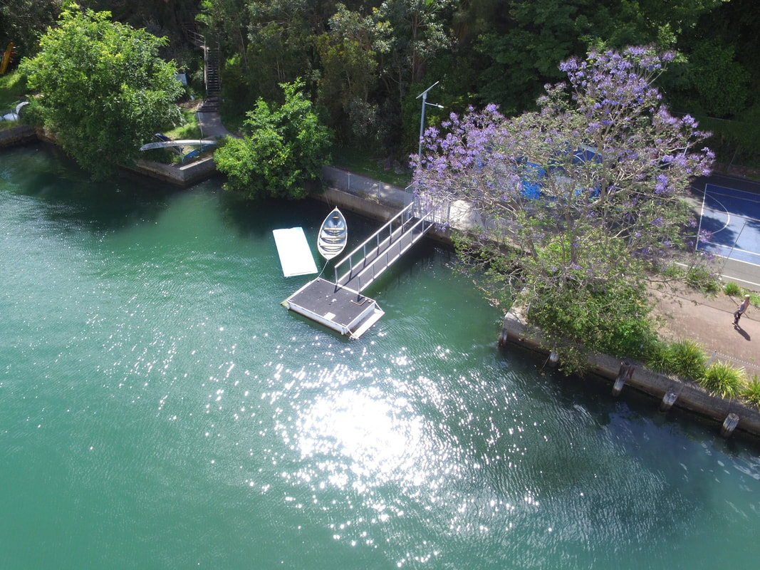
Many reports and articles have been written about teachers' perceptions about teacher administration (or "administrivia") and the impact these types of task have on teacher morale and the core purpose of the job. A couple of articles/reports you might like to read are: AITSL: Shifting the balance: Increasing the focus on teaching and learning by reducing the burden of compliance and administration. Teachers need more support, less admin to deliver quality education Reports such as these outline that teacher administration, accountability and unreasonable demands are crushing staff morale and reducing time available to work with students. I'd like to take this in a new direction and identify what this administrivia is and how it can be reduced, from someone working within a school. I'm going to start by thinking broadly at the system and whole school level, and then look at faculties. Problem 1: Curriculum Reform Following Geoff Masters' review and report on NSW Curriculum which wrapped up in 2020, the former NSW Government announced the comprehensive rewriting of K-12 Curriculum. This needs to be considered in the context that ACARA introduced a whole suite of new curriculum documents in 2013, which NESA (then BOSTES) rewrote into the NSW syllabuses. Schools have already been through the process of implementing new syllabuses in many subjects reasonably recently - Geography 7-10 was fully implemented as late as 2018. Some of the phase 3 subjects in other KLAs were implemented as late as 2019-20 (TAS). The former NSW Government set a very ambitious agenda to develop, consult formalise and implement the new syllabuses very quickly. In HSIE alone, 2023 will involve planning and preparing for Senior Geography, consultation and release of Geography, History, Aboriginal Studies, and Commerce, with planning and preparing in 2024 and implementation in 2025. Consultation and release for Geography Elective, History Elective, Work Education in HSIE will occur in 2024, with planning and preparation in 2025 and implementation in 2026. These are the changes for one KLA alone, and mostly only for 7-10. Primary schools are already well under way implementing new English and Maths syllabuses. We are now beginning to see the implication of these changes across subjects and years. Schools developing new teaching and learning program proformas, scope and sequence proformas, and assessment proformas for the new syllabuses. Faculties and teachers designing new programs, scope and sequences, teaching activities, and assessments, reviewing existing resources, and choosing new textbooks or online programs. Solution 1: Slow down the implementation. It is not necessary to implement so much change so quickly. If we want the new curriculum implementation to be successful we need to allow time for teachers to really engage with the syllabuses, and have time for proper planning and collaboration. The previous NSW Government announced five hours available per teacher per term to be used for planning. At the time no thought had gone into how this would be staffed, paid for or organised. Advice since has been scant. Given the extensive changes and period over which these changes will occur, why not provide funding to reduce teachers' teaching hours by half an hour per week and timetable it in? Problem 2: Organisational overlap, discord and change There are too many layers and levels of organisation, policies and documents that influence schools and teachers, and these are constantly changing. In the area of subject teaching alone ACARA designed the National Curriculum and looks after external testing like NAPLAN, NESA designs the NSW curriculum/syllabuses and the department then designs and implements additional layers such as literacy, numeracy and physical literacy continuums. Sometimes these layers don't always correlate with each other, and even when they do it still create fiddly jobs like coding one document against each other. In addition, the roles and responsibilities of different departments and organisations are constantly changing so that teachers complete a task one way, and then soon after have to learn to do it a new way, or understand which organisation completes which role and then it changes. Solution 2: Collaboration between the federal and state government is required to align the organisation goals, roles and objectives of federal and state curriculum authorities and government departments to reduce duplication and overlap. This would reduce time that teachers spend having to code and cross-reference multiple layers of policy and curriculum documents, and hopefully ensure that once a job is done once it doesn't need to be re-done. Problem 3: Teacher shortage The teacher shortage is not new. The impact of the teacher shortage on existing teachers in a school includes: taking extra classes, liaising with casual teachers for positions that are not filled, helping casuals plan lessons and assessments, preparing extra lessons, writing extra reports, dealing with additional behaviour management issues as students don't have a regular teacher (including assisting with recording information on the school's online systems). Solution 3: The recently announced strategy of converting long-term temporary teachers into permanent teachers is a good one. Another option would be to provide extra funding to schools to employ multiple teachers to work full-time on casual loads (for sick leave, long service leave, professional learning, etc) under contract for the whole year., or perhaps even a few years. This would informally convert more casual teachers into temporary teachers, and ensure a steady, reliable way of covering leave periods and ensure students are familiar with those covering the classes. Many schools do this in an informal way anyway, so why not formalise this process a bit more? Providing more predictable work is a way of encouraging teachers without permanent jobs to stay in the system. Problem 4: Policy There are 219 policies that schools and teacher need to comply with. This is too many. Policies are currently recorded on a department website with duplication, multiple sections, weblinks, etc. It is difficult to find the information you need, there is a lot of waffle and much of it is not relevant to people working in schools. Trying to find some basic information can take a long time and increase the time it takes to get jobs done. People across the state are duplicating work - risk assessments, WHS - all sorts of things. Solution 4: Write policies in a short, simple way. Each policy should have a short summary with key points at the beginning of the document, and then further details. Policies should be in PDF form so that they can be downloaded and printed. Policies could be divided into those relevant to teachers, managers, and Non-School Based staff. Instead of templates, ready to use documents are needed. Let's take a look at something like risk assessments for excursions. Why are people across the state writing their own? Surely someone in a Non-School Based Position (or a team) could create a bank of risk assessments that meet all the requirements and only require minimal changes by teachers. Problem 5: External Validation and School Planning Whole school accountability creates a huge administrative burden for teachers, head teachers, deputies and principals. External Validation involves a school being assessed on the judgements they have made about where the school sits on the Schools Excellence Framework. The Schools Excellence Framework (SEF) is a useful document that can be used to guide schools on the programs, strategies and actions needed to drive improvement. Each term Executive Teams can complete a Self-Assessment to review progress, reflect and plan forward. However the process of External Validation where documentary evidence and copious amount of data (did anyone say datafication of teaching?) needs to be uploaded and tagged according to the school plan and SEF elements, is overly formalised, time-consuming and basically a box-ticking activity that contributes little to the way schools are run. It creates stress when it isn't necessary, and takes time away from more meaningful activities. School Planning seems like a duplication of SEF Self-Assessment and planning and discussions that come from it, and if External Validation is based on the SEF rather than the School Plan it seems entirely superfluous. Solution 5: External Validation should be streamlined or discontinued, to be replaced by a once a term discussion with the DEL (like currently occurs for the School Plan). School Plans should be discontinued. All schools should use the School Excellence Framework to guide improvement and not write a school plan. This is basically eliminating the "middle man", and would simplify the whole process. Problem 6: Mandatory Training There is an ever-increasing list of mandatory training. Mandatory training is generally repetitive, boring (mostly poorly designed online learning), and often irrelevant. The large amount of mandatory training required eats into weekly meetings and staff development days and reduces the amount of time that can be provided for faculties to undertake planning, do faculty organisation and to work collaboratively. Solution 6: Eliminate all the superfluous mandatory training down to a list that is manageable and relevant. Reduce online learning modules - most people prefer to be spoken to by a real person, and this allows the deliverer to tailor the content for the school context. Problem 7: Extracurricular activities Many of the amazing things that happen in schools are run by teachers in their spare time by choice. All schools have so many extracurricular activities on offer - knockout sports competitions, breakfast club, art and drama club, SRC, robotics clubs, the list is never ending. The easy solution is to say to teachers to be more selfish with their time. Only that is not generally in the nature of teachers. Teachers tend to see a need, know what the limitations are in providing whatever is needed, and finding a way to do it regardless - usually the biggest cost is teacher time and workload. How can this be addressed by the new government? Providing period allocations for teachers running extracurricular activities would go some way to addressing this. Solution 7: The best solution a new government could provide is reducing teaching loads, so that teachers have the time to concentrate on fewer classes, explore meaningful data to get to know those students well, and have time to create or source the best teaching materials for those classes. An extra staff development day here and there, announcing that staff should get extra release time (when there are no casuals, funding or guidance on how to provide it) and coming up with new initiatives that talk about workload but do nothing will not solve the problem. Problem 8: Lack of support staff Additional SASS staff to undertake non-teaching tasks could reduce workload. This could be updating the school website, maintaining social media and communications. While the amount of photocopying has reduced in schools since the introduction of digital classrooms, teachers still spend time photocopying documents, scanning work samples (another accountability issue) and maintaining organisation of digital assets. SASS staff are also overburdened by cumbersome systems so we can't just allocate more work to them. Solution 8: Additional support to complete non-teaching tasks such as communications, collecting and completing photocopying, scanning documents, organising digital assets, etc would reduce workload. Providing a SASS person for one day a week per faculty could reduce these administrative tasks. Additional Comments - 6 May 2023 It was great to see the announcement that the curriculum releases as part of the curriculum reform have been pushed back. I would still argue they need to be pushed back a little further, but it's still a good outcome. Students in our Year 10 Enrichment class are currently undertaking the Balmain Foreshore Project, a cross curriculum unit of work in Geography and Science. Implementing the project The first full implementation of the project occurred during the second half of Term 1, 2023. It will result in a separate teaching and learning program for our Enrichment class (a class designed specifically to cater for HPGE students), including different content and learning activities. The students will also have a differentiated assessment task. Students were led through initial discussions about the main aim of the project - a focus on research and hands-on application of research to rehabilitate a section of Balmain foreshore on school grounds. In this iteration of the project, students focused on extent and quality of mangroves in the area. An important part of this project has been making Geography come alive as a subject - engaging students actively in physical activity, getting out of the classroom and engaging in practical activities. Students kayaked from the school grounds to observe and test mangroves on the foreshore at Rodd Point. They undertook monitoring of mangroves using GPS mapping, water testing, field sketches, underwater and aerial drone activities, photography and observation. 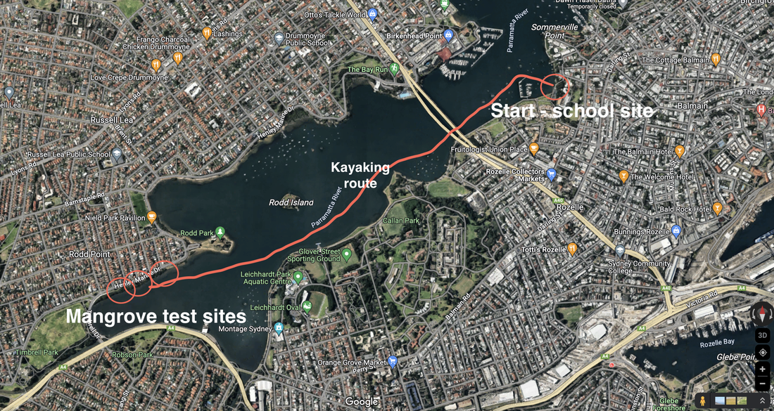 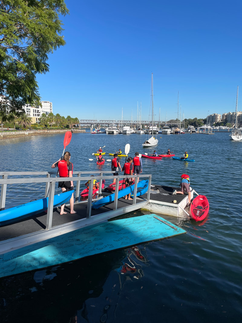 Students undertook a weed assessment on site at the school and and some weed removal, completed a rubbish count and analysis of types of rubbish around the foreshore and during the school's participation in Clean Up Australia Day, the class did their clean up focused in the foreshore area of the school.
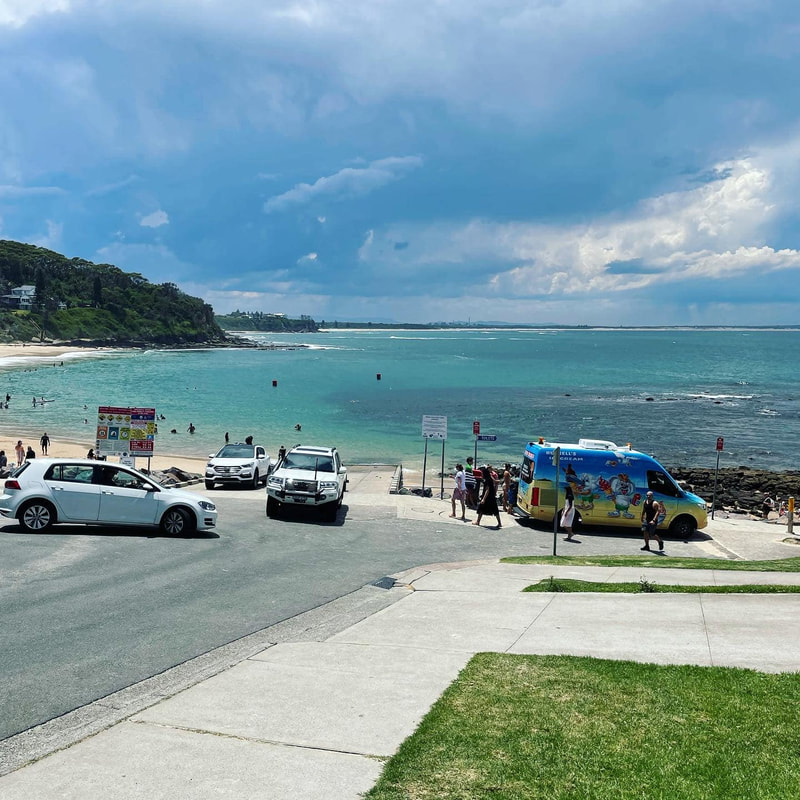
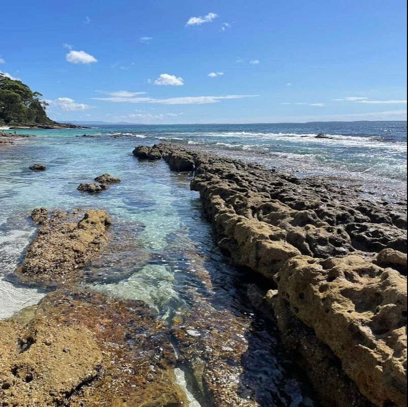
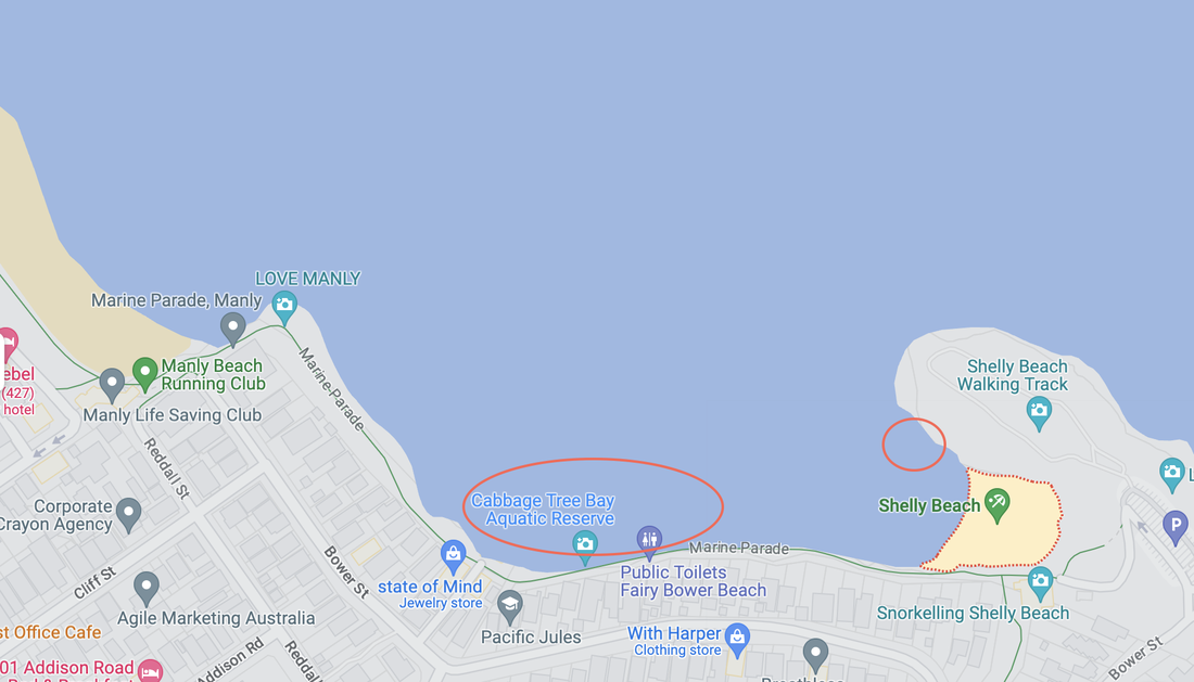
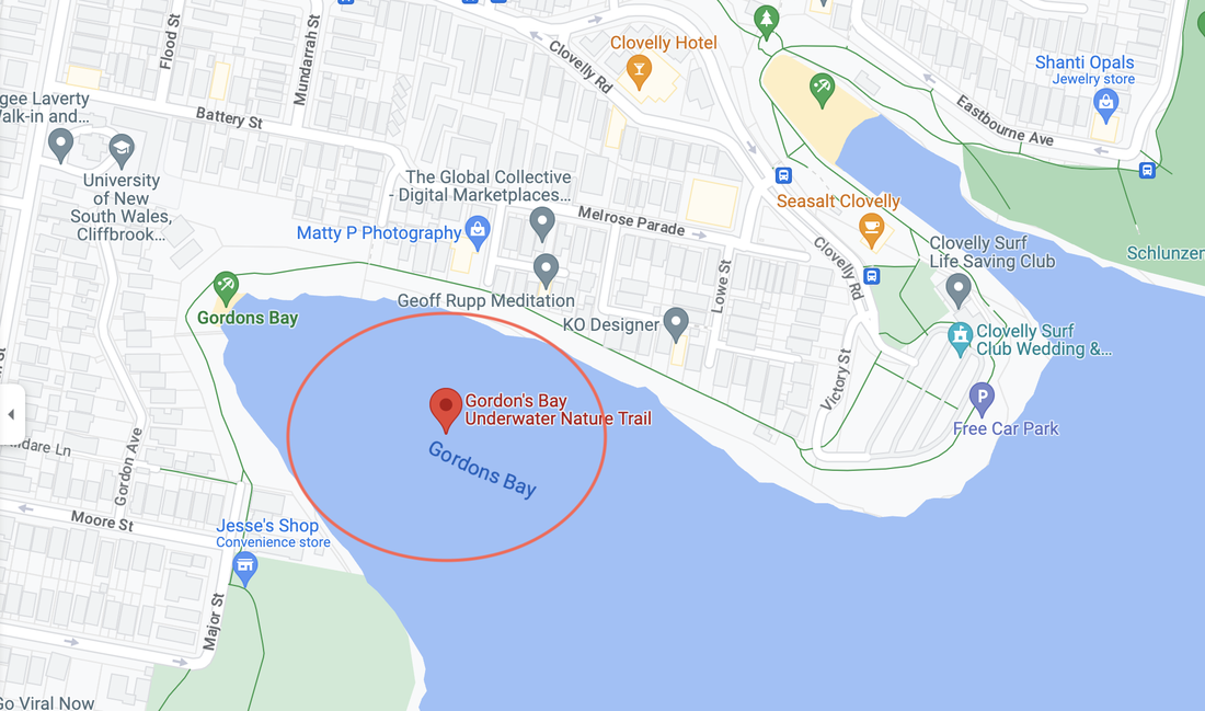
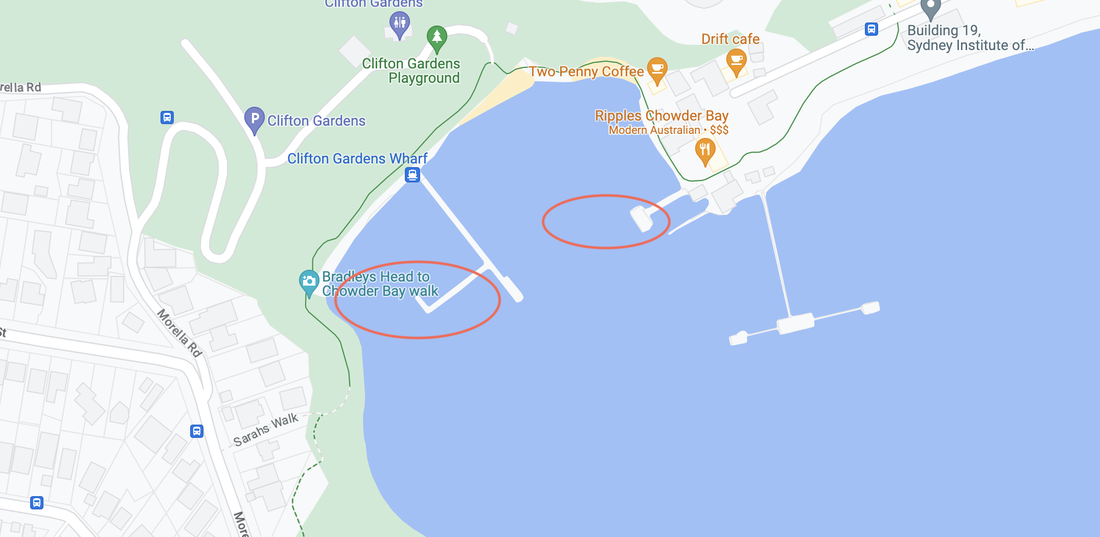
Students participated in a workshop with Jenny Newell, the Climate Change Curator at the Australian Museum. The group was involved in a discussion of the global context of environmental change and management including climate change and the sensitivity of environments, global actions that address climate change and personal responsibility around environmental issues. They also explored how the Balmain Foreshore Project, a local initiative, fits into this wider context, and how they can make a positive contribution to their community. Students also met with Charles Scarf, Environment Manager with Rozelle Interchange/Western Harbour Tunnel. He spoke about their project and the environmental impact process they had to follow to get approval, as well as how both science and geography investigation is used in the project and the careers opportunities in this kind of field. This is one of several posts about our Balmain Foreshore Project. Read more... Balmain Foreshore Project - Introduction Gardening Below the Surface - Operation Posidonia Balmain Foreshore Project - Trial Activities Balmain Foreshore Project - Implementation Balmain Foreshore Project - Living Seawalls Balmain Foreshore Project - Living Seawalls: Pre-Installation Biodiversity Survey This is part 2 of a number of posts about Fieldwork - Reef Surveying. Read the other posts: Fieldwork - Reef Survey - Preparation Fieldwork - Reef Survey - Student Activities Fieldwork - Reef Survey - Curriculum Links Where to snorkel? A good spot for a first snorkel is Clovelly because it is directly in front of the Surf Life Saving Club, it is a fairly contained area, and in most cases in is quite calm. You can pretty much count on seeing a groper. This is a good introduction site. A couple of other good sites around Sydney where you are likely to see a variety of aquatic organisms are Cabbage Tree Bay Aquatic Reserve (entry via Shelley Beach or Fairy Bower), Gordon's Bay and Chowder Bay. Outside of Sydney you might like to try: - the rockpools at Norah Head, - Shelley Beach at Toowoon Bay, - Sharknet Beach, Huskisson - Plantation Point, Vincentia - Greenfield & Blenheim Beaches, Vincentia There are obviously lots of other sites, but for ease - consider finding places where you can snorkel straight off the beach. You might like to read: - Best Snorkelling in Jervis Bay Below: Image of the Rock Polls at Norah Head (left). Image of Hyams Beach at Jervis Bay (right)
Cabbage Tree Bay
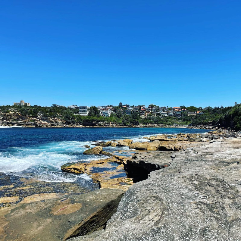
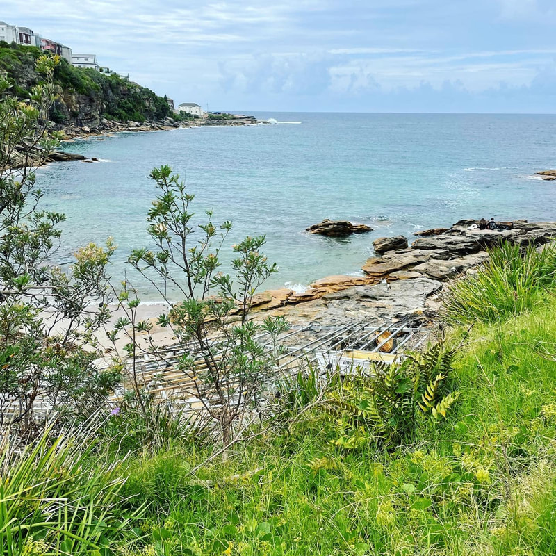
Gordon's Bay
Below: Image of Gordon's Bay from the Carpark (left). Image of Gordon's Bay from the footpath (right).
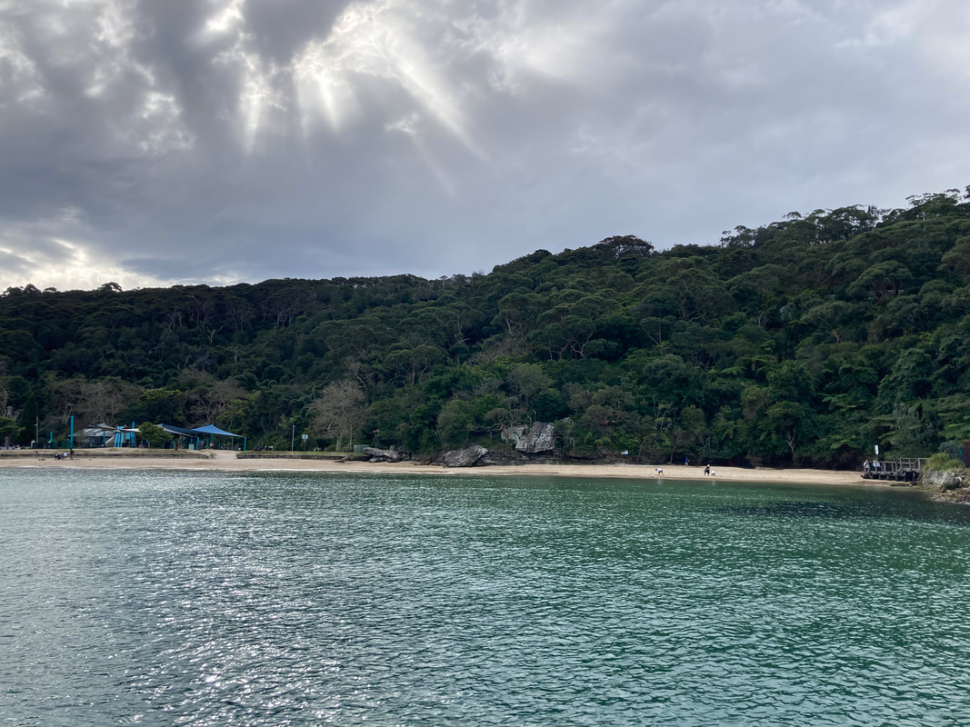
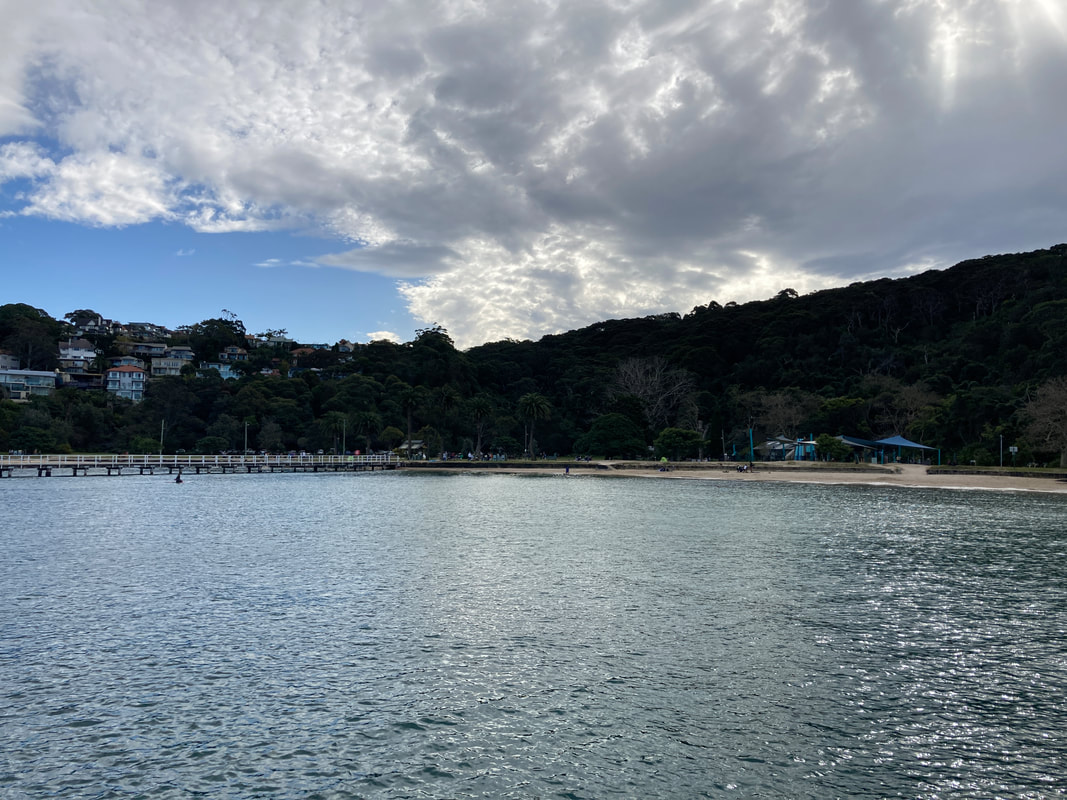
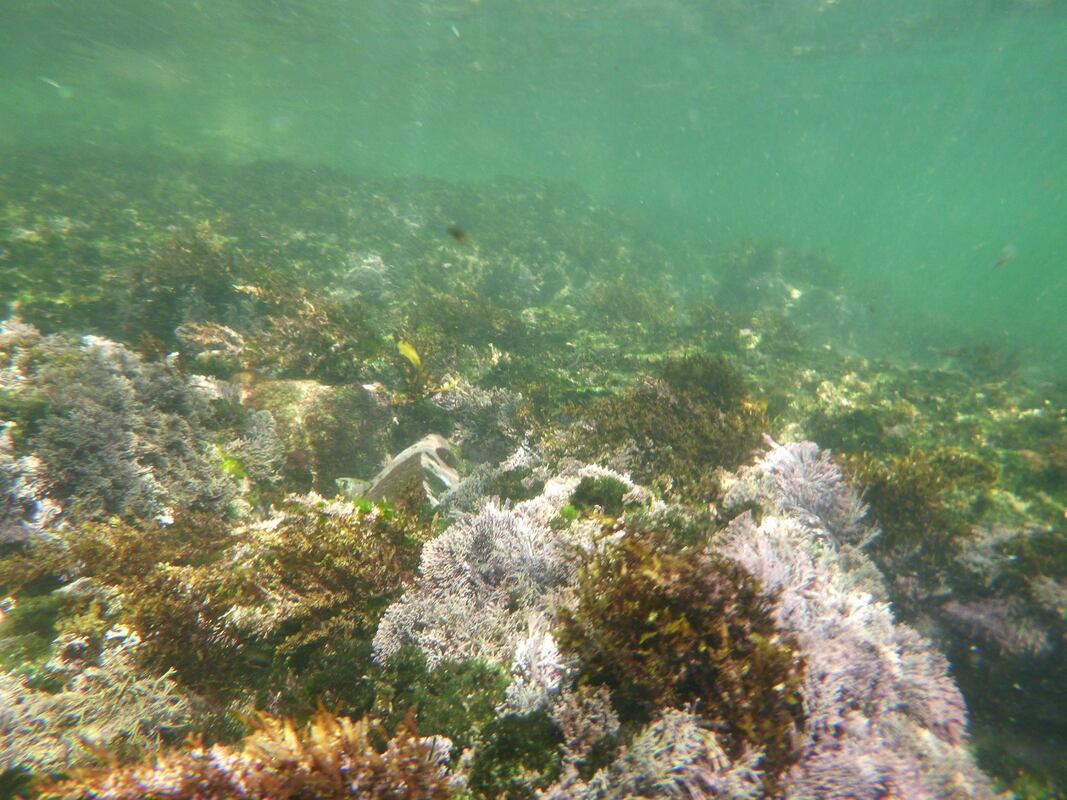
Chowder Bay
Below: Images of Chowder Bay
You might like to read: The Ultimate Guide to Snorkelling
This is part 2 of a number of posts about Fieldwork - Reef Surveying. Read the other posts: Fieldwork - Reef Survey - Where to snorkel Fieldwork - Reef Survey - Student Activities Pre-Fieldwork Activities
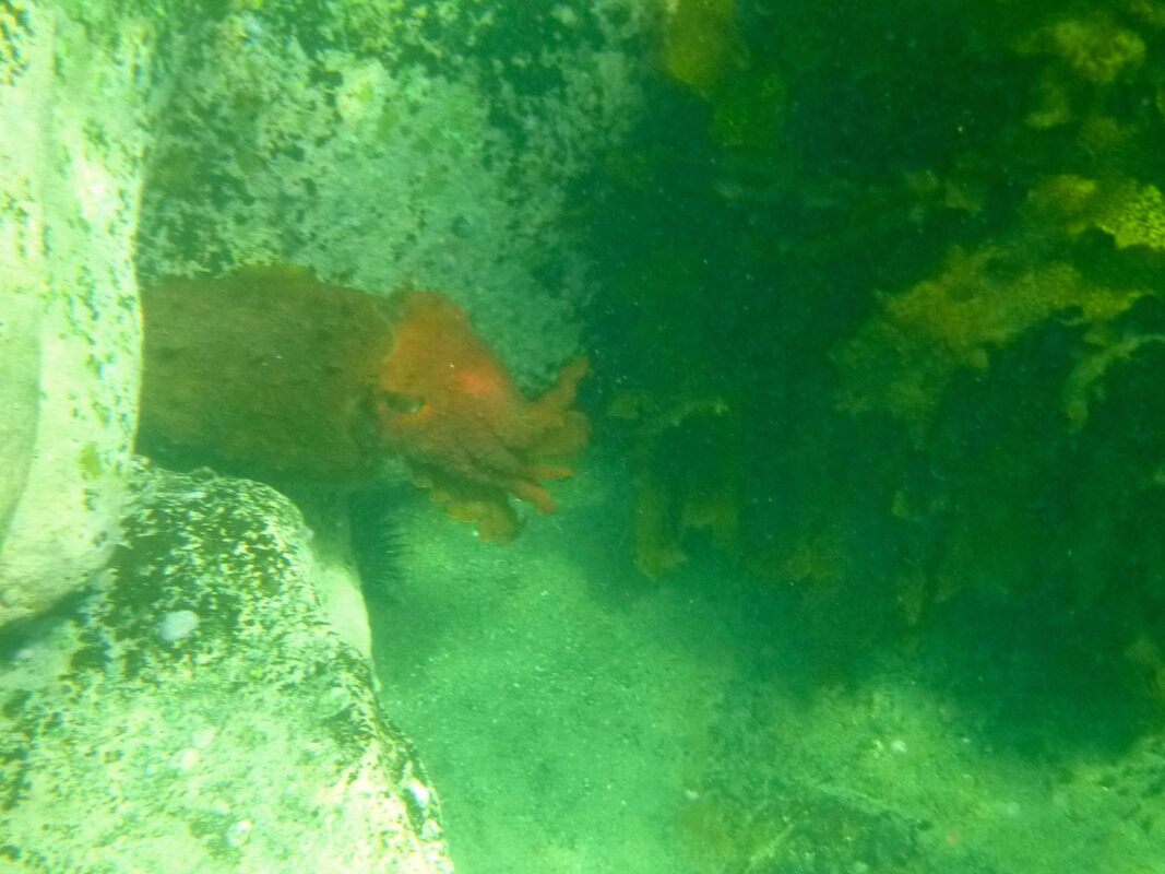
Below: Photos taken at Clovelly - the sea floor (right), cuttlefish (left).
On the day of the fieldwork:
Fieldwork activities that can be undertaken:
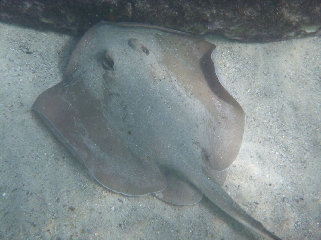
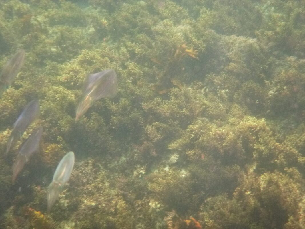
Below: Photos take at Gordon's Bay - stingray (left), squid (right)
Safety precautions Check the weather and tides to ensure the conditions are suitable. Keep an eye out for boats and other activities in the water. Exercise caution. If students go snorkelling in their own time (not organised by the school/a teacher), they should remember to always let their parents know where you are, swim with a buddy, and check the tide and weather conditions. Always be safe. Whole school teams provide a good opportunity for teachers to engage in ideas and projects outside their faculties. You can access expertise beyond your immediate colleagues, you can share you ideas more broadly and feel like you have an impact beyond your own classroom. Yes, it involves extra work, but other than faculties, whole school teams are some of the most important structures that enable schools to function and thrive.
Unfortunately we have all had experiences where we agree to become part of a team, turn up to the meetings weeks after week, but feel like nothing is happening. Numbers in the team start dropping off, and before you know it the team disbands. So, how do you lead an effective team? Just as importantly, how do you ensure that you are an effective team member (even if you don't lead the team)? Tips for running a successful team: Have long term goals. It is often worth having a look at your school plan, or the Schools Excellence Framework to see how your team fits into the bigger picture. What is the purpose of your team? How will it contribute to the School Improvement Plan? What training do staff need that relates to your team - either for the staff in your team or for the whole school? How will your team drive student improvement? Have milestones for each term and break down the milestones into smaller achievable tasks. Check these off as you achieve them. For each meeting ensure that there are actions to be completed and that these have been allocated to people in the team. This will help to drive things forward, so that you aren't going round in circles. There's nothing more frustrating than turning up to a meeting where you talk about the same thing that was discussed the previous meeting, or where you spend time looking for the next thing to do. This is why it is important to have something to aim for and a plan on how to get there. Try to have some teacher roles within the team (even if they area bit vague). Roles could include: regularly taking the minutes, sourcing/analysis data, liaising with other staff (e.g. particular faculties), liaising with the Principal/Deputies, etc. Be aware of people's workloads and what is achievable at different times. There will be times when some people are busy and others aren't. Help each other out and work together towards your team's goals. However, pushing through on your team's agenda when people are struggling with reports, or some other pressure is not a great idea. Pace out your goals, push items back as needed. Keep your eye on the prize, but slow progress over a year is better than rushing things through, and making mistakes or burning people out. Maintain records and keep files organised. You might be running a particular whole school team this year, but you aren't the first person to do it, and chances are the previous people who ran the team had lots of positive ideas too. Archive files from previous years, but keep them organised so that you can find things as needed. We all know that education goes round and round in circles. Something that was pushed aside for some reason last year, might be just what is needed this year. Don't recreate the wheel. Revisit what has already been done - it might need some revision or updating, but you may not need to create something from scratch. Try to keep organisational tasks to a minimum in the actual meetings - use emails, shared files instead, and use your shared Google Drive, or other file sharing system for storing/organising files. Whole school teams can be a great way to connect with staff, be part of innovative projects and drive school improvement. Some of my best experiences in schools have been working in these types of teams. Ensure that you balance your workload, but find something that you are interested and dig your toe in!
The Michael Leunig cartoons over the last week have definitely captured my mood about returning to work after school holidays, so I’m going to share a few goodies.
The juxtaposition between the self (the things I enjoy, things that give meaning…) and the role (responsibilities, obligations…). Where’s the middle path and how do I get on it? The inevitable ups and downs of a term. 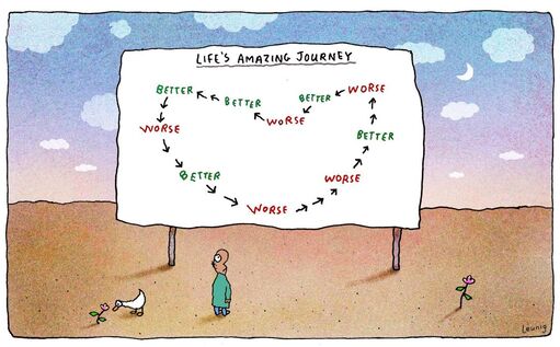
Dealing with your own (and everyone else’s) emotions. Hopefully we only have to deal with people at irritability stage and not further down the end of the hopscotch. A comment on the end of last term (and probably every end of term). Got to throw some Growth Mindset and brain plasticity in there right?? Sometimes my brain is just too full and there is too much going on to absorb much else.
And a bit of hope for what could be. It’s not all sarcasm and negativity - just got to focus on the good stuff and the stuff that matters and filter out all the other stuff. Here’s to a good start to the school year! 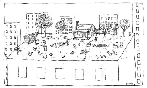
2022 Floods
Spatial dimensions and nature of a contemporary ecological hazard - "This wasn't a flood it was a demolition": How can Lismore survive? - From Gympie to Grafton, see the floods devastation from the air Characteristics of the natural environment, including the physical processes and cycles influencing the nature and occurrence of the hazard - Why it could rain for months on Australia's east coast - When will the east coast deluge end and where, oh where, did it come from? - The east coast rain and flooding seems endless. Where on Earth is all the water coming from? Human–environment interactions and evidence of change, including: The contribution of human activities to hazard events - Tram vale: the flood stricken development that should have taught Sydney a lesson, but didn't - Manly Dam has spilled, putting thousands on flooding alert: Here’s what you need to know about Sydney’s dams Change in relation to climate - Alan Kohler: Some difficult, expensive decisions will have to be made by whoever wins this election - The east coast rain seems endless. Where on Earth is all the water coming from? Challenges, opportunities, and responses, including: Changes to natural processes, systems and/or environments - Talyawalka Creek in far west NSW flows for first time in a decade, as floodwaters trickle down - Northern NSW vets work to save hundreds of starving, suffering animals amid flood crisis Impacts on people and communities - Like many disasters in Australia, Aboriginal people are over-represented and under-resourced in the NSW floods - ‘Worse than 2017’: Lismore faces mammoth rebuild after flood as community inundated by loss - Lismore flood: hundreds rescued and thousands evacuated as NSW city hit by worst flooding in history - Thousands in Sydney ordered to leave homes amid flood crisis - Tropical infections likely to afflict flood-hit communities as heavy rain continues - Sydney floods captured on social media as roads turn into rivers and cars become boats - Prime Minister declares floods a national emergency - ‘I can’t afford to go anywhere else’: the NSW caravan park residents devastated by floods Risk-management policies, procedures and practices at a range of scales, eg prevention, mitigation, preparedness and resilience-building - "Limited development" Shane Fitzsimmons adds to call to stop building on flood plains '- One-in-100-years' flood talk disastrously misleading and should change, risk experts say - A new levee and river remodelling for Lismore? Varying perspectives - ‘Farcical’: Minister shoots down flood relocation, says residents know the risks - NSW failing flood victims, with better, faster response needed: Andrew Constance - Liberal candidate for flooded marginal seat calls for Warragamba wall raising The effectiveness of people and organisations in managing ONE contemporary hazard event at a selected place - Chefs lead volunteers to feed NSw flood victims in absence of government food relief - Defence force defends response to communities in NSW devastated by floods - Additional army support arriving in Lismore as homelessness crisis mounts - Perrottet defends NSW flood response amid Lismore anger as Qld death toll rises - NSW floods: Premier says not a dollar will be spared in effort to rebuild Lismore, Northern Rivers region - Operation Flood Assist 2022 - Should natural disaster responses be part of the Australian Defence Force's job? - Northern NSW wants Prime Minister to hear how locals rescued each other in flood - Prime Minister declares floods a national emergency, more money for residents in Lismore and other NSW towns - Marcus wanted five minutes with Scott Morrison. The flood victim was told the PM had no time Read related article: Balmain Foreshore Project - Introduction about a cross curriculum project that I am co-leading with our Head Teacher HSIE Mitch Arvidson and several other teachers. In Term 4, a range of trial activities were run for the Balmain Foreshore Project, following the end of formal assessment tasks for Year 10 in Term 4. This time period was chosen for the trial activities because it is a low risk, low stakes period, and enabled teachers to experiment without impacting on report results, exams, etc. These included individual, hands on activities, excursions and a guest presenter. Only limited teaching of content occurred during the trial due to limited time available. The first full implementation of the project is proposed for the second half of Term 1, 2023. It will result in a separate teaching and learning program for the Enrichment class, including different content, learning activities, etc. The students will also have a differentiated assessment task. In this trial period, students have assessed the focus area, which is on the border fo the school. They have completed an environmental assessment and undertaken field sketches.
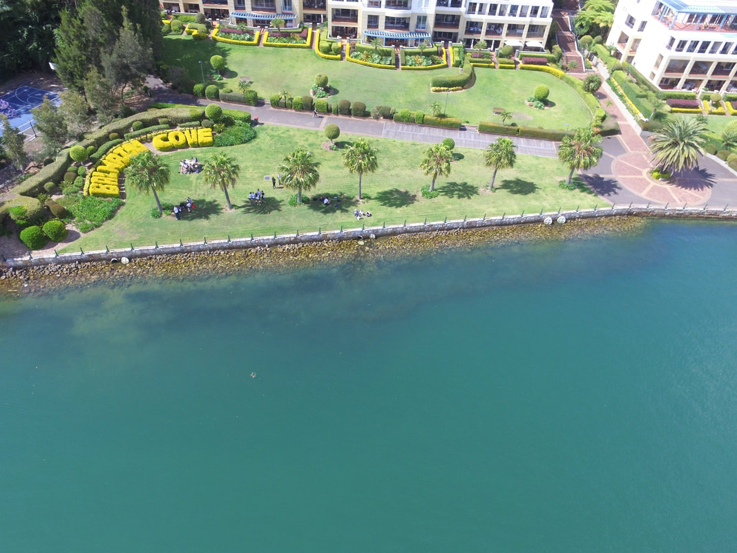
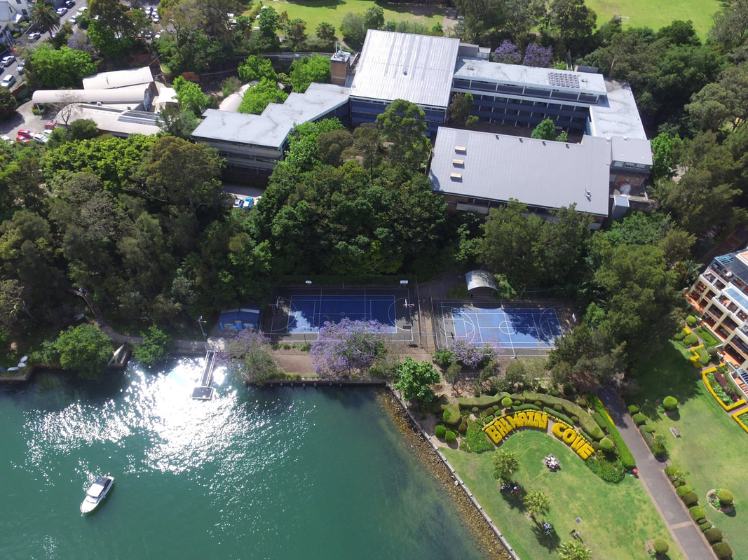
Groups of students undertook aerial surveys of the focus area with the school's drones. These are intended to be used by students in future year groups to undertake comparisons to determine change over time. In total, around 20 aerial photos were taken as well as some video footage.
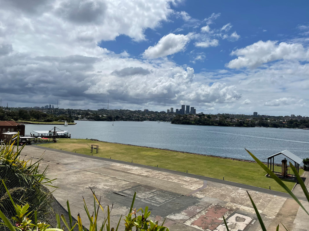
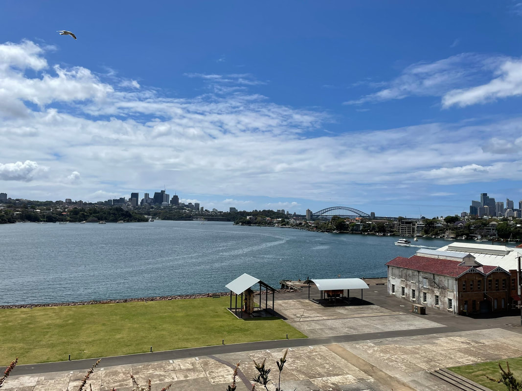
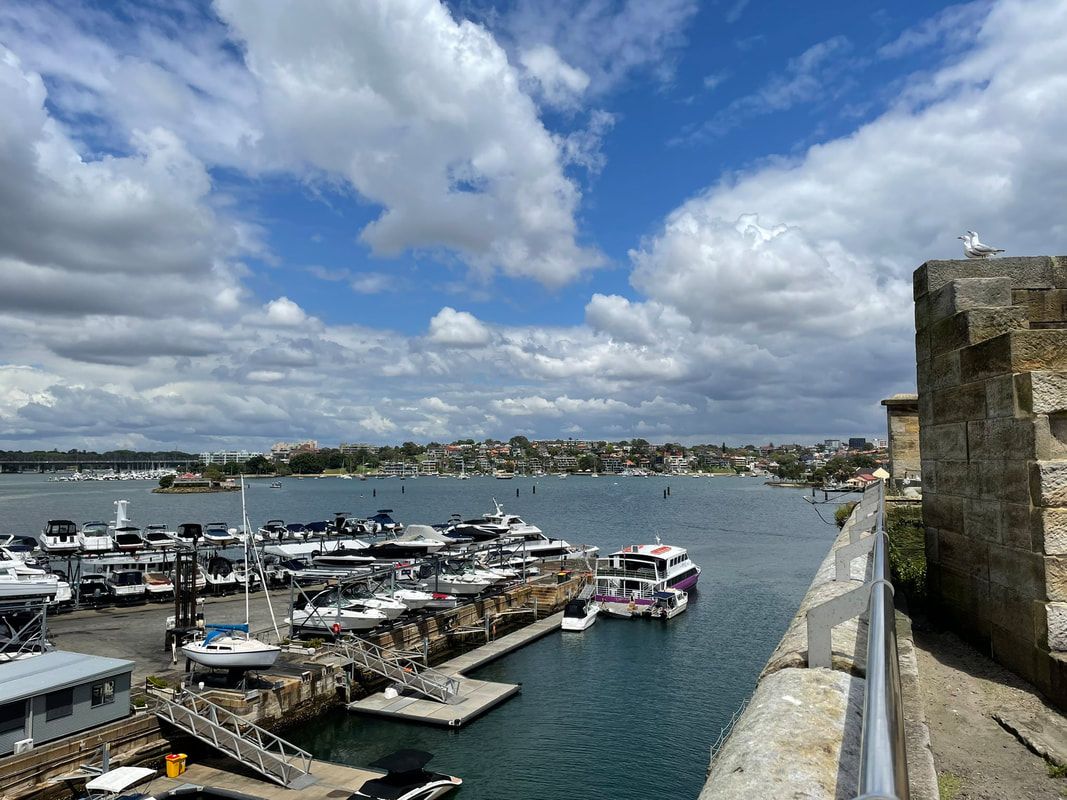
Students went on an excursion to Cockatoo Island to learn about the history of the harbour and the different ways that the harbour has been used.
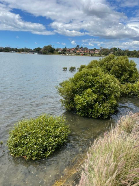
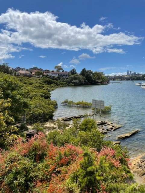
Students undertook monitoring of local mangroves using GPS mapping, photography and observation.
These trial activities were undertaken to study the Balmain Foreshore in the context of examining Environmental Change and Management (Year 10) of Sydney Harbour and Parramatta River but could also be used for studying Biomes (Year 9).
This is one of several posts about our Balmain Foreshore Project. Read more... Balmain Foreshore Project - Introduction Gardening Below the Surface - Operation Posidonia Balmain Foreshore Project - Trial Activities Balmain Foreshore Project - Implementation Balmain Foreshore Project - Living Seawalls Balmain Foreshore Project - Living Seawalls: Pre-Installation Biodiversity Survey The Australian Geography Teachers Association held the AGTA Conference this week in Hobart. The AGTA Conference is usually held every two years, and was meant to take place last year, but was delayed due to COVID.
Jason Byrne is a Professor of Human Geography and Planning at the University of Tasmania. His presentation focused on urban nature and ecology and ecological sustainability. Specifically, he addressed heatwaves, urban tree canopy mapping using machine learning and satellite imagery. and correlations with ABS data on population characteristics. You can read about visionary cities and sustainability in the Asia Pacific Network's - APAC Network - It starts with Cities You can follow Prof Jason Byrne on Twitter at @CityByrne 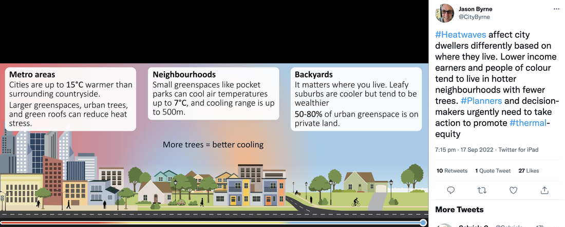 Lorraine Chaffer's presentation on The Great Southern Reef was a highlight for me. If you want to access her really detailed case study on the topic, her GTA NSW & ACT Bulletin edition on the topic is amazing. For NSW schools this is a great option for Environmental Change and Management, or Ecosystems At Risk because it provides the opportunity for fieldwork that is relatively local. As always, her presentation was detailed and comprehensive, but also included lots of practical ideas to use in the classroom. You can view the case study here: Australia's Great Southern Reef Kelp Forests You can follow Lorraine Chaffer at @lorrainegae 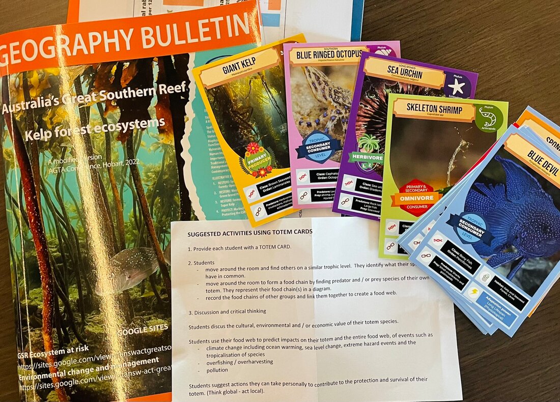 Mick Law from Contour Education presented on spatial tools. These were a selection of easy to use options to provide student access to geospatial tools and activities. Some of his suggestions were: Scribble Maps, Global Forest Watch, Atlas ID and Earth Nullschool. You can follow Mick Law at @Contour_Ed Visit the website at Contour Education. The theme of this year's conference was "The Active Geographer", and the conference included multiple field trip options. These field trips provide an opportunity for learning and inspiration outside of the usual lecture-style conference and were a great way to see some of the sites of Tasmania. I attended the University of Tasmania's Institute for Marine and Antarctic Studies for an afternoon. We heard a presentation from Cayne Layton about the ecology and restoration of kelp forests and related fieldwork undertaken by the team at IMAS. We were also taken on a tour of the facilities used in IMAS' Ice Core Project, and heard about drilling and handling ice cores, and were able to enter the freezer facility (minus 18 degrees) to handle an ice core. Follow the Institute for Marine and Antarctic Studies on twitter at @IMASUTAS Follow Cayne Layton at @CayneLayton One of the whole day field trip options was a visit to the Mt Field National Park. This involved lots of windy, dirt roads and beautiful views as we ascended the mountains. This is one of Tasmania's oldest national parks and is home to glaciated landscapes, lovely waterfalls like Russell Falls and giant eucalypts and tree ferns. It can be difficult to attend a national conference like this due to the cost and time needed for release (I pay for it myself so that I don't need to negotiate whether I can attend, because I think it is really valuable and want to make sure I can go). However, it is well worth advocating for yourself or one of your faculty to attend. It is a great way of staying up-to-date with geographical research, hearing what other geography teachers are doing in their classroom, and getting inspired to think about things a little differently. It is also a great way to build relationships beyond your school, region or state and develop your professional network. The next AGTA Conference in 2024 will be in Darwin - start planning now. |